|
Railway Walk, Hadleigh
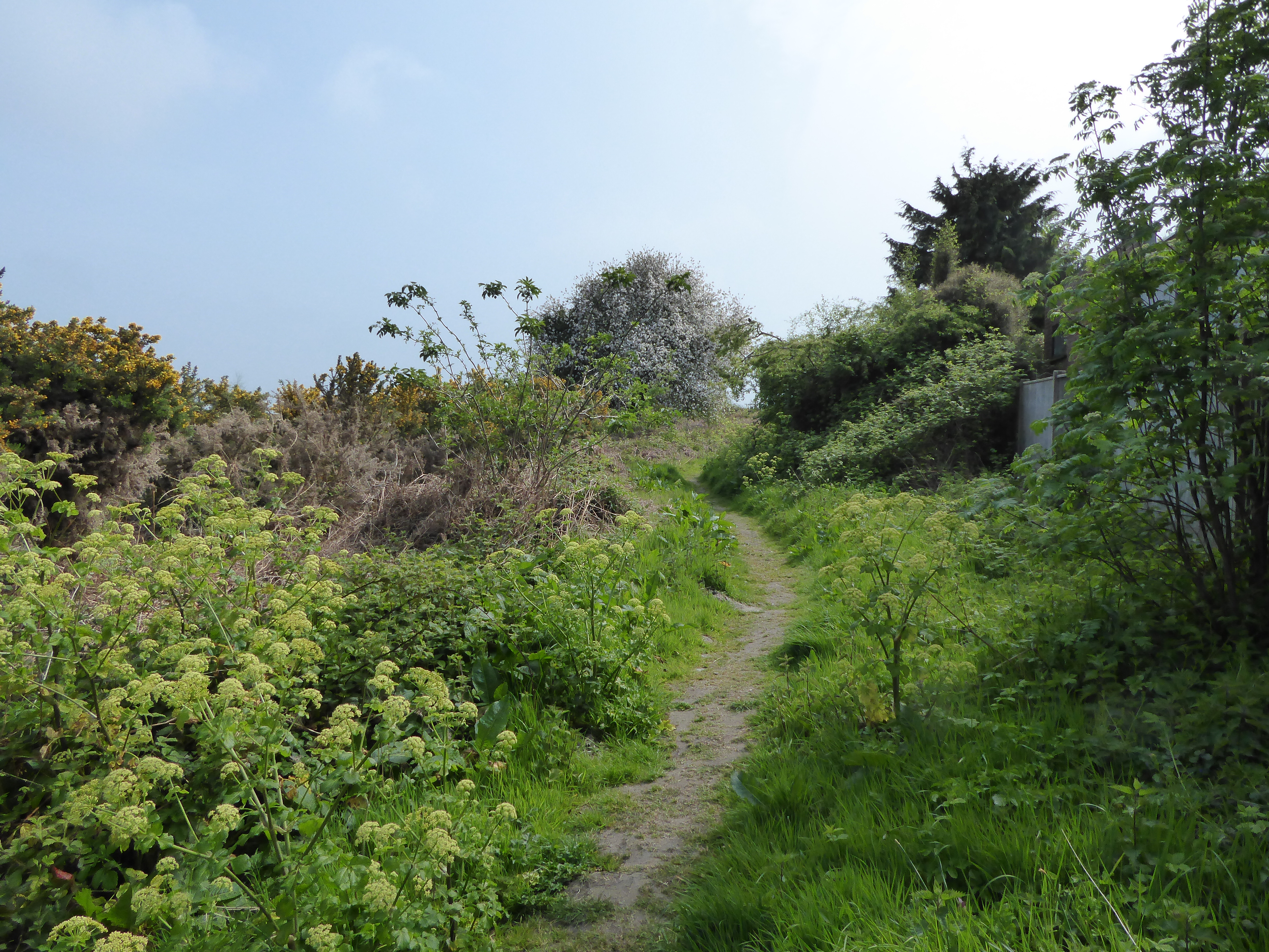
Railway Walk, Hadleigh is an 11.6 hectare Local Nature Reserve which runs for 2 miles along the route of the former Hadleigh railway south-east from Hadleigh in Suffolk. It is owned and managed by Babergh District Council Babergh may refer to the following places in England: * Babergh Hundred, a defunct hundred of the county of Suffolk, named for a "mound of a man called Babba" * Babergh District Babergh District (pronounced , ) is a Non-metropolitan district, lo .... The walk starts at the original station building in Hadleigh, which is now a private house. The route runs along a relatively level path, some of it on embankment and some in cutting. Most of it is bordered by trees. The path ends at the former Raydon Wood station, the trackbed south from that point not being open to the public. There is parking for about 5 or 6 cars at Raydon Wood, making it possible to walk from there to Hadleigh and return, a 4-mile round trip. Picture gallery File:Hadleigh_Railway_Walk_ ... [...More Info...] [...Related Items...] OR: [Wikipedia] [Google] [Baidu] |
Hadleigh Railway
The Hadleigh Railway was a long single track branch railway line in Suffolk, England, that connected Hadleigh to the main line railway network at Bentley Junction. It was built by the nominally independent Eastern Union and Hadleigh Junction Railway company and opened in 1847. By the time of opening it had been taken over by the larger Eastern Union Railway. It was never successful commercially, nor in reviving the fortunes of Hadleigh itself, and passenger services were withdrawn in 1932, followed by total closure in 1965. The northernmost two mile stretch of the trackbed, from the station site in Hadleigh to the site of Raydon Wood Station, now forms the Hadleigh Railway Walk. Unfulfilled schemes At the time of the earliest railways, the town of Hadleigh was an important centre of the wool and clothing industry. The Eastern Counties Railway was incorporated in 1836 to build a railway from London to Yarmouth; the capital was £1.6 million. This was a prodigious project, an ... [...More Info...] [...Related Items...] OR: [Wikipedia] [Google] [Baidu] |
Hadleigh, Suffolk
Hadleigh () is an ancient market town and civil parish in South Suffolk, East Anglia, situated, next to the River Brett, between the larger towns of Sudbury and Ipswich. It had a population of 8,253 at the 2011 census. The headquarters of Babergh District Council were located in the town until 2017. Origin of the name Skeat, in his 1913 ''The Place-Names of Suffolk'', says this: Spelt ''Hadlega'', R.B.; ''Hadleigh'', Ipm.; ''Hædleage'', in a late chapter, Thorpe, Diplomat, 527; ''Headlega'', Annals of St Neot, quoted in Plummer's ed. of the A.S.Chronicle, ii. 102; ''Hetlega'', D.B., p.184. In D.B. the ''t'' stands for ''th''; and the true A.S. form appears in a Worcs. charter, dated 849, as ''hæðleage''(gen.) with reference to Headley Heath (a tautological name) in Birch, C.S. ii. 40; see Duignan, Placenames of Worcs. The sense is 'heath-lea.' In a similar way the A.S. ð has become t in Hatfield (Herts.) which means 'heath-field'. History Guthrum, King of the Dan ... [...More Info...] [...Related Items...] OR: [Wikipedia] [Google] [Baidu] |
Suffolk
Suffolk () is a ceremonial county of England in East Anglia. It borders Norfolk to the north, Cambridgeshire to the west and Essex to the south; the North Sea lies to the east. The county town is Ipswich; other important towns include Lowestoft, Bury St Edmunds, Newmarket, and Felixstowe which has one of the largest container ports in Europe. The county is low-lying but can be quite hilly, especially towards the west. It is also known for its extensive farming and has largely arable land with the wetlands of the Broads in the north. The Suffolk Coast & Heaths and Dedham Vale are both nationally designated Areas of Outstanding Natural Beauty. History Administration The Anglo-Saxon settlement of Suffolk, and East Anglia generally, occurred on a large scale, possibly following a period of depopulation by the previous inhabitants, the Romanised descendants of the Iceni. By the fifth century, they had established control of the region. The Anglo-Saxon inhabitants later b ... [...More Info...] [...Related Items...] OR: [Wikipedia] [Google] [Baidu] |
Babergh District Council , a local government district in Suffolk, named after the hundred
{{disambig, geo ...
Babergh may refer to the following places in England: * Babergh Hundred, a defunct hundred of the county of Suffolk, named for a "mound of a man called Babba" * Babergh District Babergh District (pronounced , ) is a Non-metropolitan district, local government district in Suffolk, England. Primarily a rural area, Babergh contains two towns of notable size: Sudbury, Suffolk, Sudbury, and Hadleigh, Suffolk, Hadleigh, which ... [...More Info...] [...Related Items...] OR: [Wikipedia] [Google] [Baidu] |
Raydon Wood Railway Station
Raydon Wood railway station was a station in Suffolk, on a short branch line from Bentley Junction to Hadleigh. There was a goods shed on a passing loop which included a small siding on the south side of the station at the Bentley end. Together with it was extensively used for handling supplies in World War II for a nearby United States Army Air Forces base, later known as RAF Raydon The Royal Air Force (RAF) is the United Kingdom's air and space force. It was formed towards the end of the First World War on 1 April 1918, becoming the first independent air force in the world, by regrouping the Royal Flying Corps (RFC) and .... The line opened in 1847 and closed to passenger traffic in 1932, with freight services lingering on until 1965. The station building still stands and remains in use as a coal merchant's depot. References External links Raydon Wood station on navigable 1946 O. S. map Disused railway stations in Suffolk Former Great Eastern Railway sta ... [...More Info...] [...Related Items...] OR: [Wikipedia] [Google] [Baidu] |
Local Nature Reserves In Suffolk
Suffolk is a county in East Anglia. It is bounded by Norfolk to the north, Cambridgeshire to the west and Essex to the south. With an area of , it is the eighth largest county in England, and in mid-2016 the population was 745,000. At the top level of local government is Suffolk County Council, and below it are five borough and district councils: Ipswich, East Suffolk, Mid Suffolk, Babergh and West Suffolk. Much of the coast consists of the estuaries of the Orwell, Stour, Alde, Deben and Blyth rivers, with large areas of wetlands and marshes. Local nature reserves (LNRs) are designated by local authorities under the National Parks and Access to the Countryside Act 1949. The local authority must have a legal control over the site, by owning or leasing it or having an agreement with the owner. LNRs are sites which have a special local interest either biologically or geologically, and local authorities have a duty to care for them. They can apply local bye-laws to manage and ... [...More Info...] [...Related Items...] OR: [Wikipedia] [Google] [Baidu] |


