|
Radhanagari
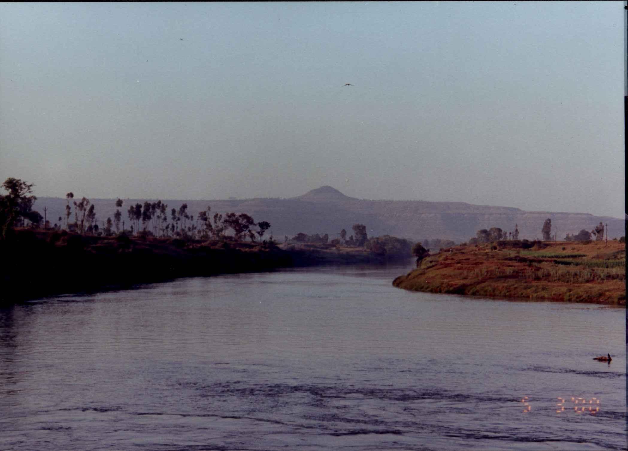
Radhanagari is a town and the headquarters of Radhanagari tehsil in the Radhanagari subdivision of Kolhapur district in the Indian state of Maharashtra. It is located on the banks of the Bhogawati River, near the Radhanagari Dam and the Radhanagari Wildlife Sanctuary. Transport ;By Rail: There is railway station at Kolhapur, which is away from Radhanagari Wildlife Sanctuary for bison. ;By Air: The nearest airport is at Kolhapur, which is away from Radhanagari. ;By Road: Radhanagari is from Kolhapur on Kolhapur-Deogad state highway. ;Nearby Excursions: Dajipur reserve forest full of biodiversity. ;Nearby Cities: Kolhapur Places to visit Radhanagri Dam Kalammawadi Dam Kalammawadi Dam, is a gravity dam on Dudhaganga river near Radhanagari in the State of Maharashtra, India. Kalammawadi dam is the biggest dam in Kolhapur District. The dam construction was initiated by the Government of Maharashtra in 1983 and w ... Cities and towns in Kolhapur district Talukas in Ma ... [...More Info...] [...Related Items...] OR: [Wikipedia] [Google] [Baidu] |
Radhanagari Wildlife Sanctuary
Radhanagari Wildlife Sanctuary ( mr, राधानगरी वन्यजीव अभयारण्य) is a wildlife sanctuary and natural World Heritage Site of category ix and x since 2012, located in Kolhapur district, Maharashtra State, India. It lies at the southern end of the Sahyadri hills in the Western Ghats. It is notable as the first declared wildlife sanctuary in Maharashtra, notified in 1958, as "Dajipur Wildlife Sanctuary" and is popularly known as the "Bison Sanctuary". Indian bison or gaur (''Bos gaurus'') with a population around 1091 in 2014, is the flagship species of the area. It was notified as Radhanagari wildlife sanctuary vide notification No. WLP/1085/CR/588/ V/F-5, Dt.16.9.1985. The area around the Sanctuary was declared as Eco sensitive zone by Govt. of India on 15 October 2020 Geography This is a natural World Heritage Site notified by UNESCO as Sahyadri sub cluster of Western Ghats. The sanctuary is located between 16°10" to 16°30" north ... [...More Info...] [...Related Items...] OR: [Wikipedia] [Google] [Baidu] |
Radhanagari Dam
Radhanagari Dam, is a gravity dam on Bhogawati river near Radhanagari in the state of Maharashtra in India. Construction was initiated by visionary Rajarshi Shahu on 18 February 1907. The dam is being used for irrigation as well as hydro-electricity. The dam is located amidst scenic surrounding in the backdrop of thick forest cover. *The scheme was suggested by Pandurangrrao Krishnajirao Shinde, Esqr, BA, I.S.E ref to Report of Examination, by Sir Henry Howard, O.I.E, M.C., M Inst.C.E., M. I. E.E.. Considering the suggested advantage towards increasing irrigated land up to 15000 hectares and satisfying Kolhapur municipal water requirement, the share capital raised was paid back to concerned share holders who had planned for thermo-electric (by letting all water into Konkan for electricity generation) and mining project. * Because of Mr Shinde's suggestion, the scheme was handed over to government in interest of people, after the capital invested was realised. (Ref report by Henry ... [...More Info...] [...Related Items...] OR: [Wikipedia] [Google] [Baidu] |
Kolhapur District
Kolhapur district (Marathi pronunciation: olʱaːpuɾ is a district in the Maharashtra state of India. The city of Kolhapur is its district headquarter. It is situated near Panchaganga river. It is bordered by the Sangli district to the North, by Ratnagiri district, Sindhudurg to the West and by Karnataka state to the East. Officer Members of Parliament * Sanjay Mandlik ( BSS) *Dhairyasheel Sambhajirao Mane ( BSS) Guardian Minister list of Guardian Minister District Magistrate/Collector list of District Magistrate / Collector History Kolhapur was a princely state during British rule of India. Shahu Maharaj ruled it from 1894 to 1922. He worked for the development of the state. It was a hub for Marathi film industry. It was known as 'Chitranagari'. It is now known as Bhalji Pendharkar Chitranagari. Geography Kolhapur district have Bauxite mineral resources in Sahyadri mountains. Ghatprabha, ''Tamraparni'', Dudhganga, Krushna, Bhogawati, Warna, ''Kasar ... [...More Info...] [...Related Items...] OR: [Wikipedia] [Google] [Baidu] |
Panchganga River
The Panchganga River is one of the important rivers of India located in Maharashtra. In English, the name translates as "Five Rivers". It is a major tributary of Krishna River, with which it joins at Narsobawadi. Origin The Panchganga River of Maharastra flows through the borders of Kolhapur. It starts from Prayag Sangam (Village: Padali BK., Taluka: Karvir, Dist:Kolhapur). The Panchganga is formed, as has been noted already, by four streams, the Kasari, the Kumbhi, the Tulsi and the Bhogawati. Local tradition believes in an underground stream Saraswati which together with the other four streams make the Panchganga. The Prayag Sangam confluence marks the beginning of the Panchganga river proper which after receiving the waters of the four tributaries continues in a larger pattern with the flow of waters received from the rivers. From North of Kolhapur it has a wide alluvial plain. After developing this plain the river resumes its course eastwards. Course From Kolhapur the Pa ... [...More Info...] [...Related Items...] OR: [Wikipedia] [Google] [Baidu] |
Kalammawadi Dam
Kalammawadi Dam, is a gravity dam on Dudhaganga river near Radhanagari in the State of Maharashtra, India. Kalammawadi dam is the biggest dam in Kolhapur District. The dam construction was initiated by the Government of Maharashtra in 1983 and was completed in 1999. It is being used for irrigation as well as hydro-electricity power generator. There are great locations for outings, listed on Kolhapur Tourism The dam was built on Dudhaganga river, which is located in the south western part of Kolhapur district in Maharashtra, it was inaugurated by Indira Gandhi, the late prime minister of India. With a water storage capacity of 28 Thousand Million Cubic(TMC), the dam is located amidst a scenic surrounding with the backdrop of a thick forest cover. The surrounding dense forest has a large biodiversity. It is also home to India's endangered bison which is called the Gaur. The dam is situated at village Kalammawadi (Dudhaganga Nagar). It has left and right canals connected to c ... [...More Info...] [...Related Items...] OR: [Wikipedia] [Google] [Baidu] |
Kolhapur
Kolhapur () is a city on the banks of the Panchganga River in the southern part of the Indian state of Maharashtra. It is the administrative headquarter of the Kolhapur district. In, around 2 C.E. Kolapur's name was 'Kuntal'. Kolhapur is known as ''`Dakshin Kashi''' or Kashi of the South because of its spiritual history and the antiquity of its shrine Mahalaxmi, better known as Ambabai. The region is known for the production of the famous hand-crafted and braided leather slippers called Kolhapuri chappal, which received the Geographical Indication designation in 2019. In Hindu mythology, the city is referred to as "''Karvir''." Before India became independent in 1947, Kolhapur was a princely state under the Bhosale Chhatrapati of the Maratha Empire. It is an important center for the Marathi film industry. Etymology Kolhapur is named after Kolhasur, a demon in Hindu History. According to History, the demon Kolhasur renounced asceticism after his sons were killed by God f ... [...More Info...] [...Related Items...] OR: [Wikipedia] [Google] [Baidu] |
India
India, officially the Republic of India (Hindi: ), is a country in South Asia. It is the seventh-largest country by area, the second-most populous country, and the most populous democracy in the world. Bounded by the Indian Ocean on the south, the Arabian Sea on the southwest, and the Bay of Bengal on the southeast, it shares land borders with Pakistan to the west; China, Nepal, and Bhutan to the north; and Bangladesh and Myanmar to the east. In the Indian Ocean, India is in the vicinity of Sri Lanka and the Maldives; its Andaman and Nicobar Islands share a maritime border with Thailand, Myanmar, and Indonesia. Modern humans arrived on the Indian subcontinent from Africa no later than 55,000 years ago., "Y-Chromosome and Mt-DNA data support the colonization of South Asia by modern humans originating in Africa. ... Coalescence dates for most non-European populations average to between 73–55 ka.", "Modern human beings—''Homo sapiens''—originated in Africa. Then, int ... [...More Info...] [...Related Items...] OR: [Wikipedia] [Google] [Baidu] |
States And Territories Of India
India is a federal union comprising 28 states and 8 union territories, with a total of 36 entities. The states and union territories are further subdivided into districts and smaller administrative divisions. History Pre-independence The Indian subcontinent has been ruled by many different ethnic groups throughout its history, each instituting their own policies of administrative division in the region. The British Raj mostly retained the administrative structure of the preceding Mughal Empire. India was divided into provinces (also called Presidencies), directly governed by the British, and princely states, which were nominally controlled by a local prince or raja loyal to the British Empire, which held ''de facto'' sovereignty ( suzerainty) over the princely states. 1947–1950 Between 1947 and 1950 the territories of the princely states were politically integrated into the Indian union. Most were merged into existing provinces; others were organised into ... [...More Info...] [...Related Items...] OR: [Wikipedia] [Google] [Baidu] |
Maharashtra
Maharashtra (; , abbr. MH or Maha) is a states and union territories of India, state in the western India, western peninsular region of India occupying a substantial portion of the Deccan Plateau. Maharashtra is the List of states and union territories of India by population, second-most populous state in India and the second-most populous country subdivision globally. It was formed on 1 May 1960 by splitting the bilingual Bombay State, which had existed since 1956, into majority Marathi language, Marathi-speaking Maharashtra and Gujarati language, Gujarati-speaking Gujarat. Maharashtra is home to the Marathi people, the predominant ethno-linguistic group, who speak the Marathi language, Marathi language, the official language of the state. The state is divided into 6 Divisions of Maharashtra, divisions and 36 List of districts of Maharashtra, districts, with the state capital being Mumbai, the List of million-plus urban agglomerations in India, most populous urban area in India ... [...More Info...] [...Related Items...] OR: [Wikipedia] [Google] [Baidu] |
Tehsil
A tehsil (, also known as tahsil, taluka, or taluk) is a local unit of administrative division in some countries of South Asia. It is a subdistrict of the area within a district including the designated populated place that serves as its administrative centre, with possible additional towns, and usually a number of villages. The terms in India have replaced earlier terms, such as '' pargana'' (''pergunnah'') and ''thana''. In Andhra Pradesh and Telangana, a newer unit called mandal (circle) has come to replace the system of tehsils. It is generally smaller than a tehsil, and is meant for facilitating local self-government in the panchayat system. In West Bengal, Bihar, Jharkhand, community development blocks are the empowered grassroots administrative unit, replacing tehsils. As an entity of local government, the tehsil office (panchayat samiti) exercises certain fiscal and administrative power over the villages and municipalities within its jurisdiction. It is the ultimate execu ... [...More Info...] [...Related Items...] OR: [Wikipedia] [Google] [Baidu] |
Vidhan Sabha
The State Legislative Assembly, or Vidhan Sabha, or also Saasana Sabha, is a legislative body in the states and union territories of India. In the 28 states and 3 union territories with a unicameral state legislature, it is the sole legislative body and in 6 states it is the lower house of their bicameral state legislatures with the upper house being State Legislative Council. 5 union territories are governed directly by the Union Government of India and have no legislative body. Each Member of the Legislative Assembly (MLA) is directly elected to serve 5-year terms by single-member constituencies. The Constitution of India states that a State Legislative Assembly must have no less than 60 and no more than 500 members however an exception may be granted via an Act of Parliament as is the case in the states of Goa, Sikkim, Mizoram and the union territory of Puducherry which have fewer than 60 members. A State Legislative Assembly may be dissolved in a state of emergency, b ... [...More Info...] [...Related Items...] OR: [Wikipedia] [Google] [Baidu] |


