|
R113 Road (Ireland)
The R113 road is a regional road in Ireland. Located in Dublin, it forms a ''semi-orbital'' route around the south of the city. As of 2007, clockwise, it starts at the N31 at ''Temple Hill'' in Blackrock and ends at a junction with the N4 at Palmerstown. The road is one of the busiest Regional Roads in Ireland. The Liffey Valley Shopping Centre, and The Square, Tallaght, two of the busiest shopping centres in Ireland, are both located just off the route. Both the ''Fonthill Road'' (in Lucan/ Clondalkin) and ''Belgard Road'' (in Tallaght) sections also have a number of large retail outlets. The ''Belgard Road'' section, running between the N7 at Newlands Cross and the N81 at Tallaght, is a standard dual carriageway and the main thoroughfare in the Tallaght area. Route The official description of the R113 from the ''Roads Act 1993 (Classification of Regional Roads) Order 2012'' [...More Info...] [...Related Items...] OR: [Wikipedia] [Google] [Baidu] |
Dún Laoghaire–Rathdown
Dún Laoghaire–Rathdown ( ga, Dún Laoghaire–Ráth an Dúin) is a Counties of Ireland, county in Republic of Ireland, Ireland. It is part of the Provinces of Ireland, province of Leinster and the Eastern and Midland Region. It is one of three successor counties to County Dublin, which was disestablished in 1994. It is named after the former borough of Dún Laoghaire and the Barony (Ireland), barony of Rathdown, County Dublin, Rathdown. Dún Laoghaire–Rathdown County Council is the Local government in the Republic of Ireland, local authority for the county. The population of the county was 218,018 at the time of the 2016 census. Geography and subdivisions Dún Laoghaire–Rathdown is bordered to the east by the Irish Sea, to the north by the city of Dublin, to the west by the county of South Dublin, and to the south by County Wicklow. With the city of Dublin, Fingal and South Dublin, it is one of four local government areas in the old County Dublin. Located to the south-east o ... [...More Info...] [...Related Items...] OR: [Wikipedia] [Google] [Baidu] |
R115 Road
The R115 road is a regional road in counties Dublin and Wicklow in Ireland. It follows the Military Road ( ga, An Bóthar Míleata) for its entire length. The R115 is long; the full length of the Military Road (Rathfarnham to Aghavannagh) is . The Military Road runs north-south across the spine of the Wicklow Mountains. It was constructed between 12 August 1800 and October 1809, in the wake of the Irish Rebellion of 1798, to open up the mountains to British forces to assist them in tracking down United Irishmen insurgents who were hiding there. Rathfarnham itself was the scene of some skirmishes in the early days of the rising.The Military Road by John Godden. Retrieved: 2011-12-04. It was one of the first purpose-built roads in Ireland, excepting [...More Info...] [...Related Items...] OR: [Wikipedia] [Google] [Baidu] |
Clondalkin
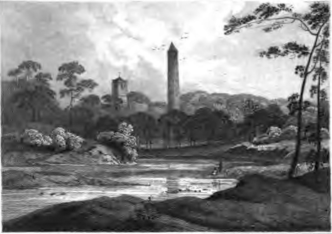
Clondalkin ( ; ) is a suburban town situated 10 km south-west of Dublin city centre, Ireland, under the administrative jurisdiction of South Dublin. It features an 8th-century round tower that acts as a focal point for the area. Clondalkin forms part of the Dublin Mid-West Dáil constituency. Clondalkin is also the name of a civil parish in the ancient barony of Uppercross, and is also used in relation to some local religious parishes. History Prehistory Neolithic tribes first settled in the area around 7,600 years ago, taking advantage of the site's favourable location on the River Camac, overlooking the River Liffey and the inland pass between the mountains and the river. Evidence of the presence of the Cualann Celtic people (an early tribe possibly noted on as the Cauci on Ptolemy's world map) can be found in various mounds and raths. Christian era Clondalkin is believed to have been founded by Saint Cronan Mochua as a monastic settlement on the River Camac over 1 ... [...More Info...] [...Related Items...] OR: [Wikipedia] [Google] [Baidu] |
N7 Road (Ireland)
The N7 road is a national primary road in Ireland, connecting Limerick and Dublin. The majority of the route (between Naas and Limerick) is motorway standard and is designated as the M7 motorway. At the Rosbrien interchange in Limerick the route continues as the N18 dual carriageway to Shannon and Ennis. The road passes through the midlands of Ireland, and acts as a trunk route out of Dublin for the N8 and N9 national primary routes to Cork and Waterford respectively. It forms part of European route E20. Route N7 - Naas Road From the M50, the N7 passes south of Clondalkin leaving the city as part of the ''Naas Road''. (The Naas Road begins at the Grand Canal as a regional road ( R810), a continuation of the Tyrconnell Road. It continues 3.4 km southwest to the M50 motorway, at the Red Cow interchange, where it becomes the N7.) The N7 route continues in a south-west direction with 3 lanes of traffic each way towards Naas for approximately . Construction of the thi ... [...More Info...] [...Related Items...] OR: [Wikipedia] [Google] [Baidu] |
Newlands Cross
Newlands Cross is a well-known junction in the south-west of County Dublin. It is the point where the N7 National Route to the South West and Mid West crosses an orbital local route, the R113. For many years this area roughly marked the place where Dublin City ended and the "country" began, though it is now inside the urban area. The R113 (in the form of the Belgard Road dual-carriageway) joins Newlands to Tallaght in the South and to the Fonthill Road in Clondalkin village to the North; the cross itself is located at the southern end of Clondalkin. By 2007, the signal-controlled junction was suffering serious traffic congestion and the upgrade to a grade-separated interchange was planned. The upgraded N7 would pass over the R113. Construction went to tender in August 2008 and preparatory work started in September 2008. Following delays, construction proper started in June 2013 and was expected to be completed in May 2015. The new flyover opened to traffic ahead of schedul ... [...More Info...] [...Related Items...] OR: [Wikipedia] [Google] [Baidu] |
Red Line (Luas)
The Red Line () is one of the two lines of Dublin's Luas light rail system. The Red Line runs in an east–west direction through the city centre, north of the River Liffey, before travelling southwest to Tallaght, with a fork to Citywest and Saggart. The Red Line opened on 26 September 2004. History Construction work began in March 2001 on the Tallaght to Connolly line, as well as the Sandyford to St. Stephen's Green section of the second line, with Gio. Ansaldo & C., Ansaldo of Italy and MVM of Australia getting the contract to build the system. The St. Stephen's Green to Dublin Airport section was dropped before construction began, as it was decided to serve the area by a Dublin Metro, metro instead. The contract to maintain operate the system was awarded to Transdev Ireland (formerly known as Connex). The extension from Connolly to The Point opened in 2009, with the extension from Belgard to Saggart opening in 2011. Interchange with the Green Line began in December 2017 with ... [...More Info...] [...Related Items...] OR: [Wikipedia] [Google] [Baidu] |
N81 Road (Ireland)
The N81 road is a national secondary road in Ireland, from the M50 motorway to Tullow, County Carlow, north to south. The N81 continues past Tullow for another 8 km to terminate at the village of Closh, County Carlow, where it intersects the N80. The N81 is longroute map. The road is a dual carriageway between M50 motorway and west of Tallaght, known as the Tallaght Bypass or Blessington Road. It intersects with the M50 motorway at Junction 11. There are plans to extend the dual carriageway by to the urban boundary. The N81 is the only major national road emanating from Dublin that is a national secondary rather than national primary road. The official definition of the N81 from the ''Roads Act, 1993 (Declaration of National Roads) Order, 2012'' Statutory I ... [...More Info...] [...Related Items...] OR: [Wikipedia] [Google] [Baidu] |
Tallaght
) , image_skyline = TallaghtDublinD24.jpg , image_caption = Tallaght, Dublin , image_flag = , flag_size = , pushpin_map = Dublin#Ireland , pushpin_label_position = left , pushpin_map_caption = Location within Greater Dublin, Ireland , coordinates = , blank_name_sec1 = Irish Grid Reference , blank_info_sec1 = , unit_pref = Metric , elevation_m = 90 , area_footnotes = , area_total_km2 = , area_land_km2 = , area_water_km2 = , area_total_sq_mi = , area_land_sq_mi = , area_water_sq_mi = , area_water_percent = , subdivision_type = Country , subdivision_name = Ireland , subdivision_type1 = Province , subdivision_name1 = Leinster , subdivision_type2 = County , subdivision_name2 = South Dublin , subdivision_ty ... [...More Info...] [...Related Items...] OR: [Wikipedia] [Google] [Baidu] |
Old Bawn
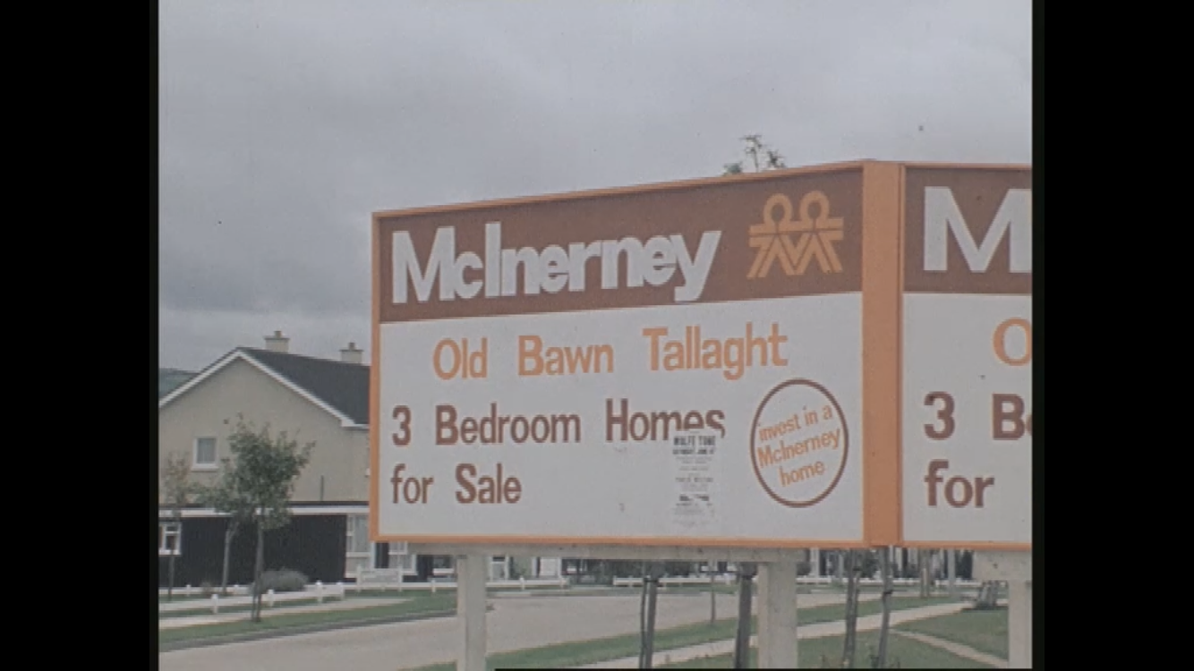
Oldbawn (or Old Bawn, ) is a small suburban area now within Tallaght on Dublin's southside. Formerly a small village in its own right, it is situated between Sean Walsh Park and the River Dodder. A bawn is the defensive wall surrounding an Irish tower house. It is the anglicised version of the Irish word ''bábhún'', meaning "cattle-stronghold" or "cattle-enclosure" History Old Bawn was the site of an estate for several centuries, and later of a small village, whose population reached over 380 in the mid-19th century to the current number of nearly 14,000. McInerney Homes began construction of the Old Bawn Housing Estate as it lies today, in the 1970s. These 3 bed semi-detached homes first sold for on average £3,700 Irish Pounds or €4,700. Old Bawn House Old Bawn House was built in 1635 by Archdeacon William Bulkeley, son of Launcelot Bulkeley the Archbishop. It was situated where the St. Maelruan's school now stands. It was one of the first Irish houses that was n ... [...More Info...] [...Related Items...] OR: [Wikipedia] [Google] [Baidu] |
R114 Road (Ireland)
The R114 road is a regional road in south Dublin, Ireland. The road runs from the city centre to Brittas in remote southwest County Dublin via Rathmines, Rathgar, Rathfarnham, Knocklyon, Firhouse and the mountainous area of Boharnabreena.Statutory Instrument 188 of 2006 — Roads Act 1993 (Classification of Regional Roads) Order 2006 ''Irish Statute Book'' (irishstatutebook.ie). Retrieved 2010-08-02. The final stretch of the road runs just north of the border between and |
Firhouse
Firhouse () is an outer suburb of Dublin, in the county of South Dublin, in the south of the traditional County Dublin in Ireland. It developed from a rural village by the River Dodder, with a second settlement, Upper Fir-house, nearby.Dublin, 1889: Handcock, George Domville: "The History and Antiquities of Tallaght in the County of Dublin", 2nd edition, Chapter 17 It is just outside the M50 orbital motorway, and in the postal district of Dublin 24. It is adjacent to Knocklyon (with which it shares a townland) and Ballycullen, and close to Tallaght. In the historic divisions of local administration, Firhouse is in the civil parish of Tallaght and the barony of Uppercross. Location and access Location Firhouse is located between Knocklyon, Ballycullen, and Tallaght, close to the foothills of the Dublin Mountains.Ordnance Survey Ireland, through geohive.ie: Online maps, Firhouse searched, accessed 16 February 2021 Located in an area that was predominantly rural until the late 20 ... [...More Info...] [...Related Items...] OR: [Wikipedia] [Google] [Baidu] |


.jpg)


