|
Russky Island
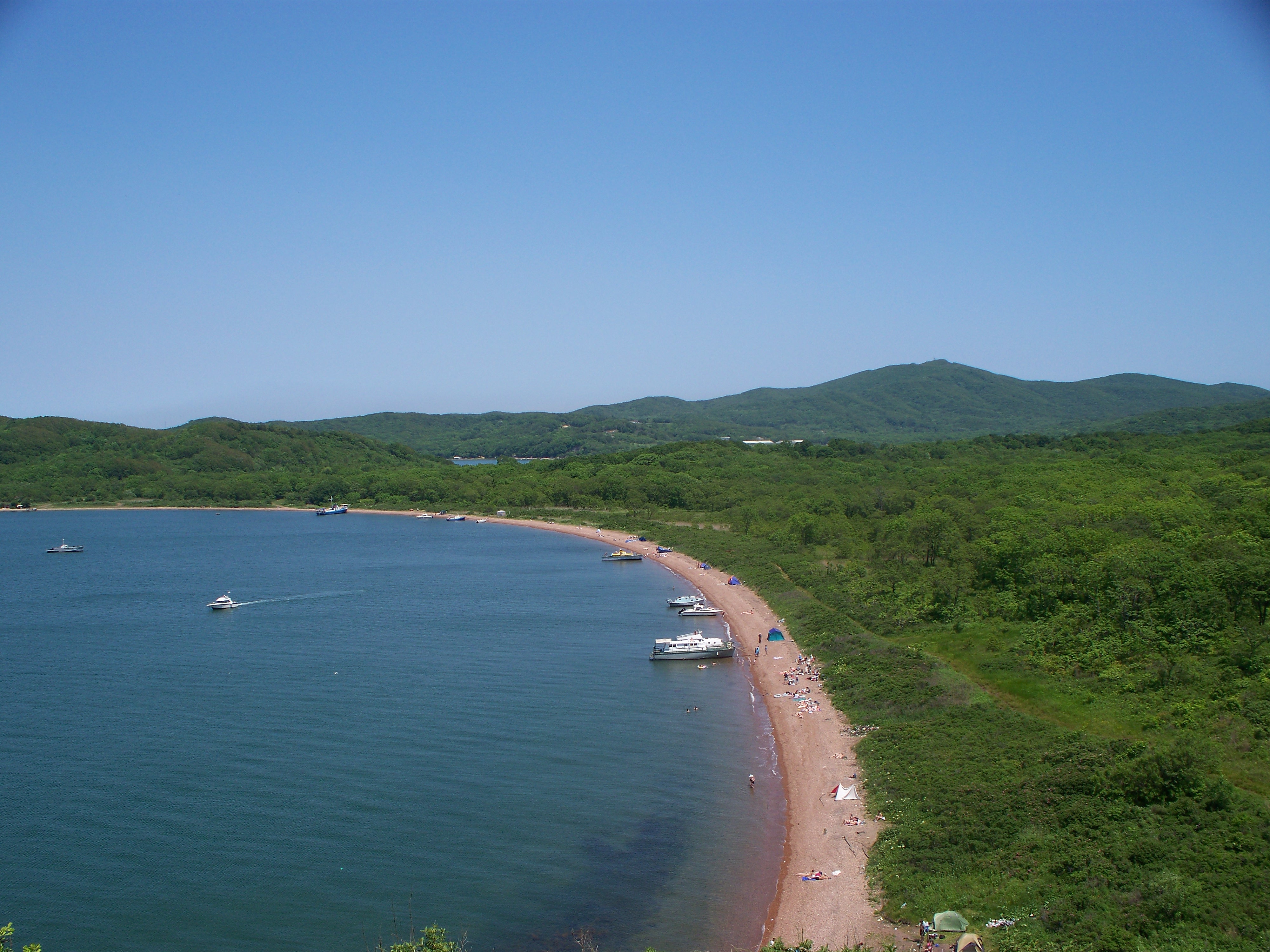
Russky Island (russian: Ру́сский о́стров, lit. ''Russian Island'') is an island in Peter the Great Gulf in the Sea of Japan, in Primorsky Krai, Russia. It is the largest island in the Eugénie Archipelago, separated from the Muravyov-Amursky Peninsula immediately to the north by the Eastern Bosphorus, and is one of the four islands in Primorsky Krai that are permanently inhabited with a population of 5,360 (2010). Russky Island is home to Far Eastern Federal University and the southern span of the Russky Bridge, the world's longest cable-stayed bridge, connecting the island across the Eastern Bosphorus to the mainland portion of Vladivostok. Geography Russky Island is located about east of Moscow, the capital of Russia. It is the largest island in Primorsky Krai, with about a quarter of its area being the Saperny Peninsula, which forms much of the north and east of the island, and the closest part to the mainland. Novik Bay is a long and thin bay located ... [...More Info...] [...Related Items...] OR: [Wikipedia] [Google] [Baidu] |
Vladivostok
Vladivostok ( rus, Владивосто́к, a=Владивосток.ogg, p=vɫədʲɪvɐˈstok) is the largest city and the administrative center of Primorsky Krai, Russia. The city is located around the Zolotoy Rog, Golden Horn Bay on the Sea of Japan, covering an area of , with a population of 600,871 residents as of 2021. Vladivostok is the second-largest city in the Far Eastern Federal District, as well as the Russian Far East, after Khabarovsk. Shortly after the signing of the Treaty of Aigun, the city was founded on July 2, 1860 as a Russian military outpost on formerly Chinese land. In 1872, the main Russian naval base on the Pacific Ocean was transferred to the city, stimulating the growth of modern Vladivostok. After the outbreak of the Russian Revolution in 1917, Vladivostok was Allied intervention in the Russian Civil War, occupied in 1918 by White Russian and Allies_of_World_War_I, Allied forces, the last of whom from Japan were not withdrawn until 1922; by that tim ... [...More Info...] [...Related Items...] OR: [Wikipedia] [Google] [Baidu] |
Shkot Island
Shkot Island ( Russian: ''Остров Шкота'' lit. ''Isle of Shkot'') is an island in the Eugénie Archipelago within the Peter the Great Gulf of the Sea of Japan. The uninhabited island is one of the five large islands in the archipelago, with an area of and its highest point at above sea level. Shkot Island is located directly south of Russky Island, to which it is connected by a low thin isthmus, making it one of only two islands in the archipelago accessible to the mainland by foot.Note: The island is shown on Google Maps as a peninsula of Russkiy island, but the satellite image, and the map at the archipelago page, show the island clearly Shkot Island, like all islands of Eugénie Archipelago, is administratively part of the city of Vladivostok in Primorsky Krai, Russia. The island was named after Nikolay Shkot, the commander of the Russian Imperial Navy corvette A corvette is a small warship. It is traditionally the smallest class of vessel considered ... [...More Info...] [...Related Items...] OR: [Wikipedia] [Google] [Baidu] |
Eastern Siberia
Siberia ( ; rus, Сибирь, r=Sibir', p=sʲɪˈbʲirʲ, a=Ru-Сибирь.ogg) is an extensive geographical region, constituting all of North Asia, from the Ural Mountains in the west to the Pacific Ocean in the east. It has been a part of Russia since the latter half of the 16th century, after the Russians conquered lands east of the Ural Mountains. Siberia is vast and sparsely populated, covering an area of over , but home to merely one-fifth of Russia's population. Novosibirsk, Krasnoyarsk and Omsk are the largest cities in the region. Because Siberia is a geographic and historic region and not a political entity, there is no single precise definition of its territorial borders. Traditionally, Siberia extends eastwards from the Ural Mountains to the Pacific Ocean, and includes most of the drainage basin of the Arctic Ocean. The river Yenisey divides Siberia into two parts, Western and Eastern. Siberia stretches southwards from the Arctic Ocean to the hills of north-cent ... [...More Info...] [...Related Items...] OR: [Wikipedia] [Google] [Baidu] |
Nikolay Muravyov-Amursky
Count Nikolay Nikolayevich Muravyov-Amursky (also spelled as Nikolai Nikolaevich Muraviev-Amurskiy; russian: link=no, Никола́й Никола́евич Муравьёв-Аму́рский; – ) was a Russian general, statesman and diplomat, who played a major role in the expansion of the Russian Empire into the Amur River basin and to the shores of the Sea of Japan. The surname Muravyov has also been transcribed as Muravyev or Murav'ev. Early life and career Nikolay Muravyov was born in Saint Petersburg and graduated from the Page Corps in 1827. He participated in the Siege of Varna in the Russo-Turkish War in 1828–1829, and later in suppression of the November Uprising in Poland in 1831. Due to health reasons, he retired from the military in 1833 and returned home to manage his father's estate. However, he returned to active duty in 1838, as General Golovin's aide-de-camp, to serve in the Caucasus region. During one of the campaigns against the mountain people Muravy ... [...More Info...] [...Related Items...] OR: [Wikipedia] [Google] [Baidu] |
Outer Manchuria
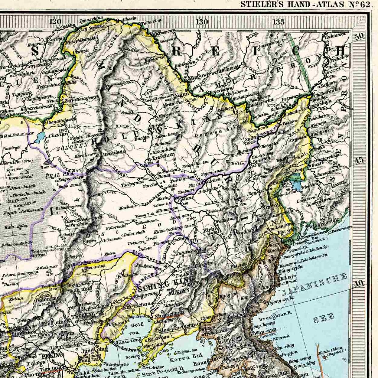
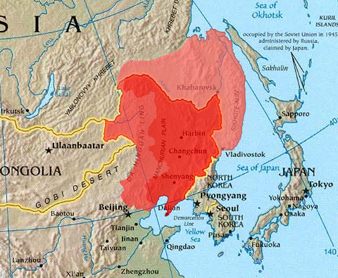
Outer Manchuria (russian: Приаму́рье, translit=Priamurye; zh, s=外满洲, t=外滿洲, p=Wài Mǎnzhōu), or Outer Northeast China ( zh, s=外东北, t=外東北, p=Wài Dōngběi), refers to a territory in Northeast Asia that is now part of Russia but used to belong to a series of Chinese dynasties, including the Tang, Liao, Jin, Eastern Xia, Yuan, Northern Yuan, Ming, Later Jin, and Qing dynasties. The Russian Empire annexed this territory through a series of unequal treaties forced upon Qing China, most notably the Treaty of Aigun in 1858 and the Treaty of Peking in 1860. It is a part of the larger region of Manchuria, with the term "Outer Manchuria" only arising because of the Russian annexation. Outer Manchuria comprises the modern-day Russian areas of Primorsky Krai, southern Khabarovsk Krai, the Jewish Autonomous Oblast, the Amur Oblast and the island of Sakhalin. The northern part of the area was disputed by Qing China and the Russian Empire, in t ... [...More Info...] [...Related Items...] OR: [Wikipedia] [Google] [Baidu] |
Convention Of Peking
The Convention of Peking or First Convention of Peking is an agreement comprising three distinct treaties concluded between the Qing dynasty of China and Great Britain, France, and the Russian Empire in 1860. In China, they are regarded as among the unequal treaties. Background On 18 October 1860, at the culmination of the Second Opium War, the British and French troops entered the Forbidden City in Beijing } Beijing ( ; ; ), alternatively romanized as Peking ( ), is the capital of the People's Republic of China. It is the center of power and development of the country. Beijing is the world's most populous national capital city, with over 21 .... Following the decisive defeat of the Chinese, Prince Gong (Qing dynasty), Prince Gong was compelled to sign two treaties on behalf of the Qing government with James Bruce, 8th Earl of Elgin, Lord Elgin and Jean-Baptiste Louis Gros, Baron Gros, who represented Britain and France respectively.Harris, David. Van Slyke, Lyman ... [...More Info...] [...Related Items...] OR: [Wikipedia] [Google] [Baidu] |
Russian Empire
The Russian Empire was an empire and the final period of the List of Russian monarchs, Russian monarchy from 1721 to 1917, ruling across large parts of Eurasia. It succeeded the Tsardom of Russia following the Treaty of Nystad, which ended the Great Northern War. The rise of the Russian Empire coincided with the decline of neighbouring rival powers: the Swedish Empire, the Polish–Lithuanian Commonwealth, Qajar Iran, the Ottoman Empire, and Qing dynasty, Qing China. It also held colonies in North America between 1799 and 1867. Covering an area of approximately , it remains the list of largest empires, third-largest empire in history, surpassed only by the British Empire and the Mongol Empire; it ruled over a population of 125.6 million people per the Russian Empire Census, 1897 Russian census, which was the only census carried out during the entire imperial period. Owing to its geographic extent across three continents at its peak, it featured great ethnic, linguistic, re ... [...More Info...] [...Related Items...] OR: [Wikipedia] [Google] [Baidu] |
Sea Level
Mean sea level (MSL, often shortened to sea level) is an average surface level of one or more among Earth's coastal bodies of water from which heights such as elevation may be measured. The global MSL is a type of vertical datuma standardised geodetic datum A geodetic datum or geodetic system (also: geodetic reference datum, geodetic reference system, or geodetic reference frame) is a global datum reference or reference frame for precisely representing the position of locations on Earth or other p ...that is used, for example, as a chart datum in cartography and Navigation, marine navigation, or, in aviation, as the standard sea level at which atmospheric pressure is measured to Calibration, calibrate altitude and, consequently, aircraft flight levels. A common and relatively straightforward mean sea-level standard is instead the midpoint between a Tide, mean low and mean high tide at a particular location. Sea levels can be affected by many factors and are known to hav ... [...More Info...] [...Related Items...] OR: [Wikipedia] [Google] [Baidu] |
Land Bridge
In biogeography, a land bridge is an isthmus or wider land connection between otherwise separate areas, over which animals and plants are able to cross and colonize new lands. A land bridge can be created by marine regression, in which sea levels fall, exposing shallow, previously submerged sections of continental shelf; or when new land is created by plate tectonics; or occasionally when the sea floor rises due to post-glacial rebound after an ice age. Prominent examples * Adam's Bridge (also known as Rama Setu), connecting India and Sri Lanka * The Bassian Plain, which linked Australia and Tasmania * The Bering Land Bridge (aka Beringia), which intermittently connected Alaska (Northern America) with Siberia (North Asia) as sea levels rose and fell under the effect of ice ages * East Asia’s former unnamed landmass, During the last Ice Age, which ended approximately 15,000 years ago, Japanese Archipelago was connected to the main continent through several land bridg ... [...More Info...] [...Related Items...] OR: [Wikipedia] [Google] [Baidu] |
Isthmus
An isthmus (; ; ) is a narrow piece of land connecting two larger areas across an expanse of water by which they are otherwise separated. A tombolo is an isthmus that consists of a spit or bar, and a strait is the sea counterpart of an isthmus. Isthmus vs land bridge vs peninsula ''Isthmus'' and ''land bridge'' are related terms, with isthmus having a broader meaning. A land bridge is an isthmus connecting Earth's major landmasses. The term ''land bridge'' is usually used in biogeology to describe land connections that used to exist between continents at various times and were important for migration of people and various species of animals and plants, e.g. Beringia and Doggerland. An isthmus is a land connection between two bigger landmasses, while a peninsula is rather a land protrusion which is connected to a bigger landmass on one side only and surrounded by water on all other sides. Technically, an isthmus can have canals running from coast to coast (e.g. the Panama ... [...More Info...] [...Related Items...] OR: [Wikipedia] [Google] [Baidu] |
Sea Stacks
A stack or sea stack is a geological landform consisting of a steep and often vertical column or columns of rock in the sea near a coast, formed by wave erosion. Stacks are formed over time by wind and water, processes of coastal geomorphology. britannica.com They are formed when part of a is by hydraulic action, which is the force of the sea or water crashing against the rock. The force of the water weakens cracks in the headland, causing them to later collapse ... [...More Info...] [...Related Items...] OR: [Wikipedia] [Google] [Baidu] |


.jpg)