|
Ruhizzi
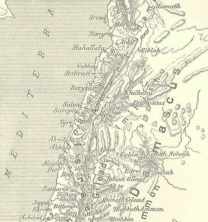
Ruhizzi, was a city, or city-state located in northern Canaan or southern Amurru territories, in the foothills of Mount Hermon during the time of the Amarna letters correspondence. During the 15-20 year Amarna letters of 1350- 1335 BC, Arsawuya was the 'mayor' of Ruhizzi and corresponded with the Egyptian pharaoh. According to EA 53, ( EA for 'el Amarna'), a letter concerning a warring Etakkama, Ruhizzi was associated with the problems of Upu in the region to the south at Damascus, (named Dimašqu), and in the region of Amqu, (the Beqaa), in the northwest. Ruhizzi is located near Kadesh-(''Qidšu''), and east of the Anti-Lebanon. See also *Arsawuya, mayor of Ruhizzi * Amarna letters References * Moran, William L. ''The Amarna Letters.'' Johns Hopkins University Press, 1987, 1992. (softcover, ) External linksRuhizzias recorded in Thutmose III Thutmose III (variously also spelt Tuthmosis or Thothmes), sometimes called Thutmose the Great, was the sixth pharaoh of the ... [...More Info...] [...Related Items...] OR: [Wikipedia] [Google] [Baidu] |
Arsawuya
Arsawuya was a 'mayor' of Ruhizzi, located east of ''Qidšu''-(Kadesh), and farther east beyond the Anti-Lebanon mountain range, during the 1350–1335 BC Amarna letters correspondence. He is referenced in five letters, two letters of which he wrote to the Egyptian pharaoh, letters EA 191, and 192, ( EA for 'el Amarna'). Arsawuya's second letter The complete topic of Arsawuya's second letter is missing because of a multi-sentence lacuna. EA 191, ''"Preparations for war"'' :To the king, my lord: Message of ''Arsawuya'', the ruler of Ruhizza. I fall at the feet of the king, my lord. The king, my lord, wrote to me to make preparations before the arrival of the archers of the king, my lord, and before the arrival of his many commissioners. :And could I think of not serving the king, my lord? :May I join up with the archers of the king and his commissioners so that, having everything prepared, I might follow them wherever they are at war against the king, my lord, and we capture them ... [...More Info...] [...Related Items...] OR: [Wikipedia] [Google] [Baidu] |
Towns Of Aram
A town is a human settlement. Towns are generally larger than villages and smaller than cities, though the criteria to distinguish between them vary considerably in different parts of the world. Origin and use The word "town" shares an origin with the German word , the Dutch word , and the Old Norse . The original Proto-Germanic word, *''tūnan'', is thought to be an early borrowing from Proto-Celtic *''dūnom'' (cf. Old Irish , Welsh ). The original sense of the word in both Germanic and Celtic was that of a fortress or an enclosure. Cognates of ''town'' in many modern Germanic languages designate a fence or a hedge. In English and Dutch, the meaning of the word took on the sense of the space which these fences enclosed, and through which a track must run. In England, a town was a small community that could not afford or was not allowed to build walls or other larger fortifications, and built a palisade or stockade instead. In the Netherlands, this space was a garden, more ... [...More Info...] [...Related Items...] OR: [Wikipedia] [Google] [Baidu] |
Amarna
Amarna (; ar, العمارنة, al-ʿamārnah) is an extensive Egyptian archaeological site containing the remains of what was the capital city of the late Eighteenth Dynasty. The city was established in 1346 BC, built at the direction of the Pharaoh Akhenaten, and abandoned shortly after his death in 1332 BC. The name that the ancient Egyptians used for the city is transliterated in English as Akhetaten or Akhetaton, meaning " the horizon of the Aten".David (1998), p. 125 The site is on the east bank of the Nile River, in what today is the Egyptian province of Minya. It is about south of the city of al-Minya, south of the Egyptian capital, Cairo, and north of Luxor (site of the previous capital, Thebes). The city of Deir Mawas lies directly to its west. On the east side of Amarna there are several modern villages, the chief of which are l-Till in the north and el-Hagg Qandil in the south. Activity in the region flourished from the Amarna Period until the later Roman era ... [...More Info...] [...Related Items...] OR: [Wikipedia] [Google] [Baidu] |
Amarna Letters Locations
Amarna (; ar, العمارنة, al-ʿamārnah) is an extensive Egyptian archaeological site containing the remains of what was the capital city of the late Eighteenth Dynasty. The city was established in 1346 BC, built at the direction of the Pharaoh Akhenaten, and abandoned shortly after his death in 1332 BC. The name that the ancient Egyptians used for the city is transliterated in English as Akhetaten or Akhetaton, meaning " the horizon of the Aten".David (1998), p. 125 The site is on the east bank of the Nile River, in what today is the Egyptian province of Minya. It is about south of the city of al-Minya, south of the Egyptian capital, Cairo, and north of Luxor (site of the previous capital, Thebes). The city of Deir Mawas lies directly to its west. On the east side of Amarna there are several modern villages, the chief of which are l-Till in the north and el-Hagg Qandil in the south. Activity in the region flourished from the Amarna Period until the later Roman era. ... [...More Info...] [...Related Items...] OR: [Wikipedia] [Google] [Baidu] |
Thutmose III
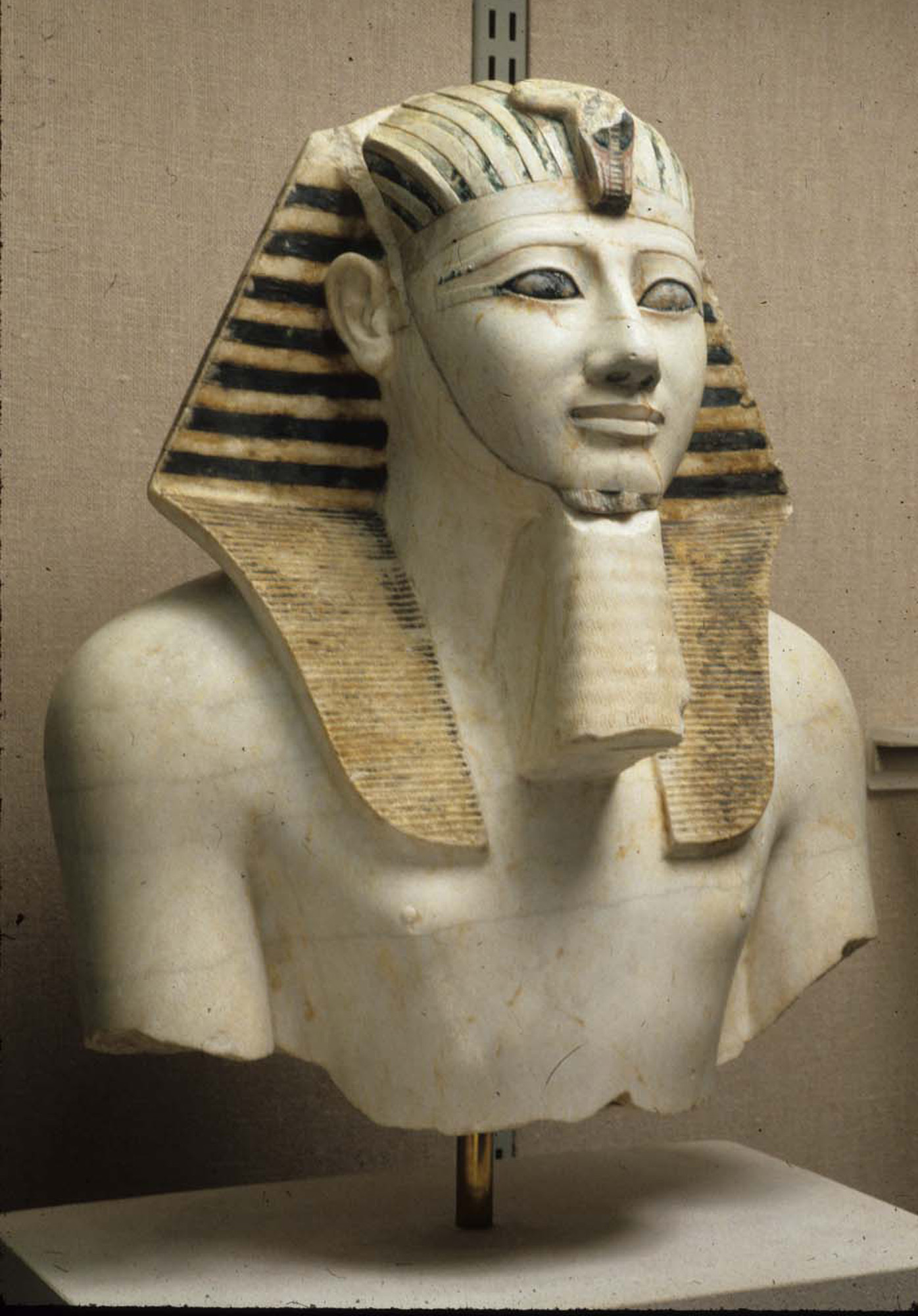
Thutmose III (variously also spelt Tuthmosis or Thothmes), sometimes called Thutmose the Great, was the sixth pharaoh of the Eighteenth Dynasty. Officially, Thutmose III ruled Egypt for almost 54 years and his reign is usually dated from 28 April 1479 BC to 11 March 1425 BC, from the age of two and until his death at age fifty-six; however, during the first 22 years of his reign, he was coregent with his stepmother and aunt, Hatshepsut, who was named the pharaoh. While he was shown first on surviving monuments, both were assigned the usual royal names and insignia and neither is given any obvious seniority over the other. Thutmose served as the head of Hatshepsut's armies. During the final two years of his reign, he appointed his son and successor, Amenhotep II, as his junior co-regent. His firstborn son and heir to the throne, Amenemhat, predeceased Thutmose III. He would become one of the most powerful pharaohs of the 18th dynasty. Becoming the sole ruling pharaoh of the ... [...More Info...] [...Related Items...] OR: [Wikipedia] [Google] [Baidu] |
William L
William is a male given name of Germanic origin.Hanks, Hardcastle and Hodges, ''Oxford Dictionary of First Names'', Oxford University Press, 2nd edition, , p. 276. It became very popular in the English language after the Norman conquest of England in 1066,All Things William"Meaning & Origin of the Name"/ref> and remained so throughout the Middle Ages and into the modern era. It is sometimes abbreviated "Wm." Shortened familiar versions in English include Will, Wills, Willy, Willie, Bill, and Billy. A common Irish form is Liam. Scottish diminutives include Wull, Willie or Wullie (as in Oor Wullie or the play ''Douglas''). Female forms are Willa, Willemina, Wilma and Wilhelmina. Etymology William is related to the given name ''Wilhelm'' (cf. Proto-Germanic ᚹᛁᛚᛃᚨᚺᛖᛚᛗᚨᛉ, ''*Wiljahelmaz'' > German ''Wilhelm'' and Old Norse ᚢᛁᛚᛋᛅᚼᛅᛚᛘᛅᛋ, ''Vilhjálmr''). By regular sound changes, the native, inherited English form of the name shoul ... [...More Info...] [...Related Items...] OR: [Wikipedia] [Google] [Baidu] |
Anti-Lebanon
The Anti-Lebanon Mountains ( ar, جبال لبنان الشرقية, Jibāl Lubnān ash-Sharqiyyah, Eastern Mountains of Lebanon; Lebanese Arabic: , , "Eastern Mountains") are a southwest–northeast-trending mountain range that forms most of the border between Syria and Lebanon. The border is largely defined along the crest of the range. Most of the range lies in Syria. Etymology Its Western name ''Anti-Lebanon'' comes from the Greek and Latin , derived from its position opposite (') and parallel to the Mount Lebanon range (). Geology The Anti-Lebanon range is approximately in length. To the south, the range adjoins the lower-lying Golan Heights plateau, but includes the highest peaks, namely Mount Hermon (''Jabal el-Shaykh'', in Arabic), at 2,814 metres, and Ta'la't Musa, at 2,669 metres. These peaks, on the Lebanese-Syrian border, are snow-covered for much of the year. Anti-Lebanon mountains are an anticline. Their predominant rocks are limestone and chalk from the Juras ... [...More Info...] [...Related Items...] OR: [Wikipedia] [Google] [Baidu] |
Kadesh (Syria)
Kadesh, or Qadesh, was an ancient city of the Levant on or near the headwaters or a ford of the Orontes River. It was of some importance during the Late Bronze Age and is mentioned in the Amarna letters. It was the site of the Battle of Kadesh between the Hittite and Egyptian empires in the 13th century BC. Name and location The name is from the West Semitic ( Canaanite) root Q-D-Š "holy". It is rendered ''Qdšw'' in Egyptian and ''Kadeš'' in Hittite. Akkadian spelling variants include ''Kinza, Kidša, Gizza''.A. B. Lloyd, ''Herodotus'', 1993p. 162 Kadesh is identified with the ruins at Tell Nebi Mend, about southwest of Homs near al-Qusayr and adjacent to the modern-day Syrian village of Tell al-Nabi Mando. The text of the Kadesh inscriptions locates Kadesh as being near Tunip in the land of the Amurru, itself assumed to have been near the Orontes River (perhaps at Tell Salhab). Some scholars also identify Kadesh with the city of ''Kadytis'' (Καδύτις in Greek) ... [...More Info...] [...Related Items...] OR: [Wikipedia] [Google] [Baidu] |
Beqaa Valley
The Beqaa Valley ( ar, links=no, وادي البقاع, ', Lebanese ), also transliterated as Bekaa, Biqâ, and Becaa and known in classical antiquity as Coele-Syria, is a fertile valley in eastern Lebanon. It is Lebanon's most important farming region. Industry also flourishes in Beqaa, especially that related to agriculture. The Beqaa is located about east of Beirut. The valley is situated between Mount Lebanon to the west and the Anti-Lebanon Mountains to the east. It forms the northeasternmost extension of the Great Rift Valley, which stretches from Syria to the Red Sea. Beqaa Valley is long and wide on average. It has a Mediterranean climate of wet, often snowy winters and dry, warm summers. The region receives limited rainfall, particularly in the north, because Mount Lebanon creates a rain shadow that blocks precipitation coming from the sea. The northern section has an average annual rainfall of , compared to in the central valley. Nevertheless, two rivers ... [...More Info...] [...Related Items...] OR: [Wikipedia] [Google] [Baidu] |
Amqu
The Amqu (also Amka, Amki, Amq) is a region (now in eastern Lebanon), equivalent to the Beqaa Valley region, named in the 1350– 1335 BC Amarna letters corpus. In the Amarna letters, two other associated regions appear to be east(?) and north(?), and are often mentioned in association with ''Amqu'', namely Nuhašše, and Niya-Niye (or Nii). A third hypothetical region, either adjacent or within the region of Amqu, is Subaru, as according to the letter corpus possessions or people were sold: "at the land of Subaru". The affairs in the region are often associated with Hatti, or the King of Hatti-(to the north), or with Etakkama of Qidšu/Qinsa-(also Kissa)-(i.e. Kadesh). Abdi-Riša letter-(his only letter) (The scribe wrote four identical letters-(for four city-state leaders), so who the 'author' is has to be speculative.) EA 363, title: "A joint report on Amqu (4)" El Amarna letter 363, ( EA for 'el Amarna'), "Report no 4" of 4. :"Say to the king-(i.e. Pharaoh), my lord, my go ... [...More Info...] [...Related Items...] OR: [Wikipedia] [Google] [Baidu] |
Damascus
)), is an adjective which means "spacious". , motto = , image_flag = Flag of Damascus.svg , image_seal = Emblem of Damascus.svg , seal_type = Seal , map_caption = , pushpin_map = Syria#Mediterranean east#Arab world#Asia , pushpin_label_position = right , pushpin_mapsize = , pushpin_map_caption = Location of Damascus within Syria , pushpin_relief = 1 , coordinates = , subdivision_type = Country , subdivision_name = , subdivision_type1 = Governorate , subdivision_name1 = Damascus Governorate, Capital City , government_footnotes = , government_type = , leader_title = Governor , leader_name = Mohammad Tariq Kreishati , parts_type = Municipalities , parts = 16 , established_title = , established_date ... [...More Info...] [...Related Items...] OR: [Wikipedia] [Google] [Baidu] |
Etakkama
Etakkama, as a common name, but also, Aitukama, Atak(k)ama, Etak(k)ama, and Itak(k)ama is the name for the 'mayor' (king) of Qidšu, ( Kadesh) of the 1350– 1335 BC Amarna letters correspondence. (Qidšu is also referenced as: Qinšu, also Kissa). Etakkama is referenced in 11 of the 382 EA letters, ( EA for 'el Amarna'), and especially, a ''series of 4'' identical letters concerning: Amqu, the region of the Beqaa in Lebanon. Those 4 letters concern the intrigues of city/city-state takeovers, along with troops from Hatti, and the claim of: ''Etakkama's troops from 'Kinsa' ''-(Qidšu-''Kissa'')- Kadesh) and are titled: ''"A joint report on Amqu (1-4)"''. Etakkama was the author of one letter, EA 189. Letter no. 189, title: ''"Etakkama of Qadesh"'' :To the king, my lord: Message of ''Etakkama'', your servant. I fall at the feet of my lord, my Sun, 7 times plus 7. My lord, I am your servant, but the wicked Biryawaza has gone on defaming me in your sight, my lord, and when he was ... [...More Info...] [...Related Items...] OR: [Wikipedia] [Google] [Baidu] |

.jpg)


