|
Rudi Kappel Airstrip
Rudi Kappel Airstrip is located south of the Tafelberg tepui in Suriname. It was constructed as part of Operation Grasshopper. It used to be named Tafelberg Airstrip, but was renamed Rudi Kappel Airstrip, after the co-pilot of a flight that crashed near Vincent Fayks Airport on 6 October 1959. History The airstrip was the first airstrip to be constructed in the interior of Suriname. On 3 March 1958, the expedition to the Tafelberg began. One of the goals of the expedition was to examine whether an airstrip could be built on the savanna. On 16 March, Rudi Kappel, H. Massink, and 18 Amerindians started clearing the area, and on 24 March, the first plane landed on the airstrip. In February 1959, Operation Grasshopper was announced which intended to map the natural resources in the interior of Suriname. As part of the operation, six more airstrips were to be constructed. Charters and destinations Charter Airlines serving this airport are: Accidents and incidents * On 25 ... [...More Info...] [...Related Items...] OR: [Wikipedia] [Google] [Baidu] |
Luchtvaartdienst Suriname
The Luchtvaartdienst Suriname is the Civil Aviation Department of the Suriname Ministry of Transport, Communication and Tourism. It is responsible for the regulation of all aviation activities in the country, and ensures that all activities are carried out in compliance with international standards. It is a member of the International Civil Aviation Organization The International Civil Aviation Organization (ICAO, ) is a specialized agency of the United Nations that coordinates the principles and techniques of international air navigation, and fosters the planning and development of international sc ... (ICAO). In April 2010, John Veira, the head of Luchtvaartdienst Suriname, was killed in his home by gunmen. Dutch language Airports and Airst ...
|
Zorg En Hoop Airport
Zorg en Hoop Airport is an airport serving general aviation in the city of Paramaribo, Suriname. It is west of the Suriname River, between the city quarters of Zorg en Hoop and Flora. The runway length includes a displaced threshold on Runway 11. The airport is suitable for charters and regular services with smaller aircraft, and for helicopter flights. Connection is maintained from the airport for several smaller airports in the interior of Suriname, and for charter flights to the Caribbean. The only regular international service is to Georgetown, Guyana Georgetown is the capital (political), capital and largest city of Guyana. It is situated in Demerara-Mahaica, region 4, on the Atlantic Ocean coast, at the mouth of the Demerara River. It is nicknamed the "Garden City of the Caribbean." It is t ..., with flights operated by Trans Guyana Airways and Gum Air with smaller propeller aircraft. Airlines operating jet aircraft serve Paramaribo via Johan Adolf Pengel Internation ... [...More Info...] [...Related Items...] OR: [Wikipedia] [Google] [Baidu] |
Transport In Suriname
The Republic of Suriname ( nl, Republiek Suriname) has a number of forms of transport. Transportation emissions are an increasing part of Suriname's contributions to climate change, as part of the Nationally Determined Contributions for the Paris Agreement, Suriname has committed to emissions controls for vehicles and increased public transit investment. Railways *Railways, total: 166 km single track. **standard gauge: 80 km gauge in West-Suriname, but not in use. This stretch was constructed as part of the West Suriname Plan. **narrow gauge: 86 km gauge Lawa Railway from Onverwacht to Sarakreek, currently not in use. In 2014, a plan had been announced to reopen the line between Onverwacht and Paramaribo Central Station. The intention was for the line to be extended onto Paramaribo Adolf Pengel Airport, but as of May 2020, the project has not started. Rail links with adjacent countries * None Highways Afobakaweg The Afobakaweg is a paved 2-lane road connect ... [...More Info...] [...Related Items...] OR: [Wikipedia] [Google] [Baidu] |
List Of Airports In Suriname
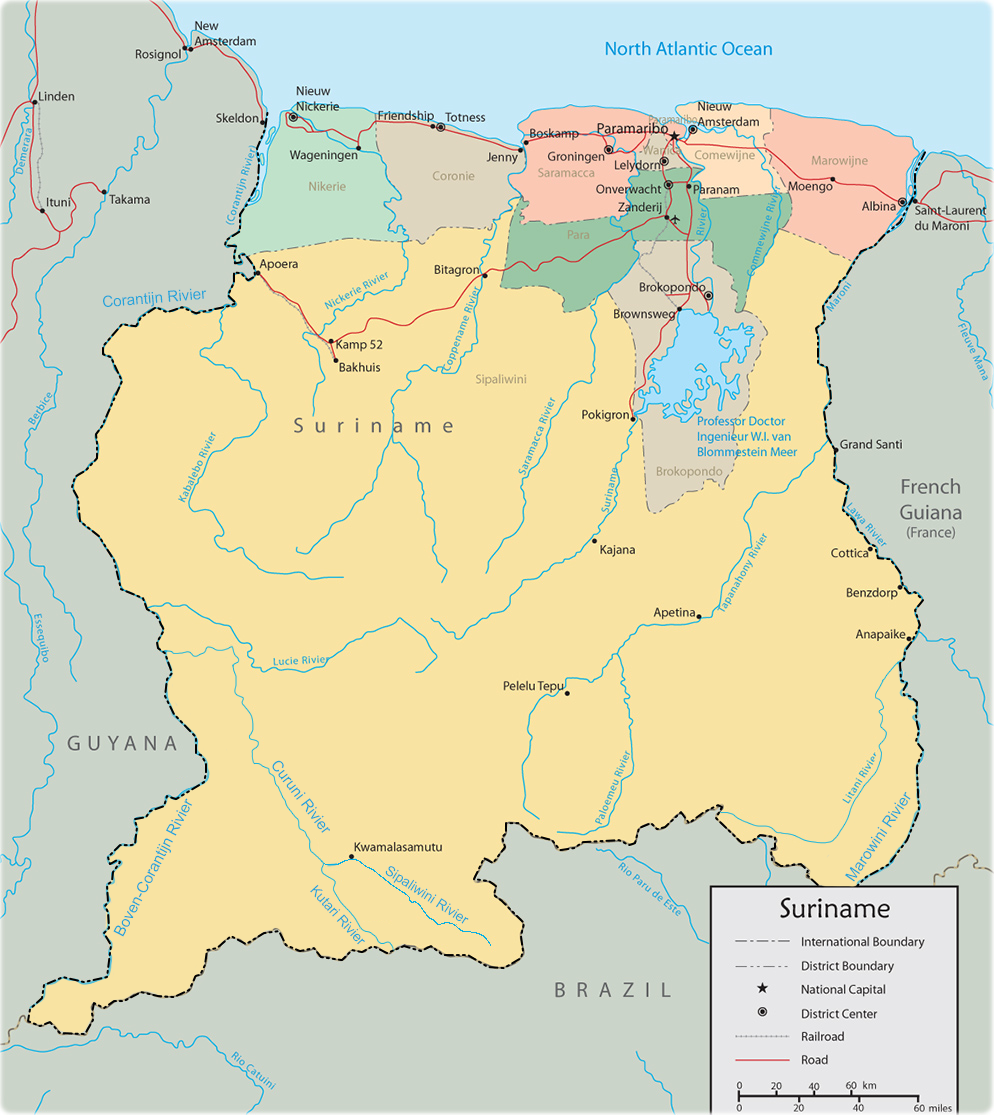
This is a list of airports in Suriname, sorted by location. Suriname, officially the Republic of Suriname, is a country in northern South America. It is situated between French Guiana to the east and Guyana to the west. The southern border is shared with Brazil and the northern border is the Atlantic coast. Suriname is the smallest sovereign state in terms of area and population in South America. The country is the only Dutch-speaking region in the Western Hemisphere that is not a part of the Kingdom of the Netherlands. __TOC__ Airports Airport names shown in bold indicate the airport has scheduled service on commercial airlines. Airports with unverified coordinates: Map See also * Transport in Suriname * Operation Grasshopper * List of airports by ICAO code: S#SM - Suriname * Wikipedia: WikiProject Aviation/Airline destination lists: South America#Suriname References Civil Aviation Department of Suriname* * - includes IATA codes World Aero Data: Airports ... [...More Info...] [...Related Items...] OR: [Wikipedia] [Google] [Baidu] |
Douglas C-47 Skytrain
The Douglas C-47 Skytrain or Dakota (RAF, RAAF, RCAF, RNZAF, and SAAF designation) is a military transport aircraft developed from the civilian Douglas DC-3 airliner. It was used extensively by the Allies during World War II and remained in front-line service with various military operators for many years.Parker 2013, pp. 13, 35, 37, 39, 45-47. Design and development The C-47 differed from the civilian DC-3 by way of numerous modifications, including being fitted with a cargo door, hoist attachment and strengthened floor - along with a shortened tail cone for glider-towing shackles, and an astrodome in the cabin roof.Wilson, Stewart. ''Aircraft of WWII''. Fyshwick, ACT, Australia: Aerospace Publications Pty Ltd., 1998. . During World War II, the armed forces of many countries used the C-47 and modified DC-3s for the transport of troops, cargo, and wounded. The U.S. naval designation was R4D. More than 10,000 aircraft were produced in Long Beach and Santa Monica, California, ... [...More Info...] [...Related Items...] OR: [Wikipedia] [Google] [Baidu] |
Military Of Suriname
, image = , alt = , caption = , image2 = , alt2 = , caption2 = , motto = , founded = 1975 , current_form = , disbanded = , branches = Surinamese Land Forces Suriname Air Force Suriname Coast Guard , headquarters = Paramaribo , flying_hours = , website = https://defense.gov.sr/ , commander-in-chief = Chan Santhokhi , commander-in-chief_title = Commander-in-chief , chief minister = , chief minister_title = , minister = Krishna Mathoera , minister_title = Minister of Defense , chief_of_staff = , chief_of_staff_title = , commander = Colonel Werner Kioe A Sen , commander_title = Commander of the Armed Forces , age = 18 , conscription = , manpower_data = 2021 , manpower_age = 18–49 , available = 134,105 ... [...More Info...] [...Related Items...] OR: [Wikipedia] [Google] [Baidu] |
Gum Air
Gum Air is a Surinamese airline based at Zorg en Hoop Airport in Paramaribo, Suriname. Gum Air cooperates with Trans Guyana Airways to provide daily flights between Zorg en Hoop Airport, Zorg en Hoop Airport (ORG) in Paramaribo, Suriname and Ogle Airport, Ogle Airport (OGL) in Georgetown, Guyana. History Gum Air was founded in 1971 by six brothers of the Gummels family. The company they started in March 1964 was agriculture airspray company named Surinam Sky Farmers and Gum Air its offspring focused more on domestic flights and regional charters. Whereas Surinam Sky Farmers has its base in the rice district of Nickerie District, Nickerie at the Wageningen Airstrip together with Overeem Air Service maintaining Grumman Ag Cat aircraft, Gum Air has set up its domestic airline at the Zorg en Hoop Airport in the city. Current operation Gum Air has its base at Zorg en Hoop airfield in the capital city Paramaribo and now mainly flies with single engine Cessna airplanes and twin-engin ... [...More Info...] [...Related Items...] OR: [Wikipedia] [Google] [Baidu] |
Caricom Airways
Caricom Airways, which stands for'' Caribbean Commuter Airways'', was a regional airline from the Caribbean, with the headquarters of the company at Paramaribo, Suriname. From the down-town Zorg en Hoop Airport in Suriname, Caricom Airways mainly flew charter flights to various destinations in the interior of Suriname, the Caribbean and Northern Brazil. Caricom Airways had plans for regular flights to regional destinations. The airline had earlier temporarily set those plans aside for cooperation with Surinam Airways (SLM = Surinaamse Luchtvaart Maatschappij). As its feeder commuter airline Caricom Airways carried out few scheduled flights to the hinterland of Suriname for SLM. This National airline, Surinam Airways (SLM), in collaboration with Caricom Airways, reintroduced domestic service to various destinations in Suriname using three aircraft belonging to Caricom Airways: two Islanders and a Cessna 206. Operational control remained in the hands of Caricom Airways. SLM periodic ... [...More Info...] [...Related Items...] OR: [Wikipedia] [Google] [Baidu] |
Blue Wing Airlines
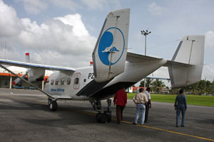
Blue Wing Airlines n.v. is an airline with its head office on the grounds of Zorg en Hoop Airport in Paramaribo, Suriname.Eight feared dead in Suriname air crash " ''''. 16 May 2010. Retrieved on 17 May 2010. The airline started operations in January 2002 and operates charter and scheduled services from to destinations in the interior of , |
Tafelberg, Suriname
Tafelberg (literally "Table Mountain") is one of the highest mountains in Suriname at . It is a tepui and is part of the Tafelberg Nature Reserve. The mountain is in the Sipaliwini District. The Rudi Kappel Airstrip, former name: Tafelberg Airstrip, is nearby. In 1943, the mountain was climbed for the first time by the Coppename River expedition lead by Dirk Geijskes. Notable disasters * In 1944 US Air Force Captain Atkinson while on a reconnaissance flight over the South of Suriname, had to make a crashlanding on the Tafelberg. Fortunately he was rescued after a few days by a military search and rescue expedition. * On 25 October 1968 a Douglas C-47 Skytrain, Douglas C-47A PH-DAA of KLM, KLM Aerocarto flew into the Tafelberg following an engine failure whilst on a survey flight. The aircraft collided with the mountain in cloud, killing three of the five people on board. References External linksGoogle Maps - Tafelberg [...More Info...] [...Related Items...] OR: [Wikipedia] [Google] [Baidu] |
Sipaliwini District
Sipaliwini is the largest district of Suriname, located in the south. Sipaliwini is the only district that does not have a regional capital, as it is directly administered by the national government in Paramaribo. History Sipaliwini was created in 1983 and has a population of 37,065 and an area of The district is nearly 4 times as large as the other 9 districts of Suriname combined; however, most of the Sipaliwini is almost completely covered by rainforest. To create the district, the Nickerie District was reduced from to Sipaliwini is the tribal area inhabited by Maroons and indigenous people. Various peace treaties starting in 1686 had recognised autonomy for the tribes over their own area; however, a specific delineation of the tribal area had been lacking. The name is of Amerindian origin, refers to the Sipaliwini River, and means "river of stones or rocks". It is thought by archaeologists that hunter-gatherers lived in what is today Sipaliwini district during the Paleolith ... [...More Info...] [...Related Items...] OR: [Wikipedia] [Google] [Baidu] |
.jpg)


.jpg)

.jpg)