|
Rudge, Somerset
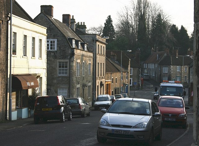
Rudge is a hamlet in the civil parish of Beckington in the Mendip district of Somerset, England. Its nearest town is Frome. Location The hamlet is located 2.5 miles (4 km) west of Westbury, Wiltshire, and 1.5 miles (2.4 km) east of A36 road going from Bath to Warminster. The neighbouring villages are Rode, Southwick, Dilton Marsh and Beckington. Amenities The Full Moon pub has developed from a small pub, now having letting rooms and a restaurant. Since 1946, a public telephone and kiosk were placed outside the pub. It is now an Information Point IPand mini book exchange. History The Old Manor House, sometimes known as Rudgehill Farm, was built in the early 17th century and refronted in 1692. The Baptist Chapel at Rudge was founded at the beginning of the 19th century. The Methodist Chapel in the centre of Rudge, which was built in 1839. It is now a private house. The electricity supply to Rudge was completed by 1950, and the piped water supply was laid on ... [...More Info...] [...Related Items...] OR: [Wikipedia] [Google] [Baidu] |
Mendip District
Mendip is a local government district of Somerset in England. The district covers a largely rural area of with a population of approximately 112,500, ranging from the Wiltshire border in the east to part of the Somerset Levels in the west. The district takes its name from the Mendip Hills which lie in its northwest. The administrative centre of the district is Shepton Mallet but the largest town (three times larger than Shepton Mallet) is Frome. The district was formed on 1 April 1974 under the Local Government Act 1972, by a merger of the municipal boroughs of Glastonbury and Wells, along with Frome, Shepton Mallet, Street urban districts, and Frome Rural District, Shepton Mallet Rural District, Wells Rural District, part of Axbridge Rural District and part of Clutton Rural District. On 1 April 2023, the district will be abolished and replaced by a new unitary district for the area at present served by Somerset County Council. The new council will be known as Somerset C ... [...More Info...] [...Related Items...] OR: [Wikipedia] [Google] [Baidu] |
Somerset
( en, All The People of Somerset) , locator_map = , coordinates = , region = South West England , established_date = Ancient , established_by = , preceded_by = , origin = , lord_lieutenant_office =Lord Lieutenant of Somerset , lord_lieutenant_name = Mohammed Saddiq , high_sheriff_office =High Sheriff of Somerset , high_sheriff_name = Mrs Mary-Clare Rodwell (2020–21) , area_total_km2 = 4171 , area_total_rank = 7th , ethnicity = 98.5% White , county_council = , unitary_council = , government = , joint_committees = , admin_hq = Taunton , area_council_km2 = 3451 , area_council_rank = 10th , iso_code = GB-SOM , ons_code = 40 , gss_code = , nuts_code = UKK23 , districts_map = , districts_list = County council area: , MPs = * Rebecca Pow (C) * Wera Hobhouse ( LD) * Liam Fox (C) * David Warburton (C) * Marcus Fysh (C) * Ian Liddell-Grainger (C) * James Heappey (C) * Jacob Rees-Mogg (C) * John Penrose (C) , police = Avon and Somerset Police ... [...More Info...] [...Related Items...] OR: [Wikipedia] [Google] [Baidu] |
Somerton And Frome (UK Parliament Constituency)
Somerton and Frome is a Constituencies of the Parliament of the United Kingdom, constituency in Somerset represented in the House of Commons of the United Kingdom, House of Commons of the Parliament of the United Kingdom, UK Parliament since 2015 United Kingdom general election, 2015 by David Warburton, who was elected as a Conservative Party (UK), Conservative, but currently sits as an Independent politician, Independent after losing the Conservative whip in April 2022 following allegations of misconduct. Boundaries 1983–1997: The District of Yeovil wards of Blackmoor Vale, Brue, Burrow Hill, Camelot, Cary, Curry Rivel, Islemoor, Ivelchester, Langport and Huish, Martock, Milborne Port, Northstone, Turn Hill, Wessex, and Wincanton, and the District of Mendip wards of Beacon, Beckington and Rode, Coleford, Creech, Frome Badcox, Frome Fromefield, Frome Keyford, Mells, Nordinton, Postlebury, Selwood and Berkley, Stratton, and Vale. 1997–2010: The District of South Somerset ward ... [...More Info...] [...Related Items...] OR: [Wikipedia] [Google] [Baidu] |
Hamlet (place)
A hamlet is a human settlement that is smaller than a town or village. Its size relative to a Parish (administrative division), parish can depend on the administration and region. A hamlet may be considered to be a smaller settlement or subdivision or satellite entity to a larger settlement. The word and concept of a hamlet has roots in the Anglo-Norman settlement of England, where the old French ' came to apply to small human settlements. Etymology The word comes from Anglo-Norman language, Anglo-Norman ', corresponding to Old French ', the diminutive of Old French ' meaning a little village. This, in turn, is a diminutive of Old French ', possibly borrowed from (West Germanic languages, West Germanic) Franconian languages. Compare with modern French ', Dutch language, Dutch ', Frisian languages, Frisian ', German ', Old English ' and Modern English ''home''. By country Afghanistan In Afghanistan, the counterpart of the hamlet is the Qila, qala (Dari language, Dari: ... [...More Info...] [...Related Items...] OR: [Wikipedia] [Google] [Baidu] |
Beckington
Beckington is a village and civil parish in the Mendip district of Somerset, England, across the River Frome from Lullington about three miles north of Frome. According to the 2011 census the parish, which includes the hamlet of Rudge, which has a population of 983, and the hamlet of Standerwick. History Beckington is mentioned in the Domesday Book of 1086, when it was held by a Roger Bushell, in the place of Æthelfrith, and it was taxed for ten hides, thereby suggesting that the cultivated area was around 1200 acres. The parish was part of the hundred of Frome and, given that a Hundred comprised one hundred hides, the estate would appear to have made up a significant proportion of its hundred. During the medieval period, Beckington was a major centre for the wool trade. By the 15th century, fulling mills had been built along the banks of the River Frome which supported the spinning and weaving cottage industries. The English antiquary John Aubrey (1626–1697) noted in ... [...More Info...] [...Related Items...] OR: [Wikipedia] [Google] [Baidu] |
Frome
Frome ( ) is a town and civil parish in eastern Somerset, England. The town is built on uneven high ground at the eastern end of the Mendip Hills, and centres on the River Frome. The town, about south of Bath, is the largest in the Mendip district of Somerset and is part of the parliamentary constituency of Somerton and Frome. The population was 28,559 in 2021. Frome was one of the largest towns in Somerset until the Industrial Revolution, and was larger than Bath from AD 950 until 1650. The town first grew due to the wool and cloth industry; it later diversified into metal-working and printing, although these have declined. The town was enlarged during the 20th century but retains a large number of listed buildings, and most of the centre falls within a conservation area. In the 2011 census, the population was given as 26,203. The town has road and rail transport links and acts as an economic centre for the surrounding area. It provides a centre for cultural and sportin ... [...More Info...] [...Related Items...] OR: [Wikipedia] [Google] [Baidu] |
Westbury, Wiltshire
Westbury is a town and civil parish in the west of the English county of Wiltshire, below the northwestern edge of Salisbury Plain, about south of Trowbridge and a similar distance north of Warminster. Originally a market town, Westbury was known for the annual Hill Fair where many sheep were sold in the 18th and 19th centuries; later growth came from the town's position at the intersection of two railway lines. The busy A350, which connects the M4 motorway with the south coast, passes through the town. The urban area has expanded to include the village of Westbury Leigh and the hamlets of Chalford and Frogmore. History A Romano-British settlement was found at The Ham, in the north of the parish, in the 1870s. The manor of Westbury, and the hundred with the same boundaries, was held by the king at the time of the Domesday survey in 1086. The Wiltshire Victoria County History recounts the fragmentation into manors, and traces their ownership. The ancient parish included B ... [...More Info...] [...Related Items...] OR: [Wikipedia] [Google] [Baidu] |
A36 Road
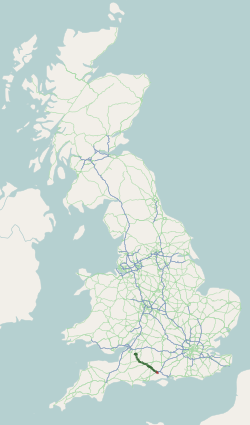
The A36 is a trunk road and primary route in southwest England that links the port city of Southampton to the city of Bath. At Bath, the A36 connects with the A4 to Bristol, thus providing a road link between the major ports of Southampton and Bristol. It also provides a link between Bristol and London via the A303. Route Originally, the A36 continued to Avonmouth, beyond Bristol, but this section was renumbered to the A4. Within Bath the A36 acts as a ring road on the southern side of the river, from the junction with the A4 at Newbridge to the west of the city. From here traffic can continue to Bristol on the A4 or to Wells and Weston-super-Mare via the A39 and A368 roads. Another link to the A4 on the eastern side at Cleveland Bridge, which provides a route to the M4 motorway via the A46, is highly congested. The A36 leaves Bath in an easterly direction towards Bathampton, then turns south to follow the Avon through its steep-sided valley, climbing out of the val ... [...More Info...] [...Related Items...] OR: [Wikipedia] [Google] [Baidu] |
Bath, Somerset
Bath () is a city in the Bath and North East Somerset unitary area in the county of Somerset, England, known for and named after its Roman-built baths. At the 2021 Census, the population was 101,557. Bath is in the valley of the River Avon, west of London and southeast of Bristol. The city became a World Heritage Site in 1987, and was later added to the transnational World Heritage Site known as the "Great Spa Towns of Europe" in 2021. Bath is also the largest city and settlement in Somerset. The city became a spa with the Latin name ' ("the waters of Sulis") 60 AD when the Romans built baths and a temple in the valley of the River Avon, although hot springs were known even before then. Bath Abbey was founded in the 7th century and became a religious centre; the building was rebuilt in the 12th and 16th centuries. In the 17th century, claims were made for the curative properties of water from the springs, and Bath became popular as a spa town in the Georgian era. ... [...More Info...] [...Related Items...] OR: [Wikipedia] [Google] [Baidu] |
Warminster
Warminster () is an ancient market town with a nearby garrison, and civil parish in south west Wiltshire, England, on the western edge of Salisbury Plain. The parish had a population of about 17,000 in 2011. The 11th-century Minster Church of St Denys stands near the River Were, which runs through the town and can be seen running through the town park. The name Warminster first occurs in the early 10th century. The High Street and Market Place have many fine buildings including the Athenaeum Centre, the Town Hall, St Lawrence Chapel, and The Old Bell, and a variety of independent shops. Etymology The origin of the root ''Wor'' is ''wara'', the genitive plural of the Old English noun ''waru'' meaning "those that care for, watch, guard, protect, or defend." It was used as an endonym by both Goths and Jutes. Their specific ethnonym is unknown, though it likely was related to the native name of the oppidum at Battlesbury Camp during Sub-Roman times. The town's name has evolved ... [...More Info...] [...Related Items...] OR: [Wikipedia] [Google] [Baidu] |
Rode, Somerset
Rode (formerly Road) is a village and civil parish in the ceremonial counties of England, ceremonial county of Somerset in England, northeast of Frome and southwest of Trowbridge. The small settlement of Rode Hill, northeast of Rode village, is now contiguous with it. The village lies within a mile of the Wiltshire border and is the easternmost settlement in Somerset. The Wiltshire village of Southwick, Wiltshire, Southwick is 2 miles (3 km) to the northeast. History The village appears as "Rode" in the Domesday Book, but the spelling was labile from an early date: it is "Roda" in assize rolls of 1201, "la Rode" in a charter roll of 1230; by the 18th century "Road" was regarded as the usual form. This was reverted to the older spelling "Rode" by Somerset County Council in 1919. The name derives from the Anglo-Saxon ''rod'', meaning a clearing. The parish was part of the Hundred (county subdivision), hundred of Frome (hundred), Frome. Rode developed from being an early cr ... [...More Info...] [...Related Items...] OR: [Wikipedia] [Google] [Baidu] |
Southwick, Wiltshire
Southwick is a semi-rural village and civil parish southwest of the county town of Trowbridge, Wiltshire, England. It is separated from the southwest fringe of Trowbridge only by the Southwick Country Park, which consists of of open fields. The majority of the village lies south of the A361, which runs through the village, linking Trowbridge with Frome. The parish includes the hamlets of Hoggington and Hoopers Pool. Geography The Somerset border lies approximately one mile southwest of Southwick village. Nearby villages are Rode, about to the southwest, and North Bradley, one mile to the east. A tributary of the River Biss, the Lambrok Stream, which is fed from streams in the south and west of the parish, flows to the southeast of the village and then turns to form part of the parish's northeastern boundary with Trowbridge. History Southwick, together with North Bradley, was part of Steeple Ashton manor in Anglo-Saxon times. The area was part of the extensive Selwoo ... [...More Info...] [...Related Items...] OR: [Wikipedia] [Google] [Baidu] |


