|
Ruaotuwhenua
Ruaotuwhenua is a hill in the Waitākere Ranges of the Auckland Region of New Zealand's North Island. At 440-metres, it is one of the tallest of the Waitākere Ranges, and the tallest of the eastern ranges adjacent to Auckland. The peak is the location of an air traffic radome, and a radio mast is located further down the slope of the hill in Waiatarua. Geology Ruaotuwhenua, along with the Scenic Drive ridge, are the remnants of one of the eastern sides of the Waitākere Volcano, a Miocene era volcanic crater complex which was uplifted from the seafloor between 3 and 5 million years ago. Geography The hill is a 440-metre peak in the eastern Waitākere Ranges. It is located near the settlement of Waiatarua, and is accessible by Scenic Drive. The northern side of the hill is the source for Stoney Creek, a tributary of the Opanuku Stream, while the south-eastern side is a source for the Mander Creek, a tributary of the Nihotupu Stream which flows into the Upper Nihotupu Re ... [...More Info...] [...Related Items...] OR: [Wikipedia] [Google] [Baidu] |
Waitākere Ranges
The Waitākere Ranges is a mountain range in New Zealand. Located in West Auckland between metropolitan Auckland and the Tasman Sea, the ranges and its foothills and coasts comprise some of public and private land. The area, traditionally known to Māori as ''Te Wao Nui o Tiriwa'' (The Great Forest of Tiriwa), is of local, regional, and national significance. The Waitākere Ranges includes a chain of hills in the Auckland Region, generally running approximately from north to south, 25 km west of central Auckland. The ranges are part of the Waitākere Ranges Regional Park. From 1 May 2018 the forested areas of the Waitākere Ranges Regional Park were closed, with some exceptions, while Auckland Council upgraded the tracks to dry foot standard protect the roots and to prevent the spread of kauri dieback, bacteria that affect kauri trees and prevents them from getting nutrients, effectively killing them. There is no cure. But Etymology The name ''Wai-tākere'' origina ... [...More Info...] [...Related Items...] OR: [Wikipedia] [Google] [Baidu] |
Scenic Drive, Auckland
Scenic Drive is a road that runs through the bush-clad Waitākere Ranges from Titirangi to Swanson on the western outskirts of Auckland, New Zealand. It is part of Auckland urban route 24. As the name indicates, it is famous for the sweeping views over the western parts of the Auckland Region. The road passes through the village of Waiatarua, but most of it is through native bush (forest), in Centennial Memorial Park or the neighbouring water catchment area. It connects with West Coast Road, Shaw Road, Konini Road and Piha Road to the surf beaches at Karekare and Piha. It is paralleled by the disused Exhibition Drive, now used by pedestrians & cyclists. The Arataki Visitor Centre provides displays of the local flora, fauna and geology and well-maintained walking tracks. Along the parts of the road that pass through private land are a native-plant seller, several potters and a disused winery. Large parts of the Waitākere Ranges are now closed to the public for hiking and wa ... [...More Info...] [...Related Items...] OR: [Wikipedia] [Google] [Baidu] |
Puketāpapa
Puketāpapa, also known as Pukewīwī and Mount Roskill, is a Volcano, volcanic peak and Tūpuna Maunga o Tāmaki Makaurau, Tūpuna Maunga (ancestral mountain) in Auckland, New Zealand. It is located in the suburb that shares its English name, Mount Roskill. Description The mountain formed as a result of volcanic activity approximately 20,000 years ago. Its peak, located in present-day Winstone Park towards the southwest end of the suburb, is 110 metres in height. It is one of the many extinct cones that dot the isthmus of Auckland, all part of the Auckland volcanic field. The scoria cone was built by lava fountain, fire-fountaining from two craters. Lava flowed from the base of the cone to the north and to the northwest. It was the site of a Māori people, Māori Pa (Māori), pā (fortified village), and was known as ''Pukewīwī'' (hill covered in rushes) and ''Puketāpapa'' (flat-topped hill). Many historic cooking pits and terracing sites were destroyed when the main south ... [...More Info...] [...Related Items...] OR: [Wikipedia] [Google] [Baidu] |
New Zealand Government
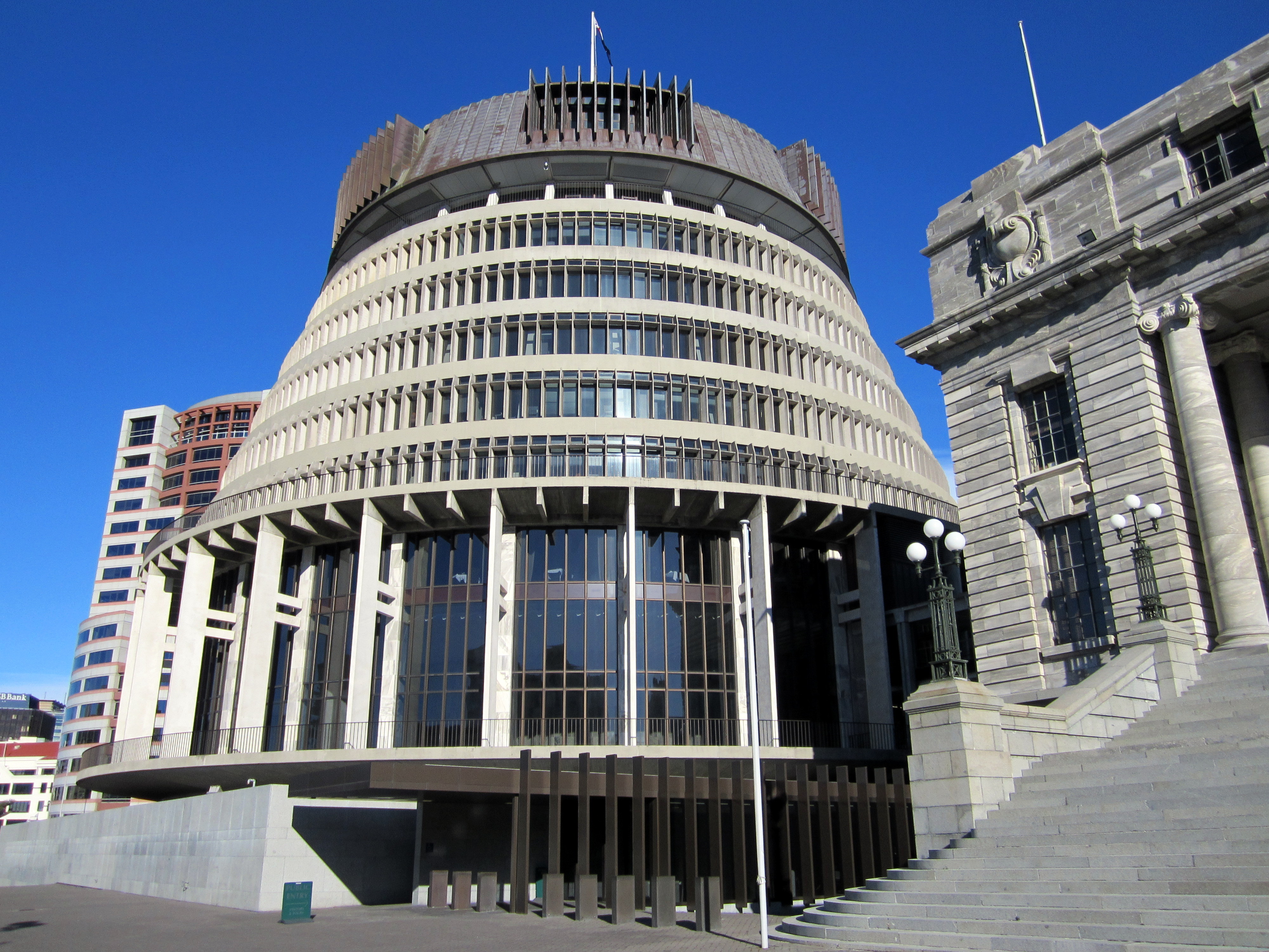
, background_color = #012169 , image = New Zealand Government wordmark.svg , image_size=250px , date_established = , country = New Zealand , leader_title = Prime Minister Jacinda Ardern , appointed = Governor-General , main_organ = , ministries = 32 ministries and departments , responsible = House of Representatives , budget = 119.3 billion (2018–19) , address = The Beehive and other locations across Wellington , url = The New Zealand Government ( mi, Te Kāwanatanga o Aotearoa) is the central government through which political authority is exercised in New Zealand. As in most other parliamentary democracies, the term "Government" refers chiefly to the executive branch, and more specifically to the collective ministry directing the executive. Based on the principle of responsible government, it operates within the framework that "the Queen reigns, but the government rules, so long as it has the support of the House of Representatives".Sir Kenneth Keith, qu ... [...More Info...] [...Related Items...] OR: [Wikipedia] [Google] [Baidu] |
Volcanoes Of The Auckland Region
A volcano is a rupture in the Crust (geology), crust of a Planet#Planetary-mass objects, planetary-mass object, such as Earth, that allows hot lava, volcanic ash, and volcanic gas, gases to escape from a magma chamber below the surface. On Earth, volcanoes are most often found where list of tectonic plates, tectonic plates are divergent boundary, diverging or convergent boundary, converging, and most are found underwater. For example, a mid-ocean ridge, such as the Mid-Atlantic Ridge, has volcanoes caused by divergent tectonic plates whereas the Pacific Ring of Fire has volcanoes caused by convergent tectonic plates. Volcanoes can also form where there is stretching and thinning of the crust's plates, such as in the East African Rift and the Wells Gray-Clearwater volcanic field and Rio Grande rift in North America. Volcanism away from plate boundaries has been postulated to arise from upwelling diapirs from the core–mantle boundary, deep in the Earth. This results in hotspot ... [...More Info...] [...Related Items...] OR: [Wikipedia] [Google] [Baidu] |
Hills Of The Auckland Region
A hill is a landform that extends above the surrounding terrain. It often has a distinct summit. Terminology The distinction between a hill and a mountain is unclear and largely subjective, but a hill is universally considered to be not as tall, or as steep as a mountain. Geographers historically regarded mountains as hills greater than above sea level, which formed the basis of the plot of the 1995 film ''The Englishman who Went up a Hill but Came down a Mountain''. In contrast, hillwalkers have tended to regard mountains as peaks above sea level. The ''Oxford English Dictionary'' also suggests a limit of and Whittow states "Some authorities regard eminences above as mountains, those below being referred to as hills." Today, a mountain is usually defined in the UK and Ireland as any summit at least high, while the official UK government's definition of a mountain is a summit of or higher. Some definitions include a topographical prominence requirement, typically o ... [...More Info...] [...Related Items...] OR: [Wikipedia] [Google] [Baidu] |
Lookouts In Auckland
A lookout or look-out is a person in charge of the observation of hazards. The term originally comes from a naval background, where lookouts would watch for other ships, land, and various dangers. The term has now passed into wider parlance. Naval application Lookouts have been traditionally placed in high on masts, in crow's nests and tops. The International Regulations for Preventing Collisions at Sea (1972) says in part: : Every vessel must at all times keep a proper look-out by sight (day shape or lights by eyes or visual aids), hearing (sound signal or Marine VHF radio) and all available means (e.g. Radar, ARPA, AIS, GMDSS...) in order to judge if risk of collision exists. Lookouts report anything they see and or hear. When reporting contacts, lookouts give information such as, bearing of the object, which way the object is headed, target angles and position angles and what the contact is. Lookouts should be thoroughly familiar with the various types of distress sign ... [...More Info...] [...Related Items...] OR: [Wikipedia] [Google] [Baidu] |
Auckland Airport
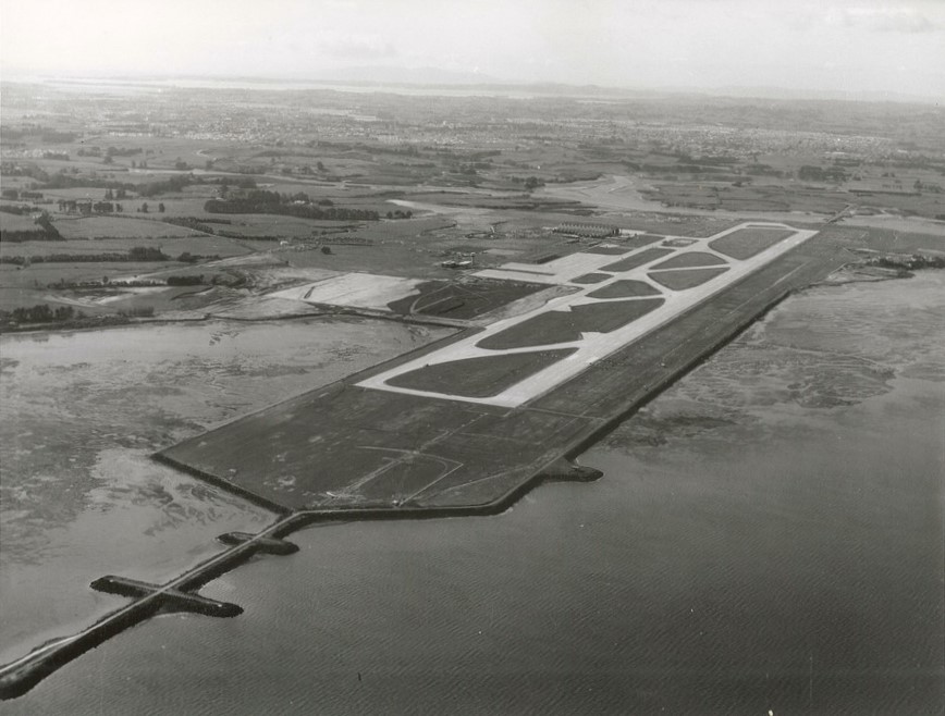
Auckland Airport is the largest and busiest airport in New Zealand, with over 21 million passengers in the year ended March 2019. The airport is located near Māngere, a residential suburb, and Airport Oaks, a service hub suburb south of the Auckland city centre. It is both a domestic and international hub for Air New Zealand, and the New Zealand hub of Jetstar. The airport is one of New Zealand's most important infrastructure assets, providing thousands of jobs for the region. It handled 71 per cent of New Zealand's international air passenger arrivals and departures in 2000. It is one of only two commercial airports in New Zealand (the other being Christchurch) capable of handling Boeing 747 and Airbus A380 aircraft. The airport has a single runway, 05R/23L, which is Cat IIIb capable (at a reduced rate of movements) in the 23L direction. It has a capacity of about 45 flight movements per hour, and is currently the busiest single-runway airport in Oceania. In November 200 ... [...More Info...] [...Related Items...] OR: [Wikipedia] [Google] [Baidu] |
Very High Frequency
Very high frequency (VHF) is the ITU designation for the range of radio frequency electromagnetic waves ( radio waves) from 30 to 300 megahertz (MHz), with corresponding wavelengths of ten meters to one meter. Frequencies immediately below VHF are denoted high frequency (HF), and the next higher frequencies are known as ultra high frequency (UHF). VHF radio waves propagate mainly by line-of-sight, so they are blocked by hills and mountains, although due to refraction they can travel somewhat beyond the visual horizon out to about 160 km (100 miles). Common uses for radio waves in the VHF band are Digital Audio Broadcasting (DAB) and FM radio broadcasting, television broadcasting, two-way land mobile radio systems (emergency, business, private use and military), long range data communication up to several tens of kilometers with radio modems, amateur radio, and marine communications. Air traffic control communications and air navigation systems (e.g. VOR and ILS) wo ... [...More Info...] [...Related Items...] OR: [Wikipedia] [Google] [Baidu] |
The New Zealand Herald
''The New Zealand Herald'' is a daily newspaper published in Auckland, New Zealand, owned by New Zealand Media and Entertainment, and considered a newspaper of record for New Zealand. It has the largest newspaper circulation of all newspapers in New Zealand, peaking at over 200,000 copies in 2006, although circulation of the daily ''Herald'' had declined to 100,073 copies on average by September 2019. Its main circulation area is the Auckland region. It is also delivered to much of the upper North Island including Northland, Waikato and King Country. History ''The New Zealand Herald'' was founded by William Chisholm Wilson, and first published on 13 November 1863. Wilson had been a partner with John Williamson in the ''New Zealander'', but left to start a rival daily newspaper as he saw a business opportunity with Auckland's rapidly growing population. He had also split with Williamson because Wilson supported the war against the Māori (which the ''Herald'' termed "the ... [...More Info...] [...Related Items...] OR: [Wikipedia] [Google] [Baidu] |
Auckland Star
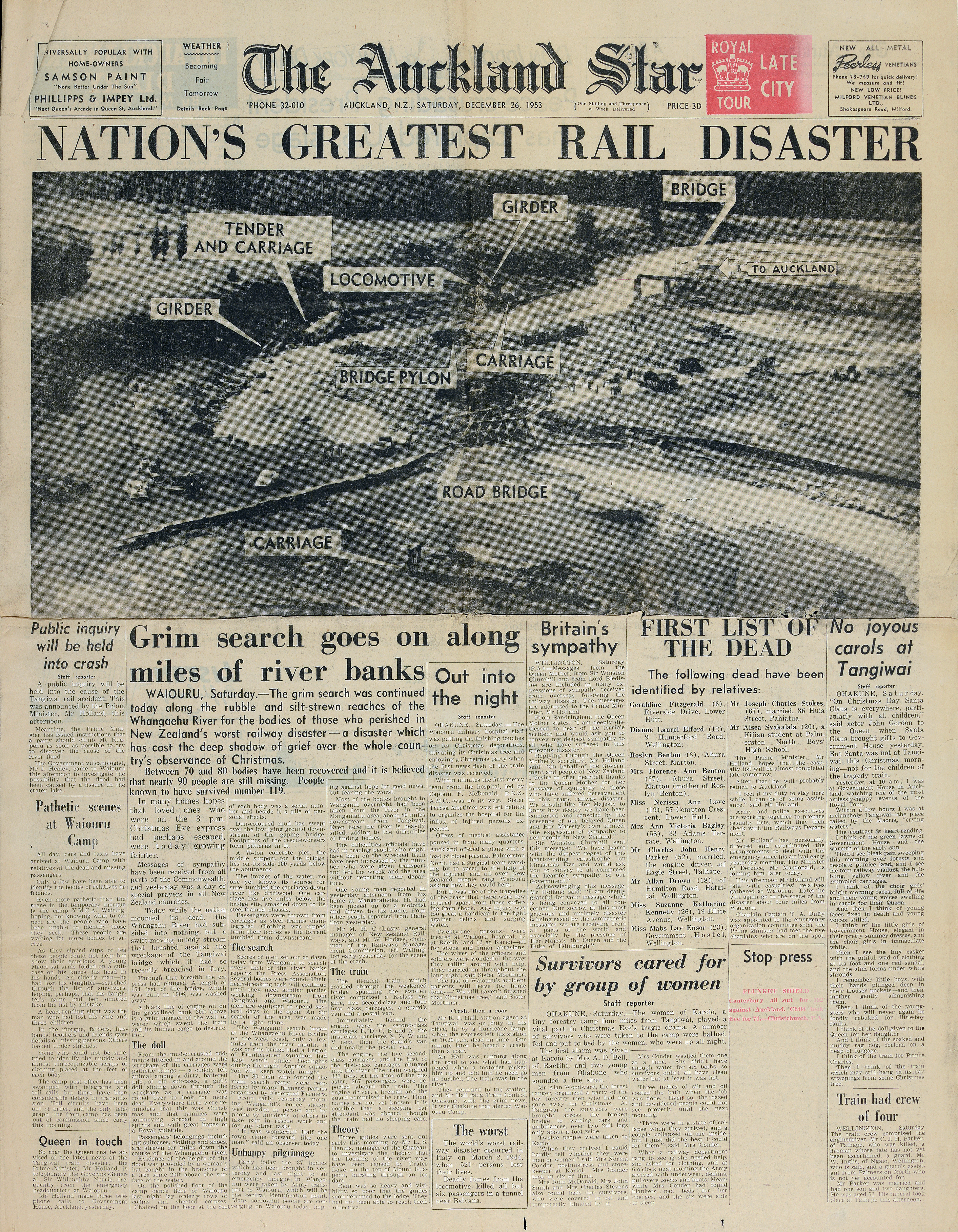
The ''Auckland Star'' was an evening daily newspaper published in Auckland, New Zealand, from 24 March 1870 to 16 August 1991. Survived by its Sunday edition, the ''Sunday Star'', part of its name endures in ''The Sunday Star-Times'', created in the 1994 merger of the ''Dominion Sunday Times'' and the ''Sunday Star''. Originally published as the ''Evening Star'' from 24 March 1870 to 7 March 1879, the paper continued as the ''Auckland Evening Star'' between 8 March 1879 and 12 April 1887, and from then on as the ''Auckland Star''. One of the paper's notable investigative journalists was Pat Booth, who was responsible for notable coverage of the Crewe murders and the eventual exoneration of Arthur Allan Thomas. Booth and the paper extensively reported on the Mr Asia case. In 1987, the owners of the ''Star'' launched a morning newspaper to more directly compete with ''The New Zealand Herald''. The ''Auckland Sun'' was affected by the 1987 stock market crash and folded a year l ... [...More Info...] [...Related Items...] OR: [Wikipedia] [Google] [Baidu] |
Te Toiokawharu
Te Toiokawharu is a hill in the Waitākere Ranges of the Auckland Region of New Zealand's North Island. At 474-metres, it is the tallest peak of the Waitākere Ranges. The peak has a low Topographic prominence, prominence due to surrounding hills of similar sizes. Description The hill is a 474-metre peak in the central Waitākere Ranges. It is accessible by the Twin Peaks Track, a tramping track linking Huia, New Zealand, Huia and the Huia Ridge Track. The northern side of Te Toiokawharu is the source of the Georges Stream, which flows into the Lower Huia Dam, while the southern side is the source for the Karamatura Stream. Both waterways flow into the Manukau Harbour near Huia, New Zealand, Huia. Geologically, Te Toiokawharu and the upper Huia and Karamatura stream valleys are formed of Miocene-era breccia rock formation. Te Toiokawharu is the highest point of the mainland Auckland Region, shorter than Hauraki Gulf island peaks such as Mount Hauturu (722-metres) on Little B ... [...More Info...] [...Related Items...] OR: [Wikipedia] [Google] [Baidu] |


