|
Roxboro, Limerick
Roxborough (Irish: ''Baile an Róistigh'') is a townland in County Limerick, Ireland comprising some 24.02 km2.CSO Census 2011 Results Retrieved on 25 January 2014. It lies to the south of the townlands of Ballysheedy and Routagh and to the east of the townland of Ballyclough. Its northern boundary, partially bounded by the Ballyclough River, lies some three kilometres to the south of the boundary at Southill. The Limerick to Fedamore road ( [...More Info...] [...Related Items...] OR: [Wikipedia] [Google] [Baidu] |
Provinces Of Ireland
There have been four Provinces of Ireland: Connacht (Connaught), Leinster, Munster, and Ulster. The Irish language, Irish word for this territorial division, , meaning "fifth part", suggests that there were once five, and at times Kingdom_of_Meath, Meath has been considered to be the fifth province; in the medieval period, however, there were often more than five. The number of provinces and their delimitation fluctuated until 1610, when they were permanently set by the English administration of James VI and I, James I. The provinces of Ireland no longer serve administrative or political purposes but function as historical and cultural entities. Etymology In modern Irish language, Irish the word for province is (pl. ). The modern Irish term derives from the Old Irish (pl. ) which literally meant "a fifth". This term appears in 8th-century law texts such as and in the legendary tales of the Ulster Cycle where it refers to the five kingdoms of the "Pentarchy". MacNeill enumer ... [...More Info...] [...Related Items...] OR: [Wikipedia] [Google] [Baidu] |
Acre
The acre is a unit of land area used in the imperial Imperial is that which relates to an empire, emperor, or imperialism. Imperial or The Imperial may also refer to: Places United States * Imperial, California * Imperial, Missouri * Imperial, Nebraska * Imperial, Pennsylvania * Imperial, Texa ... and United States customary units#Units of area, US customary systems. It is traditionally defined as the area of one Chain (unit), chain by one furlong (66 by 660 feet), which is exactly equal to 10 square chains, of a square mile, 4,840 square yards, or 43,560 square feet, and approximately 4,047 m2, or about 40% of a hectare. Based upon the International yard and pound, international yard and pound agreement of 1959, an acre may be declared as exactly 4,046.8564224 square metres. The acre is sometimes abbreviated ac but is usually spelled out as the word "acre".National Institute of Standards and Technolog(n.d.) General Tables of Units of Measurement . Traditionally, i ... [...More Info...] [...Related Items...] OR: [Wikipedia] [Google] [Baidu] |
Charles Vereker
Charles Vereker, 2nd Viscount Gort PC (Ire) (1768 – 11 November 1842), known as Charles Vereker until 1817, was an Irish soldier and politician. Background Gort was the son of Thomas Vereker by Juliana, daughter of Charles Smyth and sister of John Prendergast-Smyth, 1st Viscount Gort and was born in Ireland in 1768. He served a short time in the navy, and was afterwards appointed lieutenant-colonel of the Limerick militia. Political career Gort represented Limerick City in the Irish House of Commons from 1790 until the Act of Union in 1801. On 5 September 1798 at Collooney he checked the advance of a French force, led by General Humbert, that had landed at Killala Bay, County Sligo whereupon they were defeated at Ballinamuck, where he was wounded. In 1802 he was elected to the British House of Commons for Limerick, a seat he held until 1817, and served as a Lord of the Treasury between 1807 and 1812. He was sworn of the Irish Privy Council in 1809 and, having succeeded his ... [...More Info...] [...Related Items...] OR: [Wikipedia] [Google] [Baidu] |
Dutch Architecture
Dutch architecture has played an important role in the international discourse on architecture in three eras. The first of these was during the 17th century, when the Dutch empire was at the height of its power. The second was in the first half of the 20th century, during development of modernism. The third is not concluded and involves many contemporary Dutch architects who are achieving global prestige. Examples Renaissance and Baroque The Dutch Golden Age roughly spanned the 17th century. Due to the thriving economy, cities expanded greatly. New town halls and storehouses were built, and many new canals were dug out in and around various cities such as Delft, Leiden and Amsterdam for defence and transport purposes. Many wealthy merchants had a new houses built along these canals. These houses were generally very narrow and had ornamented façades that befitted their new status. In the countryside, new country houses were built, though not in the same numbers. Of Italian ... [...More Info...] [...Related Items...] OR: [Wikipedia] [Google] [Baidu] |
Anne, Queen Of Great Britain
Anne (6 February 1665 – 1 August 1714) was Queen of England, Scotland and Ireland from 8 March 1702 until 1 May 1707. On 1 May 1707, under the Acts of Union, the kingdoms of England and Scotland united as a single sovereign state known as Great Britain. Anne continued to reign as Queen of Great Britain and Ireland until her death. Anne was born in the reign of Charles II to his younger brother and heir presumptive, James, whose suspected Roman Catholicism was unpopular in England. On Charles's instructions, Anne and her elder sister Mary were raised as Anglicans. Mary married their Dutch Protestant cousin, William III of Orange, in 1677, and Anne married Prince George of Denmark in 1683. On Charles's death in 1685, James succeeded to the throne, but just three years later he was deposed in the Glorious Revolution of 1688. Mary and William became joint monarchs. Although the sisters had been close, disagreements over Anne's finances, status, and choice of acquaintances ar ... [...More Info...] [...Related Items...] OR: [Wikipedia] [Google] [Baidu] |
Hollow Sword Blade Company
The Hollow Sword Blades Company was a British joint-stock company founded in 1691 by a goldsmith, Sir Stephen Evance, for the manufacture of hollow-ground rapiers. In 1700 the company was purchased by a syndicate of businessmen who used the corporate identity of the company to operate as a bank. At this time the Bank of England held a monopoly by act of parliament as the only organisation permitted to operate as a bank in England, so anyone wishing to carry out banking operations had to do so by devious means. The company was used as a stepping stone to the foundation of the South Sea Company which set out to supplant the Bank of England as banker to the government. Founder Sir Stephen Evance was a goldsmith whose father had been born in New England, but who had set up a business in Lombard Street in London. Evance did not confine his interests simply to metalwork, but had attempted salvage work with a diving machine, lead mining, mineral prospecting in Canada, a fishing enterp ... [...More Info...] [...Related Items...] OR: [Wikipedia] [Google] [Baidu] |
Cromwellian Plantation
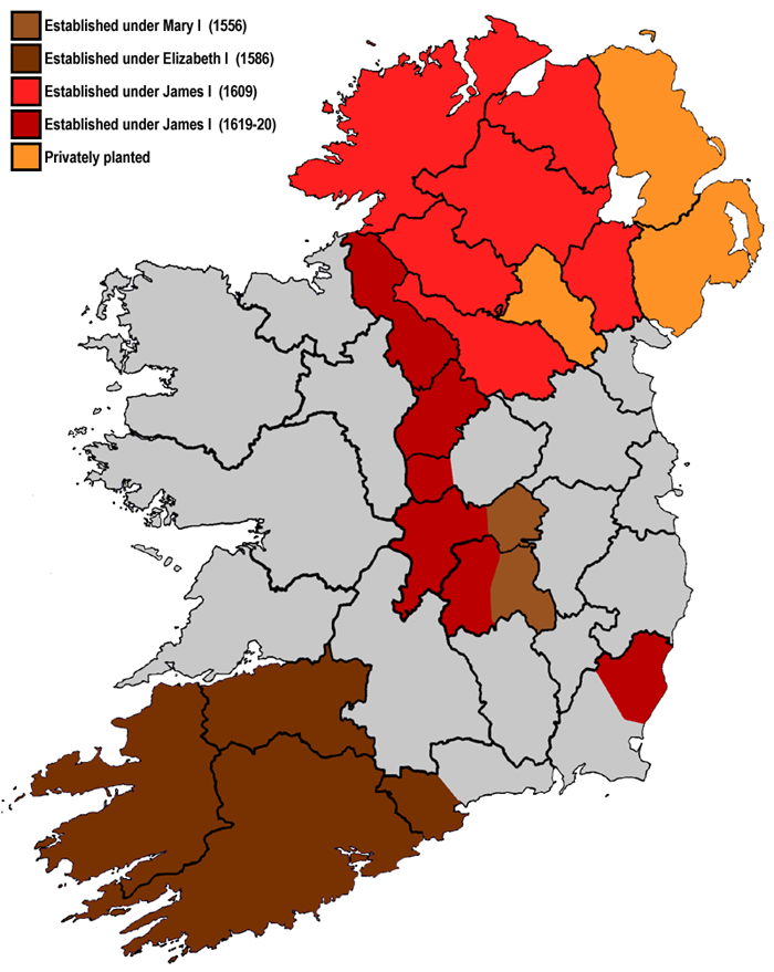
Plantations in 16th- and 17th-century Ireland involved the confiscation of Irish-owned land by the English Crown and the colonisation of this land with settlers from Great Britain. The Crown saw the plantations as a means of controlling, anglicising and 'civilising' Gaelic Ireland. The main plantations took place from the 1550s to the 1620s, the biggest of which was the plantation of Ulster. The plantations led to the founding of many towns, massive demographic, cultural and economic changes, changes in land ownership and the landscape, and also to centuries of ethnic and sectarian conflict. They took place before and during the earliest English colonisation of the Americas, and a group known as the West Country Men were involved in both Irish and American colonization. There had been small-scale immigration from Britain since the 12th century, after the Anglo-Norman invasion. By the 15th century, direct English control had shrunk to an area called the Pale. In the 1540s th ... [...More Info...] [...Related Items...] OR: [Wikipedia] [Google] [Baidu] |
James II Of England
James VII and II (14 October 1633 16 September 1701) was King of England and King of Ireland as James II, and King of Scotland as James VII from the death of his elder brother, Charles II, on 6 February 1685. He was deposed in the Glorious Revolution of 1688. He was the last Catholic monarch of England, Scotland, and Ireland. His reign is now remembered primarily for conflicts over religious tolerance, but it also involved struggles over the principles of absolutism and the divine right of kings. His deposition ended a century of political and civil strife in England by confirming the primacy of the English Parliament over the Crown. James succeeded to the thrones of England, Ireland, and Scotland following the death of his brother with widespread support in all three countries, largely because the principles of eligibility based on divine right and birth were widely accepted. Tolerance of his personal Catholicism did not extend to tolerance of Catholicism in general, an ... [...More Info...] [...Related Items...] OR: [Wikipedia] [Google] [Baidu] |
Census Of Ireland 2011
The 2011 census of Ireland was held on Sunday, 10 April 2011. It was administered by the Central Statistics Office of Ireland and found the population to be 4,588,252 people. ''CSO 2011'' Before the census, the latest population estimate was published in September 2010 and calculated that the Irish population had been 4,470,700 in April 2010. The previous census took place five years earlier, on Sunday, 23 April 2006. 2016 census of Ireland, The subsequent census took place five years later, on 24 April 2016. The 2011 census was held during the same year as the |
Electoral Division (Ireland)
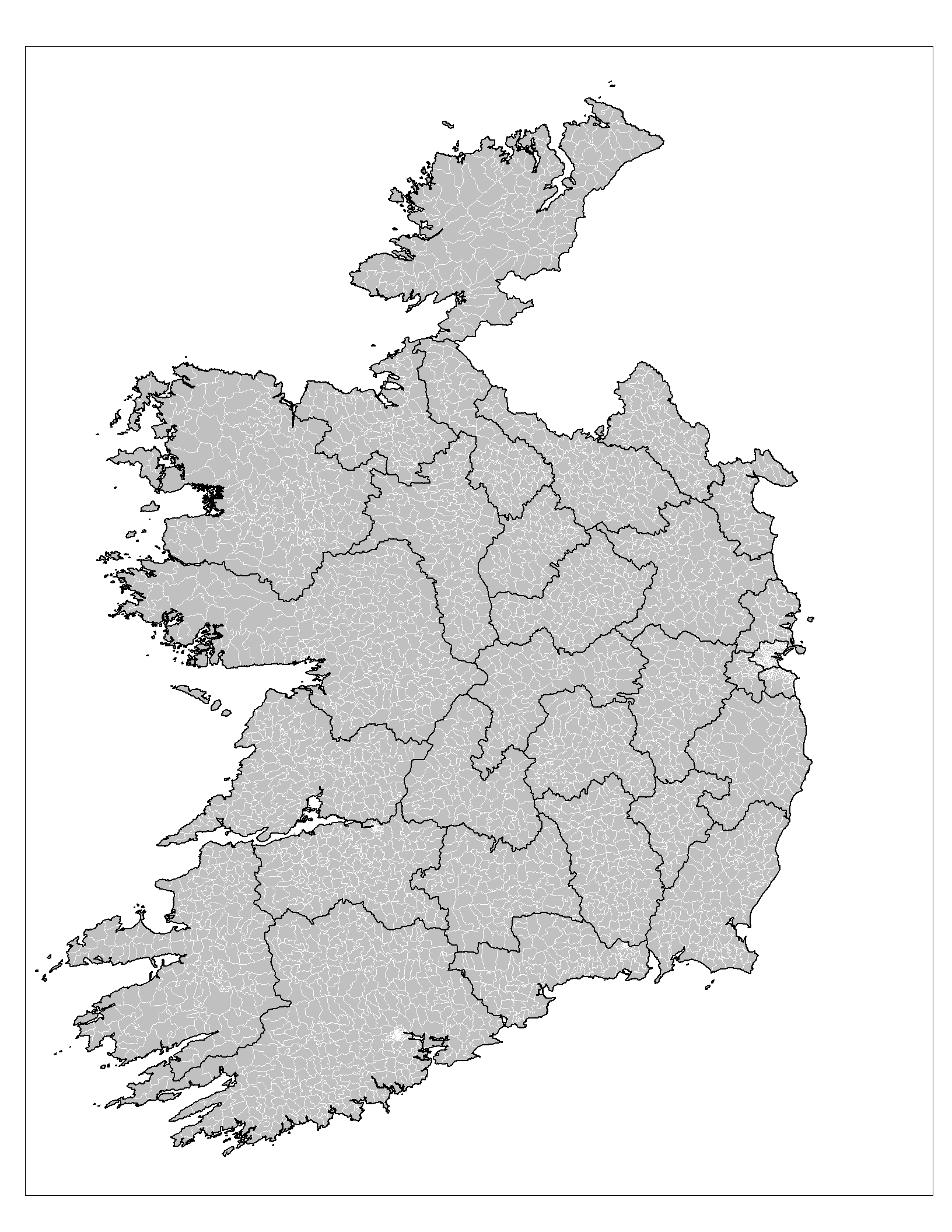
An electoral division (ED, ) is a legally defined administrative area in the Republic of Ireland, generally comprising multiple townlands, and formerly a subdivision of urban and rural districts. Until 1996, EDs were known as district electoral divisions (DEDs, ) in the 29 county council areas and wards in the five county boroughs. Until 1972, DEDs also existed in Northern Ireland. The predecessor poor law electoral divisions were introduced throughout the island of Ireland in the 1830s. The divisions were used as local-government electoral areas until 1919 in what is now the Republic and until 1972 in Northern Ireland. History until partition Electoral divisions originated under the Poor Relief (Ireland) Act 1838 as "poor law electoral divisions": electoral divisions of a poor law union (PLU) returning one or more members to the PLU's board of guardians. The boundaries of these were drawn by Poor Law Commissioners, with the intention of producing areas roughly equivalent in ... [...More Info...] [...Related Items...] OR: [Wikipedia] [Google] [Baidu] |
South Liberties GAA
South Liberties (Irish: ''Saor Theas'') is a Gaelic Athletic Association club based in County Limerick, Ireland. The club is based in the parish of Donoughmore-Knockea-Roxboro, on the southern outskirts of Limerick City and is affiliated to the East Board of Limerick GAA. It is one of the oldest clubs in the country, founded in 1884, the same year as the GAA. South Liberties' home ground in Ballysheedy is called Dooley Park, in memory of one of the club's greatest players. The club has won many county titles during its history, most notably seven Limerick Senior Hurling Championships; in 1888, 1889, 1890, 1972, 1976, 1978 and 1981. The club currently fields teams in the Senior Hurling and Junior Gaelic football Championships in Limerick. History The club was founded in May 1884 when a group of people in the Ballysheedy area of County Limerick got together to play hurling. The club name reflects its location in the former "south liberties of Limerick"; this was the portion of the ... [...More Info...] [...Related Items...] OR: [Wikipedia] [Google] [Baidu] |
Roman Catholic Diocese Of Limerick
The Diocese of Limerick (Irish: ''Deoise Luimnigh'') is a Roman Catholic diocese in mid-western Ireland, one of six suffragan dioceses in the ecclesiastical province of Cashel and Emly. The cathedral church of the diocese is St John's Cathedral in Limerick. The incumbent bishop of the diocese is Brendan Leahy. Geography The diocese is divided into 60 parishes, which are spread across three counties: 57 in Limerick, 18 of which are in the Limerick city area, two in Clare, and one between Limerick and Kerry. The parishes are grouped into 16 Pastoral Units, where groups of priests are appointed to cover a number of parishes between them. As of 2018, there were 65 priests in active ministry, 27 of whom were over the age of 65. Aside from the cathedral city of Limerick, the main towns in the diocese are Abbeyfeale, Adare, Kilmallock, Newcastle West, and Rathkeale. Ordinaries The following is a list of the ten most recent bishops: * Charles Tuohy (1814–1828) * John Ryan ... [...More Info...] [...Related Items...] OR: [Wikipedia] [Google] [Baidu] |

_p150_Portrait_of_Colonel_Charles_Vereker.jpg)


