|
Route 140 (Massachusetts)
Route 140 is a north—south state highway which passes through Bristol, Norfolk and Worcester counties in Massachusetts. The highway follows a southeast-northwest trajectory, running from U.S. Route 6 (US 6) in New Bedford just north of Buzzards Bay northwest to an intersection with Route 12 in Winchendon, a few miles south of the border with New Hampshire. The southern 19 miles (30 km) of Route 140 between New Bedford and Taunton is a freeway known as the Alfred M. Bessette Memorial Highway, or more commonly, the Taunton-New Bedford Expressway. Route description New Bedford to Taunton Route 140 begins at an intersection with U.S. Route 6 (Kempton Street) and Brownell Avenue in Downtown New Bedford. This intersection is signed as exit 1 when traveling southbound on Route 140. About a mile north, Route 140 comes to its first interchange, a cloverleaf with Interstate 195, which connects Providence to Cape Cod. Route 140 then curves slightly to the right to avoid New Bed ... [...More Info...] [...Related Items...] OR: [Wikipedia] [Google] [Baidu] |
Executive Office Of Transportation (Massachusetts)
The Massachusetts Department of Transportation (MassDOT) oversees roads, public transit, aeronautics, and transportation licensing and registration in the US state of Massachusetts. It was created on November 1, 2009, by the 186th Session of the Massachusetts General Court upon enactment of the ''2009 Transportation Reform Act.'' History In 2009, Governor Deval Patrick proposed merging all Massachusetts transportation agencies into a single Department of Transportation. Legislation consolidating all of Massachusetts' transportation agencies into one organization was signed into law on June 26, 2009. The newly established Massachusetts Department of Transportation (MASSDOT) assumed operations from the existing conglomeration of state transportation agencies on November 1, 2009. This change included: * Creating the Highway Division from the former Massachusetts Turnpike Authority and MassHighways. * Assuming responsibility for the planning and oversight functions of the Exec ... [...More Info...] [...Related Items...] OR: [Wikipedia] [Google] [Baidu] |
Buzzards Bay
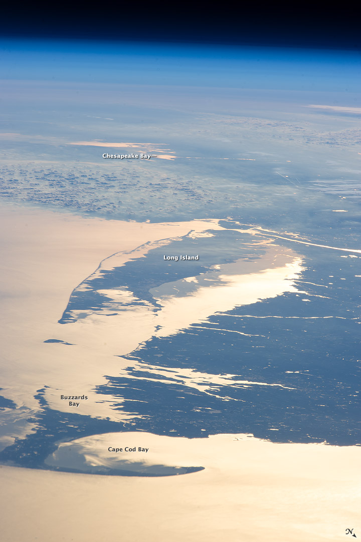
Buzzards Bay is a bay of the Atlantic Ocean adjacent to the U.S. state of Massachusetts. It is approximately 28 miles (45 kilometers) long by 8 miles (12 kilometers) wide. It is a popular destination for fishing, boating, and tourism. Since 1914, Buzzards Bay has been connected to Cape Cod Bay by the Cape Cod Canal. In 1988, under the Clean Water Act, the Environmental Protection Agency and the Commonwealth of Massachusetts designated Buzzards Bay to the National Estuary Program, as "an estuary of national significance" that is threatened by pollution, land development, or overuse. Geography It is surrounded by the Elizabeth Islands on the south, by Cape Cod on the east, and the southern coasts of Bristol and Plymouth counties in Massachusetts to the northwest. To the southwest, the bay is connected to Rhode Island Sound. The city of New Bedford, Massachusetts is a historically significant port on Buzzards Bay; it was the world's most successful whaling port during the ... [...More Info...] [...Related Items...] OR: [Wikipedia] [Google] [Baidu] |
Bristol County Courthouse Complex
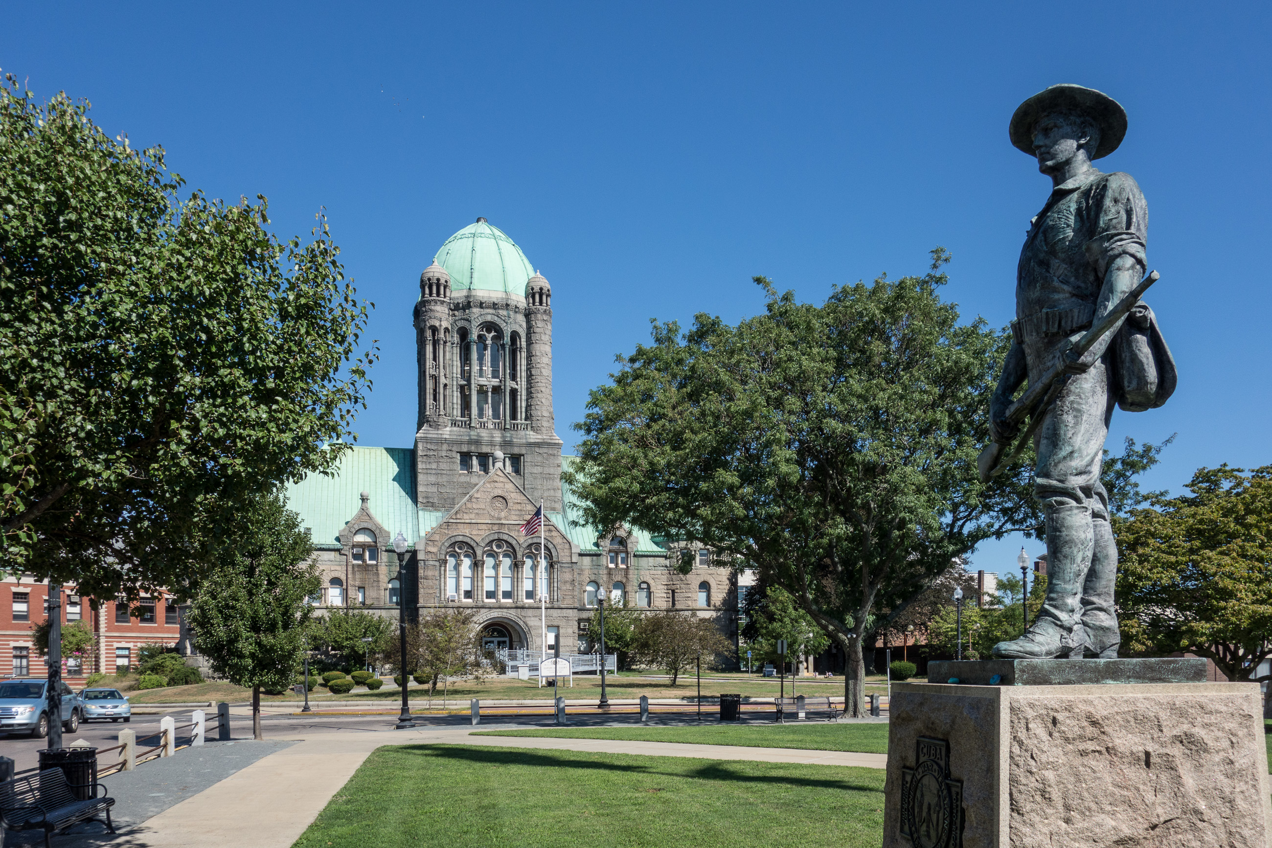
The Bristol County Courthouse Complex Historic District contains three historic buildings located along Court Street in Taunton, Massachusetts, including the Bristol County Superior Courthouse, the Bristol County Registry of Deeds and the former First District Courthouse. The city's Korean War and World War II Memorials are also located on the lawn in front of the superior courthouse. The Bristol County Courthouse Complex directly abuts the Taunton Green Historic District, the City's central square. In 2008, an $86 million expansion and renovation project began at the site which is scheduled to include the construction of a new trial court and restoration of the superior courthouse. Bristol County Superior Courthouse The Bristol County Superior Courthouse was designed by architect Frank Irving Cooper from nearby Bridgewater and built in 1894 in the Romanesque-style. The stone structure contains a tall central tower capped with a copper-clad dome, constructed of Guastavino ti ... [...More Info...] [...Related Items...] OR: [Wikipedia] [Google] [Baidu] |
Massachusetts Route 138
Route 138 is a north–south state highway in Massachusetts. From the state line in Tiverton, Rhode Island to Milton, Route 138 runs as an extension of Rhode Island Route 138, which is itself an extension of Connecticut Route 138. Route 138's northern terminus is at Route 28 in Milton. Route description Running generally north, Route 138 crosses from Rhode Island into Fall River, where it meets the southern terminus of Route 79 at exit 11 (formerly 5) of Interstate 195, then begins a concurrency with Route 79 and later, U.S. Route 6. Routes 138 and 6 then travel off of Route 79 and over the Brightman Street Bridge into Somerset, where the concurrency with U.S. Route 6 splits at an intersection with Route 103. Route 138 proceeds through Dighton and into Taunton, intersecting Route 140 and U.S. Route 44 at Taunton Green. In Raynham, the route has an interchange with Interstate 495 at exit 22 (formerly 8) before continuing into Easton, where it intersects Route 106 befo ... [...More Info...] [...Related Items...] OR: [Wikipedia] [Google] [Baidu] |
Taunton Green Historic District
The Taunton Green Historic District encompasses the core area of the historic 19th-century commercial downtown business district of Taunton, Massachusetts. It is centered on the town green, laid out in the 1740s, and now stands at the intersection of U.S. Route 44 and State routes 140 and 138. The district was listed on the National Register of Historic Places in 1985. History The early commercial center of the city of Taunton was southeast of the present center, at the confluence of the Taunton and Mill Rivers. In the 18th century early industry in the form of sawmills and gristmills developed on the Mill River. The Taunton Green was given to the town in 1743 as a militia training ground, and it is also where an early meetinghouse was built. Originally in size, it is now much reduced by the surrounding development. Early commercial buildings were mostly of wood-frame construction, of which a few survive. Taunton Green has historically the gathering place for troops hea ... [...More Info...] [...Related Items...] OR: [Wikipedia] [Google] [Baidu] |
Massachusetts Route 79
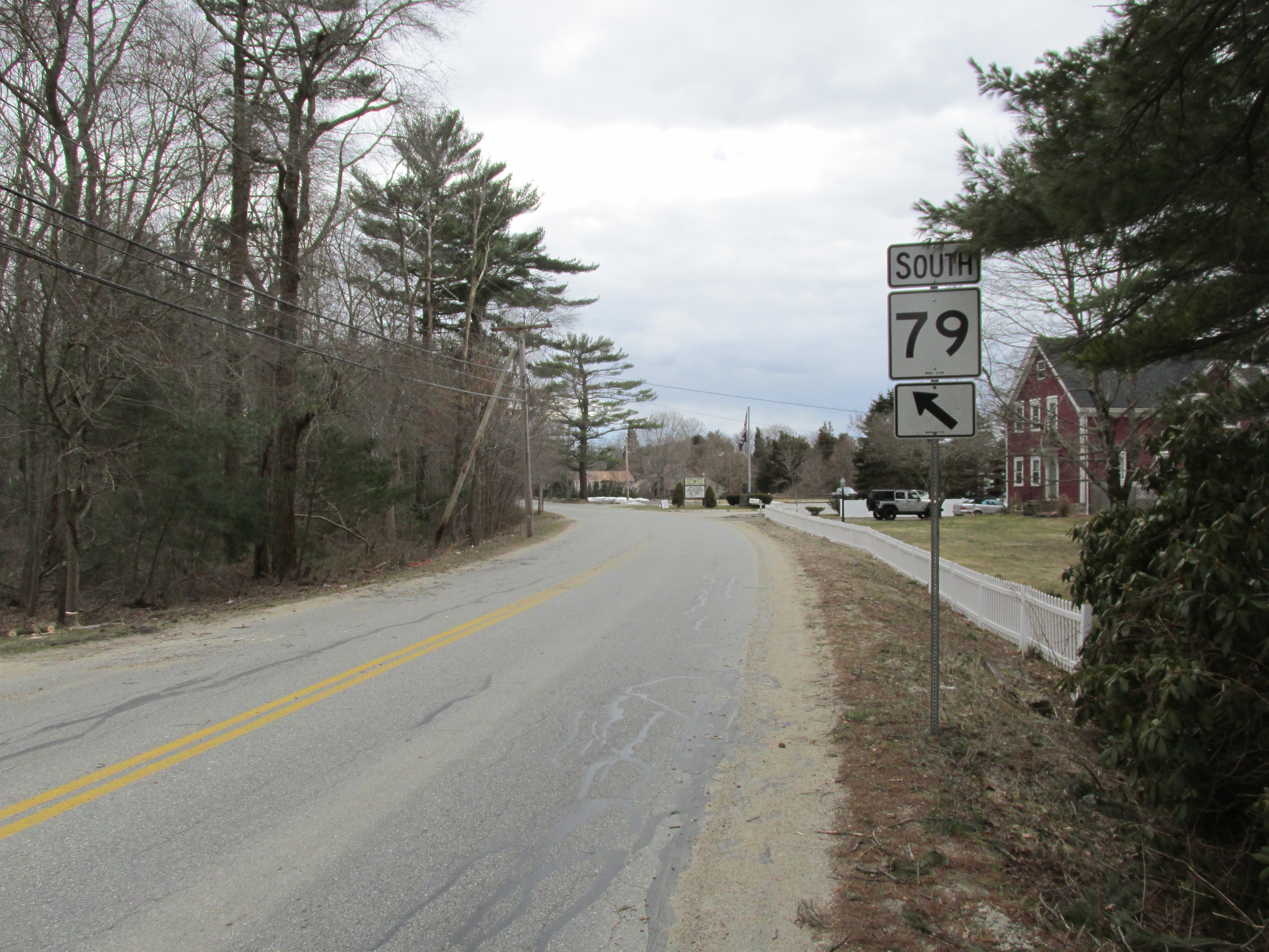
Route 79 is a state highway in southeastern Massachusetts. The route begins as a highway in Fall River, Massachusetts, Fall River also known as the Fall River Viaduct and Western Fall River Expressway before becoming a more rural route. Route description Route 79 begins south of the Charles M. Braga Jr. Memorial Bridge, Braga Bridge and Interstate 195 (Rhode Island-Massachusetts), I-195, multiplexed with Massachusetts Route 138, Route 138 as a surface four-lane controlled-access highway. It has exits to Davol Street, which act as one-way frontage roads on both sides of Route 79, and to the Veterans Memorial Bridge (Bristol County, Massachusetts), Veterans Memorial Bridge, at which point Route 138 leaves Route 79 and goes over the bridge. The route continues northward, passing under North Main Street with exit access to that street. It then connects to Massachusetts Route 24, Route 24 at that route's exit 7. There is no access between Route 79 north and Route 24 south, or ... [...More Info...] [...Related Items...] OR: [Wikipedia] [Google] [Baidu] |
Massachusetts Route 24
Route 24 is a freeway south of Interstate 93 (I-93) in southeastern Massachusetts, linking Fall River with the Boston metropolitan area. It begins in the south in Fall River at the border with Tiverton, Rhode Island where it connects with Rhode Island Route 24, and runs north to an interchange with I-93/U.S. Route 1 (US 1) in Randolph. Route 24 is also known as the Fall River Expressway, and officially as the Amvets Highway. Route 24 has a total of 21 interchanges (including the split at its northern terminus with I-93.) Route 24 connects many of the major cities of Southeastern Massachusetts with Boston and Providence: Brockton, Taunton, Fall River, and New Bedford (via the junction with Route 140). Route description The highway continues at the Rhode Island border at Rhode Island Route 24 and meets Interstate 195 in Fall River. It briefly runs concurrently with I-195 east (for less than a mile), then exits the interstate and travels north, merging with Route 79 at Exi ... [...More Info...] [...Related Items...] OR: [Wikipedia] [Google] [Baidu] |
Long Pond (Plymouth, Massachusetts)
Long Pond is a cold water pond in Plymouth, Massachusetts, east of Myles Standish State Forest, Halfway Pond and Round Pond, west of Route 3 at Exit 3 and The Pinehills, northwest of Bloody Pond, and north of West Wind Shores. The pond has an average depth of and a maximum depth of . It is fed by groundwater and an inlet from Little Long Pond, and drains through the pond bottom. A paved boat ramp provided by the Public Access Board with ample parking spaces is easily accessible from Route 3. The Pond has a 50 hp limitation on boating. Long Pond village The village of the same name to the southwest of the pond includes Faunce Church . See also *Neighborhoods in Plymouth, Massachusetts *Plymouth, Massachusetts Plymouth (; historically known as Plimouth and Plimoth) is a town in Plymouth County, Massachusetts, United States. Located in Greater Boston, the town holds a place of great prominence in American history, folklore, and culture, and is known as ... References ... [...More Info...] [...Related Items...] OR: [Wikipedia] [Google] [Baidu] |
East Freetown, Massachusetts
East Freetown is one of two villages in the town of Freetown, Bristol County, Massachusetts, United States. Added to the town in 1747, East Freetown was originally an outpost settlement of Tiverton, Rhode Island, then a part of Massachusetts. It rests on the shore of Long Pond. History East Freetown was made a part of Freetown as a result of the Pocasset Purchase of 1747. It remained less economically developed and industrialized than its sister village, Assonet well into the 20th century. The village was the birthplace of Massachusetts Governor Marcus Morton. Historic District The East Freetown Historic District has been on the National Register of Historic Places since 1999. It contains many buildings, sites, and features of local historical significance. The district is located roughly along Howland, Gurney, Washburn County Roads. Geography East Freetown is located in Southeastern Massachusetts. It is bounded by Dartmouth, Fall River, New Bedford, Lakeville, Asson ... [...More Info...] [...Related Items...] OR: [Wikipedia] [Google] [Baidu] |
New Bedford Regional Airport
New Bedford Regional Airport is a Part 139 Commercial-Service Airport, municipally-owned and available for public use. The airport is located northwest of the City of New Bedford, a city in Bristol County, Massachusetts, United States. The airport lies within Class D airspace and has an operating FAA control tower (0600-2300). The Acushnet Cedar Swamp borders the airport to the north. History New Bedford Regional Airport was constructed between 1940 and 1942 as a commercial airport, but was soon drafted into use for the United States Army Air Forces until the end of World War II as New Bedford Army Air Field. In April 1944, the Navy took over control of the airport and used it as a training post and naval auxiliary air facility (NAAF New Bedford) to the Naval Air Station Quonset Point in Rhode Island. During its time, the field also had control of Naval Outlying Landing Field Plymouth and Naval Outlying Landing Field Westfield. After the war ended, the airport was converted b ... [...More Info...] [...Related Items...] OR: [Wikipedia] [Google] [Baidu] |
Cape Cod
Cape Cod is a peninsula extending into the Atlantic Ocean from the southeastern corner of mainland Massachusetts, in the northeastern United States. Its historic, maritime character and ample beaches attract heavy tourism during the summer months. The name Cape Cod, coined in 1602 by Bartholomew Gosnold, is the ninth oldest English place-name in the U.S. As defined by the Cape Cod Commission's enabling legislation, Cape Cod is conterminous with Barnstable County, Massachusetts. It extends from Provincetown in the northeast to Woods Hole in the southwest, and is bordered by Plymouth to the northwest. The Cape is divided into fifteen towns, several of which are in turn made up of multiple named villages. Cape Cod forms the southern boundary of the Gulf of Maine, which extends north-eastward to Nova Scotia. Since 1914, most of Cape Cod has been separated from the mainland by the Cape Cod Canal. The canal cuts roughly across the base of the peninsula, though small portions of the ... [...More Info...] [...Related Items...] OR: [Wikipedia] [Google] [Baidu] |
Providence, Rhode Island
Providence is the capital and most populous city of the U.S. state of Rhode Island. One of the oldest cities in New England, it was founded in 1636 by Roger Williams, a Reformed Baptist theologian and religious exile from the Massachusetts Bay Colony. He named the area in honor of "God's merciful Providence" which he believed was responsible for revealing such a haven for him and his followers. The city developed as a busy port as it is situated at the mouth of the Providence River in Providence County, at the head of Narragansett Bay. Providence was one of the first cities in the country to industrialize and became noted for its textile manufacturing and subsequent machine tool, jewelry, and silverware industries. Today, the city of Providence is home to eight hospitals and List of colleges and universities in Rhode Island#Institutions, eight institutions of higher learning which have shifted the city's economy into service industries, though it still retains some manufacturin ... [...More Info...] [...Related Items...] OR: [Wikipedia] [Google] [Baidu] |


