|
Roter Sand Lighthouse
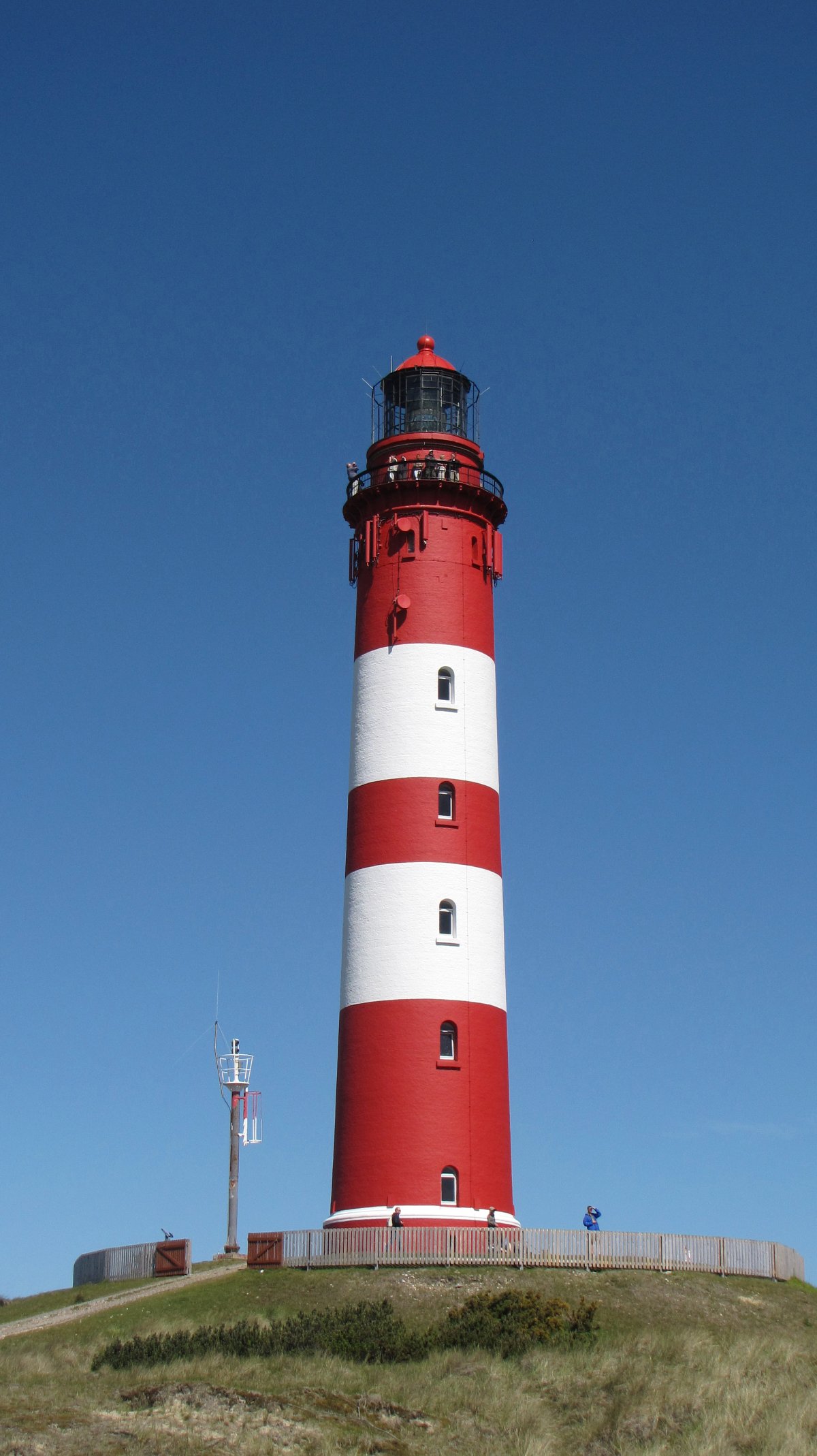
Roter Sand is a lighthouse in the North Sea, in the Weser estuary. It entered service in 1885. The light was deactivated in 1986 but the tower still serves as a day beacon. Roter Sand Lighthouse was the first building ever to be erected directly on the sea floor. On 1 October 2010, the structure was awarded the title "Historical Monument of Engineering in Germany" (''Historisches Wahrzeichen der Ingenieurbaukunst in Deutschland'') by the Federal Chamber of Engineers. Description Including the foundation, Roter Sand Lighthouse is tall. At low tide, it measures above sea level. Its focal height is above mean high tide, while the tower as such is tall. The foundation is cylindrical and protrudes from the sea at low tide. The tower above is conical. It is painted with red and white bands above a black base. The order of colours is white-red-white-red-white whereby the coloured section also marks the five floors inside the tower. The entrance is located at the lower rim of ... [...More Info...] [...Related Items...] OR: [Wikipedia] [Google] [Baidu] |
Weser River
The Weser () is a river of Lower Saxony in north-west Germany. It begins at Hannoversch Münden through the confluence of the Werra and Fulda. It passes through the Hanseatic city of Bremen. Its mouth is further north against the ports of Bremerhaven and Nordenham. The latter is on the Butjadingen Peninsula. It then merges into the North Sea via two highly saline, estuarine mouths. It connects to the canal network running east-west across the North German Plain. The river, when combined with the Werra (a dialectal form of "Weser"), is long and thus, the longest river entirely situated within Germany (the Main, however, is the longest if the Weser and Werra are not combined). The Weser itself is long. The Werra rises in Thuringia, the German state south of the main projection (tongue) of Lower Saxony. Etymology "Weser" and "Werra" are the same words in different dialects. The difference reflects the old linguistic border between Central and Low German, passing through Ha ... [...More Info...] [...Related Items...] OR: [Wikipedia] [Google] [Baidu] |
German Bight
The German Bight (german: Deutsche Bucht; da, tyske bugt; nl, Duitse bocht; fry, Dútske bocht; ; sometimes also the German Bay) is the southeastern bight of the North Sea bounded by the Netherlands and Germany to the south, and Denmark and Germany to the east (the Jutland peninsula). To the north and west it is limited by the Dogger Bank. The Bight contains the Frisian and Danish Islands. The Wadden Sea is approximately ten to twelve kilometres wide at the location of the German Bight.C.Michael Hogan. 2011''Wadden Sea''. eds. P.Saundry & C.Cleveland. Encyclopedia of Earth. National Council for Science and the Environment. Washington DC/ref> The Frisian islands and the nearby coastal areas are collectively known as Frisia. The southern portion of the bight is also known as the Heligoland Bight. Between 1949 and 1956 the BBC Sea Area Forecast (Shipping Forecast) used "Heligoland" as the designation for the area now referred to as German Bight. Use The German bight contains ... [...More Info...] [...Related Items...] OR: [Wikipedia] [Google] [Baidu] |
Weser
The Weser () is a river of Lower Saxony in north-west Germany. It begins at Hannoversch Münden through the confluence of the Werra and Fulda. It passes through the Hanseatic city of Bremen. Its mouth is further north against the ports of Bremerhaven and Nordenham. The latter is on the Butjadingen Peninsula. It then merges into the North Sea via two highly saline, estuarine mouths. It connects to the canal network running east-west across the North German Plain. The river, when combined with the Werra (a dialectal form of "Weser"), is long and thus, the longest river entirely situated within Germany (the Main, however, is the longest if the Weser and Werra are not combined). The Weser itself is long. The Werra rises in Thuringia, the German state south of the main projection (tongue) of Lower Saxony. Etymology "Weser" and "Werra" are the same words in different dialects. The difference reflects the old linguistic border between Central and Low German, passing through H ... [...More Info...] [...Related Items...] OR: [Wikipedia] [Google] [Baidu] |
Estuary
An estuary is a partially enclosed coastal body of brackish water with one or more rivers or streams flowing into it, and with a free connection to the open sea. Estuaries form a transition zone between river environments and maritime environments and are an example of an ecotone. Estuaries are subject both to marine influences such as tides, waves, and the influx of saline water, and to fluvial influences such as flows of freshwater and sediment. The mixing of seawater and freshwater provides high levels of nutrients both in the water column and in sediment, making estuaries among the most productive natural habitats in the world. Most existing estuaries formed during the Holocene epoch with the flooding of river-eroded or glacially scoured valleys when the sea level began to rise about 10,000–12,000 years ago. Estuaries are typically classified according to their geomorphological features or to water-circulation patterns. They can have many different names, such as bays, ... [...More Info...] [...Related Items...] OR: [Wikipedia] [Google] [Baidu] |
Day Beacon
A day beacon (sometimes "daybeacon") is an unlighted nautical sea mark. A signboard identifying it is called a day mark. Day beacons typically mark channels whose key points are marked by lighted buoys. They may also mark smaller navigable routes in their entirety. They are the most common navigation aid in shallow water, as they are relatively inexpensive to install and maintain. Navigation around them is similar to that around other navigation aids. Identification Lateral marking For historical reasons, there are two systems for lateral day beacons. When proceeding from open water towards harbor, marks with cylindrical topmarks or square dayboards are kept to port in both regions, but colors and numbers are reversed. When lateral beacons are paired, vessels should pass between the pairing. However, beacons are also frequently placed individually. Generally, single lateral beacons are at the inside corner of a turn. Interior or exterior placement can be determined based up ... [...More Info...] [...Related Items...] OR: [Wikipedia] [Google] [Baidu] |
Deutsche Stiftung Denkmalschutz
The ''Deutsche Stiftung Denkmalschutz'' ("German Foundation for Monument Protection") is a German private initiative founded in 1985 that works for the preservation of cultural heritage in Germany and to promote the idea of cultural heritage management. Background Since 1900, when Georg Dehio published his ''Handbook of German Art Heritage'', Germany has not had a central list of National Heritage Sites. Each of the sixteen states keeps their own set of lists and many towns and cities keep their own lists, all based on varying criteria for inclusion. Monument protection Denkmalschutz works to coordinate efforts, promote public awareness, and also to act as a central contact for worldwide organizations such as UNESCO World Heritage. They also organize and fund the European Heritage Days in Germany, which are called Tag des offenen Denkmals. This "open monument day" has been held yearly with a different theme since 1993 on the second Sunday of September. For example, in 2011 ... [...More Info...] [...Related Items...] OR: [Wikipedia] [Google] [Baidu] |
RoterSand2005-1
Rotersand is a German electronic music act, formed in September 2002 by musician/producer Gun and singer Rascal with dance music producer/DJ Krischan J.E. Wesenberg joining them shortly after. Rotersand's music can generally be described as futurepop; the band themselves refer to it as "industrial pop." History Prior to Rotersand, Gun and Rasc had collaborated on various other projects, most notably Gun as one producer and Rasc as one member of the band The Fair Sex. Rotersand's debut release was the 'Merging Oceans' EP in 2003, followed by their debut album ''Truth Is Fanatic''. 'Merging Oceans' peaked at #8 on the German Alternative Charts (DAC) and ranked #72 on the DAC Top Singles of 2003. In 2005, they released the single 'Exterminate Annihilate Destroy', a precursor to their second album ''Welcome To Goodbye'', both of which reached 1 on the DAC. The 2006 EP, ''Dare to Live'', peaked at #2 on the DAC Singles chart. The third Rotersand album, ''1023'', was released in 2 ... [...More Info...] [...Related Items...] OR: [Wikipedia] [Google] [Baidu] |
Oriel Window
An oriel window is a form of bay window which protrudes from the main wall of a building but does not reach to the ground. Supported by corbels, bracket (architecture), brackets, or similar cantilevers, an oriel window is most commonly found projecting from an upper floor but is also sometimes used on the ground floor. Oriel windows are seen in Arab architecture in the form of mashrabiya and in Turkish are known as ''şahnişin'' or ''cumba''. In Islamic culture, these windows and balconies project from the street-front of a house, providing an area in which women could peer out and see the activities below while remaining invisible. Origins According to the ''Oxford English Dictionary'', the term ''oriel'' is derived from Anglo-Norman language, Anglo-Norman ' and Late Latin ', both meaning "gallery" or "porch", perhaps from Classical Latin ' ("curtain"). * Oriel College, Oxford, took its name from a balcony or oriel window forming a feature of a building which occupied the ... [...More Info...] [...Related Items...] OR: [Wikipedia] [Google] [Baidu] |
List Of Lighthouses In Germany ...
This is a list of lighthouses in Germany. List See also * Lists of lighthouses and lightvessels References External links * {{Lighthouses in Europe Germany Lighthouses Lighthouses A lighthouse is a tower, building, or other type of physical structure designed to emit light from a system of lamps and lenses and to serve as a beacon for navigational aid, for maritime pilots at sea or on inland waterways. Lighthouses mark ... [...More Info...] [...Related Items...] OR: [Wikipedia] [Google] [Baidu] |
Lighthouses Completed In 1885
A lighthouse is a tower, building, or other type of physical structure designed to emit light from a system of lamps and lenses and to serve as a beacon for navigational aid, for maritime pilots at sea or on inland waterways. Lighthouses mark dangerous coastlines, hazardous shoals, reefs, rocks, and safe entries to harbors; they also assist in aerial navigation. Once widely used, the number of operational lighthouses has declined due to the expense of maintenance and has become uneconomical since the advent of much cheaper, more sophisticated and effective electronic navigational systems. History Ancient lighthouses Before the development of clearly defined ports, mariners were guided by fires built on hilltops. Since elevating the fire would improve the visibility, placing the fire on a platform became a practice that led to the development of the lighthouse. In antiquity, the lighthouse functioned more as an entrance marker to ports than as a warning signal for reefs a ... [...More Info...] [...Related Items...] OR: [Wikipedia] [Google] [Baidu] |
Lighthouses In Lower Saxony
A lighthouse is a tower, building, or other type of physical structure designed to emit light from a system of lamps and lenses and to serve as a beacon for navigational aid, for maritime pilots at sea or on inland waterways. Lighthouses mark dangerous coastlines, hazardous shoals, reefs, rocks, and safe entries to harbors; they also assist in aerial navigation. Once widely used, the number of operational lighthouses has declined due to the expense of maintenance and has become uneconomical since the advent of much cheaper, more sophisticated and effective electronic navigational systems. History Ancient lighthouses Before the development of clearly defined ports, mariners were guided by fires built on hilltops. Since elevating the fire would improve the visibility, placing the fire on a platform became a practice that led to the development of the lighthouse. In antiquity, the lighthouse functioned more as an entrance marker to ports than as a warning signal for reefs and ... [...More Info...] [...Related Items...] OR: [Wikipedia] [Google] [Baidu] |


%2C_Elbe%2C_Trischen.jpg)


