|
Rosser Ridge
Rosser Ridge () is a rock ridge, 4 nautical miles (7 km) long, marking the north limit of the Cordiner Peaks, Pensacola Mountains. Mapped by United States Geological Survey (USGS) from surveys and U.S. Navy air photos, 1956–66. Named by Advisory Committee on Antarctic Names The Advisory Committee on Antarctic Names (ACAN or US-ACAN) is an advisory committee of the United States Board on Geographic Names responsible for recommending commemorative names for features in Antarctica. History The committee was established ... (US-ACAN) for Earl W. Rosser, topographic engineer in the Pensacola Mountains, 1965–66. Ridges of Queen Elizabeth Land {{QueenElizabethLand-geo-stub ... [...More Info...] [...Related Items...] OR: [Wikipedia] [Google] [Baidu] |
Cordiner Peaks
The Cordiner Peaks are a group of peaks extending over an area of , standing southwest of Dufek Massif in the northern part of the Pensacola Mountains. They were discovered and photographed on January 13, 1956, in the course of a transcontinental nonstop plane flight by personnel of U.S. Navy Operation Deep Freeze I from McMurdo Sound to the Weddell Sea and return. They were named by the Advisory Committee on Antarctic Names for Captain Douglas L. Cordiner, U.S. Navy, an observer on the P2V-2N Neptune aircraft making this flight. The entire Pensacola Mountains were mapped by the United States Geological Survey in 1967 and 1968 from ground surveys and from U.S. Navy tricamera aerial photographs taken in 1964. Features Geographical features include: * Jaburg Glacier * Jackson Peak * Rosser Ridge * Sumrall Peak Sumrall Peak is a peak in Antarctica, 1,130 m, standing 1 nautical mile (1.9 km) south of Rosser Ridge in the Cordiner Peaks, Pensacola Mountains. It was mapped by t ... [...More Info...] [...Related Items...] OR: [Wikipedia] [Google] [Baidu] |
Pensacola Mountains
The Pensacola Mountains are a large group of mountain ranges of the Transantarctic Mountains System, located in the Queen Elizabeth Land region of Antarctica. Geography They extend 450 km (280 mi) in a NE-SW direction. Subranges of the Pensacola Mountains include: Argentina Range, Forrestal Range, Dufek Massif, Cordiner Peaks, Neptune Range, Patuxent Range, Rambo Nunataks and Pecora Escarpment. These mountain units lie astride the extensive Foundation Ice Stream and Support Force Glacier which drain northward to the Ronne Ice Shelf. ;Naming Discovered and photographed on 13 January 1956 in the course of a transcontinental nonstop plane flight by personnel of United States Navy Operation Deep Freeze I from McMurdo Sound to Weddell Sea and return. Named by US-ACAN for the U.S. Naval Air Station, Pensacola, Florida, in commemoration of the historic role of that establishment in training aviators of the U.S. Navy. The mountains were mapped in detail by USGS from surveys ... [...More Info...] [...Related Items...] OR: [Wikipedia] [Google] [Baidu] |
United States Geological Survey
The United States Geological Survey (USGS), formerly simply known as the Geological Survey, is a scientific agency of the United States government. The scientists of the USGS study the landscape of the United States, its natural resources, and the natural hazards that threaten it. The organization's work spans the disciplines of biology, geography, geology, and hydrology. The USGS is a fact-finding research organization with no regulatory responsibility. The agency was founded on March 3, 1879. The USGS is a bureau of the United States Department of the Interior; it is that department's sole scientific agency. The USGS employs approximately 8,670 people and is headquartered in Reston, Virginia. The USGS also has major offices near Lakewood, Colorado, at the Denver Federal Center, and Menlo Park, California. The current motto of the USGS, in use since August 1997, is "science for a changing world". The agency's previous slogan, adopted on the occasion of its hundredt ... [...More Info...] [...Related Items...] OR: [Wikipedia] [Google] [Baidu] |
Advisory Committee On Antarctic Names
The Advisory Committee on Antarctic Names (ACAN or US-ACAN) is an advisory committee of the United States Board on Geographic Names responsible for recommending commemorative names for features in Antarctica. History The committee was established in 1943 as the Special Committee on Antarctic Names (SCAN). It became the Advisory Committee on Antarctic Names in 1947. Fred G. Alberts was Secretary of the Committee from 1949 to 1980. By 1959, a structured nomenclature was reached, allowing for further exploration, structured mapping of the region and a unique naming system. A 1990 ACAN gazeeter of Antarctica listed 16,000 names. Description The United States does not recognise territorial boundaries within Antarctica, so ACAN assigns names to features anywhere within the continent, in consultation with other national nomenclature bodies where appropriate, as defined by the Antarctic Treaty System. The research and staff support for the ACAN is provided by the United States Geologi ... [...More Info...] [...Related Items...] OR: [Wikipedia] [Google] [Baidu] |
Earl W
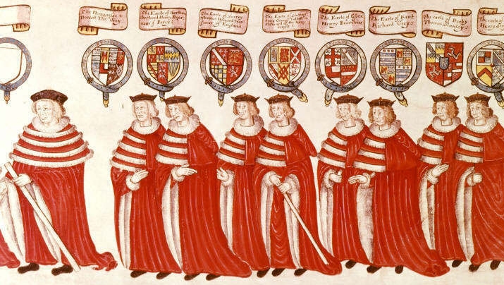
Earl () is a rank of the nobility in the United Kingdom. The title originates in the Old English word ''eorl'', meaning "a man of noble birth or rank". The word is cognate with the Scandinavian form ''jarl'', and meant "chieftain", particularly a chieftain set to rule a territory in a king's stead. After the Norman Conquest, it became the equivalent of the continental count (in England in the earlier period, it was more akin to a duke; in Scotland, it assimilated the concept of mormaer). Alternative names for the rank equivalent to "earl" or "count" in the nobility structure are used in other countries, such as the '' hakushaku'' (伯爵) of the post-restoration Japanese Imperial era. In modern Britain, an earl is a member of the peerage, ranking below a marquess and above a viscount. A feminine form of ''earl'' never developed; instead, ''countess'' is used. Etymology The term ''earl'' has been compared to the name of the Heruli, and to runic ''erilaz''. Proto-Norse ''e ... [...More Info...] [...Related Items...] OR: [Wikipedia] [Google] [Baidu] |

