|
Rosedale, New South Wales
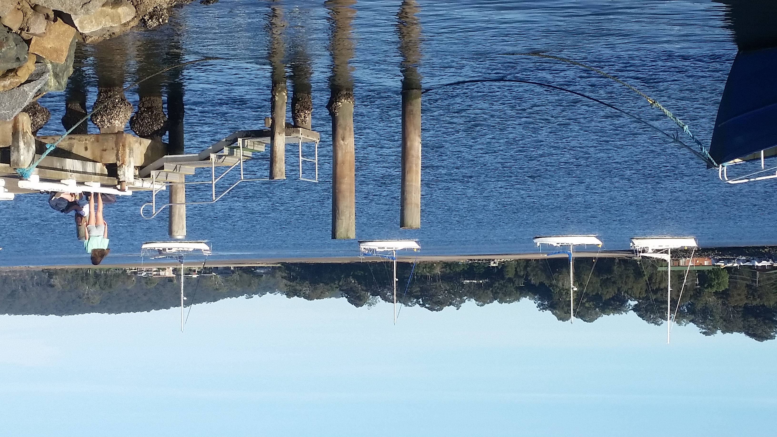
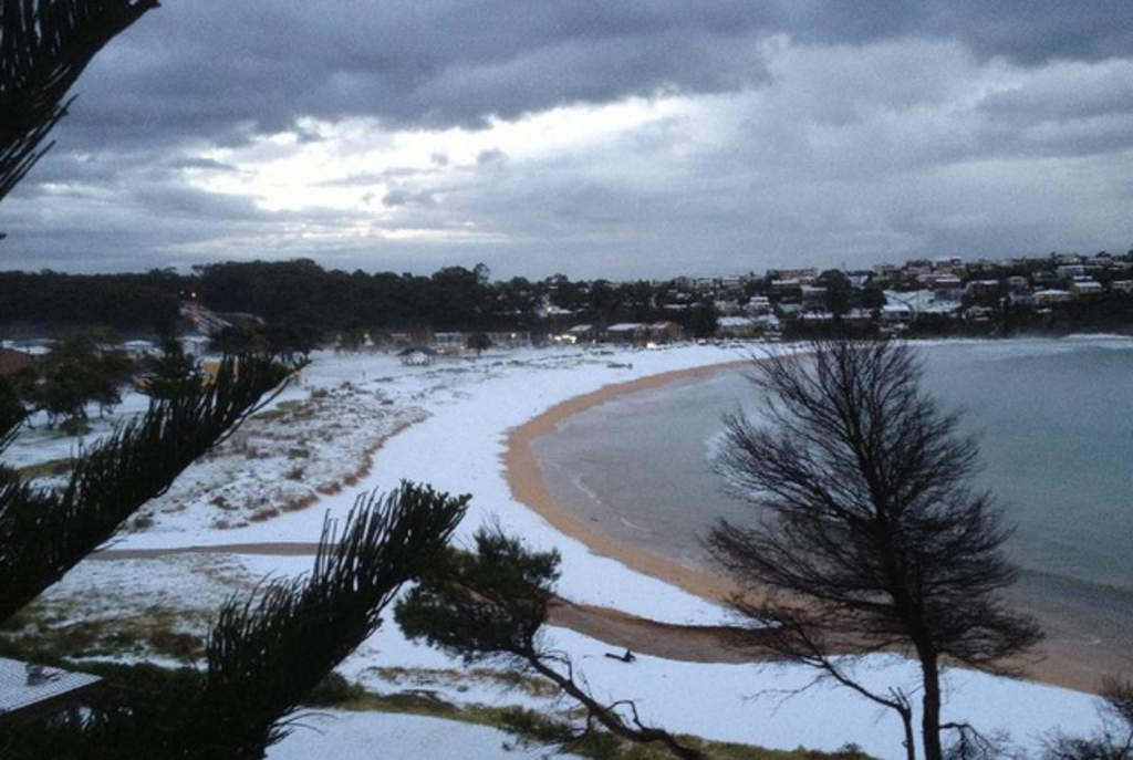
Rosedale is a beachside settlement in New South Wales, Australia. It is on the south coast, about 18 kilometres by road south of Batemans Bay, New South Wales, Batemans Bay. The area is administered by the Eurobodalla Shire. At the , Rosedale had a population of 221. History :''The material in this section is derived from a brief history of Rosedale, written by Ian Harrison and published in the Rosedale Association newsletters oJanuary 2004anMarch 2004' There was clearing of bush at South and North Rosedale for grazing. There were very few buildings in Rosedale prior to the second world war. In the 1950s the council approved a subdivision plan by Miller, a builder, in which many blocks were below 600 m². However, notwithstanding this subdivision, Rosedale is one of very few seaside settlements in Australia where the bush is more prominent than the buildings. Farming in the nineteenth century The Rosedale valley includes portions 11, 12, 32, 81, 98, 118, 213, 214, 215 and ... [...More Info...] [...Related Items...] OR: [Wikipedia] [Google] [Baidu] |
Burrewarra Point
Burrewarra Point is to the north of Broulee and 25 kilometres south of Batemans Bay on the south coast of New South Wales, Australia. An active lighthouse, Burrewarra Point Light, is located at Burrewarra Point. It was built in 1974. Also at Burrewarra Point are the remains of concrete igloo buildings of No. 17 Radar Station used by the Royal Australian Air Force during World War II World War II or the Second World War, often abbreviated as WWII or WW2, was a world war that lasted from 1939 to 1945. It involved the vast majority of the world's countries—including all of the great powers—forming two opposing .... Also present at the location is a commemorative plaque. References Headlands of New South Wales {{NewSouthWales-geo-stub ... [...More Info...] [...Related Items...] OR: [Wikipedia] [Google] [Baidu] |
Electoral District Of Bega
Bega is an electoral district of the Legislative Assembly in the Australian state of New South Wales. It is represented by Michael Holland of the Labor Party. Bega is a regional electorate in the southeastern corner of the state. It encompasses the entirety of Bega Valley Shire and Eurobodalla Shire. Its population centres include Bega, Tathra, Merimbula, Eden, Bemboka, Eurobodalla Shire, Moruya, Batemans Bay and Narooma. History In 1894, single-member electorates were introduced statewide and the two-member electorate of Eden was split into Bega and Eden-Bombala. In 1904 Eden-Bombala was abolished as a result of the 1903 New South Wales referendum which reduced the number of members of the Legislative Assembly from 125 to 90 and part of the district was absorbed by Bega. In 1920, with the introduction of proportional representation, it was absorbed into Goulburn, along with Monaro. It was recreated in 1988. Bega has historically tended to be a safe conservative seat, ... [...More Info...] [...Related Items...] OR: [Wikipedia] [Google] [Baidu] |
Division Of Gilmore
The Division of Gilmore is an Australian electoral division in the state of New South Wales. History The Division of Gilmore was created in 1984 when the House of Representatives was expanded, and was named after Dame Mary Gilmore, the poet and author. The seat was first won by John Sharp of the National Party. The electorate originally included the areas of Goulburn and Southern Highlands but, following a redistribution, the seat moved to its current boundaries along the New South Wales South Coast. As a consequence, Sharp moved to the nearby seat of Hume in 1993. He served in the First Howard Ministry until he resigned in 1997 due to the "travel rorts affair". The seat was won by the ALP's Peter Knott in 1993, but he was defeated at the 1996 election by Joanna Gash of the Liberal Party. The seat was considered marginal after the 1996 and 1998 elections, but a big swing in 2001 saw Gash hold the seat by a much larger margin. That was cut back to a margin of about 4% ... [...More Info...] [...Related Items...] OR: [Wikipedia] [Google] [Baidu] |
Malua Bay, New South Wales
Malua Bay (postcode: 2536) is a locality in the South Coast region of the state of New South Wales, Australia. It is situated in the Eurobodalla Shire. At the , Malua Bay had a population of 1,929. Malua Bay town centre is located astride George Bass Drive, which is approximately 13 kilometres drive from the town of Batemans Bay. The town boundaries extend to Dunns Creek Road in the West, Ridge Road to the North, and almost to Broulee Road in the South, where it abuts the town of Rosedale. Malua Bay is approximately South of Sydney, and East of Canberra Canberra ( ) is the capital city of Australia. Founded following the federation of the colonies of Australia as the seat of government for the new nation, it is Australia's largest inland city and the eighth-largest city overall. The ci ... via the Kings Highway. Malua Bay has a range of beaches and bays on its border with the Tasman Sea, including; Malua Bay Beach, Mosquito Bay, Garden Bay, and McKenzies Beach ... [...More Info...] [...Related Items...] OR: [Wikipedia] [Google] [Baidu] |
Mogo, New South Wales
Mogo (postcode: 2536) is a small heritage town in the South Coast region of the state of New South Wales, Australia. Mogo is administered by the Eurobodalla Shire council. The town is located on the Princes Highway (Highway 1), south of Batemans Bay and north of Moruya. At the , Mogo had a population of 322. Mogo was established during the Gold Rush after a gold find was reported in 1851. Bimbimbie, the last gold mine in the Mogo area, closed in 1984. The town survived as a sleepy highway town, and during the 1990s was revitalised with the growth in regional tourism. Mogo is now home to a variety of tourist-centric stores including cafes, art galleries, potters, and furniture stores. Mogo is also a centre for the Aboriginal population of the area. Mogo is home to the Mogo Zoo, a private zoo specializing in breeding programs for endangered species. Although small in comparison to metropolitan zoos, Mogo Zoo is home to many exotic species, such as the red panda and the snow ... [...More Info...] [...Related Items...] OR: [Wikipedia] [Google] [Baidu] |
Tomakin, New South Wales
Tomakin is a small seaside village on the south coast of New South Wales between the major towns of Batemans Bay and Moruya Moruya is a town located on the far south coast of New South Wales, Australia, situated on the Moruya River. The Princes Highway runs through the town that is about south of Sydney and from Canberra. At the , Moruya had a population of 4 .... At the , the town had a population of 1,001. It is most closely flanked by the other small villages of Guerilla Bay and Mossy Point (adjacent to Broulee which is separated by the Candalagan Creek). The town is located at the mouth of the Tomaga River. It has a boat ramp which, along with another boat ramp at Mossy Point, provides access to the Pacific Ocean. Tourist attractions There are three caravan parks with on-site vans and cabins available. There are other accommodation options including bed and breakfast establishments and holiday cottages for rent. Activities in the area include surfing, swimming ... [...More Info...] [...Related Items...] OR: [Wikipedia] [Google] [Baidu] |
Tasman Sea
The Tasman Sea (Māori: ''Te Tai-o-Rēhua'', ) is a marginal sea of the South Pacific Ocean, situated between Australia and New Zealand. It measures about across and about from north to south. The sea was named after the Dutch explorer Abel Janszoon Tasman, who in 1642 was the first known person to cross it. British explorer Lieutenant James Cook later extensively navigated the Tasman Sea in the 1770s during his three voyages of exploration. The Tasman Sea is informally referred to in both Australian and New Zealand English as the Ditch; for example, "crossing the Ditch" means travelling to Australia from New Zealand, or vice versa. The diminutive term "the Ditch" used for the Tasman Sea is comparable to referring to the North Atlantic Ocean as "the Pond". Climate The south of the sea is passed over by depressions going from west to east. The northern limit of these westerly winds is near to 40°S. During the southern winter, from April to October, the northern branch ... [...More Info...] [...Related Items...] OR: [Wikipedia] [Google] [Baidu] |
Guerilla Bay
Guerilla Bay (postcode: 2536) is a bay and village located in Eurobodalla Shire, the South Coast, New South Wales, Australia Australia, officially the Commonwealth of Australia, is a Sovereign state, sovereign country comprising the mainland of the Australia (continent), Australian continent, the island of Tasmania, and numerous List of islands of Australia, sma .... Fishing is banned as the entire area is a sanctuary zone. Climate Guerilla Bay experiences an oceanic climate (Köppen climate classification Cfb). The climate of Guerilla bay is moderated by the sea, with warm summers and mild sunny winters. Nights can be cold in winter. Thunderstorms mostly occur between November and March, with rainfall maximums in summer. References Towns in New South Wales Towns in the South Coast (New South Wales) Bays of New South Wales Eurobodalla Shire {{SouthCoastNSW-geo-stub ... [...More Info...] [...Related Items...] OR: [Wikipedia] [Google] [Baidu] |
New South Wales
) , nickname = , image_map = New South Wales in Australia.svg , map_caption = Location of New South Wales in AustraliaCoordinates: , subdivision_type = Country , subdivision_name = Australia , established_title = Before federation , established_date = Colony of New South Wales , established_title2 = Establishment , established_date2 = 26 January 1788 , established_title3 = Responsible government , established_date3 = 6 June 1856 , established_title4 = Federation , established_date4 = 1 January 1901 , named_for = Wales , demonym = , capital = Sydney , largest_city = capital , coordinates = , admin_center = 128 local government areas , admin_center_type = Administration , leader_title1 = Monarch , leader_name1 = Charles III , leader_title2 = Governor , leader_name2 = Margaret Beazley , leader_title3 = Premier , leader_name3 = Dominic Perrottet (Liberal) , national_representation = Parliament of Australia , national_representation_type1 = Senat ... [...More Info...] [...Related Items...] OR: [Wikipedia] [Google] [Baidu] |
Australia
Australia, officially the Commonwealth of Australia, is a Sovereign state, sovereign country comprising the mainland of the Australia (continent), Australian continent, the island of Tasmania, and numerous List of islands of Australia, smaller islands. With an area of , Australia is the largest country by area in Oceania and the world's List of countries and dependencies by area, sixth-largest country. Australia is the oldest, flattest, and driest inhabited continent, with the least fertile soils. It is a Megadiverse countries, megadiverse country, and its size gives it a wide variety of landscapes and climates, with Deserts of Australia, deserts in the centre, tropical Forests of Australia, rainforests in the north-east, and List of mountains in Australia, mountain ranges in the south-east. The ancestors of Aboriginal Australians began arriving from south east Asia approximately Early human migrations#Nearby Oceania, 65,000 years ago, during the Last Glacial Period, last i ... [...More Info...] [...Related Items...] OR: [Wikipedia] [Google] [Baidu] |
Batemans Bay, New South Wales
Bateman's is a 17th-century house located in Burwash, East Sussex, England. It was the home of Rudyard Kipling from 1902 until his death in 1936. The house was built in 1634. Kipling's widow Caroline Starr Balestier Kipling, Caroline bequeathed the house to the National Trust for Places of Historic Interest or Natural Beauty, National Trust on her death in 1939. The house is a Listed building, Grade I listed building. History Bateman's is a Jacobean architecture, Jacobean Wealden mansion constructed in 1634. There is debate as to the original builder. Historic England follows the tradition favoured by Kipling of ascribing the construction to a Sussex ironmaster, John Britten. The historian Adam Nicolson reports the tradition in the National Trust's guidebook, but notes that Britten was a dealer in iron, rather than a manufacturer. Pevsner Architectural Guides, Pevsner attributes the construction to a lawyer, William Langham. By the early twentieth century, the house had descen ... [...More Info...] [...Related Items...] OR: [Wikipedia] [Google] [Baidu] |
Eurobodalla Shire
Eurobodalla Shire is a Local government in Australia, local government area located in the South Coast (New South Wales), South Coast region of New South Wales, Australia. The Shire is located in a largely mountainous coastal region and situated adjacent to the ''Tasman Sea'', the Princes Highway and the Kings Highway, Australia, Kings Highway. The Mayor of Eurobodalla Shire Council is Councillor, Cr. Mathew Hatcher, an Independent (politician), unaligned politician. He is also the youngest mayor, in the modern-era, ever for the Eurobodalla. The Deputy Mayor, Cllr Alison Worthington, is the first female Deputy Mayor for the Eurobodalla. Towns and localities The shire chambers are located in the town of Moruya, New South Wales, Moruya in the central part of the Shire. Other major towns within the shire include Batemans Bay and Narooma, New South Wales, Narooma. Smaller towns, suburbs and hamlets include: History The area which is now Eurobodalla Shire was originally the home ... [...More Info...] [...Related Items...] OR: [Wikipedia] [Google] [Baidu] |


