|
Ronks, Pennsylvania
Ronks is a small unincorporated farming community and census-designated place (CDP) in East Lampeter Township, Lancaster County, Pennsylvania, United States, just west of Paradise. As of the 2010 census the population was 362. The community is the home of Ronks Concrete Company and has a large Amish and Mennonite population. The Ronks ZIP code of 17572 covers a much larger area than the CDP, extending south into Strasburg Township and east into Leacock Township. Within this larger area are several Amish-themed tourist attractions, shops, restaurants, and lodging. Geography Ronks is in east-central Lancaster County, in the eastern part of East Lampeter Township. It is bordered to the north by Bird-in-Hand and to the southeast by Soudersburg. U.S. Route 30, the Lincoln Highway, forms the southern edge of the community, with the center of Ronks to the north along Ronks Road. Lancaster, the county seat, is to the west. According to the U.S. Census Bureau The United Stat ... [...More Info...] [...Related Items...] OR: [Wikipedia] [Google] [Baidu] |
Census-designated Place
A census-designated place (CDP) is a concentration of population defined by the United States Census Bureau for statistical purposes only. CDPs have been used in each decennial census since 1980 as the counterparts of incorporated places, such as self-governing cities, towns, and villages, for the purposes of gathering and correlating statistical data. CDPs are populated areas that generally include one officially designated but currently unincorporated community, for which the CDP is named, plus surrounding inhabited countryside of varying dimensions and, occasionally, other, smaller unincorporated communities as well. CDPs include small rural communities, edge cities, colonias located along the Mexico–United States border, and unincorporated resort and retirement communities and their environs. The boundaries of any CDP may change from decade to decade, and the Census Bureau may de-establish a CDP after a period of study, then re-establish it some decades later. Most unin ... [...More Info...] [...Related Items...] OR: [Wikipedia] [Google] [Baidu] |
Mill Creek (Conestoga River Tributary)
Mill Creek is a U.S. Geological Survey. National Hydrography Dataset high-resolution flowline dataThe National Map, accessed August 8, 2011 tributary of the Conestoga River in Lancaster County, Pennsylvania, in the United States.Gertler, Edward. ''Keystone Canoeing'', Seneca Press, 2004. Mill Creek joins the Conestoga River near the community of Lyndon. See also *List of rivers of Pennsylvania This is a list of streams and rivers in the U.S. state of Pennsylvania. By drainage basin This list is arranged by drainage basin, with respective tributaries indented under each larger stream's name. Delaware Bay Chesapeake Bay *''E ... References Rivers of Pennsylvania Tributaries of the Conestoga River Rivers of Lancaster County, Pennsylvania {{Pennsylvania-river-stub ... [...More Info...] [...Related Items...] OR: [Wikipedia] [Google] [Baidu] |
County Seat
A county seat is an administrative center, seat of government, or capital city of a county or civil parish. The term is in use in Canada, China, Hungary, Romania, Taiwan, and the United States. The equivalent term shire town is used in the US state of Vermont and in some other English-speaking jurisdictions. County towns have a similar function in the Republic of Ireland and the United Kingdom, as well as historically in Jamaica. Function In most of the United States, counties are the political subdivisions of a state. The city, town, or populated place that houses county government is known as the seat of its respective county. Generally, the county legislature, county courthouse, sheriff's department headquarters, hall of records, jail and correctional facility are located in the county seat, though some functions (such as highway maintenance, which usually requires a large garage for vehicles, along with asphalt and salt storage facilities) may also be located or conducted ... [...More Info...] [...Related Items...] OR: [Wikipedia] [Google] [Baidu] |
Lancaster, Pennsylvania
Lancaster, ( ; pdc, Lengeschder) is a city in and the county seat of Lancaster County, Pennsylvania. It is one of the oldest inland cities in the United States. With a population at the 2020 census of 58,039, it ranks 11th in population among Pennsylvania's municipalities. The Lancaster metropolitan area population is 507,766, making it the 104th-largest metropolitan area in the U.S. and second-largest in the South Central Pennsylvania area. The city's primary industries include healthcare, tourism, public administration, manufacturing, and both professional and semi-professional services. Lancaster is a hub of Pennsylvania's Dutch Country. Lancaster is located southwest of Allentown and west of Philadelphia. History Originally called Hickory Town, the city was renamed after the English city of Lancaster by native John Wright. Its symbol, the red rose, is from the House of Lancaster. Lancaster was part of the 1681 Penn's Woods Charter of William Penn, and was laid ... [...More Info...] [...Related Items...] OR: [Wikipedia] [Google] [Baidu] |
Lincoln Highway
The Lincoln Highway is the first transcontinental highway in the United States and one of the first highways designed expressly for automobiles. Conceived in 1912 by Indiana entrepreneur Carl G. Fisher, and formally dedicated October 31, 1913, the Lincoln Highway runs coast-to-coast from Times Square in New York City west to Lincoln Park in San Francisco, originally through 13 states: New York, New Jersey, Pennsylvania, Ohio, Indiana, Illinois, Iowa, Nebraska, Colorado, Wyoming, Utah, Nevada, and California. In 1915, the "Colorado Loop" was removed, and in 1928, a realignment relocated the Lincoln Highway through the northern tip of West Virginia. Thus, there are a total of 14 states, 128 counties, and more than 700 cities, towns and villages through which the highway passed at some time in its history. The first officially recorded length of the entire Lincoln Highway in 1913 was . Over the years, the road was improved and numerous realignments were made, See throughout, bu ... [...More Info...] [...Related Items...] OR: [Wikipedia] [Google] [Baidu] |
Soudersburg, Pennsylvania
Soudersburg is an unincorporated community and census-designated place (CDP) in East Lampeter and Leacock townships in Lancaster County, Pennsylvania, United States. As of the 2010 census, the population was 540. Geography Soudersburg is in eastern Lancaster County, in the eastern corner of East Lampeter Township and the southwestern corner of Leacock Township. It is bordered to the northwest by Ronks, to the northeast by Gordonville, and to the southeast by Paradise. U.S. Route 30, the Lincoln Highway, passes through Soudersburg, leading west to Lancaster, the county seat, and east to Coatesville. According to the U.S. Census Bureau, the Soudersburg CDP has a total area of , of which , or 1.21%, are water. Pequea Creek Pequea Creek (pronounced ''PECK-way'') is a tributary of the Susquehanna River that runs for U.S. Geological Survey. National Hydrography Dataset high-resolution flowline dataThe National Map accessed August 8, 2011 from the eastern border of Lan ... f ... [...More Info...] [...Related Items...] OR: [Wikipedia] [Google] [Baidu] |
Bird-in-Hand, Pennsylvania
Bird-in-Hand is an unincorporated community and census-designated place (CDP) in Lancaster County, Pennsylvania, United States, in East Lampeter Township. The "Bird in Hand" ZIP code extends east from the CDP into Leacock and Upper Leacock townships. The community has a large Amish and Mennonite population. As of the 2010 census, the population within the CDP was 402. History The area's first inhabitants were Native American Shawnee and Susquehannock people.''Bird-in-Hand History'' at amishnews.com The earliest European settlers of what was to become Bird-in-Hand were Quakers and Swiss Mennonites. James Smith was the first of the Quakers known to have settled in the area, arriving by the year 1715. William and Dorothy McNabb were pioneer landowners and the owners of the original Bird-in-Hand Hotel. The Quakers built a meetinghouse and two-story academy, which stands today, next to the present day Bird-in-Hand fire company. The community was founded in 1734. The legend o ... [...More Info...] [...Related Items...] OR: [Wikipedia] [Google] [Baidu] |
Leacock Township, Pennsylvania
Leacock Township is a township in east central Lancaster County, Pennsylvania. As of the 2020 census, the population of the township was 5,652, up from 5,220 at the 2010 census. The township has a large Amish and Mennonite population. According to the 2020 "ACS 5-Year Estimates Data Profiles", 40.9% of the township's population spoke only English, while 55.7 spoke an "other han SpanishIndo-European language." Geography According to the U.S. Census Bureau, the township has a total area of , of which, is land and (0.10%) is water. It contains the unincorporated communities of Intercourse, Gordonville, Weavertown, Irishtown, Mascot, and parts of Soudersburg and New Milltown. Demographics At the 2000 census, there were 4,878 people, 1,426 households, and 1,159 families living in the township. The population density was 236.0 people per square mile (91.1/km2). There were 1,476 housing units at an average density of 71.4/sq mi (27.6/km2). The racial makeup of the t ... [...More Info...] [...Related Items...] OR: [Wikipedia] [Google] [Baidu] |
Strasburg Township, Pennsylvania
Strasburg Township is a township in south central Lancaster County, Pennsylvania, United States. The population was 4,467 at the 2020 census. Geography According to the United States Census Bureau, the township has a total area of , of which are land and , or 0.20%, are water. The township surrounds the borough of Strasburg, a separate municipality. Unincorporated communities in the township include Refton and Hessdale. Demographics At the 2000 census there were 4,021 people, 1,275 households, and 1,071 families living in the township. The population density was . There were 1,295 housing units at an average density of . The racial makeup of the township was 98.96% White, 0.20% African American, 0.02% Native American, 0.10% Asian, 0.05% Pacific Islander, 0.07% from other races, and 0.60% from two or more races. Hispanic or Latino of any race were 0.25%. There were 1,275 households, 41.8% had children under the age of 18 living with them, 77.4% were married couples livin ... [...More Info...] [...Related Items...] OR: [Wikipedia] [Google] [Baidu] |
Mennonite
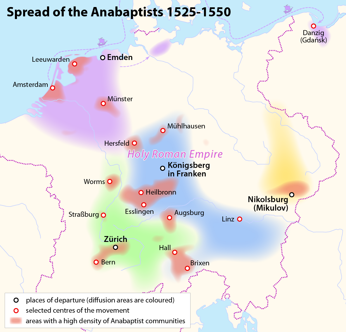
Mennonites are groups of Anabaptist Christian church communities of denominations. The name is derived from the founder of the movement, Menno Simons (1496–1561) of Friesland. Through his writings about Reformed Christianity during the Radical Reformation, Simons articulated and formalized the teachings of earlier Swiss founders, with the early teachings of the Mennonites founded on the belief in both the mission and ministry of Jesus, which the original Anabaptist followers held with great conviction, despite persecution by various Roman Catholic and Mainline Protestant states. Formal Mennonite beliefs were codified in the Dordrecht Confession of Faith in 1632, which affirmed "the baptism of believers only, the washing of the feet as a symbol of servanthood, church discipline, the shunning of the excommunicated, the non-swearing of oaths, marriage within the same church, strict pacifistic physical nonresistance, anti-Catholicism and in general, more emphasis on "true Chris ... [...More Info...] [...Related Items...] OR: [Wikipedia] [Google] [Baidu] |
Amish
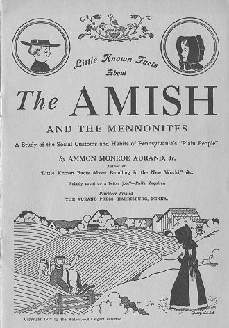
The Amish (; pdc, Amisch; german: link=no, Amische), formally the Old Order Amish, are a group of traditionalist Anabaptist Christian church fellowships with Swiss German and Alsatian origins. They are closely related to Mennonite churches, another Anabaptist denomination. The Amish are known for simple living, plain dress, Christian pacifism, and slowness to adopt many conveniences of modern technology, with a view neither to interrupt family time, nor replace face-to-face conversations whenever possible, and a view to maintain self-sufficiency. The Amish value rural life, manual labor, humility and '' Gelassenheit'' (submission to God's will). The history of the Amish church began with a schism in Switzerland within a group of Swiss and Alsatian Mennonite Anabaptists in 1693 led by Jakob Ammann. Those who followed Ammann became known as Amish. In the second half of the 19th century, the Amish divided into Old Order Amish and Amish Mennonites; the latter do not abstain fr ... [...More Info...] [...Related Items...] OR: [Wikipedia] [Google] [Baidu] |


