|
Rodovia Dos Bandeirantes
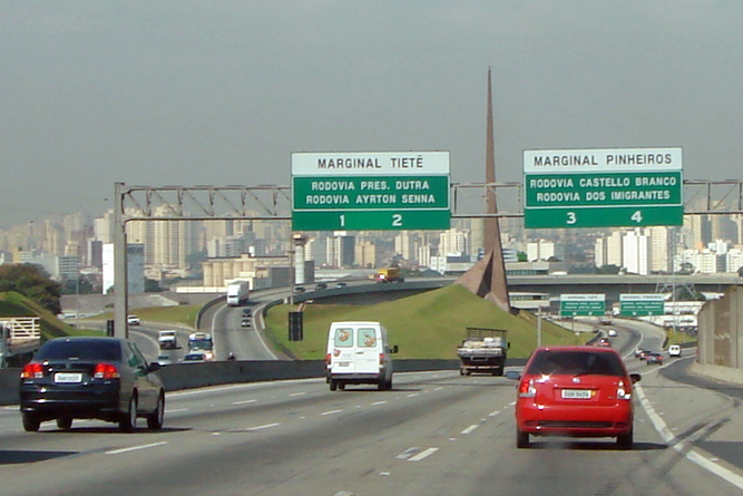
The Rodovia Bandeirantes (official designation SP-348) is a highway in the state of São Paulo, Brazil. Once the traffic capacity of the Anhangüera Highway was exceeded in the 1960s, the state government decided to build another highway, with a much higher capacity and modern design, directly connecting São Paulo City to Jundiaí, Campinas and merging into the Anhangüera just after Campinas. Among the first six-lane highways in Brazil, it opened to traffic in 1978. It has always been a toll road, and since 1998, the highway is managed by a state contract with a private company, AutoBan. Subsequently, in 2001 it was extended to Santa Bárbara d'Oeste merging with the Washington Luis Highway, to Rio Claro, São Carlos, Araraquara and São José do Rio Preto. In 2006, it was widened to 4 lanes each way between São Paulo and Jundiaí. It is today the major thoroughfare between several mighty industrial cities around São Paulo and Campinas, and the Viracopos Airport, the sec ... [...More Info...] [...Related Items...] OR: [Wikipedia] [Google] [Baidu] |
São Paulo
São Paulo (, ; Portuguese for 'Saint Paul') is the most populous city in Brazil, and is the capital of the state of São Paulo, the most populous and wealthiest Brazilian state, located in the country's Southeast Region. Listed by the GaWC as an alpha global city, São Paulo is the most populous city proper in the Americas, the Western Hemisphere and the Southern Hemisphere, as well as the world's 4th largest city proper by population. Additionally, São Paulo is the largest Portuguese-speaking city in the world. It exerts strong international influences in commerce, finance, arts and entertainment. The city's name honors the Apostle, Saint Paul of Tarsus. The city's metropolitan area, the Greater São Paulo, ranks as the most populous in Brazil and the 12th most populous on Earth. The process of conurbation between the metropolitan areas around the Greater São Paulo (Campinas, Santos, Jundiaí, Sorocaba and São José dos Campos) created the São Paulo Macrometr ... [...More Info...] [...Related Items...] OR: [Wikipedia] [Google] [Baidu] |
São Carlos
São Carlos (Saint Charles, in English, ; named after Saint Charles Borromeo) is a Brazilian municipality in the interior of the state of São Paulo, 254 kilometers from the city of São Paulo. With a population of 254,484 inhabitants, it is the 13th largest city in the state in terms of the number of residents, being almost in the center of the state of São Paulo. The municipality is formed by the headquarters and the districts of Água Vermelha, Bela Vista São-Carlense, Santa Eudóxia and Vila Nery. The city is an important regional industrial center, with the economy based on industrial activities and farming, such as the production of sugar cane, orange, milk and chicken. Served by road and rail systems, São Carlos houses several multinational companies. Given local and, in some ways, regional needs, there is a network of commerce and services distributed in street stores, convenience stores and a mall of the Iguatemi network. In the field of research, besides the univers ... [...More Info...] [...Related Items...] OR: [Wikipedia] [Google] [Baidu] |
Brazilian Highway System
The Brazilian Highway System (Portuguese language, Portuguese: ''Sistema Nacional de Rodovias'') is a network of Trunk road, trunk roads administrated by the Ministry of Infrastructure of Brazil (MINFRA). It is constructed, managed and maintained by the National Department of Transport Infrastructure (DNIT), federal agency linked to the Ministry of Infrastructure, and the Public works department, public works departments of state governments. The National Travel System (Portuguese language, Portuguese: ''Sistema Nacional de Viação –'' SNV) comprises the road infrastructure and the operational structure of the different means of transporting people and goods. As for jurisdiction, the national road system is composed of the Federal Road Traffic System (Portuguese language, Portuguese: Sistema Federal de Viação – SFV) and the road systems of the Federative units of Brazil, States, the Federal District (Brazil), Federal District and the Municipalities of Brazil, Municipalities ... [...More Info...] [...Related Items...] OR: [Wikipedia] [Google] [Baidu] |
Highway System Of São Paulo
The highway system of São Paulo is the largest statewide road transportation system in Brazil, with 34,650 km. It consists of a hugely interconnected network of municipal (11,600 km), state (22,000 km) and federal (1,050 km) roads. More than 90% of the population is within 5 km of a paved road. It has also the largest number of two-, four- and six-lane highways in Latin America. According to the National Confederation of Transports, it is the best highway grid in the country, with 59.4% classified as excellent. The term used in Portuguese language for ''highway'' is ''rodovia'', and for ''road'' is ''estrada''. Management systems The responsibility for building, maintaining, expanding, managing and exploiting the state roads fall into the following categories: * DERSA Desenvolvimento Rodoviário S.A. A state-owned company, responsible for some state-built roads and highways, such as Rodovias Dom Pedro I, Carvalho Pinto, Ayrton Senna, etc. (see below for t ... [...More Info...] [...Related Items...] OR: [Wikipedia] [Google] [Baidu] |
Araras
Araras () is a municipality located in the interior of State of São Paulo, Brazil. The population is 135,506 as of the 2020 IBGE estimate. Etymology Araras means macaws. Sports União São João Esporte Clube, founded in 1981, is the most successful football club of the city. Notable residents *Alice Piffer Canabrava, economic historian *Thiago Andrade Thiago Eduardo de Andrade (born 31 October 2000) is a Brazilian professional footballer who plays as a forward for Major League Soccer club New York City FC. Career Born in Araras, Andrade began his career at Fluminense before moving to Portu ..., Soccer Player References Populated places established in 1862 1862 establishments in Brazil {{SaoPauloState-geo-stub ... [...More Info...] [...Related Items...] OR: [Wikipedia] [Google] [Baidu] |
Mário Covas
Mário Covas Almeida Júnior ( or ; 21 April 1930 – 6 March 2001) was a Brazilian politician. Biography Covas studied engineering at the Polytechnic School of the University of São Paulo. He entered politics in his native city of Santos, in the state of São Paulo. He was elected federal representative, mayor of São Paulo City (1983–1985), senator and twice Governor of the state of São Paulo (1994–1998 and 1998–2001). He was a founder and member of PMDB (Party of the Brazilian Democratic Movement) and later PSDB (Brazilian Social Democracy Party). In 1989, he was the PSDB presidential candidate, receiving 11% of the votes. In the run-off of that election, he supported, like his party, Luís Inácio Lula da Silva. He took a medical leave of absence on 22 January 2001, due to bladder cancer Bladder cancer is any of several types of cancer arising from the tissues of the urinary bladder. Symptoms include blood in the urine, pain with urination, and low bac ... [...More Info...] [...Related Items...] OR: [Wikipedia] [Google] [Baidu] |
Rodovia Bandeirantes SAO 2008 06
The Brazilian Highway System (Portuguese: ''Sistema Nacional de Rodovias'') is a network of trunk roads administrated by the Ministry of Infrastructure of Brazil (MINFRA). It is constructed, managed and maintained by the National Department of Transport Infrastructure (DNIT), federal agency linked to the Ministry of Infrastructure, and the public works departments of state governments. The National Travel System (Portuguese: ''Sistema Nacional de Viação –'' SNV) comprises the road infrastructure and the operational structure of the different means of transporting people and goods. As for jurisdiction, the national road system is composed of the Federal Road Traffic System (Portuguese: Sistema Federal de Viação – SFV) and the road systems of the States, the Federal District and the Municipalities. The Investment Partnership Program (PPI) is a major effort to expand and upgrade the network of highways aside with the Federal Highway Concessions Program (PROCROFE). The Min ... [...More Info...] [...Related Items...] OR: [Wikipedia] [Google] [Baidu] |
Rain Forest
Rainforests are characterized by a closed and continuous tree canopy, moisture-dependent vegetation, the presence of epiphytes and lianas and the absence of wildfire. Rainforest can be classified as tropical rainforest or temperate rainforest, but other types have been described. Estimates vary from 40% to 75% of all biotic species being indigenous to the rainforests. There may be many millions of species of plants, insects and microorganisms still undiscovered in tropical rainforests. Tropical rainforests have been called the "jewels of the Earth" and the " world's largest pharmacy", because over one quarter of natural medicines have been discovered there. Rainforests as well as endemic rainforest species are rapidly disappearing due to deforestation, the resulting habitat loss and pollution of the atmosphere. Definition Rainforest are characterized by a closed and continuous tree canopy, high humidity, the presence of moisture-dependent vegetation, a moist layer of leaf ... [...More Info...] [...Related Items...] OR: [Wikipedia] [Google] [Baidu] |
Explorer
Exploration refers to the historical practice of discovering remote lands. It is studied by geographers and historians. Two major eras of exploration occurred in human history: one of convergence, and one of divergence. The first, covering most of ''Homo sapiens'' history, saw humans moving out of Africa, settling in new lands, and developing distinct cultures in relative isolation. Early explorers settled in Europe and Asia; 14,000 years ago, some crossed the Ice Age land bridge from Siberia to Alaska, and moved southbound to settle in the Americas. For the most part, these cultures were ignorant of each other's existence. The second period of exploration, occurring over the last 10,000 years, saw increased cross-cultural exchange through trade and exploration, and marked a new era of cultural intermingling, and more recently, convergence. Early writings about exploration date back to the 4th millennium B.C. in ancient Egypt. One of the earliest and most impactful thinkers of ... [...More Info...] [...Related Items...] OR: [Wikipedia] [Google] [Baidu] |
Bandeirantes
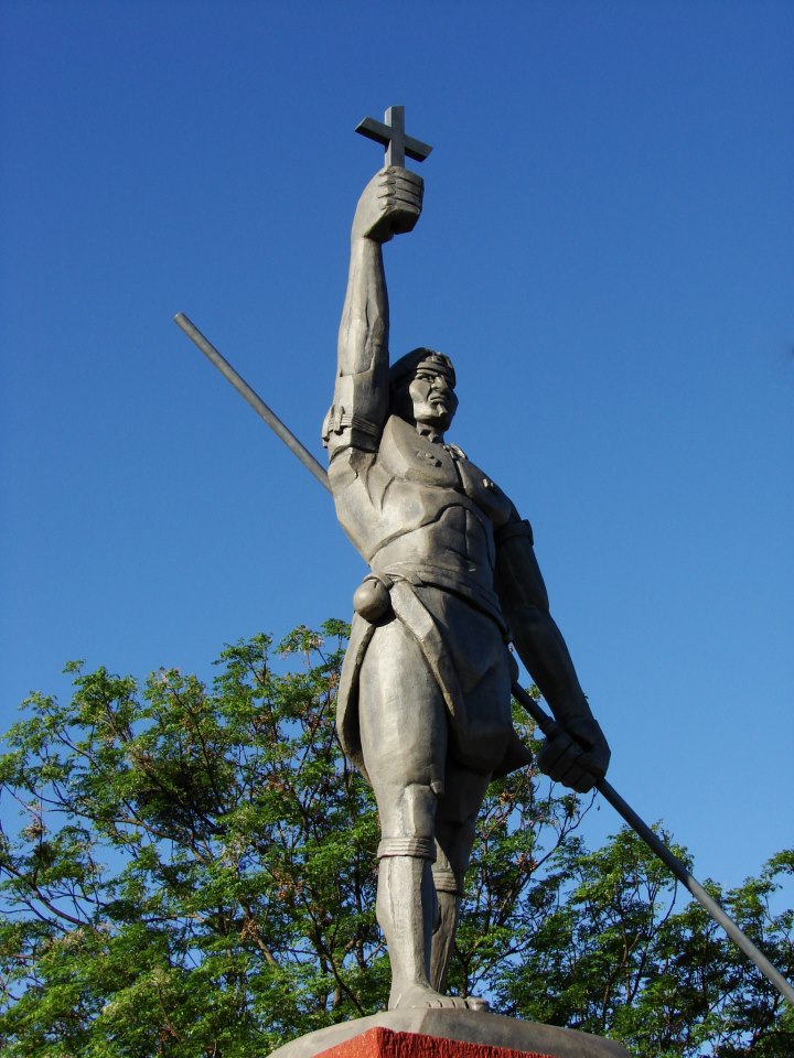
The ''Bandeirantes'' (), literally "flag-carriers", were slavers, explorers, adventurers, and fortune hunters in early Colonial Brazil. They are largely responsible for Brazil's great expansion westward, far beyond the Tordesillas Line of 1494, by which Pope Alexander VI divided the new continent into a western, Crown of Castile, Castilian section, and an eastern, Portugal, Portuguese section. The ''bandeirantes'' were also known as Paulistas and Mamelucos. They mostly hailed from the São Paulo (state), São Paulo region, called the Captaincy of São Vicente until 1709 and then as the Captaincy of São Paulo. The São Paulo settlement served as the home base for the most famous ''bandeirantes.'' Some ''bandeirante'' leaders were descendants of first- and second-generation Portuguese who settled in São Paulo, but the bulk of their numbers was made of people of mameluco background (people of both European and Indigenous peoples in Brazil, Indian ancestries) and natives. Misceg ... [...More Info...] [...Related Items...] OR: [Wikipedia] [Google] [Baidu] |
Airport
An airport is an aerodrome with extended facilities, mostly for commercial air transport. Airports usually consists of a landing area, which comprises an aerially accessible open space including at least one operationally active surface such as a runway for a plane to take off and to land or a helipad, and often includes adjacent utility buildings such as control towers, hangars and terminals, to maintain and monitor aircraft. Larger airports may have airport aprons, taxiway bridges, air traffic control centres, passenger facilities such as restaurants and lounges, and emergency services. In some countries, the US in particular, airports also typically have one or more fixed-base operators, serving general aviation. Operating airports is extremely complicated, with a complex system of aircraft support services, passenger services, and aircraft control services contained within the operation. Thus airports can be major employers, as well as important hubs for tourism ... [...More Info...] [...Related Items...] OR: [Wikipedia] [Google] [Baidu] |
Cargo
Cargo consists of bulk goods conveyed by water, air, or land. In economics, freight is cargo that is transported at a freight rate for commercial gain. ''Cargo'' was originally a shipload but now covers all types of freight, including transport by rail, van, truck, or intermodal container. The term cargo is also used in case of goods in the cold-chain, because the perishable inventory is always in transit towards a final end-use, even when it is held in cold storage or other similar climate-controlled facility. The term freight is commonly used to describe the movements of flows of goods being transported by any mode of transportation. Multi-modal container units, designed as reusable carriers to facilitate unit load handling of the goods contained, are also referred to as cargo, especially by shipping lines and logistics operators. Similarly, aircraft ULD boxes are also documented as cargo, with an associated packing list of the items contained within. When empty conta ... [...More Info...] [...Related Items...] OR: [Wikipedia] [Google] [Baidu] |


