|
Rock Formations In The United Kingdom
This is a selected list of notable, natural landscape features in England, Scotland, Wales and Northern Ireland. It includes isolated, scenic, or spectacular surface rock outcrops. These formations are usually the result of weathering and erosion sculpting the existing rock. For the stratigraphic term 'formation' applied by geologists to rock sequences, see Formation (stratigraphy). England * Avon Gorge, Bristol *Brimham Rocks, Nidderdale, Yorkshire * Cheddar Gorge and Cave, Somerset *Cheesewring, Bodmin Moor, Cornwall *Dovedale, Derbyshire * Durdle Door, Dorset * Ebbor Gorge, Somerset * Hunstanton cliffs, Norfolk *Lathkill Dale, Derbyshire * Lydford Gorge, Devon * The Needles, Isle of Wight * Old Harry Rocks, Dorset *Penninis, St. Mary's, Isles of Scilly * Pulpit Rock, Isle of Portland, Dorset *Tar Rocks, Isle of Portland, Dorset Scotland * Ailsa Craig, Firth of Clyde * Arthur's Seat, Edinburgh * Bass Rock, Firth of Forth * Beinn Eighe, Wester Ross * The Cobbl ... [...More Info...] [...Related Items...] OR: [Wikipedia] [Google] [Baidu] |
Natural Landscape
A natural landscape is the original landscape that exists before it is acted upon by human culture Culture () is an umbrella term which encompasses the social behavior, institutions, and norms found in human societies, as well as the knowledge, beliefs, arts, laws, customs, capabilities, and habits of the individuals in these groups.Tylo .... The natural landscape and the cultural landscape are separate parts of the landscape. However, in the 21st century, landscapes that are totally untouched by human behavior, human activity no longer exist, so that reference is sometimes now made to degrees of naturalness within a landscape.The European Environment Agency's planned forest naturalness index is an example of an attempt to define one type of natural landscape in Europe. The Agency lists forests in three categories: (1) Plantations; (2) Semi-natural; and (3) Naturally dynamic. The latter are "forests whose structure, composition and function have been shaped by natural dy ... [...More Info...] [...Related Items...] OR: [Wikipedia] [Google] [Baidu] |
Durdle Door
Durdle Door (sometimes written Durdle Dor) is a natural limestone arch on the Jurassic Coast near Lulworth in Dorset, England.West, I.W., 2003.Durdle Door; Geology of the Dorset Coast. Southampton University, UK. Version H.07.09.03. It is privately owned by the Weld Family who own the Lulworth Estate, but it is also open to the public. Geology The form of the coastline around Durdle Door is controlled by its geology—both by the contrasting hardnesses of the rocks, and by the local patterns of faults and folds.Nowell, D. A. G. "The geology of Lulworth Cove, Dorset." Geology Today 14 (1998): 71–74. The arch has formed on a concordant coastline where bands of rock run parallel to the shoreline. The rock strata are almost vertical, and the bands of rock are quite narrow. Originally a band of resistant Portland limestone ran along the shore, the same band that appears one mile along the coast forming the narrow entrance to Lulworth Cove. Behind this is a band of weaker, easi ... [...More Info...] [...Related Items...] OR: [Wikipedia] [Google] [Baidu] |
Tar Rocks
Tar Rocks are coastal rocks on the west side of the Isle of Portland, Dorset, England. The rocks become mostly covered at high tide. See also * List of rock formations in the United Kingdom * Pulpit Rock (Isle of Portland) Pulpit Rock is a coastal feature at Portland Bill, the southern tip of the Isle of Portland, Dorset, England. Intended to have the appearance of an open bible leaning on a pulpit, Pulpit Rock was formed in the 1870s after a natural arch was cut a ... Gallery File:Tar Rocks, Portland at low tide - geograph.org.uk - 736987.jpg, Tar Rocks from above at low tide. File:Tar Rocks, Portland at low tide from the south - geograph.org.uk - 737000.jpg, Tar Rocks from the south at low tide. References Rock formations of England Geography of Dorset Isle of Portland Jurassic Coast {{UK-geology-stub ... [...More Info...] [...Related Items...] OR: [Wikipedia] [Google] [Baidu] |
Isle Of Portland
An isle is an island, land surrounded by water. The term is very common in British English. However, there is no clear agreement on what makes an island an isle or its difference, so they are considered synonyms. Isle may refer to: Geography * Isle (river), a river in France * Isle, Haute-Vienne, a commune of the Haute-Vienne ''département'' in France * Isle, Minnesota, a small city in the United States * River Isle, a river in England Arts, entertainment, and media * ''Interdisciplinary Studies in Literature and Environment'' (or ''ISLE''), a journal published by Oxford University Press for the Association for the Study of Literature and Environment *''The Isle'', 2017 film with Conleth Hill * ''The Isle'', a 2000 South Korean film directed by Kim Ki-duk * ''Isle'' (album) Other uses * International Society for the Linguistics of English (ISLE), a learned society of linguists See also * Aisle An aisle is, in general, a space for walking with rows of non-walking spaces o ... [...More Info...] [...Related Items...] OR: [Wikipedia] [Google] [Baidu] |
Pulpit Rock (Isle Of Portland)
Pulpit Rock is a coastal feature at Portland Bill, the southern tip of the Isle of Portland, Dorset, England. Intended to have the appearance of an open bible leaning on a pulpit, Pulpit Rock was formed in the 1870s after a natural arch was cut away by quarrymen at Bill Quarry, and the leaning slab was added. As a quarrying relic, the rock is similar to that of Nicodemus Knob, another quarrying landmark on the island. Pulpit Rock has become a popular tourist attraction on the island and is often photographed. Despite the danger, for many decades it has been a popular place for tombstoning. Pulpit Rock is also a popular point for wrasse anglers. The British record Ballan wrasse was caught there in 1998 by Pete Hegg. The geological succession up from sea level is: Portland Cherty Series (up to the level of the neighbouring quarried platform), then Portland Freestone (the oolitic limestone quarried inland of Pulpit Rock), then a cap of thin-bedded limestones which are part of th ... [...More Info...] [...Related Items...] OR: [Wikipedia] [Google] [Baidu] |
Old Harry Rocks
Old Harry Rocks are three chalk formations, including a stack and a stump, located at Handfast Point, on the Isle of Purbeck in Dorset, southern England. They mark the most eastern point of the Jurassic Coast, a UNESCO World Heritage Site. Location Old Harry Rocks lies directly east of Studland, about northeast of Swanage, and about south of the large towns of Poole and Bournemouth. To the south are the chalk cliffs of Ballard Down, much of which is owned by the National Trust. The rocks can be viewed from the Dorset section of the South West Coast Path. Formation The chalk of Old Harry Rocks used to be part of a long stretch of chalk between Purbeck and the Isle of Wight, but remained as a headland after large parts of this seam were eroded away. As the headland suffered hydraulic action (a process in which air and water are forced into small cracks by the force of the sea, resulting in enlarging cracks), first caves, then arches formed. The tops of the arches collapse ... [...More Info...] [...Related Items...] OR: [Wikipedia] [Google] [Baidu] |
Isle Of Wight
The Isle of Wight ( ) is a county in the English Channel, off the coast of Hampshire, from which it is separated by the Solent. It is the largest and second-most populous island of England. Referred to as 'The Island' by residents, the Isle of Wight has resorts that have been popular holiday destinations since Victorian times. It is known for its mild climate, coastal scenery, and verdant landscape of fields, downland and chines. The island is historically part of Hampshire, and is designated a UNESCO Biosphere Reserve. The island has been home to the poets Algernon Charles Swinburne and Alfred, Lord Tennyson. Queen Victoria built her summer residence and final home, Osborne House at East Cowes, on the Isle. It has a maritime and industrial tradition of boat-building, sail-making, the manufacture of flying boats, hovercraft, and Britain's space rockets. The island hosts annual music festivals, including the Isle of Wight Festival, which in 1970 was the largest rock music ... [...More Info...] [...Related Items...] OR: [Wikipedia] [Google] [Baidu] |
The Needles
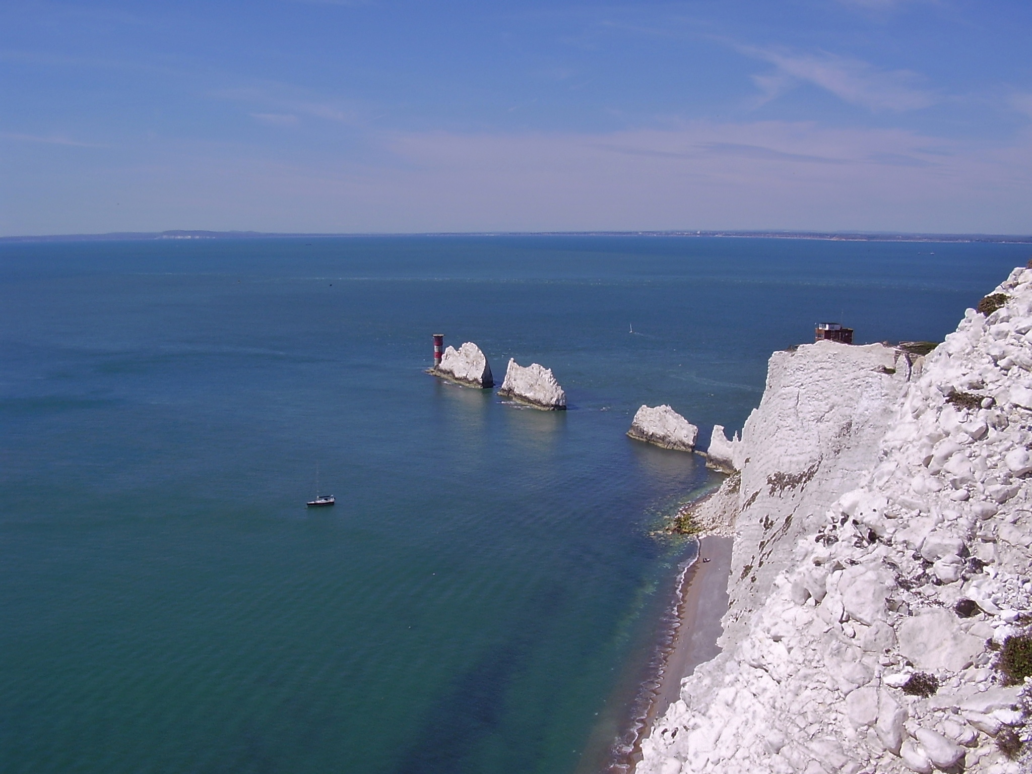
The Needles is a row of three stacks of chalk that rise about out of the sea off the western extremity of the Isle of Wight in the English Channel, United Kingdom, close to Alum Bay and Scratchell's Bay, and part of Totland, the westernmost civil parish of the Isle of Wight. The Needles Lighthouse stands at the outer, western end of the formation. Built in 1859, it has been automated since 1994. The waters and adjoining seabed form part of the Needles Marine Conservation Zone and the Needles along with the shore and heath above are part of the Headon Warren and West High Down Site of Special Scientific Interest. The formation takes its name from a fourth needle-shaped pillar called Lot's Wife, which collapsed in a storm in 1764. The remaining rocks are not at all needle-like, but the name has stuck. The Needles were featured on the BBC Two TV programme ''Seven Natural Wonders'' (2005) as one of the wonders of Southern England. During Storm Eunice on 18 February 2022, t ... [...More Info...] [...Related Items...] OR: [Wikipedia] [Google] [Baidu] |
Devon
Devon ( , historically known as Devonshire , ) is a ceremonial and non-metropolitan county in South West England. The most populous settlement in Devon is the city of Plymouth, followed by Devon's county town, the city of Exeter. Devon is a coastal county with cliffs and sandy beaches. Home to the largest open space in southern England, Dartmoor (), the county is predominately rural and has a relatively low population density for an English county. The county is bordered by Somerset to the north east, Dorset to the east, and Cornwall to the west. The county is split into the non-metropolitan districts of East Devon, Mid Devon, North Devon, South Hams, Teignbridge, Torridge, West Devon, Exeter, and the unitary authority areas of Plymouth, and Torbay. Combined as a ceremonial county, Devon's area is and its population is about 1.2 million. Devon derives its name from Dumnonia (the shift from ''m'' to ''v'' is a typical Celtic consonant shift). During the Briti ... [...More Info...] [...Related Items...] OR: [Wikipedia] [Google] [Baidu] |
Lydford Gorge
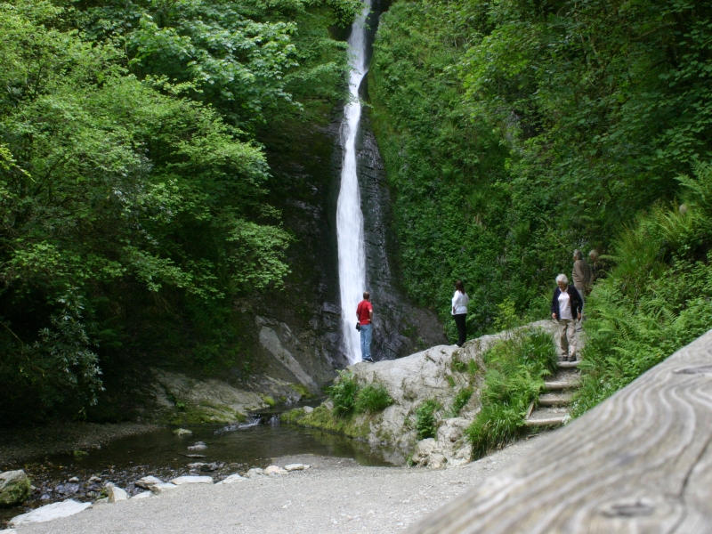
The Lyd is a river rising at Lyd Head (Corn Ridge in NW Dartmoor) in the Dartmoor national park in Devon in South West England and flowing into the River Tamar beyond Lifton. It runs through Lydford Gorge, the deepest gorge in South West England. Lydford Gorge Lydford Gorge (National Trust) is a dramatic feature of the river at Lydford on the edge of the Dartmoor National Park; it is a gorge near Lydford on the River Lyd, which is the deepest in South West England. It was formed by the process of river capture, where the start of a nearby river eroded backwards until its origin met the Lyd, diverting its course into the second channel. Owned and maintained by the National Trust since 1947, the gorge features the tall White Lady Waterfall and a series of whirlpool A whirlpool is a body of rotating water produced by opposing currents or a current running into an obstacle. Small whirlpools form when a bath or a sink is draining. More powerful ones formed in seas or oceans ... [...More Info...] [...Related Items...] OR: [Wikipedia] [Google] [Baidu] |
Lathkill Dale
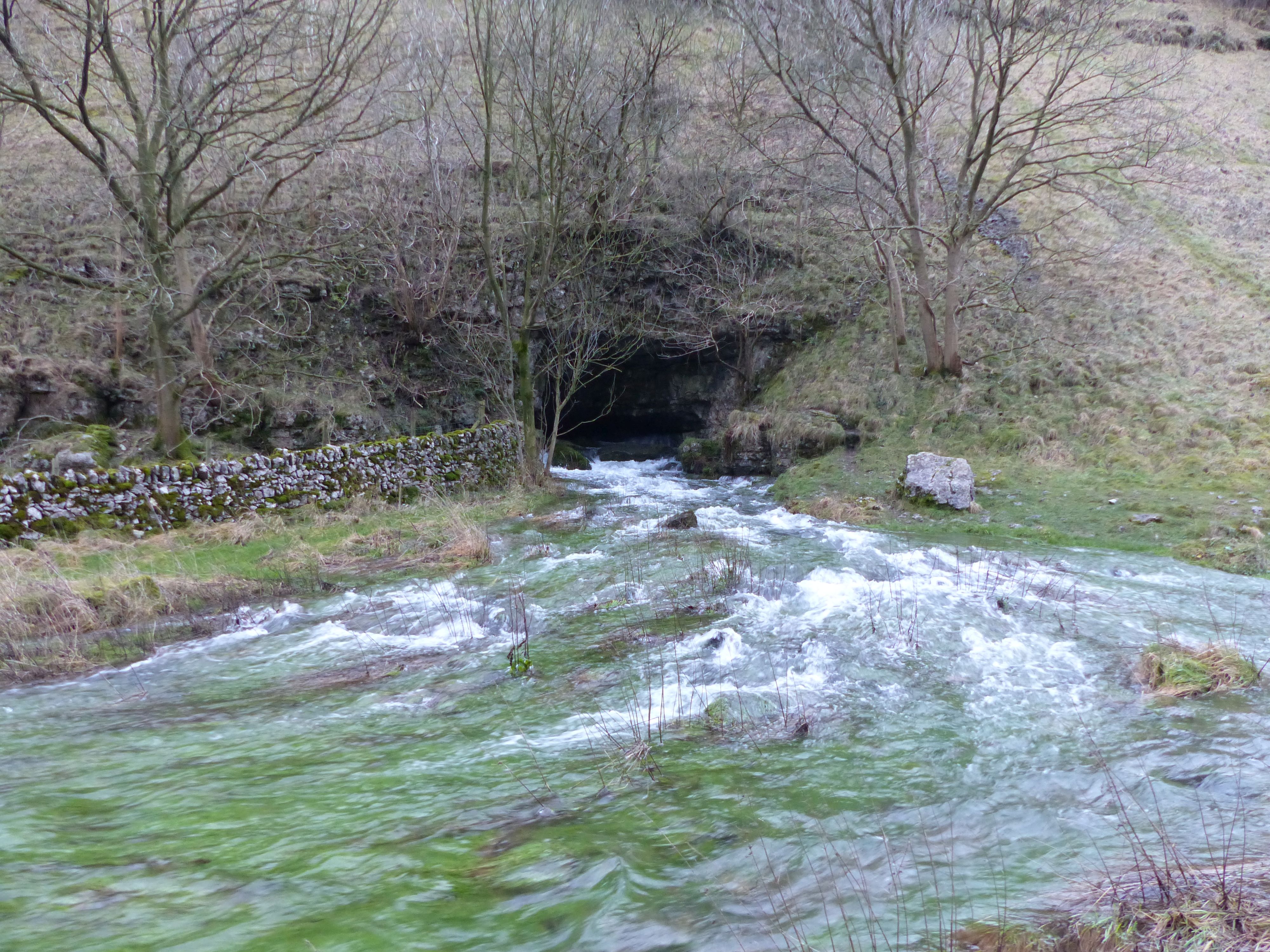
Lathkill Dale is the valley of the River Lathkill near Bakewell, Derbyshire in the Peak District of England. The river emerges into the dale from springs below Lathkill Head Cave (or, in wet conditions, from the cave itself). Towards the head of the dale is the side valley Cales Dale. Nature reserve The river valley is part of the Derbyshire Dales National Nature Reserve and is popular with tourists who visit for its natural environment and wildlife. Natural England manages the reserve which covers five separate dales of the White Peak (Lathkill Dale, Cressbrook Dale, Hay Dale, Long Dale and Monk’s Dale). The dale includes two Sites of Special Scientific Interest (SSSIs) and areas designated as Open Access Land in the Countryside and Rights of Way Act 2000. Lathkill Dale is known for its range of wildflower species (including orchids and the rare Jacob's ladder), butterflies, ancient woodland and the presence of birds of prey, dippers, woodpeckers and water voles. T ... [...More Info...] [...Related Items...] OR: [Wikipedia] [Google] [Baidu] |
Norfolk
Norfolk () is a ceremonial and non-metropolitan county in East Anglia in England. It borders Lincolnshire to the north-west, Cambridgeshire to the west and south-west, and Suffolk to the south. Its northern and eastern boundaries are the North Sea, with The Wash to the north-west. The county town is the city of Norwich. With an area of and a population of 859,400, Norfolk is a largely rural county with a population density of 401 per square mile (155 per km2). Of the county's population, 40% live in four major built up areas: Norwich (213,000), Great Yarmouth (63,000), King's Lynn (46,000) and Thetford (25,000). The Broads is a network of rivers and lakes in the east of the county, extending south into Suffolk. The area is protected by the Broads Authority and has similar status to a national park. History The area that was to become Norfolk was settled in pre-Roman times, (there were Palaeolithic settlers as early as 950,000 years ago) with camps along the highe ... [...More Info...] [...Related Items...] OR: [Wikipedia] [Google] [Baidu] |


