|
Rock, Kansas
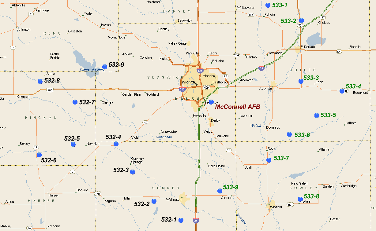
Rock is an unincorporated community in Cowley County, Kansas, United States. As of the 2020 census, the population of the community and nearby areas was 94. History 19th century The post office was established August 12, 1870. In 1877, the Florence, El Dorado, and Walnut Valley Railroad Company built a branch line from Florence to El Dorado, in 1881 it was extended to Douglass, and later to Arkansas City. The line was leased and operated by the Atchison, Topeka and Santa Fe Railway. The line from Florence to El Dorado was abandoned in 1942. The original branch line connected Florence, Burns, De Graff, El Dorado, Augusta, Douglass, Rock, Akron, Winfield, Arkansas City. 20th century In 1905, the nearby Bucher Bridge, on the National Register of Historic Places, was built. On August 24, 1978, the community was evacuated when a major oxidizer spill at a Titan II ICBM site (533-7) 2.5 miles south of Rock. The spill resulted in the deaths of 2 airmen that were based o ... [...More Info...] [...Related Items...] OR: [Wikipedia] [Google] [Baidu] |
Unincorporated Area
An unincorporated area is a region that is not governed by a local municipal corporation. Widespread unincorporated communities and areas are a distinguishing feature of the United States and Canada. Most other countries of the world either have no unincorporated areas at all or these are very rare: typically remote, outlying, sparsely populated or List of uninhabited regions, uninhabited areas. By country Argentina In Argentina, the provinces of Chubut Province, Chubut, Córdoba Province (Argentina), Córdoba, Entre Ríos Province, Entre Ríos, Formosa Province, Formosa, Neuquén Province, Neuquén, Río Negro Province, Río Negro, San Luis Province, San Luis, Santa Cruz Province, Argentina, Santa Cruz, Santiago del Estero Province, Santiago del Estero, Tierra del Fuego Province, Argentina, Tierra del Fuego, and Tucumán Province, Tucumán have areas that are outside any municipality or commune. Australia Unlike many other countries, Australia has only local government in Aus ... [...More Info...] [...Related Items...] OR: [Wikipedia] [Google] [Baidu] |
Florence, Kansas
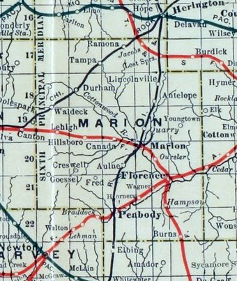
Florence is a city in Marion County, Kansas, United States. The city was named after the daughter of the third Governor of Kansas Samuel J. Crawford.Century of Pride, 1872-1972 : Florence Kansas Centennial; Florence Centennial Book Committee; 1972. As of the 2020 census, the population of the city was 394. It is located at the intersection of U.S. Route 50 and U.S. Route 77 highways. History Early history For millennia, the Great Plains of North America was inhabited by nomadic Native Americans. These tribes considered native included: the Arapaho, Cheyenne, Comanche, Kansa, Kiowa, Osage, Pawnee, and Wichita. From the 16th century to 18th century, the Kingdom of France claimed ownership of large parts of North America. In 1762, after the French and Indian War, France secretly ceded New France to Spain, per the Treaty of Fontainebleau. 19th century In 1802, Spain returned most of the land to France. In 1803, most of the land for modern day Kansas was acqu ... [...More Info...] [...Related Items...] OR: [Wikipedia] [Google] [Baidu] |
LGM-25C Titan II
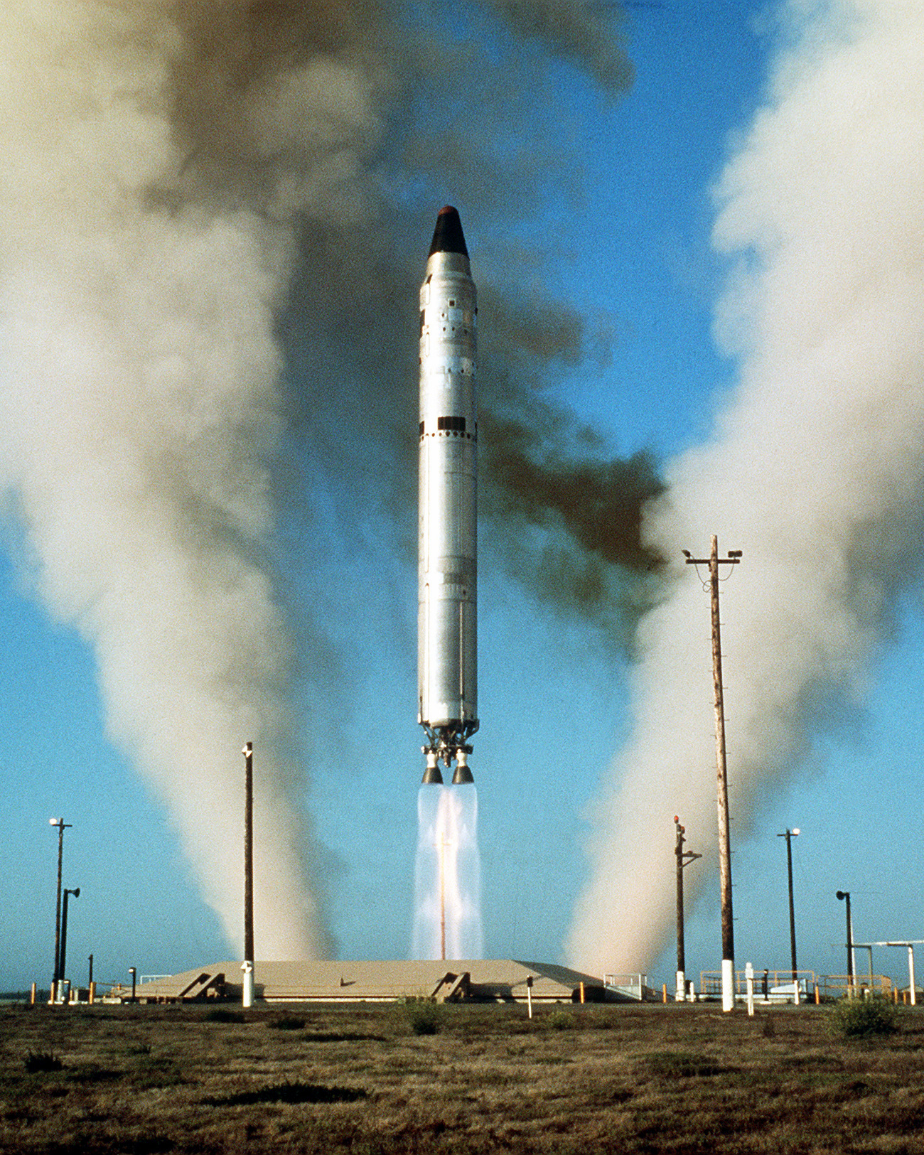
The Titan II was an intercontinental ballistic missile (ICBM) developed by the Glenn L. Martin Company from the earlier Titan I missile. Titan II was originally designed and used as an ICBM, but was later adapted as a medium-lift space launch vehicle (these adaptations were designated Titan II GLV and Titan 23G) to carry payloads to Earth orbit for the United States Air Force (USAF), National Aeronautics and Space Administration (NASA) and National Oceanic and Atmospheric Administration (NOAA). Those payloads included the USAF Defense Meteorological Satellite Program (DMSP), NOAA weather satellites, and NASA's Gemini crewed space capsules. The modified Titan II SLVs (Space Launch Vehicles) were launched from Vandenberg Air Force Base, California, up until 2003. Titan II missile The Titan II ICBM was the successor to the Titan I, with double the payload. Unlike the Titan I, it used hydrazine-based hypergolic propellant which was storable and reliably ignited. This red ... [...More Info...] [...Related Items...] OR: [Wikipedia] [Google] [Baidu] |
National Register Of Historic Places
The National Register of Historic Places (NRHP) is the United States federal government's official list of districts, sites, buildings, structures and objects deemed worthy of preservation for their historical significance or "great artistic value". A property listed in the National Register, or located within a National Register Historic District, may qualify for tax incentives derived from the total value of expenses incurred in preserving the property. The passage of the National Historic Preservation Act (NHPA) in 1966 established the National Register and the process for adding properties to it. Of the more than one and a half million properties on the National Register, 95,000 are listed individually. The remainder are contributing resources within historic districts. For most of its history, the National Register has been administered by the National Park Service (NPS), an agency within the U.S. Department of the Interior. Its goals are to help property owners a ... [...More Info...] [...Related Items...] OR: [Wikipedia] [Google] [Baidu] |
Bucher Bridge
The Bucher Bridge, located off U.S. Route 77 near the town of Rock in Cowley County, Kansas, was listed on the National Register of Historic Places in 1985. It is located about north and west of Rock. Also known as Eight Mile Creek Bridge, the bridge crosses Eight Mile Creek. It is long and wide. It was completed in 1905 by Walter Sharp of El Dorado and constructed of solid concrete. It is a concrete arch bridge, and is possibly reinforced by steel. It has short limestone wing walls A wing wall (also "wingwall" or "wing-wall") is a smaller wall attached or next to a larger wall or structure. Bridges In a bridge, the wing walls are adjacent to the abutments and act as retaining walls. They are generally constructed of the same .... With . It is possibly just the second bridge of this type built by Walter Sharp, who was experimenting. The township did not complete the approaches to the bridge, so people in the area who would use the bridge got together and built the a ... [...More Info...] [...Related Items...] OR: [Wikipedia] [Google] [Baidu] |
Winfield, Kansas
Winfield is a city and county seat of Cowley County, Kansas, United States. It is situated along the Walnut River in South Central Kansas. As of the 2020 census, the population of the city was 11,777. It is home to Southwestern College. History 19th century Winfield was founded in 1870. It was named for Rev. Winfield Scott, who promised to build the town a church in exchange for the naming rights. The first post office at Winfield was established in May, 1870. In 1873, Winfield incorporated as a city. Railroads Railroads reached Winfield in the late 1870s, and finished at Arkansas City in 1881.''Marion County Kansas : Past and Present''; Sondra Van Meter; MB Publishing House; LCCN 72-92041; 344 pages; 1972. Eventually, a total of five railroads passed through Winfield. State mental hospital In 1881, the State of Kansas established the Kansas State Asylum for Idiotic and Imbecile Youth, temporarily established at Lawrence, but moved to Winfield in 1887/1888, where it s ... [...More Info...] [...Related Items...] OR: [Wikipedia] [Google] [Baidu] |
Akron, Kansas
Akron is an unincorporated community in Fairview Township, Cowley County, Kansas, United States. Akron is located at . History The first post office at Akron (called Little Dutch until 1882) was opened in 1872, and remained in operation until it was discontinued in 1912. Education The community is served by Winfield USD 465 Winfield USD 465 is a public unified school district headquartered in Winfield, Kansas, United States. The district includes the communities of Winfield, Akron, Floral, Hackney, New Salem, Tisdale, and nearby rural areas. Schools The school ... public school district. References Further reading External links * Cowley County mapsCurrent KDOT [...More Info...] [...Related Items...] OR: [Wikipedia] [Google] [Baidu] |
Augusta, Kansas
Augusta is a city in Butler County, Kansas, United States. As of the 2020 census, the population of the city was 9,256. History 19th century The confluence of the Whitewater River and the Walnut River was originally inhabited by Osage people, who found the land ideal for hunting and fishing. In 1868, C. N. James settled in the area and built a log cabin to serve also as a general store and trading post. Around that same time, a post office was established in the settlement, and as the first postmaster, C. N. James named the post office and the town in honor of his wife, Augusta James. In 1877, the Florence, El Dorado, and Walnut Valley Railroad Company built a branch line from Florence to El Dorado. In 1881 it was extended to Douglass, and later to Arkansas City. The rail line was leased and operated by the Atchison, Topeka and Santa Fe Railway. Service from Florence to El Dorado was abandoned in 1942. The original branch line connected Florence, Burns, De Graff, ... [...More Info...] [...Related Items...] OR: [Wikipedia] [Google] [Baidu] |
De Graff, Kansas
De Graff is an unincorporated community in Butler County, Kansas, United States. It is located on U.S. Route 77 approximately north of I-35 (Kansas Turnpike) History In 1877, the Florence, El Dorado, and Walnut Valley Railroad Company built a branch line from Florence to El Dorado,''Marion County Kansas : Past and Present''; Sondra Van Meter; MB Publishing House; LCCN 72-92041; 344 pages; 1972. and a station called De Graff was built. In 1881, the rail line was extended to Douglass, then later to Arkansas City. The line was leased and operated by the Atchison, Topeka and Santa Fe Railway. The line from Florence through Burns to El Dorado was abandoned in 1942. The original branch line connected Florence through El Dorado to Arkansas City. De Graff was founded around a train station in 1877, then stagnated after the railroad was abandoned in 1942. De Graff had a post office from 1887 until 1942. Climate The climate in this area is characterized by hot, humid summers ... [...More Info...] [...Related Items...] OR: [Wikipedia] [Google] [Baidu] |
Burns, Kansas
Burns is a city in Marion County, Kansas, United States. The city name came from a nearby train station, which was named prior to the city being incorporated. As of the 2020 census, the population of the city was 234. It is located between El Dorado and Florence along the west side of U.S. Route 77 highway. The south edge of the city is the border of Marion and Butler counties. History Early history For many millennia, the Great Plains of North America was inhabited by nomadic Native Americans. From the 16th century to 18th century, the Kingdom of France claimed ownership of large parts of North America. In 1762, after the French and Indian War, France secretly ceded New France to Spain, per the Treaty of Fontainebleau. 19th century In 1802, Spain returned most of the land to France. In 1803, most of the land for modern day Kansas was acquired by the United States from France as part of the 828,000 square mile Louisiana Purchase for 2.83 cents per acre. ... [...More Info...] [...Related Items...] OR: [Wikipedia] [Google] [Baidu] |
Atchison, Topeka And Santa Fe Railway
The Atchison, Topeka and Santa Fe Railway , often referred to as the Santa Fe or AT&SF, was one of the larger railroads in the United States. The railroad was chartered in February 1859 to serve the cities of Atchison and Topeka, Kansas, and Santa Fe, New Mexico. The railroad reached the Kansas–Colorado border in 1873 and Pueblo, Colorado, in 1876. To create a demand for its services, the railroad set up real estate offices and sold farmland from the land grants that it was awarded by Congress. Despite being chartered to serve the city, the railroad chose to bypass Santa Fe, due to the engineering challenges of the mountainous terrain. Eventually a branch line from Lamy, New Mexico, brought the Santa Fe railroad to its namesake city. The Santa Fe was a pioneer in intermodal freight transport; at various times, it operated an airline, the short-lived Santa Fe Skyway, and the fleet of Santa Fe Railroad Tugboats. Its bus line extended passenger transportation to areas not ... [...More Info...] [...Related Items...] OR: [Wikipedia] [Google] [Baidu] |
LCCN
The Library of Congress Control Number (LCCN) is a serially based system of numbering cataloged records in the Library of Congress, in the United States. It is not related to the contents of any book, and should not be confused with Library of Congress Classification (LCC). History The LCCN numbering system has been in use since 1898, at which time the acronym LCCN originally stood for Library of Congress Card Number. It has also been called the Library of Congress Catalog Card Number, among other names. The Library of Congress prepared cards of bibliographic information for their library catalog and would sell duplicate sets of the cards to other libraries for use in their catalogs. This is known as centralized cataloging. Each set of cards was given a serial number to help identify it. Although most of the bibliographic information is now electronically created, stored, and shared with other libraries, there is still a need to identify each unique record, and the LCCN conti ... [...More Info...] [...Related Items...] OR: [Wikipedia] [Google] [Baidu] |


