|
River, Kent
River is a village and civil parish in Kent, England, situated between the historic town of Dover and the neighbouring village of Temple Ewell. The 2011 census recorded a population of 3,876 in the village. River is 1 mile south west of the A2 and 2 miles north of the A20, and a railway station at Kearsney provides direct access to London. History There are two churches in the village, the 11th-century Anglican parish church of St Peter & St Paul, and a Methodist church with a history dating back to 1834. The oldest residential sections of River date from the 1800s or earlier. Later development possibly dates to the 1930s, as well as recent developments from the 1960s and 1970s. Geography River is situated in a steep wooded valley formed by the River Dour. At its north-west end the valley splits into the Dour Valley, in which Temple Ewell lies, and the Alkham Valley, which for much of the time is dry but which contains the Drellingore, a highly seasonal stream characterist ... [...More Info...] [...Related Items...] OR: [Wikipedia] [Google] [Baidu] |
Dover (district)
Dover is a local government district in Kent, England. The port town of Dover is its administrative centre. It was formed on 1 April 1974 by the merger of the boroughs of Deal, Dover, and Sandwich along with Dover Rural District and most of Eastry Rural District. Settlements There are three towns within the district: Deal, Dover and Sandwich; and the parishes below: * Alkham * Ash * Aylesham * Capel-le-Ferne * Denton with Wootton * Eastry * Eythorne * Goodnestone * Great Mongeham * Guston * Hougham Without * Langdon * Lydden * Nonington * Northbourne * Preston * Ringwould with Kingsdown * Ripple * River * Shepherdswell with Coldred * Sholden * St Margaret's at Cliffe * Staple * Stourmouth * Sutton * Temple Ewell * Tilmanstone * Walmer * Whitfield * Wingham * Woodnesborough * Worth The northern boundary of the district is the River Stour; on its western side is the district of Canterbury; to the south the parish of Capel-le-Ferne; and to the east the Straits of Dove ... [...More Info...] [...Related Items...] OR: [Wikipedia] [Google] [Baidu] |
Drellingore
Drellingore is a village in South East Kent, England. It lies in the Alkham Valley, an area of outstanding natural beauty between Folkestone and Dover. Although the Alkham Valley is a ''dry valley'' most of the surrounding land forms a water catchment area. Water is extracted from the chalk aquifer for use in the Dover to Folkestone area of Kent. The population is included in the civil parish of Aylesham. References Villages in Kent {{Kent-geo-stub ... [...More Info...] [...Related Items...] OR: [Wikipedia] [Google] [Baidu] |
River Dour
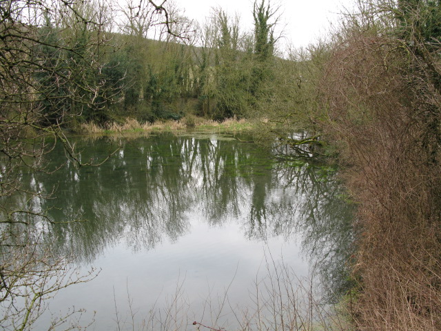
The River Dour is a chalk stream in the county of Kent, England. It flows from the villages of Temple Ewell and River between which is a neighbourhood served by a railway station, Kearsney. It is roughly long. It originally had a wide estuary on the site of modern Dover, although today it flows into the Dover Harbour through a culvert. The estuary was a natural harbour for the Bronze Age settlers and traders in the area. The remains of a Bronze Age seagoing boat (from 3,500 years ago), known as the Dover Bronze Age Boat, were found in 1992, and it can be seen in Dover Museum. The Dour Estuary was then used as a port for the Roman town, as a natural harbour for the Roman fleet. This silted up in the medieval period, necessitating the construction of various artificial harbours for Dover instead. The river has been used since AD 762 to power various watermills along its route. These included eight corn mills and five paper mills. Buckland Mill near Buckland Bridge was one ... [...More Info...] [...Related Items...] OR: [Wikipedia] [Google] [Baidu] |
Watermill
A watermill or water mill is a mill that uses hydropower. It is a structure that uses a water wheel or water turbine to drive a mechanical process such as milling (grinding), rolling, or hammering. Such processes are needed in the production of many material goods, including flour, lumber, paper, textiles, and many metal products. These watermills may comprise gristmills, sawmills, paper mills, textile mills, hammermills, trip hammering mills, rolling mills, wire drawing mills. One major way to classify watermills is by wheel orientation (vertical or horizontal), one powered by a vertical waterwheel through a gear mechanism, and the other equipped with a horizontal waterwheel without such a mechanism. The former type can be further divided, depending on where the water hits the wheel paddles, into undershot, overshot, breastshot and pitchback (backshot or reverse shot) waterwheel mills. Another way to classify water mills is by an essential trait about their location: tide mills ... [...More Info...] [...Related Items...] OR: [Wikipedia] [Google] [Baidu] |
Dover Athletic F
Dover () is a town and major ferry port in Kent, South East England. It faces France across the Strait of Dover, the narrowest part of the English Channel at from Cap Gris Nez in France. It lies south-east of Canterbury and east of Maidstone. The town is the administrative centre of the Dover District and home of the Port of Dover. Archaeological finds have revealed that the area has always been a focus for peoples entering and leaving Britain. The name derives from the River Dour that flows through it. In recent times the town has undergone transformations with a high-speed rail link to London, new retail in town with St James' area opened in 2018, and a revamped promenade and beachfront. This followed in 2019, with a new 500m Pier to the west of the Harbour, and new Marina unveiled as part of a £330m investment in the area. It has also been a point of destination for many illegal migrant crossings during the English channel migrant crisis. The Port of Dover provides mu ... [...More Info...] [...Related Items...] OR: [Wikipedia] [Google] [Baidu] |
Crabble Athletic Ground
The Crabble Athletic Ground, also known as simply Crabble, or The Crabble is a football stadium located in the northern Dover suburb of River, Kent. It was the home of the various incarnations of Dover F.C. from 1931 until the club folded in 1983. Since then it has been the home of Dover Athletic F.C., and it was also the temporary home of Margate F.C. between 2002 and 2004, when the club's Hartsdown Park stadium was being redeveloped. The stadium has two seated stands and two covered terraces and holds a total of 5,745 fans (including 1,010 seats and 3,642 covered terracing), although in the past, crowds larger than that figure could be accommodated. It also has a clubhouse, which the club completely redeveloped in 2008. A sports ground was first established on the site at the end of the 19th century and was used for both cricket and football as well as for other sports. This ground was used by Kent County Cricket Club for over 100 first-class cricket matches between 1907 and ... [...More Info...] [...Related Items...] OR: [Wikipedia] [Google] [Baidu] |
Co-operative
A cooperative (also known as co-operative, co-op, or coop) is "an autonomous association of persons united voluntarily to meet their common economic, social and cultural needs and aspirations through a jointly owned and democratically-controlled enterprise".Statement on the Cooperative Identity. ''.'' Cooperatives are democratically controlled by their members, with each member having one vote in electing the board of directors. Cooperatives may include: * businesses owned and managed by the people who consume th ... [...More Info...] [...Related Items...] OR: [Wikipedia] [Google] [Baidu] |
Hougham Without
Hougham Without is a civil parish between Dover and Folkestone in southeast England. The main settlements are the villages of Church Hougham and West Hougham, collectively known simply as "Hougham". Great Hougham Court Farm is located to the south of the two villages, near the Dover transmitting station. The Channel Tunnel runs underground just south of West Hougham and directly under both Church Hougham and the Farm. See also * Hougham Battery * Lydden Spout Battery * St. Radegund's Abbey * Samphire Hoe * Alkham Valley thumb The Alkham Valley is in the Kent Downs (the eastern part of the North Downs), an Area of Outstanding Natural Beauty, in South East Kent, England. The valley lies between Folkestone and Dover. The Valley is a dry valley A dry valley may de ... References External links Hougham church illustrations Villages in Kent Dover District Civil parishes in Kent {{Kent-geo-stub ... [...More Info...] [...Related Items...] OR: [Wikipedia] [Google] [Baidu] |
Wards And Electoral Divisions Of The United Kingdom
The wards and electoral divisions in the United Kingdom are electoral districts at sub-national level, represented by one or more councillors. The ward is the primary unit of English electoral geography for civil parishes and borough and district councils, the electoral ward is the unit used by Welsh principal councils, while the electoral division is the unit used by English county councils and some unitary authorities. Each ward/division has an average electorate of about 5,500 people, but ward population counts can vary substantially. As of 2021 there are 8,694 electoral wards/divisions in the UK. England The London boroughs, metropolitan boroughs and non-metropolitan districts (including most unitary authorities) are divided into wards for local elections. However, county council elections (as well as those for several unitary councils which were formerly county councils, such as the Isle of Wight and Shropshire Councils) instead use the term ''electoral division''. In s ... [...More Info...] [...Related Items...] OR: [Wikipedia] [Google] [Baidu] |
Dover Castle
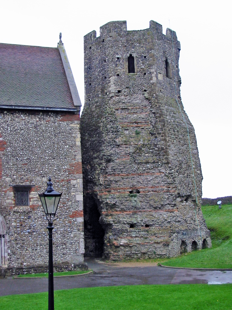
Dover Castle is a medieval castle in Dover, Kent, England and is Grade I listed. It was founded in the 11th century and has been described as the "Key to England" due to its defensive significance throughout history. Some sources say it is the largest castle in England, a title also claimed by Windsor Castle. History Iron age This site may have been fortified with earthworks in the Iron Age or earlier, before the Romans invaded in AD 43. This is suggested on the basis of the unusual pattern of the earthworks which does not seem to be a perfect fit for the medieval castle. Excavations have provided evidence of Iron Age occupation within the locality of the castle, but it is not certain whether this is associated with the hillfort. Roman era The site also contains one of Dover's two Roman lighthouses (or pharoses), one of only three surviving Roman-era lighthouses in the world, and the tallest and most complete standing Roman structure in England. It is also claimed to be B ... [...More Info...] [...Related Items...] OR: [Wikipedia] [Google] [Baidu] |
Little Stour
The Little Stour is one of the tributaries of the River Stour in the English county of Kent. The upper reaches of the river is known as the Nailbourne, whilst the lower reaches were once known as the Seaton Navigation. The intermittent source of the Nailbourne is at Lyminge, and in its early reaches from Lyminge to Bekesbourne it forms a chalk stream and winterbourne. Below Bekesbourne it joins the Little Stour, which in turn joins with the Great Stour at Plucks Gutter near East Stourmouth. Course Nailbourne The Nailbourne flows from Lyminge, through the Elham Valley until it joins the Little Stour at Bekesbourne. The Nailbourne bubbles up beneath St Ethelburga's Well in Tayne Field in the centre of Lyminge. Whilst the stream often holds a plentiful supply of water from Lyminge to Elham throughout the year, it rarely holds any water from Elham to Bishopsbourne even in the winter months. However, in wet years the normally dry ditch can turn into a fast flowing torrent, flo ... [...More Info...] [...Related Items...] OR: [Wikipedia] [Google] [Baidu] |


