|
Ripogenus Gorge
Ripogenus Gorge is a rock-walled canyon formed where the West Branch Penobscot River crosses the Caribou Lake anticline. Ripogenus Falls controlled discharge from Ripogenus Lake until Ripogenus Dam was completed at the upstream end of the gorge in 1916. The dam forms a hydroelectric reservoir raising the level of Ripogenus Lake to include the upstream Chesuncook Lake, Caribou Lake, and Moose Pond. The resulting reservoir is often identified by the name of the largest included lake: Chesuncook. The gorge provides an unusual exposure of Maine North Woods bedrock typically covered by saturated glacial till. The Silurian Ripogenus Formation of weakly metamorphosed shallow marine siliciclastics and fossiliferous limestone has been described from investigation of the gorge. History Spruce forests along the west branch were harvested through the 19th century with logs floated through the gorge to sawmills as far downstream as Bangor, Maine. Log driving rivermen altered the gorge wi ... [...More Info...] [...Related Items...] OR: [Wikipedia] [Google] [Baidu] |
Northeast Piscataquis, Maine
Northeast Piscataquis is an unincorporated area in Piscataquis County, Maine, United States. The population was 304 at the 2020 census. Geography According to the United States Census Bureau, the unorganized territory has a total area of 1,820.4 square miles (4,714.8 km2), of which, 1,710.5 square miles (4,430.3 km2) of it is land and 109.8 square miles (284.5 km2) of it (6.03%) is water. The territory contains 42 townships plus parts of ten other townships (shared with Northwest Piscataquis). Baxter State Park, the location of Mount Katahdin, Maine's highest mountain, is located within the territory. Demographics As of the census of 2000, there were 347 people, 157 households, and 108 families residing in the unorganized territory. The population density was 0.2 people per square mile (0.1/km2). There were 1,214 housing units at an average density of 0.7/sq mi (0.3/km2). The racial makeup of the unorganized territory was 99.14% White, 0. ... [...More Info...] [...Related Items...] OR: [Wikipedia] [Google] [Baidu] |
Bangor, Maine
Bangor ( ) is a city in the U.S. state of Maine and the county seat of Penobscot County. The city proper has a population of 31,753, making it the state's 3rd-largest settlement, behind Portland (68,408) and Lewiston (37,121). Modern Bangor was established in the mid-19th century with the lumber and shipbuilding industries. Lying on the Penobscot River, logs could be floated downstream from the Maine North Woods and processed at the city's water-powered sawmills, then shipped from Bangor's port to the Atlantic Ocean downstream, and from there to any port in the world. Evidence of this is still visible in the lumber barons' elaborate Greek Revival and Victorian mansions and the 31-foot-high (9.4 m) statue of Paul Bunyan. Today, Bangor's economy is based on services and retail, healthcare, and education. Bangor has a port of entry at Bangor International Airport, also home to the Bangor Air National Guard Base. Historically Bangor was an important stopover on the Great Ci ... [...More Info...] [...Related Items...] OR: [Wikipedia] [Google] [Baidu] |
Boulder
In geology, a boulder (or rarely bowlder) is a rock fragment with size greater than in diameter. Smaller pieces are called cobbles and pebbles. While a boulder may be small enough to move or roll manually, others are extremely massive. In common usage, a boulder is too large for a person to move. Smaller boulders are usually just called rocks or stones. The word ''boulder'' derives from ''boulder stone'', from the Middle English ''bulderston'' or Swedish ''bullersten''. Online Etymology Dictionary. Retrieved December 9, 2011, from Dictionary.com website. In places covered by s during s, s ... [...More Info...] [...Related Items...] OR: [Wikipedia] [Google] [Baidu] |
Rapids
Rapids are sections of a river where the river bed has a relatively steep gradient, causing an increase in water velocity and turbulence. Rapids are hydrological features between a ''run'' (a smoothly flowing part of a stream) and a ''cascade''. Rapids are characterized by the river becoming shallower with some rocks exposed above the flow surface. As flowing water splashes over and around the rocks, air bubbles become mixed in with it and portions of the surface acquire a white color, forming what is called "whitewater". Rapids occur where the bed material is highly resistant to the erosive power of the stream in comparison with the bed downstream of the rapids. Very young streams flowing across solid rock may be rapids for much of their length. Rapids cause water aeration of the stream or river, resulting in better water quality. Rapids are categorized in classes, generally running from I to VI. A Class 5 rapid may be categorized as Class 5.1-5.9. While Class I rapids are eas ... [...More Info...] [...Related Items...] OR: [Wikipedia] [Google] [Baidu] |
Whitewater
Whitewater forms in a rapid context, in particular, when a river's gradient changes enough to generate so much turbulence that air is trapped within the water. This forms an unstable current that froths, making the water appear opaque and white. The term "whitewater" also has a broader meaning, applying to any river or creek that has a significant number of rapids. The term is also used as an adjective describing boating on such rivers, such as whitewater canoeing or whitewater kayaking. Fast rivers Four factors, separately or in combination, can create rapids: gradient, constriction, obstruction, and flow rate. Gradient, constriction, and obstruction are streambed topography factors and are relatively consistent. Flow rate is dependent upon both seasonal variation in precipitation and snowmelt and upon release rates of upstream dams. Streambed topography Streambed topography is the primary factor in creating rapids, and is generally consistent over time. Increased f ... [...More Info...] [...Related Items...] OR: [Wikipedia] [Google] [Baidu] |
Golden Road (Maine)
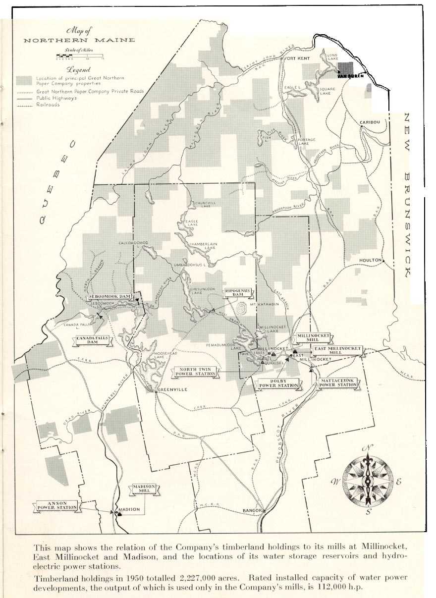
The Golden Road is a private road built by the Great Northern Paper Company that stretches from the St. Zacharie Border Crossing to its former mill at Millinocket, Maine. The road, which parallels the West Branch of the Penobscot River, was built between 1969 and 1972 to bring raw wood to the mill from the company's of woodland in the Maine North Woods. Before the road was built logs were floated down the river to the mill. The of the road from the Millinocket mill to Ripogenus Dam ''Eutelia'' is a genus of moths of the family Euteliidae erected by Jacob Hübner Jacob Hübner (20 June 1761 – 13 September 1826, in Augsburg) was a German entomologist. He was the author of ''Sammlung Europäischer Schmetterlinge'' (1796 ... is partly paved and the remaining is stone. Great Northern had always allowed private drivers access to the road (except for the portion next to the mill) and it is a major thoroughfare into the North Woods for sportsmen and white water paddlers o ... [...More Info...] [...Related Items...] OR: [Wikipedia] [Google] [Baidu] |
Great Northern Paper Company
Great Northern Paper Company was a Maine-based pulp and paper manufacturer that at its peak in the 1970s and 1980s operated mills in Arkansas, Georgia, Maine, and Wisconsin and produced 16.4% of the newsprint made in the United States. It was also one of the largest landowners in the state of Maine. The company was acquired by Georgia-Pacific Corporation in 1990. Its name was revived in 2011 when private equity firm Cate Street Capital acquired Great Northern's original Maine mills. History Maine The company got its start when the Maine legislature authorized Charles W. Mullen to form a water power company on the West Branch Penobscot River. Mullen had observed the drop of the West Branch Penobscot River at Grand Falls in 1891 while surveying a route for the Bangor and Aroostook Railroad. He later worked with Garret Schenck, part owner of the Rumford Falls Paper Company, to build a paper mill in Millinocket, Maine, Millinocket, Penobscot County, Maine, Penobscot County, Maine ... [...More Info...] [...Related Items...] OR: [Wikipedia] [Google] [Baidu] |
Pulpwood
Pulpwood is timber with the principal use of making wood pulp for paper production. Applications * Trees raised specifically for pulp production account for 15% of world pulp production, old growth forests 9% and second- and third- and more generation forests account for the balance. Reforestation is practiced in most areas, so trees are a renewable resource. * Pulpwood is also used as the raw material for some wood products, such as oriented strand board (OSB). * There is an increasing demand for pulpwood as a source of bio-energy for burning and baking into charcoal. Properties The fiber length of the cellulose fiber is the most important parameter of the pulpwood and determines what it may be used for. The first separation is into softwood and hardwood, that have long and short fibers respectively. In paper production fiber from softwood give tensile strength and fibers from hardwood give opacity. Sources Logging In the logging of mixed forest stands, the better trees are u ... [...More Info...] [...Related Items...] OR: [Wikipedia] [Google] [Baidu] |
Penstock
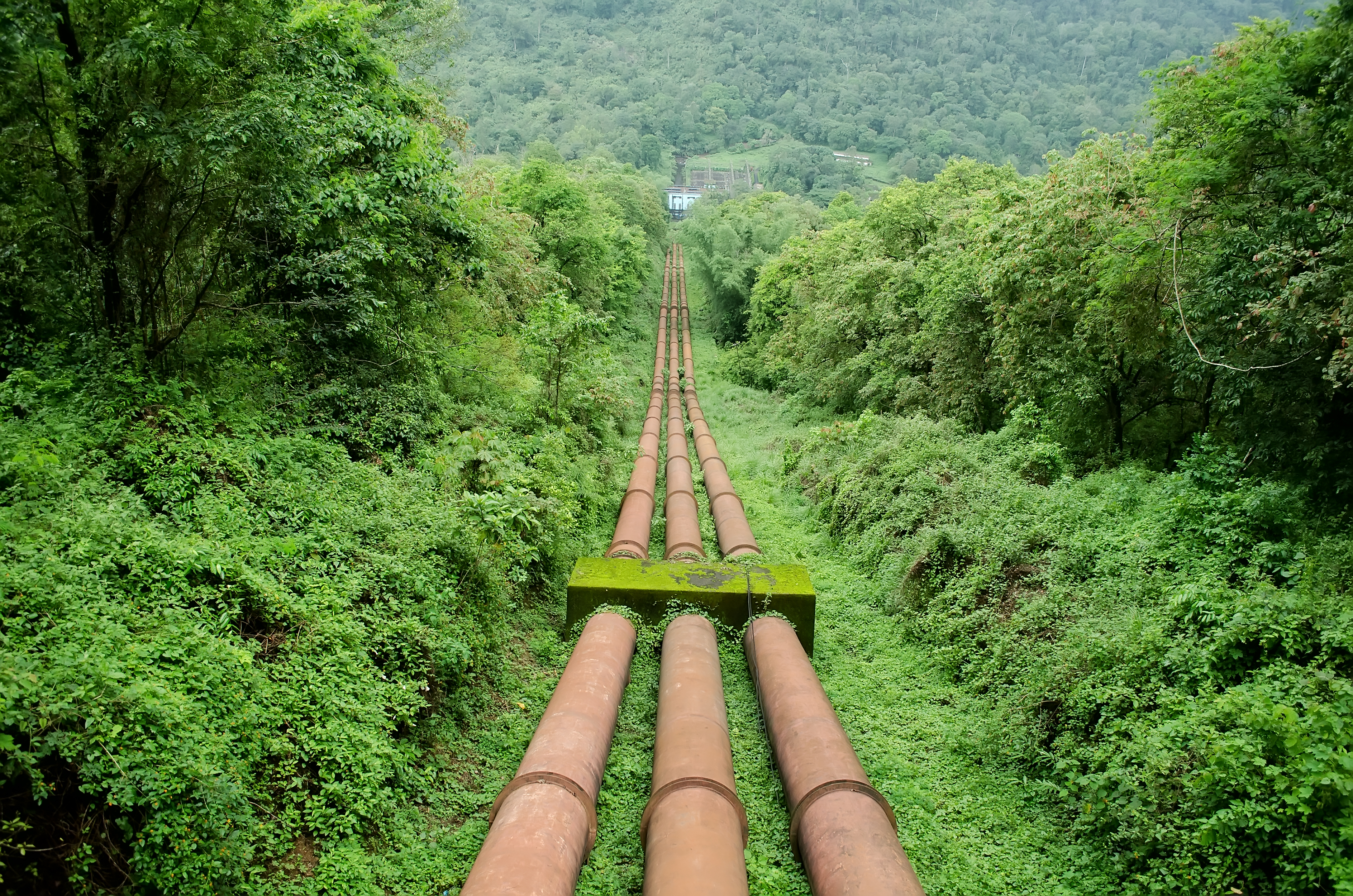
A penstock is a sluice or gate or intake structure that controls water flow, or an enclosed pipe that delivers water to hydro turbines and sewerage systems. The term is inherited from the earlier technology of mill ponds and watermills. Hydroelectric systems and dams Penstocks for hydroelectric installations are normally equipped with a gate system and a surge tank. They can be a combination of many components such as anchor block, drain valve, air bleed valve, and support piers depending on the application. Flow is regulated by turbine operation and is nil when turbines are not in service. Penstocks, particularly where used in polluted water systems, need to be maintained by hot water washing, manual cleaning, antifouling coatings, and desiccation. The term is also used in irrigation dams to refer to the channels leading to and from high-pressure sluice gates. Penstocks are also used in mine tailings dam construction. The penstock is usually situated fairly close to the ... [...More Info...] [...Related Items...] OR: [Wikipedia] [Google] [Baidu] |
Hydroelectricity
Hydroelectricity, or hydroelectric power, is Electricity generation, electricity generated from hydropower (water power). Hydropower supplies one sixth of the world's electricity, almost 4500 TWh in 2020, which is more than all other Renewable energy, renewable sources combined and also more than nuclear power. Hydropower can provide large amounts of Low-carbon power, low-carbon electricity on demand, making it a key element for creating secure and clean electricity supply systems. A hydroelectric power station that has a dam and reservoir is a flexible source, since the amount of electricity produced can be increased or decreased in seconds or minutes in response to varying electricity demand. Once a hydroelectric complex is constructed, it produces no direct waste, and almost always emits considerably less greenhouse gas than fossil fuel-powered energy plants. [...More Info...] [...Related Items...] OR: [Wikipedia] [Google] [Baidu] |
Millinocket, Maine
Millinocket is a town in Penobscot County, Maine, United States. The population was 4,114 at the 2020 census. Millinocket's economy has historically been centered on forest products and recreation, but the paper company closed in 2008. History Millinocket was first settled in 1829 by Betsy and Thomas Fowler and their family, who cleared land for a farm. When the Bangor and Aroostook Railroad extended service to Houlton in 1894, the line ran through the area, opening it to development. Charles W. Mullen, an engineering graduate from the University of Maine, proposed a hydroelectric dam on the Penobscot River. He recognized the falls as an ideal water power source to operate a large pulp and paper mill. Mullen contacted Garret Schenck, vice-president of the International Paper mill at Rumford Falls and an expert in the industry, about building a pulp and paper mill near the dam. Mr. Schenck agreed, and set about obtaining the necessary financial backing. After securing lan ... [...More Info...] [...Related Items...] OR: [Wikipedia] [Google] [Baidu] |
Paper Mill
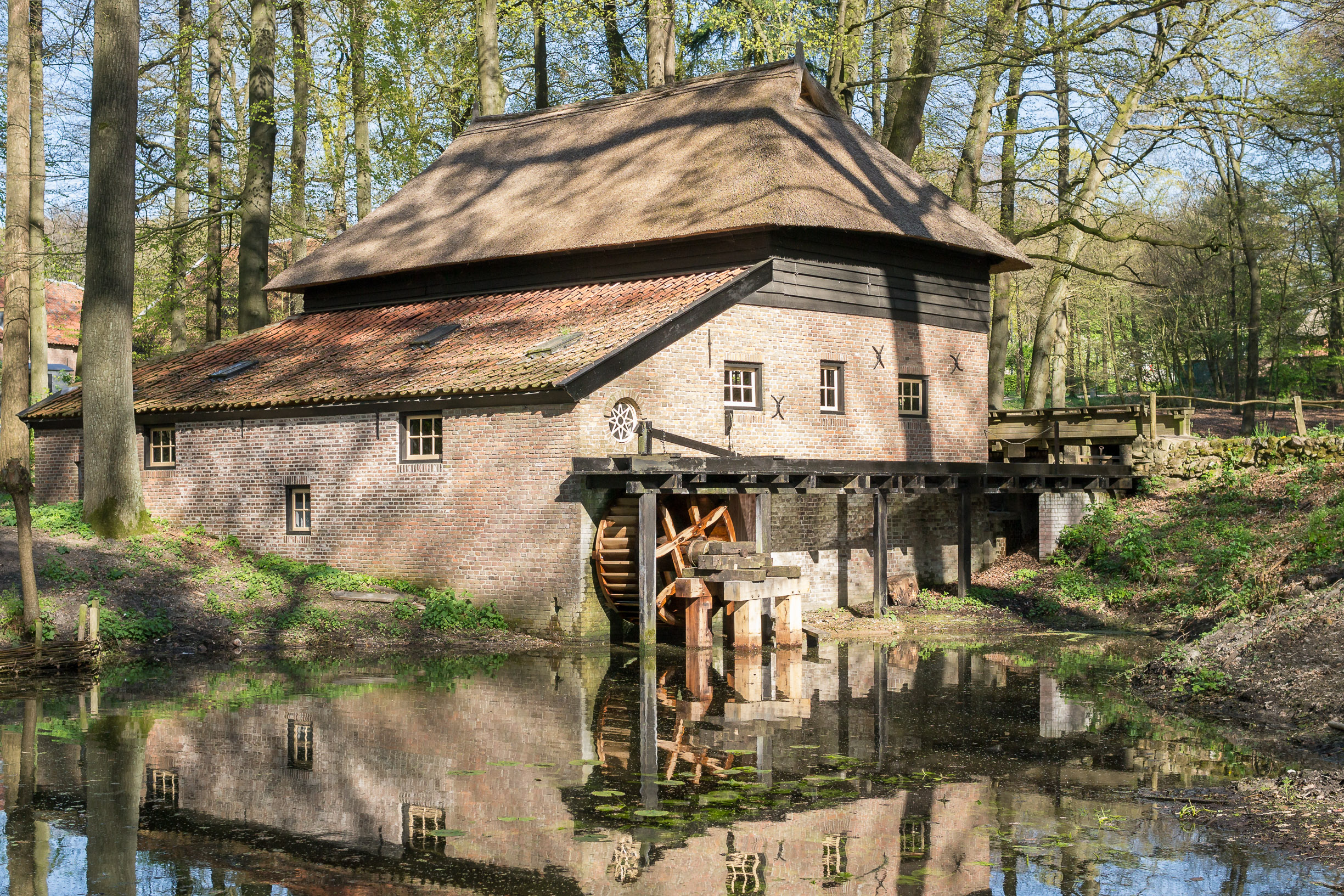
A paper mill is a factory devoted to making paper from vegetable fibres such as wood pulp, old rags, and other ingredients. Prior to the invention and adoption of the Fourdrinier machine and other types of paper machine that use an endless belt, all paper in a paper mill was made by hand, one sheet at a time, by specialized laborers. History Historical investigations into the origin of the paper mill are complicated by differing definitions and loose terminology from modern authors: Many modern scholars use the term to refer indiscriminately to all kinds of mills, whether powered by humans, by animals or by water. Their propensity to refer to any ancient paper manufacturing center as a "mill", without further specifying its exact power source, has increased the difficulty of identifying the particularly efficient and historically important water-powered type. Human and animal-powered mills The use of human and animal powered mills was known to Muslim and Chinese paperma ... [...More Info...] [...Related Items...] OR: [Wikipedia] [Google] [Baidu] |

.jpg)


