|
Rincon Formation
The Rincon Formation (or Rincon Shale) is a sedimentary geologic unit of Lower Miocene age, abundant in the coastal portions of southern Santa Barbara County, California eastward into Ventura County. Consisting of massive to poorly bedded shale, mudstone, and siltstone, it weathers readily to a rounded hilly topography with clayey, loamy soils in which landslides and slumps are frequent. It is recognizable on the south slopes of the Santa Ynez Mountains as the band at the base of the mountains which supports grasses rather than chaparral. Outcrops of the unit are infrequent, with the best exposures on the coastal bluffs near Naples, in the San Marcos Foothills, at the Tajiguas Landfill, and in road cuts. The geologic unit is notorious as a source of radon gas related to its high uranium content, released by radioactive decay.City of Goleta, California. ''Background Report #16''. Geology/Geologic Hazards. March 19, 2004. p. 2, 4, 11. Accessed at www.cityofgoleta.org/Modules/S ... [...More Info...] [...Related Items...] OR: [Wikipedia] [Google] [Baidu] |
Miocene
The Miocene ( ) is the first geological epoch of the Neogene Period and extends from about (Ma). The Miocene was named by Scottish geologist Charles Lyell; the name comes from the Greek words (', "less") and (', "new") and means "less recent" because it has 18% fewer modern marine invertebrates than the Pliocene has. The Miocene is preceded by the Oligocene and is followed by the Pliocene. As Earth went from the Oligocene through the Miocene and into the Pliocene, the climate slowly cooled towards a series of ice ages. The Miocene boundaries are not marked by a single distinct global event but consist rather of regionally defined boundaries between the warmer Oligocene and the cooler Pliocene Epoch. During the Early Miocene, the Arabian Peninsula collided with Eurasia, severing the connection between the Mediterranean and Indian Ocean, and allowing a faunal interchange to occur between Eurasia and Africa, including the dispersal of proboscideans into Eurasia. During the la ... [...More Info...] [...Related Items...] OR: [Wikipedia] [Google] [Baidu] |
Ventura County
Ventura County () is a County (United States), county in Southern California, the southern part of the U.S. state of California. As of the 2020 United States Census, 2020 census, the population was 843,843. The largest city is Oxnard, California, Oxnard, and the county seat is the city of Ventura, California, Ventura. Ventura County comprises the Oxnard–Thousand Oaks–Ventura, CA Metropolitan Statistical Area, which is part of the Greater Los Angeles area (Los Angeles-Long Beach, CA Combined Statistical Area). It is also considered the southernmost county along the Central Coast (California), California Central Coast. Two of the Channel Islands (California), Channel Islands are part of the county: Anacapa Island, which is the most visited island in Channel Islands National Park, and San Nicolas Island. History Pre-colonial period Ventura County was historically inhabited by the Chumash people, who also settled much of Santa Barbara County, California, Santa Barbara and San ... [...More Info...] [...Related Items...] OR: [Wikipedia] [Google] [Baidu] |
North American Plate
The North American Plate is a tectonic plate covering most of North America, Cuba, the Bahamas, extreme northeastern Asia, and parts of Iceland and the Azores. With an area of , it is the Earth's second largest tectonic plate, behind the Pacific Plate (which borders the plate to the west). It extends eastward to the Mid-Atlantic Ridge and westward to the Chersky Range in eastern Siberia. The plate includes both continental and oceanic crust. The interior of the main continental landmass includes an extensive granitic core called a craton. Along most of the edges of this craton are fragments of crustal material called terranes, which are accreted to the craton by tectonic actions over a long span of time. It is thought that much of North America west of the Rocky Mountains is composed of such terranes. Boundaries The southern boundary with the Cocos Plate to the west and the Caribbean Plate to the east is a transform fault, represented by the Swan Islands Transform Fa ... [...More Info...] [...Related Items...] OR: [Wikipedia] [Google] [Baidu] |
Tectonic
Tectonics (; ) are the processes that control the structure and properties of the Earth's crust and its evolution through time. These include the processes of mountain building, the growth and behavior of the strong, old cores of continents known as cratons, and the ways in which the relatively rigid plates that constitute the Earth's outer shell interact with each other. Tectonics also provide a framework for understanding the earthquake and volcanic belts that directly affect much of the global population. Tectonic studies are important as guides for economic geologists searching for fossil fuels and ore deposits of metallic and nonmetallic resources. An understanding of tectonic principles is essential to geomorphologists to explain erosion patterns and other Earth surface features. Main types of tectonic regime Extensional tectonics Extensional tectonics is associated with the stretching and thinning of the crust or the lithosphere. This type of tectonics is fou ... [...More Info...] [...Related Items...] OR: [Wikipedia] [Google] [Baidu] |
Cozy Dell Shale
The Cozy Dell Shale is a geologic formation of middle Eocene age that crops out in the Santa Ynez Mountains and Topatopa Mountains of California, extending from north of Fillmore in Ventura County westward to near Point Arguello, north of Santa Barbara. Because the Cozy Dell easily weathers to a clay-rich soil, it crops out infrequently and generally forms dense stands of chaparral in saddles between peaks and ridges of the more resistant Matilija and Coldwater formations. Type locality and extent The Cozy Dell was first described in 1928 as the middle member of the Tejon Formation. However, Dibblee (1966) reclassified it as a formation, along with the underlying Matilija Sandstone and overlying Coldwater Sandstone. He also named the formation after its type locality at Cozy Dell Canyon, which is located on the south side of Nordhoff Ridge, just north of Ojai in Ventura County. The Cozy Dell crops out continuously in the mountains to the north and east of Ojai, where it ... [...More Info...] [...Related Items...] OR: [Wikipedia] [Google] [Baidu] |
Temblor Formation
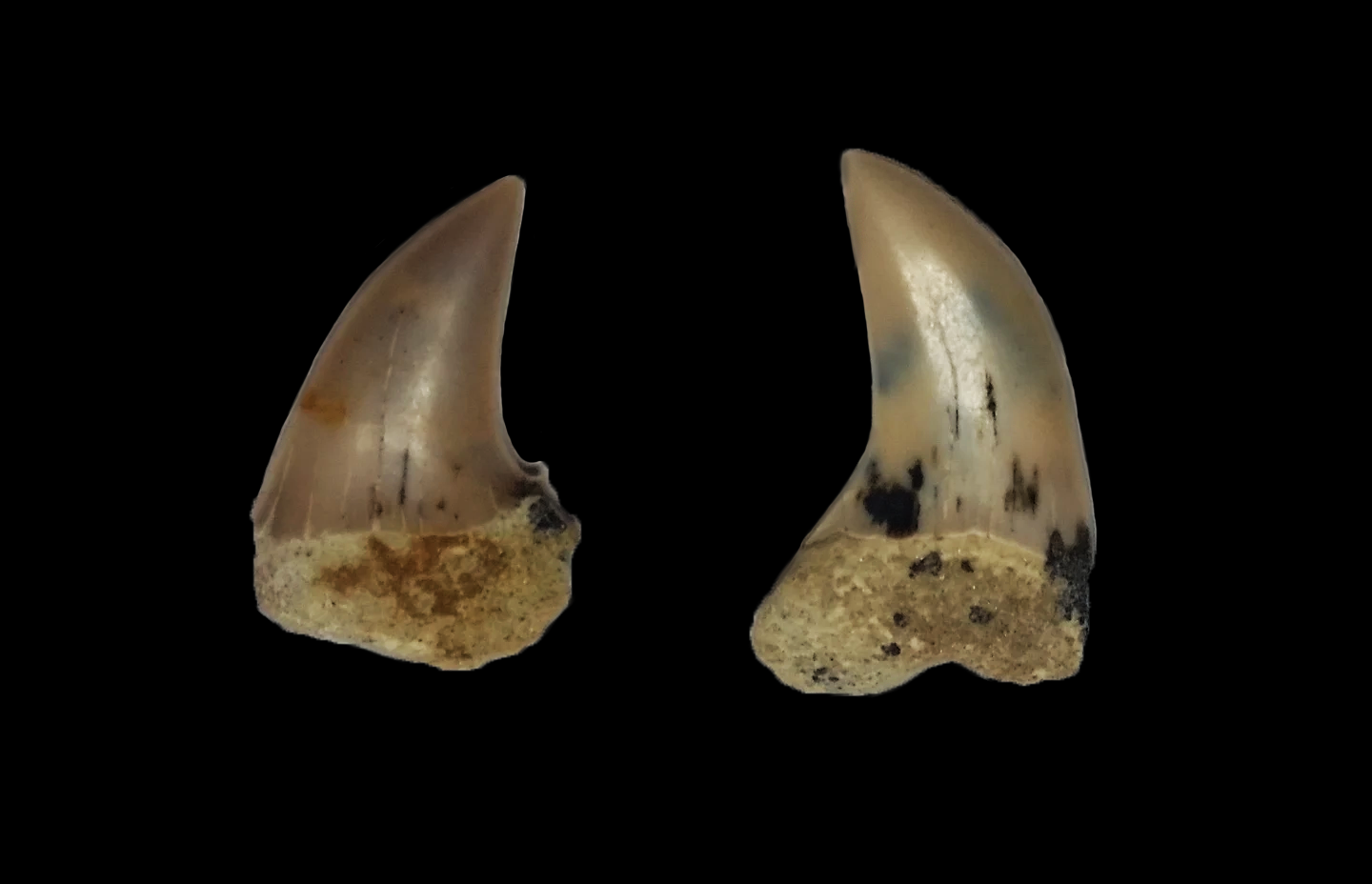
The Temblor Formation is a geologic formation in California. It preserves fossils dating back from the Late Oligocene to the Middle Miocene of the Neogene period. It is notable for the famous Sharktooth Hill deposit (otherwise known as Ernst Quarry). Fossils Vertebrates Cartilagenous fishes = Sharks = * ''Carcharias'' * '' Cephaloscyllium'' * '' Cetorhinus'' * †'' Carcharocles megalodon'' Boessenecker, Ehret, D, Long, D, Churchill, M, Martin, E, Boessenecker, S. The Early Pliocene extinction of the mega-toothed shark ''Otodus megalodon'': a view from the eastern north Pacific. PeerJ. 2019 Feb 13;7:e6088. doi: 10.7717/peerj.6088. eCollection 2019. * †'' Galeocerdo aduncus'' * †'' Hemipristis serra'' * '' Heterodontus'' * '' Hexanchus'' * †''Isurus desori'' * †''Isurus hastalis'' * †'' Isurus planus''Malchow, A. 2009. MIOCENE SHARK TOOTH HILL LOCALITY, KERN COUNTY, CALIFORNIA. Geological Society of America North-Central Section - 43rd Annual Meeting (2-3 Apr ... [...More Info...] [...Related Items...] OR: [Wikipedia] [Google] [Baidu] |
Bentonite
Bentonite () is an absorbent swelling clay consisting mostly of montmorillonite (a type of smectite) which can either be Na-montmorillonite or Ca-montmorillonite. Na-montmorillonite has a considerably greater swelling capacity than Ca-montmorillonite. Bentonite usually forms from the weathering of volcanic ash in seawater, or by hydrothermal circulation through the porosity of volcanic ash beds, which converts ( devitrification) the volcanic glass (obsidian, rhyolite, dacite) present in the ash into clay minerals. In the mineral alteration process, a large fraction (up to 40-50 wt.%) of amorphous silica is dissolved and leached away, leaving the bentonite deposit in place. Bentonite beds are white or pale blue or green (traces of reduced ) in fresh exposures, turning to a cream color and then yellow, red, or brown (traces of oxidized ) as the exposure is weathered further. As a swelling clay, bentonite has the ability to absorb large quantities of water, whic ... [...More Info...] [...Related Items...] OR: [Wikipedia] [Google] [Baidu] |
Glauconitic
Glauconite is an iron potassium phyllosilicate (mica group) mineral of characteristic green color which is very friable and has very low weathering resistance. It crystallizes with a monoclinic geometry. Its name is derived from the Greek () meaning 'bluish green', referring to the common blue-green color of the mineral; its sheen (mica glimmer) and blue-green color. Its color ranges from olive green, black green to bluish green, and yellowish on exposed surfaces due to oxidation. In the Mohs scale it has hardness of 2. The relative specific gravity range is 2.4 - 2.95. It is normally found in dark green rounded brittle pellets, and with the dimension of a sand grain size. It can be confused with chlorite (also of green color) or with a clay mineral. Glauconite has the chemical formula . Glauconite particles are one of the main components of greensand, glauconitic siltstone and glauconitic sandstone. Glauconite has been called a marl in an old and broad sense of that word. Thus ... [...More Info...] [...Related Items...] OR: [Wikipedia] [Google] [Baidu] |
Siliceous
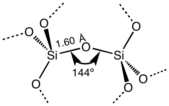
Silicon dioxide, also known as silica, is an oxide of silicon with the chemical formula , most commonly found in nature as quartz and in various living organisms. In many parts of the world, silica is the major constituent of sand. Silica is one of the most complex and most abundant families of materials, existing as a compound of several minerals and as a synthetic product. Notable examples include fused quartz, fumed silica, silica gel, opal and aerogels. It is used in structural materials, microelectronics (as an electrical insulator), and as components in the food and pharmaceutical industries. Structure In the majority of silicates, the silicon atom shows tetrahedral coordination, with four oxygen atoms surrounding a central Si atomsee 3-D Unit Cell. Thus, SiO2 forms 3-dimensional network solids in which each silicon atom is covalently bonded in a tetrahedral manner to 4 oxygen atoms. In contrast, CO2 is a linear molecule. The starkly different structures of t ... [...More Info...] [...Related Items...] OR: [Wikipedia] [Google] [Baidu] |
Dolomite (rock)
Dolomite (also known as dolomite rock, dolostone or dolomitic rock) is a sedimentary carbonate rock that contains a high percentage of the mineral dolomite, CaMg(CO3)2. It occurs widely, often in association with limestone and evaporites, though it is less abundant than limestone and rare in Cenozoic rock beds (beds less than about 66 million years in age). The first geologist to distinguish dolomite rock from limestone was Belsazar Hacquet in 1778. Most dolomite was formed as a magnesium replacement of limestone or of lime mud before lithification. The geological process of conversion of calcite to dolomite is known as dolomitization and any intermediate product is known as dolomitic limestone. The "dolomite problem" refers to the vast worldwide depositions of dolomite in the past geologic record in contrast to the limited amounts of dolomite formed in modern times. Recent research has revealed sulfate-reducing bacteria living in anoxic conditions precipitate dolomite whic ... [...More Info...] [...Related Items...] OR: [Wikipedia] [Google] [Baidu] |
Argillaceous
Clay minerals are hydrous aluminium phyllosilicates (e.g. kaolin, Al2 Si2 O5( OH)4), sometimes with variable amounts of iron, magnesium, alkali metals, alkaline earths, and other cations found on or near some planetary surfaces. Clay minerals form in the presence of water and have been important to life, and many theories of abiogenesis involve them. They are important constituents of soils, and have been useful to humans since ancient times in agriculture and manufacturing. Properties Clay is a very fine-grained geologic material that develops plasticity when wet, but becomes hard, brittle and non–plastic upon drying or firing. It is a very common material, and is the oldest known ceramic. Prehistoric humans discovered the useful properties of clay and used it for making pottery. The chemistry of clay, including its capacity to retain nutrient cations such as potassium and ammonium, is important to soil fertility. Because the individual particles in clay are less than ... [...More Info...] [...Related Items...] OR: [Wikipedia] [Google] [Baidu] |


