|
Retezat-Godeanu Mountains Group
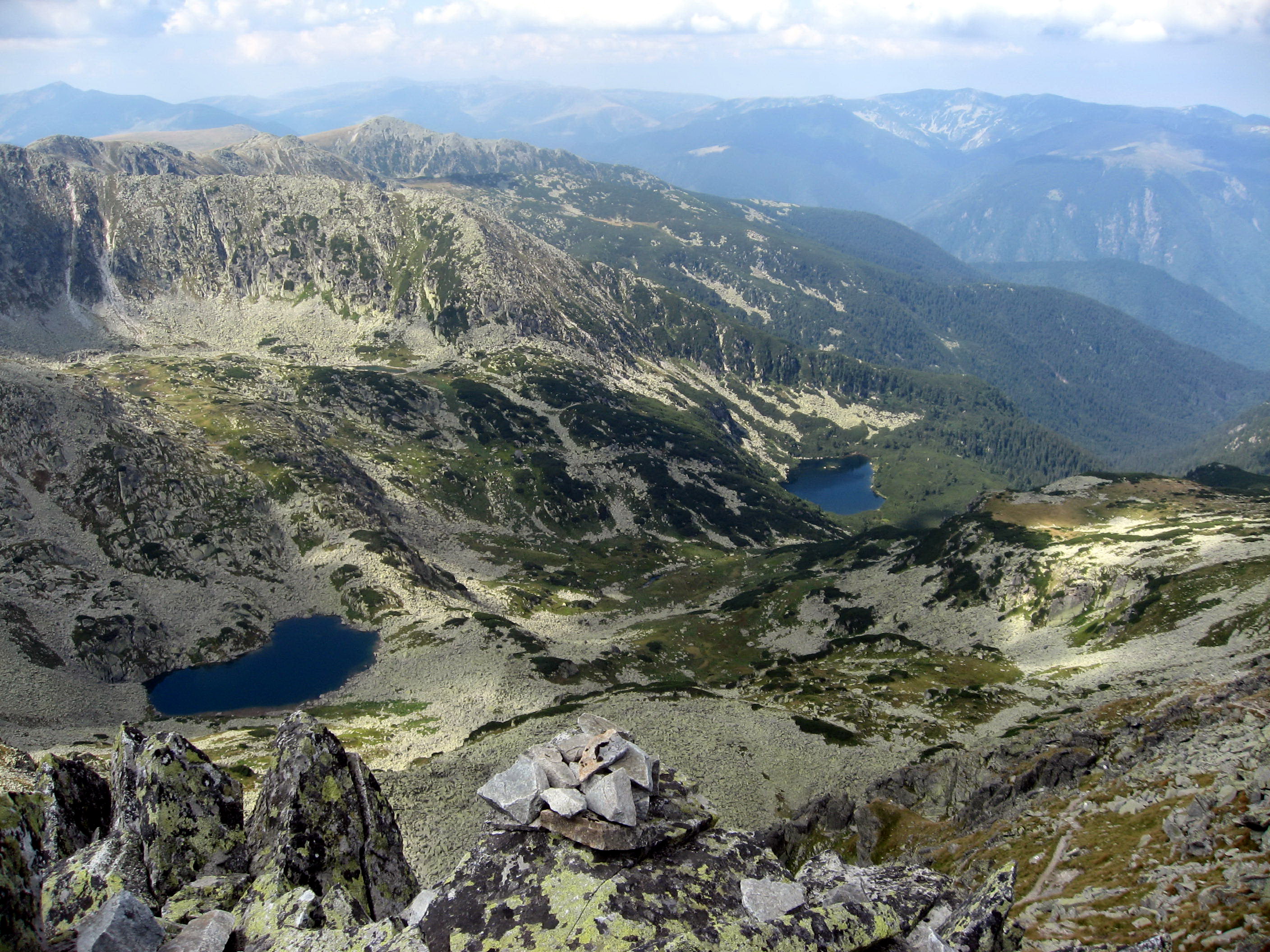
The Retezat–Godeanu mountain group is a subgroup of mountains in the Southern Carpathians, Romania. It is named after the highest mountains in the group, the Retezat Mountains. Boundaries The Retezat–Godeanu group of mountains is bounded: *in the east, by the Jiu River; *in the west, by the Timiș-Cerna Gap (the Cerna River and the Timiș River); *in the north, by the Bistra River and the Hațeg depression. Mountains *Retezat Mountains (''Munții Retezat''; literally: ''Hewed Mountains'') * (''Munții Godeanu'') *Vâlcan Mountains (''Munții Vâlcan'') *Mehedinți Mountains (''Munții Mehendinţi'') * (''Munții Cernei'') *Țarcu Mountains The Țarcu Mountains are a mountain range in the southwestern Romania, at the western edge of the Southern Carpathians. They are located between the Bistra Valley (to the south), Timiș River (to the east), Godeanu Mountains (to the northwest) and ... (''Munții Țarcu''; literally: ''Pen Mountains'') See also * Carpathian Mount ... [...More Info...] [...Related Items...] OR: [Wikipedia] [Google] [Baidu] |
Retezat Near Camp Bucura
Retezat can refer to: * Retezat National Park, Romania * Retezat Mountains, Romania {{geodis ... [...More Info...] [...Related Items...] OR: [Wikipedia] [Google] [Baidu] |
Bistra (Timiș)
The Bistra is a river in south-western Romania, in the Banat. It is a right tributary of the river Timiș. Its valley delimits the Țarcu Mountains to the south from the Poiana Ruscă mountains to the north. Its name is derived from a Slavic word meaning "fast-flowing". The Bistra has its source in the Bistra Lake, located in the Țarcu Mountains, near Vârful Pietrei (2192 metres). It flows as a rapid river from south to north until it reaches the village of Bucova, where it changes direction and turns west. Its first major tributary is the Marga River; further down it collects the waters of the river Rusca. Before entering Oțelu Roșu, Bistra collects its greatest influx of waters, the Bistra Mărului. Near Ciuta, north of the town of Caransebeș, it flows into the Timiș. [...More Info...] [...Related Items...] OR: [Wikipedia] [Google] [Baidu] |
Parâng Mountains Group
The Parâng ( hu, Páring-hegység) mountain group is a subgroup of mountains in the Southern Carpathians. It is named after the highest of the mountains in the group, the Parâng Mountains. Boundaries The Parâng group is bounded: *in the east, by the Olt River *in the west, by the Jiu River Mountains *Parâng Mountains (''Munții Parâng'') *Șureanu Mountains (''Munții Șureanu''/''M. Sebeșului'') * Cindrel Mountains (''Munții Cindrel''/''M. Cibinului'') *Lotru Mountains (''Munții Lotrului''; literally: ''Mountains of the Thief'') *Căpățână Mountains Căpățână or Căpățînă is a Romanian surname. Notable people with the surname include: * Chesarie Căpățână (1784–1846), Wallachian bishop * Eugen Căpățână (born 1986), Romanian rugby union footballer * Mihai Căpățînă (born ... (''Munții Căpățânii''; literally: ''Mountains of the Head'' or ''Mountains of the Skull'') See also * Carpathian Mountains * Retezat-Godeanu Mountains group * F� ... [...More Info...] [...Related Items...] OR: [Wikipedia] [Google] [Baidu] |
Carpathian Mountains
The Carpathian Mountains or Carpathians () are a range of mountains forming an arc across Central Europe. Roughly long, it is the third-longest European mountain range after the Urals at and the Scandinavian Mountains at . The range stretches from the far eastern Czech Republic (3%) and Austria (1%) in the northwest through Slovakia (21%), Poland (10%), Ukraine (10%), Romania (50%) to Serbia (5%) in the south. "The Carpathians" European Travel Commission, in The Official Travel Portal of Europe, Retrieved 15 November 2016 The Carpathian ... [...More Info...] [...Related Items...] OR: [Wikipedia] [Google] [Baidu] |
Țarcu Mountains
The Țarcu Mountains are a mountain range in the southwestern Romania, at the western edge of the Southern Carpathians. They are located between the Bistra Valley (to the south), Timiș River (to the east), Godeanu Mountains (to the northwest) and Râul Mare Valley (to the west), the last one being a natural barrier between them and the Retezat Mountains. The Țarcu Mountains have been declared Natura 2000 protected area since 2007 because they shelter valuable biodiversity and spectacular nature. Together with the Retezat Mountains, the Godeanu Mountains and Cernei Mountains they form the last European Intact Forest Landscape, if we do not take boreal forests (from Scandinavia and Russia) into account. Geology Most rocks in the range are crystalline, with few areas with sedimentary rocks. As such, the mountains are massifs, cut by narrow valleys. Limestone is found only in a few places. Erosion has formed several very prominent platforms, such as the Borăscu platform. Glaciers we ... [...More Info...] [...Related Items...] OR: [Wikipedia] [Google] [Baidu] |
Mehedinți Mountains
The Mehedinți Mountains ( ro, Munții Mehedinți) are a mountain range in southwestern Romania, part of the Retezat-Godeanu Mountains group. The range represents the highest relief form in Mehedinți County Mehedinți County () is a county ( ro, județ) of Romania on the border with Serbia and Bulgaria. It is mostly located in the historical province of Oltenia, with one municipality (Orșova) and three communes ( Dubova, Eșelnița, and Svinița) ..., with an average height of 1100-1200 meters.Gheorghe Niculescu, "Munții Godeanu: studiu geomorfologic", p. 27. Bucharest: Editura Academiei Republicii Populare Române, 1965 The tallest peak is Vârful lui Stan, which reaches 1466 meters.Vasile Cucu, Dragoș Buga, George Erdeli, Valeria Alexandrescu, "Locul județului Mehedinți în peisajul geografic și în economia R. S. România", in ''Analele Universitații București: Geografie'', vol. 29/1980, p. 13 Notes {{coord missing, Mehedinți County Mountain ranges of Romania ... [...More Info...] [...Related Items...] OR: [Wikipedia] [Google] [Baidu] |
Vâlcan Mountains
The Vâlcan Mountains are a chain of mountains in the Southern Carpathians in Gorj County, Romania. They are part of the Retezat-Godeanu Mountains group. They run for approximately and the highest peak is the Vâlcan Peak at . The mountains run the length of the Jiu Valley The Jiu Valley ( ro, Valea Jiului ) is a region in southwestern Transylvania, Romania, in Hunedoara county, situated in a valley of the Jiu River between the Retezat Mountains and the Parâng Mountains. The region was heavily industrialised and th ..., and serve as a barrier to entry on the southern side of the valley. References External links * — the regional web portal host, with maps and information of the Vâlcan Mountains and surrounding region. {{DEFAULTSORT:Valcan Mountains Mountain ranges of Romania Mountain ranges of the Southern Carpathians ... [...More Info...] [...Related Items...] OR: [Wikipedia] [Google] [Baidu] |
Țara Hațegului
Țara Hațegului ("Hațeg Land"; german: Wallenthal, hu, Hátszegvidék, la, terra Harszoc) is a historical and ethnographical area in Hunedoara County, Romania, in the south-western corner of Transylvania. It is centered in the town of Hațeg. Țara Hațegului is located in the Depression of Hațeg. Here there are: the site of Ulpia Traiana Sarmizegetusa (the capital of the Roman Dacia, established in the 2nd century A.D.), the Densuș Church and palaeontological remains (see Hațeg Island and Hatzegopteryx). Under the Kingdom of Hungary, the Hátszeg District was part of Hunyad County. The region is composed of one town and ten communes: Hațeg, Baru, Densuș, General Berthelot, Pui, Răchitova, Râu de Mori, Sarmizegetusa, Sălașu de Sus, Sântămăria-Orlea and Totești Totești ( hu, Totesd) is a Commune in Romania, commune in Hunedoara County, Transylvania, Romania. It is composed of five villages: Cârnești, Copaci, Păclișa (''Poklisa''), Reea (''Rea'') and Toteș ... [...More Info...] [...Related Items...] OR: [Wikipedia] [Google] [Baidu] |
Timiș (river)
The Timiș or Tamiš ( ro, Timiș, sr, Тамиш; german: Temesch, hu, Temes) is a long river that flows through the Banat region of Romania and Serbia and joins the Danube near Pančevo, in northern Serbia. Due to its position in the region, it has been labeled as the "spine of the Banat". Name In Classical antiquity, antiquity, the river was known as ''Tibiscus'' (in Latin) and ''Tibisis'' (Θίβισις in ancient Greek); in addition, Edward Gibbon referred to it as the ''Teyss''. ''The Romans, who traversed the plains of Hungary, suppose that they passed several navigable rivers, either in canoes or portable boats; but there is reason to suspect that the winding stream of the Teyss, or Tibiscus, might present itself in different places under different names.'' Geography The Drainage basin, drainage area covers , of which in Romania. With the Danube, it belongs to the Black Sea drainage basin. The river flows through Romania for , and through Serbia. Its average ... [...More Info...] [...Related Items...] OR: [Wikipedia] [Google] [Baidu] |
Jezera V Pohoří Retezat
Jezera, meaning "Lakes" in several Slavic languages, may refer to: * Jezera, Teslić, a village in the municipality of Teslić, Bosnia and Herzegovina * Jezera, Tisno Jezera is a village in Croatia , image_flag = Flag of Croatia.svg , image_coat = Coat of arms of Croatia.svg , anthem = " Lijepa naša domovino"("Our Beautiful Homeland") , image_map = , ..., a village in the municipality of Tisno, Croatia See also * Jezero (other) {{disambig, geo ... [...More Info...] [...Related Items...] OR: [Wikipedia] [Google] [Baidu] |
Cerna River (Danube)
The Cerna ( hu, Cserna) is a river in Romania, a left tributary of the river Danube. The Cerna has its source on the south-east side of the Godeanu Mountains and flows into the Danube near the town Orșova. e-calauza.ro The upper reach of the river is sometimes called Cernișoara. With a length of and its basin of , it carves an erosive tectonic valley with numerous gorges, quite deep sometimes. There is a man-made lake on it (Tierna), just before it crosses the spa, to perpetuate the old toponimic od Dierna. The upper course of the Cerna is part of the |
Timiș-Cerna Gap
Timiș-Cerna Gap () is a mountain pass in South-Western Romania, mostly in Caraș-Severin County, dividing the Southern Carpathians and the Banat mountain ranges, both part of the Carpathians. The pass follows the paths of the rivers Timiș (which flows northward) and Cerna (which flows southward). To the west lie the Almăj and Semenic Mountains and to the east the Mehedinți, Cerna, Țarcului, and Poiana Ruscă Mountains. The town of Caransebeș lies in the Timiș-Cerna Gap and Orșova lies on the Danube The Danube ( ; ) is a river that was once a long-standing frontier of the Roman Empire and today connects 10 European countries, running through their territories or being a border. Originating in Germany, the Danube flows southeast for , pa ... at the gap's southern end. Mountain passes of Romania Mountain passes of the Carpathians Western Romanian Carpathians {{Romania-geo-stub ... [...More Info...] [...Related Items...] OR: [Wikipedia] [Google] [Baidu] |


