|
Reppisch
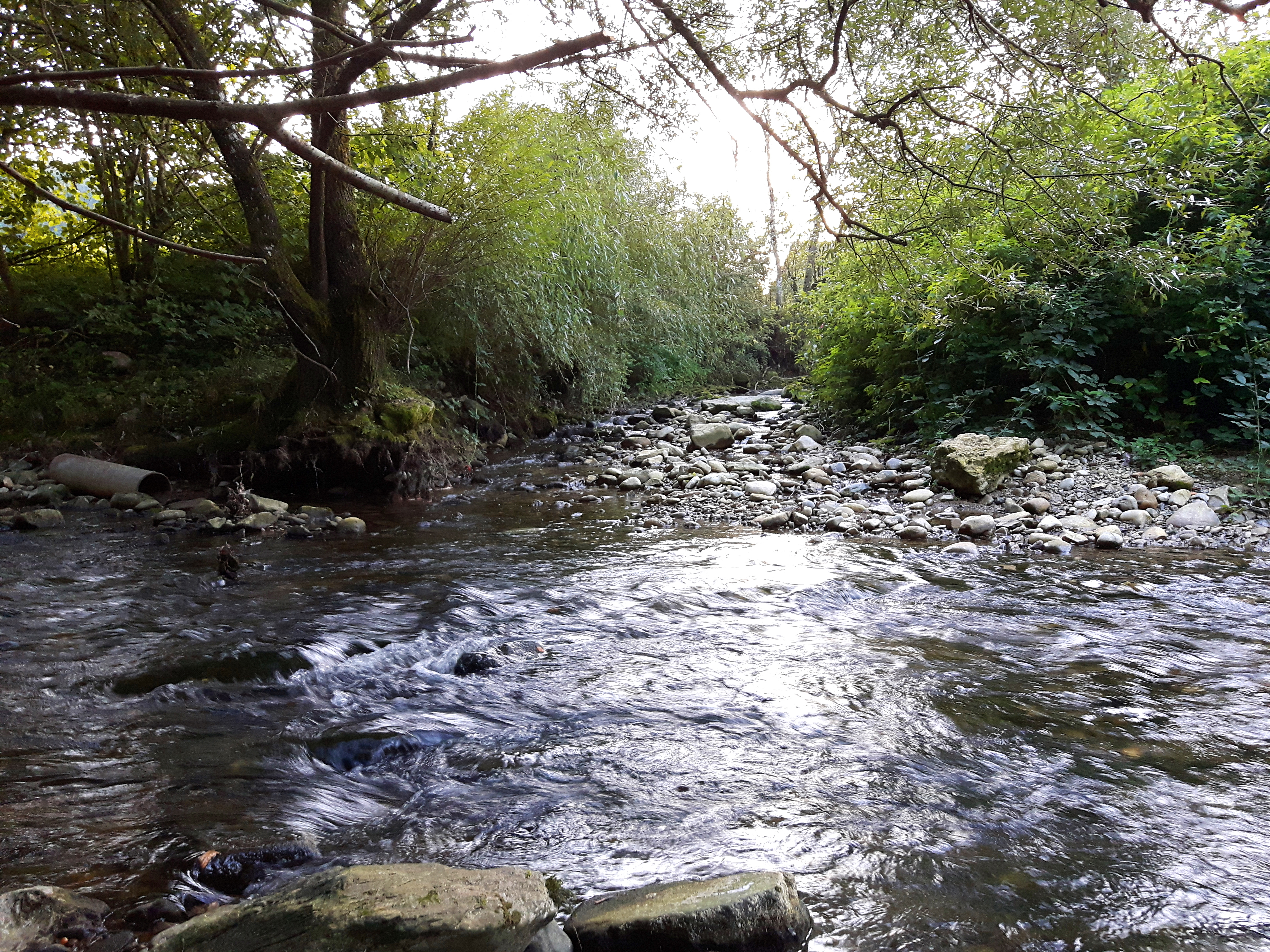
The Reppisch is a river in Switzerland. It rises in the Türlersee and joins the Limmat as its tributary, near the town of Dietikon. The Reppisch flows in the Säuliamt (Affoltern district), canton of Zürich, an area featuring still partially untouched nature. Between Birmensdorf and Dietikon, the river crosses a narrow valley which is used as a target range by the Swiss army troops stationed in the infantry barracks nearby. Therefore, this valley may be closed to entry during some parts of the week. Shortly before entering Dietikon, the river underruns the Mutschellenpassstrasse and the Bremgarten-Dietikon-Bahn railway. In the spring of 1999, there were heavy floods in this area, blocking the road and the railway service for several days. Tributaries Sixty eight named streams empty into the Reppisch, of which three, namely the Wüeribach, the Rummelbach and the Lunnerenbach, are 4 or more kilometres long. In addition there are 5 tributaries that are 2 kilometres lo ... [...More Info...] [...Related Items...] OR: [Wikipedia] [Google] [Baidu] |
Wüeribach
The Wüeribach (also called the Dorfbach and Fischbach in its upper reaches) is a tributary of the Reppisch, around 8 kilometres long, in the Canton of Zürich in Switzerland. It rises in the municipality of Bonstetten, flows through the narrow ''Wüerital'' valley and reaches the Reppisch valley near Birmensdorf, wo it empties, parallel to the rather smaller Lunnerenbach, into the lower Reppisch. The Wüeribach is the longest and biggest tributary of the Reppisch and has an average flow rate of 310 L/s. Geography Course The Wüeribach rises as the ''Dorfbach'' at in the forest area of ''Birch'' above Bonstetten. From here it flows initially mainly in a northwestern direction through the village of Bonstetten, much of it being canalized as it passes through. It leaves the village and runs, having been straightened out, through fields across a wide plain in a northern direction. Shortly afterwards the stream reaches the municipal boundary with Wettswil am Albis, where it ... [...More Info...] [...Related Items...] OR: [Wikipedia] [Google] [Baidu] |
Dietikon
Dietikon is the fifth biggest city of the canton of Zürich in Switzerland, after Zürich, Winterthur, Uster and Dübendorf. It is the capital of the same-named district of Dietikon and part of the Zürich metropolitan area. Geography The industrial city Dietikon is situated at an elevation of at the confluence of the Reppisch and the Limmat, located in the Limmat Valley (German: ''Limmattal''), along the railway line from Zürich to Baden. Here and in the neighboring region, Spreitenbach, is also the large Limmattal rail freight marshalling yard. Dietikon has an area of . Of this area, 17.2% is used for agricultural purposes, while 27% is forested. Of the rest of the land, 49.1% is settled (buildings or roads) and the remainder (6.7%) is non-productive (rivers, glaciers or mountains). housing and buildings made up 33.8% of the total area, while transportation infrastructure made up the rest (15.3%). Of the total unproductive area, water (streams and lakes) made up 4.9% ... [...More Info...] [...Related Items...] OR: [Wikipedia] [Google] [Baidu] |
Limmat
The Limmat is a river in Switzerland. The river commences at the outfall of Lake Zurich, in the southern part of the city of Zurich. From Zurich it flows in a northwesterly direction, after 35 km reaching the river Aare. The confluence is located north of the small town of Brugg and shortly after the mouth of the Reuss. The main towns along the Limmat Valley downstream of Zurich are Dietikon, Wettingen, and Baden. Its main tributaries are the Linth, via Lake Zurich, the Sihl, in Zurich, and the Reppisch, in Dietikon. The hydronym is first attested in the 8th century, as ''Lindimacus''. It is of Gaulish origin, from ''*lindo-'' "lake" (Welsh ''llyn'') and ''*magos'' "plain" (Welsh ''maes''), and was thus presumably in origin the name of the plain formed by the Linth. Power generation Like many Swiss rivers, the Limmat is intensively used for production of hydroelectric power: along its course of , its fall is used by no less than ten hydroelectric power stations. Th ... [...More Info...] [...Related Items...] OR: [Wikipedia] [Google] [Baidu] |
Türlersee
Türlersee is a lake in the district of Affoltern, Canton of Zurich, Switzerland. It lies on the border of the municipalities of Aeugst and Hausen am Albis at an elevation of 643 m. The lake has an area of 0.49 km² (maximum length 1.4 km, width 500 m). Gallery File:Türlersee1.jpg File:Türlersee2.jpg File:Türlersee3.jpg File:Türlersee4.jpg File:Türlersee winter 01.jpg File:Türlersee winter 02.jpg See also *List of lakes of Switzerland This article contains a sortable table listing all major lakes of Switzerland. The table includes all still water bodies, natural or artificial, that have a surface area of at least , regardless of water volume, maximum depth or other metric. The ... External links *Legend about the formation of the lake * Lakes of the canton of Zürich Lakes of Switzerland LTurlersee {{Zürich-lake-stub ... [...More Info...] [...Related Items...] OR: [Wikipedia] [Google] [Baidu] |
Canton Of Zürich
The canton of Zürich (german: Kanton Zürich ; rm, Chantun Turitg; french: Canton de Zurich; it, Canton Zurigo) is a Swiss canton in the northeastern part of the country. With a population of (as of ), it is the most populous canton in the country. Zürich is the ''de facto'' capital of the canton, but is not specifically mentioned in the constitution. The official language is German. The local Swiss German dialect, called '' Züritüütsch'', is commonly spoken. History Early history The prehistoric pile dwellings around Zürichsee comprise 11 of total 56 prehistoric pile dwellings around the Alps in Switzerland, that are located around Lake Zürich in the cantons of Schwyz, St. Gallen and Zürich. Located on the shore of Lake Zürich, there are Freienbach–Hurden Rosshorn, Freienbach–Hurden Seefeld, Rapperswil-Jona/Hombrechtikon–Feldbach, Rapperswil-Jona–Technikum, Erlenbach–Winkel, Meilen–Rorenhaab, Wädenswil–Vorder Au, Zürich–Enge Alpenquai, Gross ... [...More Info...] [...Related Items...] OR: [Wikipedia] [Google] [Baidu] |
Rivers Of Switzerland
The following is a list of rivers in Switzerland: Rivers by length (> 100 km, only the length in Switzerland) #Rhine - 375 km - 36,494 km2 #Aare (or Aar) - 295 km - 17,779 km2 #Rhône - 264 km - 10,403 km2 #Reuss - 158 km - 3,425 km2 #Linth and Limmat together - 140 km - 2,416 km2 # Saane/La Sarine - 128 km - 1,892 km2 # Thur - 125 km Rivers by drainage area (> 1000 km2, only the area in Switzerland) #Rhine - 375 km - 36,494 km2 #Aare - 295 km - 17,779 km2 #Rhône - 264 km - 10,403 km2 #Reuss - 158 km - 3,425 km2 #Linth / Limmat - 140 km - 2,416 km2 #Inn - 104 km - 2,150 km2 # Saane/La Sarine - 128 km - 1,892 km2 # Thur - 125 km - 1,724 km2 #Ticino - 91 km - 1,616 km2 # Hinterrhein - 57.3 km - 1,693 km2 #Vorderrhein - 67.5 km - 1,514 km2 #Doubs - 74 km - 1,310 km2 # Kander - 44 km - ... [...More Info...] [...Related Items...] OR: [Wikipedia] [Google] [Baidu] |
Bonstetten ZH
Bonstetten is a village in the district of Affoltern in the canton of Zürich in Switzerland. History Bonstetten is first mentioned in 1120 as ''Buonstetin'', though this reference is debated. In 1184 it was mentioned as ''Bowensteden''. Geography Bonstetten has an area of . Of this area, 57.3% is used for agricultural purposes, while 29.2% is forested. Of the rest of the land, 13.3% is settled (buildings or roads) and the remainder (0.1%) is non-productive (rivers, glaciers or mountains). Demographics Bonstetten has a population (as of ) of . , 11.5% of the population was made up of foreign nationals. Over the last 10 years the population has grown at a rate of 32.6%. Most of the population () speaks German (90.6%), with English being second most common ( 2.2%) and Italian being third ( 1.9%). In the 2007 election the most popular party was the SVP which received 30.6% of the vote. The next three most popular parties were the SPS (20.4%), the FDP (17.2%) and the CSP ... [...More Info...] [...Related Items...] OR: [Wikipedia] [Google] [Baidu] |
Wettswil Am Albis
Wettswil am Albis is a municipality in the district of Affoltern in the canton of Zürich in Switzerland. Geography Wettswil am Albis (sometimes written ''Wettswill a.A.'') has an area of . Of this area, 42.3% is used for agricultural purposes, while 23.7% is forested. Of the rest of the land, 30.9% is settled (buildings or roads) and the remainder (3.2%) is non-productive (rivers, glaciers or mountains). The term ''am Albis'' in the name refers to the chain of hills in the area. History The earliest written mentions of Wettswil am Albis date back to 1184 where it is referred to as ''Wettesweilare''. The village is believed to have been settled during the period of Alemannic immigration into Switzerland (somewhere between 500 and 700 CE). A chieftain, likely named 'Wetto' or 'Wettin' who might have settled in the region with his clan, might have given the village its name. Demographics Wettswil am Albis has a population (as of ) of . , 11.3% of the population was made up ... [...More Info...] [...Related Items...] OR: [Wikipedia] [Google] [Baidu] |
Tobelbach (Birmensdorf)
Tobelbach is a river of Baden-Württemberg, Germany. It flows into the Stehenbach near Rottenacker. See also *List of rivers of Baden-Württemberg A list of rivers of Baden-Württemberg, Germany: A * Aal * Aalbach * Aalenbach * Ablach * Ach *Acher * Adelbach *Aich * Aid * Aischbach, tributary of the Kinzig * Aischbach, tributary of the Körsch *Aitrach, tributary of the Danube *Aitrach, tr ... References Rivers of Baden-Württemberg Rivers of Germany {{BadenWürttemberg-river-stub ... [...More Info...] [...Related Items...] OR: [Wikipedia] [Google] [Baidu] |


