|
Renmark, South Australia
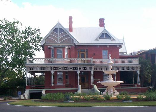
Renmark is a town in South Australia's rural Riverland area, and is located northeast of Adelaide, on the banks of the River Murray. The Sturt Highway between Adelaide and Sydney runs through the town; Renmark is the last major town encountered in South Australia when driving this route. It is a few kilometres west of the SA-Victoria and SA-NSW borders. It is above sea level. At the , Renmark had a population of 4,634. History It has been suggested that the name Renmark refers to a local Aboriginal word meaning "red mud" (the original inhabitants of the area were the Erawirung people). However, the mud at Renmark is not red. Alternatively, it could be derived from the name Bookmark, later Calperum, the station founded by the Chambers brothers, from which was excised for the town and irrigation project. Another possibility is the name of an early settler in the district, William Renny. The first unambiguous use of the name (as "Renmark Flat") in newspapers was in Octobe ... [...More Info...] [...Related Items...] OR: [Wikipedia] [Google] [Baidu] |
Murray River
The Murray River (in South Australia: River Murray) ( Ngarrindjeri: ''Millewa'', Yorta Yorta: ''Tongala'') is a river in Southeastern Australia. It is Australia's longest river at extent. Its tributaries include five of the next six longest rivers of Australia (the Murrumbidgee, Darling, Lachlan, Warrego and Paroo Rivers). Together with that of the Murray, the catchments of these rivers form the Murray–Darling basin, which covers about one-seventh the area of Australia. It is widely considered Australia's most important irrigated region. The Murray rises in the Australian Alps, draining the western side of Australia's highest mountains, then meanders northwest across Australia's inland plains, forming the border between the states of New South Wales and Victoria as it flows into South Australia. From an east–west direction it turns south at Morgan for its final , reaching the eastern edge of Lake Alexandrina, which fluctuates in salinity. The water then flow ... [...More Info...] [...Related Items...] OR: [Wikipedia] [Google] [Baidu] |
Sea Level
Mean sea level (MSL, often shortened to sea level) is an average surface level of one or more among Earth's coastal bodies of water from which heights such as elevation may be measured. The global MSL is a type of vertical datuma standardised geodetic datum A geodetic datum or geodetic system (also: geodetic reference datum, geodetic reference system, or geodetic reference frame) is a global datum reference or reference frame for precisely representing the position of locations on Earth or other p ...that is used, for example, as a chart datum in cartography and Navigation, marine navigation, or, in aviation, as the standard sea level at which atmospheric pressure is measured to Calibration, calibrate altitude and, consequently, aircraft flight levels. A common and relatively straightforward mean sea-level standard is instead the midpoint between a Tide, mean low and mean high tide at a particular location. Sea levels can be affected by many factors and are known to hav ... [...More Info...] [...Related Items...] OR: [Wikipedia] [Google] [Baidu] |
William Chaffey
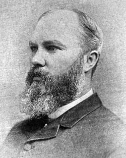
William Benjamin Chaffey, CMG (21 October 1856 – 4 June 1926) was a Canadian engineer and irrigation planner who with his older brother George Chaffey developed what became the cities of Etiwanda, California, Ontario, California, and Upland, California in the United States of America, as well as the cities of Mildura, Victoria and the town of Renmark, South Australia, in Australia. Life Chaffey was born in Brockville, Ontario, Canada, the third son of George and his wife Anne ''née'' Legoe. The Chaffey brothers developed irrigation colonies, named by them Etiwanda and Ontario, on the Cucamonga Plain in the early 1880s. The brothers had bought land and water-rights at a low price and resold 10 acre (4 ha) blocks to settlers; a non-profit mutual irrigation company distributed water. Alfred Deakin, then a minister in the Victorian government and chairman of a royal commission on water supply, visited the irrigation areas of California in 1885 where he met George and Willi ... [...More Info...] [...Related Items...] OR: [Wikipedia] [Google] [Baidu] |
George Chaffey
George Chaffey (28 January 1848 – 1 March 1932) was a Canadian–born engineer who with his brother William developed large parts of Southern California, including what became the community of Etiwanda and cities of Ontario, and Upland. They undertook similar developments in Australia which became the city of Mildura, and the town of Renmark and Paringa. Biography Chaffey was born in Brockville, Ontario and attended Kingston Grammar School on Lake Ontario. Chaffey's family was of Scottish heritage. Although not interested in schoolroom instruction, he read engineering books from the local library. Chaffey left school at 13 years of age, was fascinated by the shipbuilding yard of his father and became an apprentice marine engineer in May 1862. By 1880 he was well established as a designer of ships for Great Lakes traffic. While visiting his father in California that year, however, he became interested in the Riverside irrigation colony. By 1886 he and his brother William had ... [...More Info...] [...Related Items...] OR: [Wikipedia] [Google] [Baidu] |
Lake Alexandrina (South Australia)
Lake Alexandrina is a coastal freshwater lake located between the Fleurieu and Kangaroo Island and Murray and Mallee regions of South Australia, about south-east of Adelaide. The lake adjoins the smaller Lake Albert (together known as the Lower Lakes) and a coastal lagoon called The Coorong to its southeast, before draining into the Great Australian Bight via a short, narrow opening known as Murray Mouth. Nomenclature Aboriginal naming Aboriginal people having an association with the lake were reported as knowing it by such names as ''Mungkuli,'' ''Parnka'' and ''Kayinga.'' European naming English settlers named the lake after Princess Alexandrina, niece and successor of King William IV of Great Britain and Ireland. When the princess ascended the throne and took the name Queen Victoria, there was some talk of changing the name of the lake to Lake Victoria, but the idea was dropped. Description Lake Alexandrina is located north of Encounter Bay and east of Fleu ... [...More Info...] [...Related Items...] OR: [Wikipedia] [Google] [Baidu] |
Great Dividing Range
The Great Dividing Range, also known as the East Australian Cordillera or the Eastern Highlands, is a cordillera system in eastern Australia consisting of an expansive collection of mountain ranges, plateaus and rolling hills, that runs roughly parallel to the east coast of Australia and forms the fifth-longest land-based mountain chain in the world, and the longest entirely within a single country. It is mainland Australia's most substantial topographic feature and serves as the definitive watershed for the river systems in eastern Australia, hence the name. The Great Dividing Range stretches more than from Dauan Island in the Torres Strait off the northern tip of Cape York Peninsula, running the entire length of the eastern coastline through Queensland and New South Wales, then turning west across Victoria before finally fading into the Wimmera plains as rolling hills west of the Grampians region. The width of the Range varies from about to over .Shaw, John ... [...More Info...] [...Related Items...] OR: [Wikipedia] [Google] [Baidu] |
Charles Sturt
Charles Napier Sturt (28 April 1795 – 16 June 1869) was a British officer and explorer of Australia, and part of the European exploration of Australia. He led several expeditions into the interior of the continent, starting from Sydney and later from Adelaide. His expeditions traced several of the westward-flowing rivers, establishing that they all merged into the Murray River, which flows into the Southern Ocean. He was searching to prove his own passionately held belief that an "inland sea" was located at the centre of the continent. He reached the rank of Captain, served in several appointed posts, and on the Legislative Council. Born to British parents in Bengal, British India, Sturt was educated in England for a time as a child and youth. He was placed in the British Army because his father was not wealthy enough to pay for Cambridge. After assignments in North America, Sturt was assigned to accompany a ship of convicts to Australia in 1827. Finding the place to his li ... [...More Info...] [...Related Items...] OR: [Wikipedia] [Google] [Baidu] |
South Australian Register
''The Register'', originally the ''South Australian Gazette and Colonial Register'', and later ''South Australian Register,'' was South Australia's first newspaper. It was first published in London in June 1836, moved to Adelaide in 1837, and folded into '' The Advertiser'' almost a century later in February 1931. The newspaper was the sole primary source for almost all information about the settlement and early history of South Australia. It documented shipping schedules, legal history and court records at a time when official records were not kept. According to the National Library of Australia, its pages contain "one hundred years of births, deaths, marriages, crime, building history, the establishment of towns and businesses, political and social comment". All issues are freely available online, via Trove. History ''The Register'' was conceived by Robert Thomas, a law stationer, who had purchased for his family of land in the proposed South Australian province after be ... [...More Info...] [...Related Items...] OR: [Wikipedia] [Google] [Baidu] |
State Library Of South Australia
The State Library of South Australia, or SLSA, formerly known as the Public Library of South Australia, located on North Terrace, Adelaide, is the official library of the Australian state of South Australia. It is the largest public research library in the state, with a collection focus on South Australian information, being the repository of all printed and audiovisual material published in the state, as required by legal deposit legislation. It holds the "South Australiana" collection, which documents South Australia from pre-European settlement to the present day, as well as general reference material in a wide range of formats, including digital, film, sound and video recordings, photographs, and microfiche. Home access to many journals, newspapers and other resources online is available. History and governance 19th century On 29 August 1834, a couple of weeks after the passing of the '' South Australia Act 1834'', a group led by the Colonial Secretary, Robert Gouger, a ... [...More Info...] [...Related Items...] OR: [Wikipedia] [Google] [Baidu] |
Chambers Brothers
The Chambers Brothers are an American psychedelic soul band, best known for their eleven-minute 1967 psychedelic soul hit " Time Has Come Today". The group was part of the wave of new music that integrated American blues and gospel traditions with modern psychedelic and rock elements. Their music has been kept alive through frequent use in film soundtracks. Early career Originally from Carthage, Mississippi, the Chambers Brothers first honed their skills as members of the choir in their Baptist church. This arrangement ended in 1952 when the eldest brother, George, was drafted into the Army. George relocated to Los Angeles after his discharge, and his brothers soon joined him. Beginning in 1954, the foursome played gospel and folk music throughout the Southern California region, but remained little known until 1965 when they began performing in New York City. Consisting of George (September 26, 1931 – October 12, 2019) on washtub bass (later on bass guitar Danelectro and Gibso ... [...More Info...] [...Related Items...] OR: [Wikipedia] [Google] [Baidu] |
Erawirung
The Erawirung (Yirawirung, Jirawirung) people, also known as Yirau, Juju and other names, were an Aboriginal Australian people whose traditional territory was located in what is today the Riverland of South Australia. They consisted of sub-groups or clans, including Jeraruk, Rankbirit and Wilu, and have been referred to as Meru people, which was a larger grouping which could also include the Ngawait and Ngaiawang peoples. Language The Erawirung appear to have spoken a dialect of the Yuyu language common to their neighbours. This language group is alternatively called the Meru language group, and is included under this name on the AIATSIS Language Map. Country According to Norman Tindale, Erawirung traditional lands covered about , around the eastern bank of the Murray River, reaching from north of Paringa past Loxton into the sandy stretches some to its south. Their western boundary reached from Rufus Creek into the vicinity of the Overland Corner. Social organisation and ... [...More Info...] [...Related Items...] OR: [Wikipedia] [Google] [Baidu] |


