|
Reichenbach (Oberhasli)
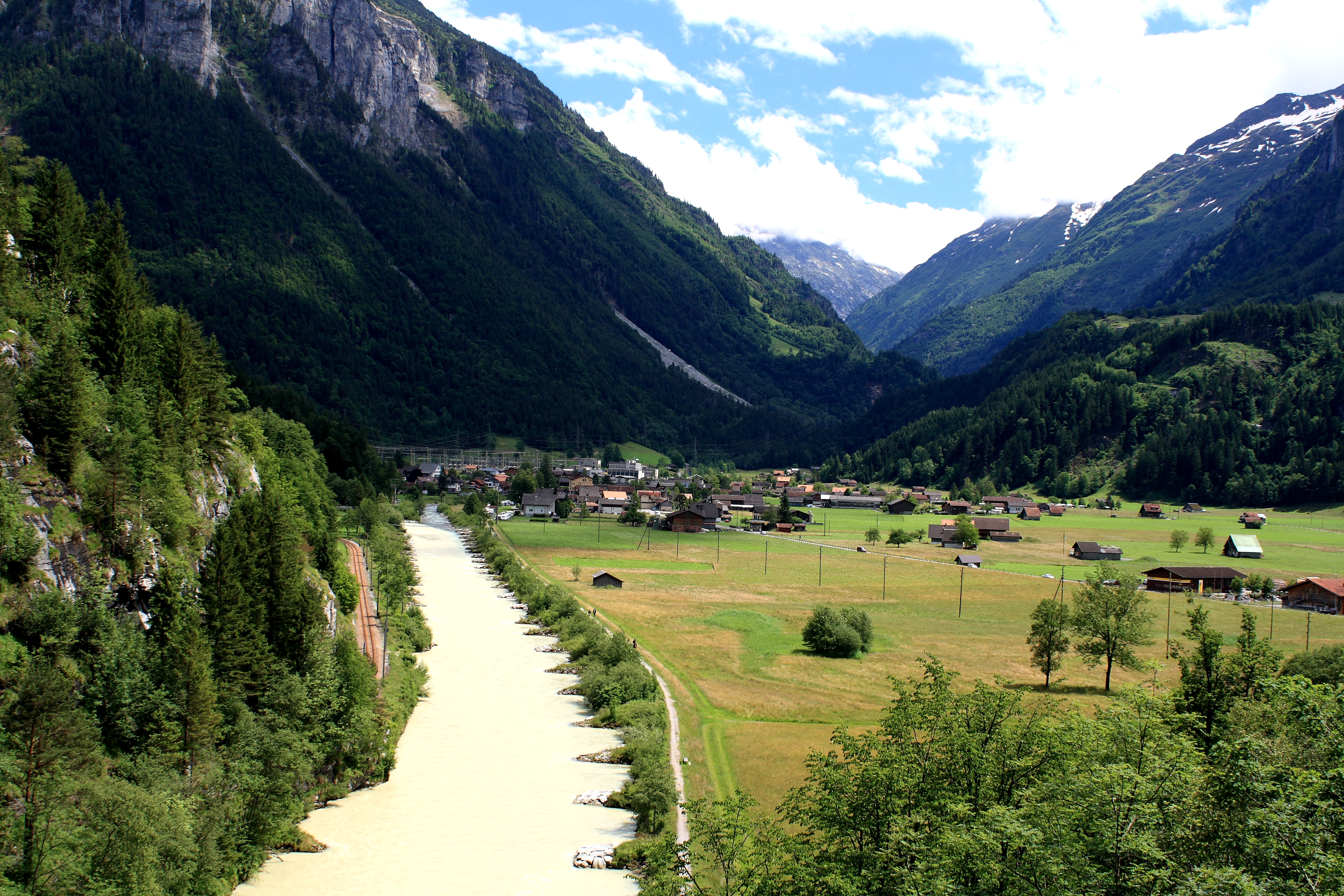
Reichenbachtal is an Alpine valley in Oberhasli, canton of Berne, Switzerland. It is situated within the municipality of Schattenhalb, connecting Meiringen with the Grosse Scheidegg pass towards Grindelwald. Its water, the Rychenbach, forms the Reichenbach Fall before joining the Aare at Meiringen. Rosenlaui is the highest settlement in the valley, situated approximately halfway up, at 1,328 m above sea level. The valley is also known as ''Rosenlauital'' after the settlement. Rosenlaui hotel is among the oldest in the region, bearing testimony to the early boom of tourism in Switzerland in the mid 19th century. On the eastern side of the valley rise the Wetterhorn (3,692 m), the Engelhörner (2,782 m), the Wellhorn (3,191 m), besides the Rosenlaui Glacier. Also east of the valley is the Rosenlouwi Gorge, a deep and narrow gorge formed by the meltwater of the Rosenlaui Glacier, accessible by a 500 m footpath. Further up the valley lies Schwarzwaldalp, marking the end of the ... [...More Info...] [...Related Items...] OR: [Wikipedia] [Google] [Baidu] |
Aare
The Aare () or Aar () is a tributary of the High Rhine and the longest river that both rises and ends entirely within Switzerland. Its total length from its source to its junction with the Rhine comprises about , during which distance it descends , draining an area of , almost entirely within Switzerland, and accounting for close to half the area of the country, including all of Central Switzerland. There are more than 40 hydroelectric plants along the course of the Aare. The river's name dates to at least the La Tène period, and it is attested as ''Nantaror'' "Aare valley" in the Berne zinc tablet. The name was Latinized as ''Arula''/''Arola''/''Araris''. Course The Aare rises in the great Aargletschers (Aare Glaciers) of the Bernese Alps, in the canton of Bern and west of the Grimsel Pass. The Finsteraargletscher and Lauteraargletscher come together to form the Unteraargletscher (Lower Aar Glacier), which is the main source of water for the Grimselsee (Lake of ... [...More Info...] [...Related Items...] OR: [Wikipedia] [Google] [Baidu] |
Valleys Of The Alps
The main valleys of the Alps, orographically by drainage basin. Rhine basin (North Sea) High Rhine *Aare (river), Aare **Limmat (river), Limmat ***Linth (river), Linth (Glarus) ****Lake Walen *****Seeztal ****Klöntal ****Sernftal **Reuss (river), Reuss ***Lake Lucerne ****Sarner Aa (river), Sarner Aa (Brünig Pass connects to the Aare basin) ****Muota (river), Muota ***Schächental, Klausen Pass connects to Glarus ***Urseren ***Susten Pass connects to the Gadmertal ***Furka Pass connects to the Goms (district), Goms **Saane/Sarine (river), Saane/Sarine ***Sense (river), Sense **Gürbetal **Lake Thun, Bernese Oberland ***Kander (Switzerland), Kander ****Simmental *****Diemtigental (Chirel, Fildrich (Narebach, Senggibach, Gurbsbach)) **** Suldtal **** Kiental **** Engstligental ****Kandertal ***, Habkern ***Brienzersee, Interlaken ****Lütschine (river), Lütschine *****Saxettal *****Schwarze Lütschine (river), Schwarze Lütschine, Lütschental, Grindelwald, Grosse Scheidegg con ... [...More Info...] [...Related Items...] OR: [Wikipedia] [Google] [Baidu] |
Aare Basin
The Aare () or Aar () is a tributary of the High Rhine and the longest river that both rises and ends entirely within Switzerland. Its total length from its source to its junction with the Rhine comprises about , during which distance it descends , draining an area of , almost entirely within Switzerland, and accounting for close to half the area of the country, including all of Central Switzerland. There are more than 40 hydroelectric plants along the course of the Aare. The river's name dates to at least the La Tène period, and it is attested as ''Nantaror'' "Aare valley" in the Berne zinc tablet. The name was Latinized as ''Arula''/''Arola''/''Araris''. Course The Aare rises in the great Aargletschers (Aare Glaciers) of the Bernese Alps, in the canton of Bern and west of the Grimsel Pass. The Finsteraargletscher and Lauteraargletscher come together to form the Unteraargletscher (Lower Aar Glacier), which is the main source of water for the Grimselsee (Lake of Gr ... [...More Info...] [...Related Items...] OR: [Wikipedia] [Google] [Baidu] |
PostBus Switzerland
PostAuto Switzerland, PostBus Ltd. (known as in Swiss Standard German (), in Swiss French (), in Swiss Italian (), and in Romansh () is a subsidiary company of the Swiss Post, which provides regional and rural bus services throughout Switzerland, and also in France, Germany, and Liechtenstein. The Swiss PostAuto service evolved as a motorized successor to the stagecoaches that previously carried passengers and mail in Switzerland, with the Swiss postal service providing postbus services carrying both passengers and mail. Although this combination had been self-evident in the past, the needs of each diverged towards the end of the twentieth century, when the conveyance of parcels was progressively separated from public transportation. This split became official with the conversion of PostAuto into a separate subsidiary of the Swiss Post in February 2005. The buses operated by PostAuto are a Swiss icon, with a distinctive yellow livery and three-tone horn. The company ... [...More Info...] [...Related Items...] OR: [Wikipedia] [Google] [Baidu] |
Rosenlaui Glacier
The Rosenlaui Glacier (german: Rosenlauigletscher) is a 5-km-long glacier (2005) in the Bernese Alps in the canton of Berne in Switzerland. In 1973 it had an area of 6.14 km2. Johann Heinrich Müller, 1825-1894 H19 Rosenlauigletscher.JPG, Rosenlaui Glacier c. 1870/80. Etching by Heinrich Müller See also *List of glaciers in Switzerland *Swiss Alps The Alpine region of Switzerland, conventionally referred to as the Swiss Alps (german: Schweizer Alpen, french: Alpes suisses, it, Alpi svizzere, rm, Alps svizras), represents a major natural feature of the country and is, along with the Swiss ... External linksSwiss glacier monitoring network Glaciers of the canton of Bern Oberhasli Glaciers of the Alps GRosenlaui {{bern-glacier-stub ... [...More Info...] [...Related Items...] OR: [Wikipedia] [Google] [Baidu] |
Wellhorn The Wellhorn is a mountain of the Bernese Alps, overlooking Rosenlaui in the Bernese Oberland. On its eastern side is the Rosenlaui Glacier. References External links Wellhorn on Hikr Bernese Alps Mountains of the Alps Alpine three-thousanders Mountains of Switzerland Oberhasli Mountains of the canton of Bern {{ |


