|
Regions Of Cape Verde
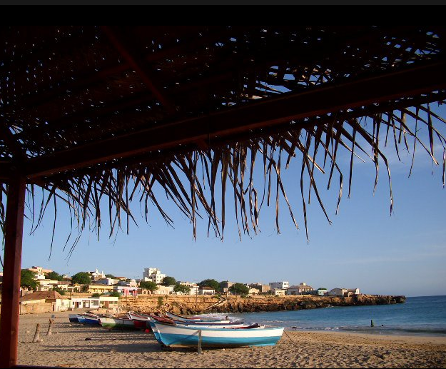
{{short description, none Cape Verde is an archipelago, and its islands are historically divided into two groups, or regions: * Barlavento (meaning literally Windward), including Santo Antão, São Vicente, Santa Luzia, São Nicolau, Sal and Boa Vista, in the northern side. * Sotavento (meaning literally Leeward), including Maio, Santiago, Fogo and Brava, in the southern side. In addition to the historical regions, the islands can also be divided by geographical features, resulting in: * A group of dry, very flat, and geologically old islands (Sal, Boa Vista and Maio), lying to the east and closer to the African coast (which makes them a target for sand from the Sahara desert, resulting in long sandy beaches, typically used for beach tourism), and * A group of rocky, volcanic, agricultural islands more to the west. Their orography is rougher because they're geologically newer, and the westernmost islands (such as Santo Antão) tend to be the most mountainous. Geogra ... [...More Info...] [...Related Items...] OR: [Wikipedia] [Google] [Baidu] |
Cape Verde
, national_anthem = () , official_languages = Portuguese , national_languages = Cape Verdean Creole , capital = Praia , coordinates = , largest_city = capital , demonym = Cape Verdean or Cabo Verdean , ethnic_groups_year = 2017 , government_type = Unitary semi-presidential republic , leader_title1 = President , leader_name1 = José Maria Neves , leader_title2 = Prime Minister , leader_name2 = Ulisses Correia e Silva , legislature = National Assembly , area_rank = 166th , area_km2 = 4033 , area_sq_mi = 1,557 , percent_water = negligible , population_census = 561,901 , population_census_rank = 172nd , population_census_year = 2021 , population_density_km2 = 123.7 , population_density_sq_mi = 325.0 , population_density_rank = 89th , GDP_PPP ... [...More Info...] [...Related Items...] OR: [Wikipedia] [Google] [Baidu] |
Sotavento Islands
The Sotavento Islands (Portuguese: ''Ilhas de Sotavento'', literally, the ''Leeward Islands'') is the southern island group of the Cape Verde archipelago.Valor simbólico do centro histórico da Praia Lourenço Conceição Gomes, Universidade Portucalense, 2008, p. 58-59 There are four main islands. The western three islands, , Fogo and , are rocky and |
Orography
Orography is the study of the topographic relief of mountains, and can more broadly include hills, and any part of a region's elevated terrain. Orography (also known as ''oreography'', ''orology'' or ''oreology'') falls within the broader discipline of geomorphology. The term orography comes from the Greek: , hill, , to write. Uses Mountain ranges and elevated land masses have a major impact on global climate. For instance, the elevated areas of East Africa substantially determine the strength of the Indian monsoon.Srinivasan, J., Nanjundiah, Ravi S. and Chakraborty, Arindam (2005Impact of Orography on the Simulation of Monsoon Climate in a General Circulation Model''Indian Institute of Science'' In scientific models, such as general circulation models, orography defines the lower boundary of the model over land. When a river's tributaries or settlements by the river are listed in 'orographic sequence', they are in order from the highest (nearest the source of the river) to the l ... [...More Info...] [...Related Items...] OR: [Wikipedia] [Google] [Baidu] |
Sahara Desert
, photo = Sahara real color.jpg , photo_caption = The Sahara taken by Apollo 17 astronauts, 1972 , map = , map_image = , location = , country = , country1 = , country2 = , country3 = , country4 = , country5 = , country6 = , country7 = , country8 = , country9 = , country10 = ( disputed) , region = , state = , district = , city = , relief = , label = , label_position = , coordinates = , coordinates_ref = , elevation = , elevation_m = , elevation_ft = , elevation_ref = , length = , length_mi = , length_km = 4,800 , length_orientation = , length_note = , width = , width_mi = , widt ... [...More Info...] [...Related Items...] OR: [Wikipedia] [Google] [Baidu] |
Brava, Cape Verde
Brava (Portuguese for "wild" or "brave") is an island in Cape Verde, in the Sotavento group. At , it is the smallest inhabited island of the Cape Verde archipelago, but at the same time the greenest. First settled in the early 16th century, its population grew after Mount Fogo on neighbouring Fogo erupted in 1680. For more than a century, its main industry was whaling, but the island economy is now primarily agricultural. History Brava was discovered in 1462 by the Portuguese explorer Diogo Afonso.Valor simbólico do centro histórico da Praia Lourenço Conceição Gomes, Universidade Portucalense, 2008, p. 97 There is no evidence of human presence on the Cape Verde islands before the arrival of the Portuguese. Around 1620 the population of Brava started with the arrival of settlers from |
Fogo, Cape Verde
Fogo (Portuguese for "fire") is an island in the Sotavento group of Cape Verde. Its population is 35,837 (2015),Cabo Verde, Statistical Yearbook 2015 Instituto Nacional de Estatística with an area of 476 km2. It reaches the highest altitude of all the islands in Cape Verde, rising to at the summit of its active volcano, |
Santiago, Cape Verde
Santiago (Portuguese for “ Saint James”) is the largest island of Cape Verde, its most important agricultural centre and home to half the nation's population. Part of the Sotavento Islands, it lies between the islands of Maio ( to the east) and Fogo ( to the west). It was the first of the islands to be settled: the town of Ribeira Grande (now Cidade Velha and a UNESCO World Heritage Site) was founded in 1462. Santiago is home to the nation's capital city of Praia. History The eastern side of the nearby island of Fogo collapsed into the ocean 73,000 years ago, creating a tsunami 170 meters high which struck Santiago. In 1460, António de Noli became the first to visit the island. Da Noli settled at ''Ribeira Grande'' (now Cidade Velha) with his family members and Portuguese from Algarve and Alentejo in 1462.Valor simbóli ... [...More Info...] [...Related Items...] OR: [Wikipedia] [Google] [Baidu] |
Maio, Cape Verde
Maio is the easternmost of the Sotavento islands of Cape Verde. Maio is located south of the island of Boa Vista and east of Santiago. Administratively, the island forms one ''concelho'' (municipality): Maio. History The island was discovered in 1460. It was first settled at the end of the 16th century, when the land was used to raise livestock, especially goats. Salt was first exploited in the 17th century which caused the population to grow. The English exported salt to Europe from Porto Inglês, hence the name of that city.História Municipio do Maio The inconclusive was fought between British and French |
Leeward
Windward () and leeward () are terms used to describe the direction of the wind. Windward is ''upwind'' from the point of reference, i.e. towards the direction from which the wind is coming; leeward is ''downwind'' from the point of reference, i.e. along the direction towards which the wind is going. The side of a ship that is towards the leeward is its "lee side". If the vessel is heeling under the pressure of crosswind, the lee side will be the "lower side". During the Age of Sail, the term ''weather'' was used as a synonym for ''windward'' in some contexts, as in the ''weather gage''. Because it captures rain, the windward side of a mountain tends to be wet compared to the leeward it blocks. Origin The term "lee" comes from the middle-low German word // meaning "where the sea is not exposed to the wind" or "mild". The terms Luv and Lee (engl. Windward and Leeward) have been in use since the 17th century. Usage Windward and leeward directions (and the points ... [...More Info...] [...Related Items...] OR: [Wikipedia] [Google] [Baidu] |
Boa Vista, Cape Verde
Boa Vista (Portuguese for "good view"), also written as Boavista, is a desert-like island that belongs to the Cape Verde Islands. At , it is the third largest island of the Cape Verde archipelago. The island of Boa Vista is closer to the African continent than all the other islands in Cape Verde, being the easternmost island of all. The distance between Boa Vista and Senegal is only 450 km. The capital of Boa Vista, Sal Rei, is located in the north-western part of the island. Boa Vista is mainly known for its beaches, turtles and traditional music. Geography Boa Vista is the third largest island after Santo Antão and Santiago, with an area of 631.1 square kilometres. It is situated south of Sal and north of Maio. The island is generally flat, but it has numerous hills like Monte Estância (the highest point of the island at 387 m), [...More Info...] [...Related Items...] OR: [Wikipedia] [Google] [Baidu] |
Archipelago
An archipelago ( ), sometimes called an island group or island chain, is a chain, cluster, or collection of islands, or sometimes a sea containing a small number of scattered islands. Examples of archipelagos include: the Indonesian Archipelago, the Andaman and Nicobar Islands, the Lakshadweep Islands, the Galápagos Islands, the Japanese archipelago, the Philippine Archipelago, the Maldives, the Balearic Islands, The Bahamas, the Aegean Islands, the Hawaiian Islands, the Canary Islands, Malta, the Azores, the Canadian Arctic Archipelago, the British Isles, the islands of the Archipelago Sea, and Shetland. They are sometimes defined by political boundaries. For example, the Gulf archipelago off the northeastern Pacific coast forms part of a larger archipelago that geographically includes Washington state's San Juan Islands; while the Gulf archipelago and San Juan Islands are geographically related, they are not technically included in the same archipelago due to manmad ... [...More Info...] [...Related Items...] OR: [Wikipedia] [Google] [Baidu] |
Sal, Cape Verde
Sal (Portuguese for "salt") is an island in Cape Verde. Sal is a tourist destination with white sandy beaches and over 350 days of sunshine a year. It is one of the three sandy eastern islands of the Cape Verde archipelago in the central Atlantic Ocean, off the west coast of Africa. Cabo Verde is known for year-round kiteboarding, for the large reserve of Caretta turtles which hatch from July to September, and the music of Cesaria Evora. History For Europeans , the island was discovered on 3 December 1460 and named ''Llana'' ("flat"). This name was changed into the current "Sal" when the two large salt ponds (Pedra de Lume and Santa Maria) were discovered. The first three centuries after its discovery, the island was only sparsely inhabited; in 1720 there was a small fishing village near present Palmeira. This changed when the salt industry was developed at the end of the 18th century, starting in Pedra de Lume. Santa Maria was founded in the south of the island in 1830 by ... [...More Info...] [...Related Items...] OR: [Wikipedia] [Google] [Baidu] |


