|
Redhill, Surrey
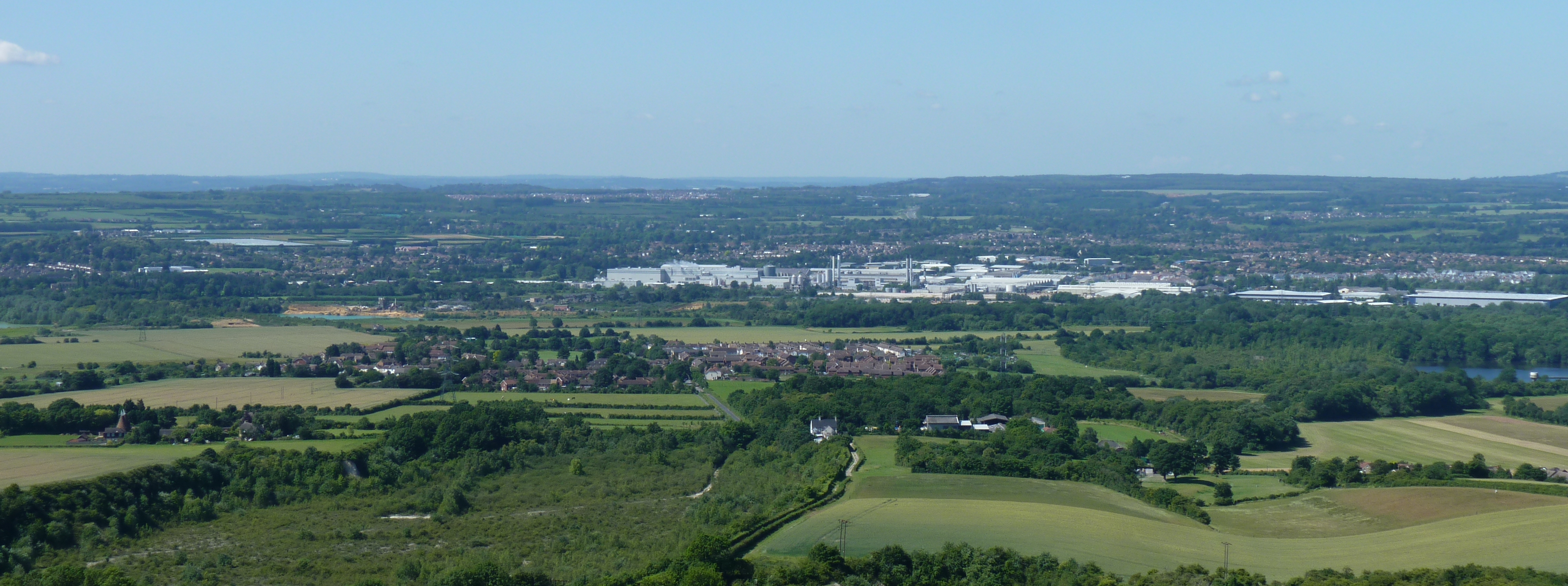
Redhill () is a town in the borough of Reigate and Banstead within the county of Surrey, England. The town, which adjoins the town of Reigate to the west, is due south of Croydon in Greater London, and is part of the London commuter belt. The town is also the post town, entertainment and commercial area of three adjoining communities : Merstham, Earlswood and Whitebushes, as well as of two small rural villages to the east in the Tandridge District, Bletchingley and Nutfield. The town is situated on the junction of the north–south A23 (London to Brighton) road, and the east–west A25 road which runs from Guildford through to Sevenoaks. It is also on the railway junction, served by Redhill railway station, of the Brighton Main Line, North-Downs line, and Redhill-Tonbridge line. Geography Redhill is located within the Weald Basin, and the Weald-Artois Anticline. The town is situated in the east–west lying Vale of Holmesdale at a place where there is a natural water-c ... [...More Info...] [...Related Items...] OR: [Wikipedia] [Google] [Baidu] |
United Kingdom Census 2011
A Census in the United Kingdom, census of the population of the United Kingdom is taken every ten years. The 2011 census was held in all countries of the UK on 27 March 2011. It was the first UK census which could be completed online via the Internet. The Office for National Statistics (ONS) is responsible for the census in England and Wales, the General Register Office for Scotland (GROS) is responsible for the census in Scotland, and the Northern Ireland Statistics and Research Agency (NISRA) is responsible for the census in Northern Ireland. The Office for National Statistics is the executive office of the UK Statistics Authority, a non-ministerial department formed in 2008 and which reports directly to Parliament. ONS is the UK Government's single largest statistical producer of independent statistics on the UK's economy and society, used to assist the planning and allocation of resources, policy-making and decision-making. ONS designs, manages and runs the census in England an ... [...More Info...] [...Related Items...] OR: [Wikipedia] [Google] [Baidu] |
A23 Road
The A23 road is a major road in the United Kingdom between London and Brighton, East Sussex, England. It is managed by Transport for London for the section inside the Greater London boundary, Surrey County Council and West Sussex County Council for the section shadowed by the M23 motorway, National Highways (as a trunk road) between the M23 and Patcham, and by Brighton and Hove Council from the A27 to the centre of Brighton. The road has been a major route for centuries, and seen numerous upgrades, bypasses and diversions. Route The A23 begins near Lambeth North tube station. Formerly, it started as ''Westminster Bridge Road'' near Waterloo station, but this is now part of the A302. Almost immediately it turns south; the straightness of much of the heading south shows its Roman origins. The road becomes: * Kennington Road: long; near Kennington Park it joins the A3 (''Kennington Park Road''), but soon bears south again, becoming in turn over the next : * Brixton Road * ... [...More Info...] [...Related Items...] OR: [Wikipedia] [Google] [Baidu] |
Greensand Ridge
The Greensand Ridge, also known as the Wealden Greensand is an extensive, prominent, often wooded, mixed greensand/sandstone escarpment in south-east England. Forming part of the Weald, a former dense forest in Sussex, Surrey and Kent, it runs to and from the East Sussex coast, wrapping around the High Weald and Low Weald. It reaches its highest elevation, , at Leith Hill in Surrey—the second highest point in south-east England, while another hill in its range, Blackdown, is the highest point in Sussex at . The eastern end of the ridge forms the northern boundary of Romney Marsh. About 51 per cent of the Wealden Greensand is protected as the South Downs National Park, Kent Downs Area of Outstanding Natural Beauty and Surrey Hills Area of Outstanding Natural Beauty. Geology and soils Geological history The Greensand Ridge, formed of Lower Greensand, much of which is sandstone and where hardest is locally termed Bargate stone, is a remnant of the Weald dome, part of ... [...More Info...] [...Related Items...] OR: [Wikipedia] [Google] [Baidu] |
Vale Of Holmesdale
Holmesdale, also known as the Vale of Holmesdale, is a valley in South-East England South East England is one of the nine official regions of England at the first level of ITL for statistical purposes. It consists of the counties of Buckinghamshire, East Sussex, Hampshire, the Isle of Wight, Kent, Oxfordshire, Berkshire, ... that falls between the hill ranges of the North Downs and the Greensand Ridge of the Weald, in the counties of Kent and Surrey. It stretches from Folkestone on the Kent coast, through Ashford, Kent, Ashford, Harrietsham, Maidstone, Riverhead, Kent, Riverhead/Sevenoaks, Westerham, Oxted, Godstone, Redhill, Surrey, Redhill, Reigate, Dorking, Gomshall, and Guildford – west of which it is also called by the local name of "Puttenham Vale" – as it continues through the village of Puttenham, Surrey, Puttenham, to the market town of Farnham. Geology Holmesdale is part of the Weald Basin and Weald–Artois Anticline, Weald-Artois Anticline. The valley ... [...More Info...] [...Related Items...] OR: [Wikipedia] [Google] [Baidu] |
Weald–Artois Anticline
The Weald–Artois Anticline, or Wealden Anticline, is a large anticline, a geological structure running between the regions of the Weald in southern England and Artois in northern France. The fold formed during the Alpine orogeny, from the late Oligocene to middle Miocene as an uplifted form of the Weald basin through inversion of the basin. The folding resulted in uplift of about , though concurrent erosion may have substantially reduced the actual height of the resulting chalk ridges. As is the case with all anticlines, older rock strata are found in the core of the structure. These are in this case Upper Jurassic and Lower Cretaceous strata. The western part of the ridge (the Weald of Kent, Sussex and Surrey in England) has been greatly eroded, with the presumed chalk surface removed to expose older, Lower Cretaceous rocks (Wealden Group) and a small area of Upper Jurassic Purbeck Beds. On the French side of the English Channel more Upper Jurassic rocks crop out in a small ar ... [...More Info...] [...Related Items...] OR: [Wikipedia] [Google] [Baidu] |
Weald Basin
The Weald Basin () is a major topographic feature of the area that is now southern England and northern France from the Triassic to the Late Cretaceous. Its uplift in the Late Cretaceous marked the formation of the Wealden Anticline. The rock strata contain hydrocarbon deposits which have yielded coal, oil and gas. Formation The Weald Basin's formation commenced during the Carboniferous, with the rocks which are today basement deposited within a low swamp providing coals which were exploited to the north and east in Kent, but boreholes drilled in the 19th century failed to find this deposit in the area of the Weald. The Carboniferous coals may be overlain by early Triassic sediments. The sediments were uplifted and faulted within the Variscan Orogeny, with the land now occupied by the Weald Basin being a low external fold belt to the main orogeny, which was located within the present day English Channel. The remnants of the mountain belt can be seen today in Devon and Cornwall i ... [...More Info...] [...Related Items...] OR: [Wikipedia] [Google] [Baidu] |
Redhill–Tonbridge Line
The Redhill–Tonbridge line is a railway line in South East England that links Redhill, Surrey (on the Brighton Main Line) with Tonbridge, Kent (on the South Eastern Main Line). History It was originally part of the South Eastern Railway, having been sanctioned by Act of Parliament in 1836 as part of the first railway line from London to Dover. This may explain why the route runs in a remarkably straight line: serving the settlements en route was a secondary consideration. Following the completion in 1868 of the new South Eastern Main Line, which provided a much more direct route between London and Tonbridge, the Redhill–Tonbridge line was used mainly for local services. Aircraft landing at London's Croydon Airport in the early 20th century used this line to help with navigation. All the stations along this route had their names in bold white paint on the roof of the station buildings. British Rail In the British Rail era, there were through trains from Reading via Redhi ... [...More Info...] [...Related Items...] OR: [Wikipedia] [Google] [Baidu] |
North Downs Line
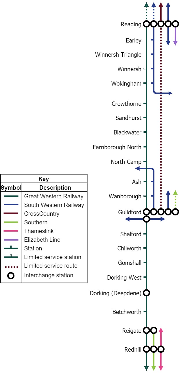
The North Downs Line is a passenger-train line connecting Reading, on the Great Western Main Line, to Redhill and , along the Brighton Main Line, linking many centres of population in that part of the North Downs which it traverses en route. The route Between Redhill and Ash the line runs roughly parallel with the North Downs. Between Reigate and Gomshall the line runs along the foot of the North Downs escarpment in the Vale of Holmesdale. At Guildford it passes through the gap in the Downs formed by the River Wey, with two short tunnels just south of Guildford station, and further west between Guildford and Ash the line runs to the north of the Hog's Back. It then follows the Blackwater valley as far as Sandhurst, before continuing to Reading. History of the line's construction The line was authorised by Acts of Parliament in 1846 and 1847 and most of it was constructed by the Reading, Guildford and Reigate Railway Company (RG&RRC), opening in 1849. (A central section of the ... [...More Info...] [...Related Items...] OR: [Wikipedia] [Google] [Baidu] |
Brighton Main Line
The Brighton Main Line (also known as the South Central Main Line) is a major railway line in the United Kingdom that links Brighton, on the south coast of England, with central London. In London the line has two branches, out of and stations respectively, which join up in Croydon and continue towards Brighton as one line. The line is electrified throughout using the third rail system. Aside from London and Brighton themselves, the line serves multiple large urban areas along its route, including Redhill, eastern Crawley, Haywards Heath and Burgess Hill. It also serves the major London suburbs of south-west Battersea, Balham, Streatham, Croydon and Purley, as well as London Gatwick Airport the second-busiest passenger airport in the country. In addition, the line operates as a "trunk" route for both mainline and suburban services all across Sussex, east Surrey and the southern boroughs of London. Towns such as Sutton, Epsom, Caterham, Reigate, East Grinstead, Ea ... [...More Info...] [...Related Items...] OR: [Wikipedia] [Google] [Baidu] |
Redhill Railway Station
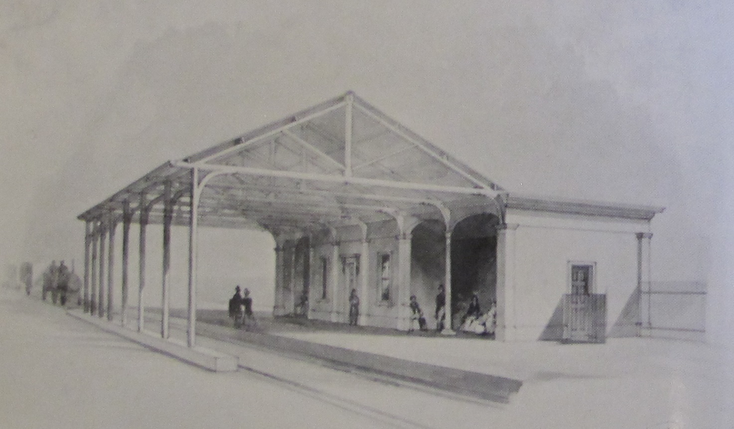
Redhill railway station serves the town of Redhill, Surrey, England. The station is a major interchange point on the Brighton Main Line, measured from . It is managed by Southern, and is also served by Thameslink and GWR. History The local topography determined that it was cheaper to build and operate a railway line between London and Brighton which by-passed the parliamentary borough and long-established market town of Reigate and instead passed through the nearby Redstone or Red Hill gap in the Reigate Foreign (countryside) parish. According to the Acts of Parliament establishing railways between London and Brighton, and London and Dover, the line was to be shared between Croydon and Red Hill after which these two would deviate. The London and Brighton Railway (L&BR) constructed the new line during 1840 and 1841, with the South Eastern Railway (SER) contributing half of the construction cost and taking ownership of the section between Croydon and Red Hill. (The SER had ho ... [...More Info...] [...Related Items...] OR: [Wikipedia] [Google] [Baidu] |
Sevenoaks
Sevenoaks is a town in Kent with a population of 29,506 situated south-east of London, England. Also classified as a civil parishes in England, civil parish, Sevenoaks is served by a commuter South Eastern Main Line, main line railway into London. Sevenoaks is from Charing Cross, the traditional centre of London. It is the principal town of the Sevenoaks (district), Sevenoaks district, followed by Swanley and Edenbridge, Kent, Edenbridge. A settlement was recorded in the 13th century, when a market was established. Construction of Knole House in the 15th century helped develop the village. Sevenoaks became part of the modern communications network when one of the early toll road, turnpikes was opened in the 18th century; the railway was relatively late in reaching it. In the 21st century, it has a large Commuter town, commuting population. The nearby Fort Halstead defence installation was formerly a major local employer. Located to the south-east of the town is Knole Park, wit ... [...More Info...] [...Related Items...] OR: [Wikipedia] [Google] [Baidu] |
Guildford
Guildford () is a town in west Surrey, around southwest of central London. As of the 2011 census, the town has a population of about 77,000 and is the seat of the wider Borough of Guildford, which had around inhabitants in . The name "Guildford" is thought to derive from a crossing of the River Wey, a tributary of the River Thames that flows through the town centre. The earliest evidence of human activity in the area is from the Mesolithic and Guildford is mentioned in the will of Alfred the Great from . The exact location of the main Anglo-Saxon settlement is unclear and the current site of the modern town centre may not have been occupied until the early 11th century. Following the Norman Conquest, a motte-and-bailey castle was constructed, which was developed into a royal residence by Henry III. During the late Middle Ages, Guildford prospered as a result of the wool trade and the town was granted a charter of incorporation by Henry VII in 1488. The River Wey Navig ... [...More Info...] [...Related Items...] OR: [Wikipedia] [Google] [Baidu] |


.jpg)