|
Real-time Geotagging
Real-time geotagging refers to the automatic technique of acquiring media (such as photos, audio or video), associating a specific location with the media, transferring the media to an online map and publishing the media in real time. It is thus an extension of an automatic geotagging process, requiring an in-built or attached location acquisition device (such as GPS or Wi-Fi positioning system), but also requires communication with a wireless data transfer device (such as mobile phone networks or Wi-Fi networks). Most modern smartphones and several digital cameras already integrate camera, aGPS, and wireless data transfer into one device, thus directly producing a geotagged photograph. Real-time geotagging is sometimes referred to as "mobile geotagging" or "autogeotagging", but this does not imply the real-time publishing step. Location Acquisition Geotagging is gaining popularity with photographers to produce geotagged photographs. A few cameras have built-in geolocation c ... [...More Info...] [...Related Items...] OR: [Wikipedia] [Google] [Baidu] |
Online Map
Web mapping or an online mapping is the process of using maps, usually created through Geographic Information Systems, geographic information systems (GIS), on the Internet, more specifically in the World Wide Web (WWW). A web map or an online map is both served and consumed, thus web mapping is more than just web cartography, it is a service by which consumers may choose what the map will show. Web GIS emphasizes geodata processing aspects more involved with design aspects such as data acquisition and server software architecture such as data storage and algorithms, than it does the end-user reports themselves. The terms ''web GIS'' and ''web mapping ''remain somewhat synonymous. Web GIS uses web maps, and end users who are ''web mapping'' are gaining analytical capabilities. The term ''location-based services'' refers to ''web mapping'' consumer goods and services. Web mapping usually involves a web browser or other user agent capable of client-server interactions. Questions o ... [...More Info...] [...Related Items...] OR: [Wikipedia] [Google] [Baidu] |
Wireless Access Point
In computer networking, a wireless access point (WAP), or more generally just access point (AP), is a networking hardware device that allows other Wi-Fi devices to connect to a wired network. As a standalone device, the AP may have a wired connection to a router, but, in a wireless router, it can also be an integral component of the router itself. An AP is differentiated from a hotspot which is a physical location where Wi-Fi access is available. Connections An AP connects directly to a wired local area network, typically Ethernet, and the AP then provides wireless connections using wireless LAN technology, typically Wi-Fi, for other devices to use that wired connection. APs support the connection of multiple wireless devices through their one wired connection. Wireless data standards There are many wireless data standards that have been introduced for wireless access point and wireless router technology. New standards have been created to accommodate the increasing n ... [...More Info...] [...Related Items...] OR: [Wikipedia] [Google] [Baidu] |
Panoramio
Panoramio was a geo-tagging, geo-located tagging, photo sharing Mashup (web application hybrid), mashup active between 2005 and 2016. Photos uploaded to the site were accessible as a layer in Google Earth and Google Maps. The site's goal was to allow Google Earth users to learn more about a given area by viewing the photos that other users had taken at that location. Panoramio was acquired by Google in 2007. In 2009 the website was among 1000 most popular websites worldwide. Panoramio was launched in 2005, and closed on November 4, 2016, although the layer in Google Earth was available until January 2018. Image source URLs are still available. After the acquisition of Panoramio by Google, the headquarters were located in Zurich, in the office building of Google Switzerland, but subsequently were moved to Mountain View, California, Mountain View, California, US. History Panoramio was started in the summer of 2005 by Spanish people, Spanish entrepreneurs Joaquín Cuenca Abela an ... [...More Info...] [...Related Items...] OR: [Wikipedia] [Google] [Baidu] |
Flickr
Flickr ( ; ) is an American image hosting and video hosting service, as well as an online community, founded in Canada and headquartered in the United States. It was created by Ludicorp in 2004 and was a popular way for amateur and professional photographers to host high-resolution photos. It has changed ownership several times and has been owned by SmugMug since April 20, 2018. Flickr had a total of 112 million registered members and more than 3.5 million new images uploaded daily. On August 5, 2011, the site reported that it was hosting more than 6 billion images. Photos and videos can be accessed from Flickr without the need to register an account, but an account must be made to upload content to the site. Registering an account also allows users to create a profile page containing photos and videos that the user has uploaded and also grants the ability to add another Flickr user as a contact. For mobile users, Flickr has official mobile apps for iOS, Android, and an op ... [...More Info...] [...Related Items...] OR: [Wikipedia] [Google] [Baidu] |
Geofencing
A geofence is a virtual perimeter for a real-world geographic area. A geofence could be dynamically generated (as in a radius around a point location) or match a predefined set of boundaries (such as school zones or neighborhood boundaries). The use of a geofence is called geofencing, and one example of use involves a location-aware device of a location-based service (LBS) user entering or exiting a geofence. Geofencing approach is based on the observation that users move from one place to another and then stay at that place for a while. This method combines awareness of the user's current location with awareness of the user's proximity to locations that may be of interest. This activity could trigger an alert to the device's user as well as messaging to the geofence operator. This info, which could contain the location of the device, could be sent to a mobile telephone or an email account. History Geofencing was invented in the early 1990’s and patented in 1995 by American ... [...More Info...] [...Related Items...] OR: [Wikipedia] [Google] [Baidu] |
Geosocial Networking
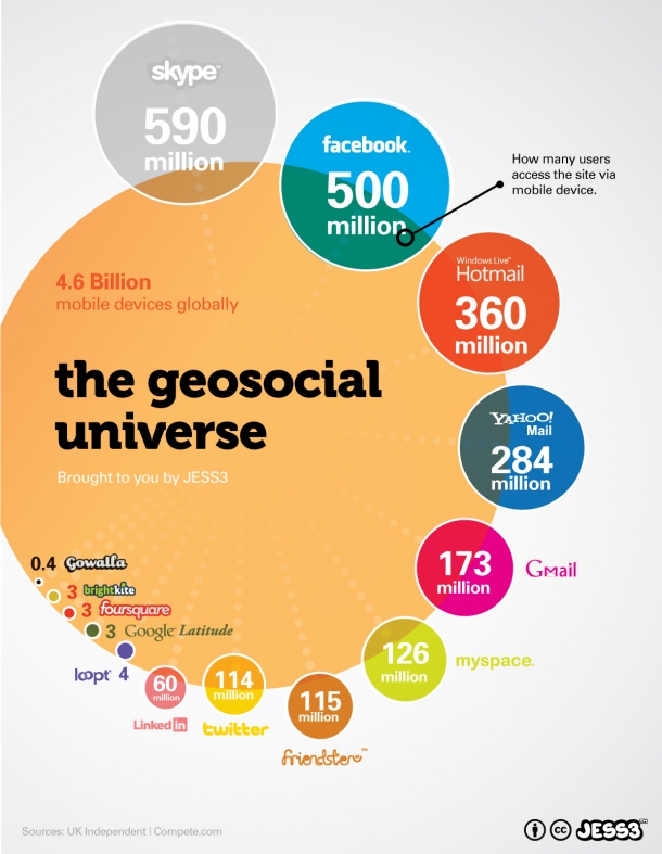
Geosocial networking is a type of social networking in which geographic services and capabilities such as geocoding and geotagging are used to enable additional social dynamics."Recommending Social Events from Mobile Phone Location Data" Daniele Quercia, et al., ICDM 2010 User-submitted location data or techniques can allow social networks to connect and coordinate users with local people or events that match their interests. Geolocation on web-based s can be [...More Info...] [...Related Items...] OR: [Wikipedia] [Google] [Baidu] |
Mobile App
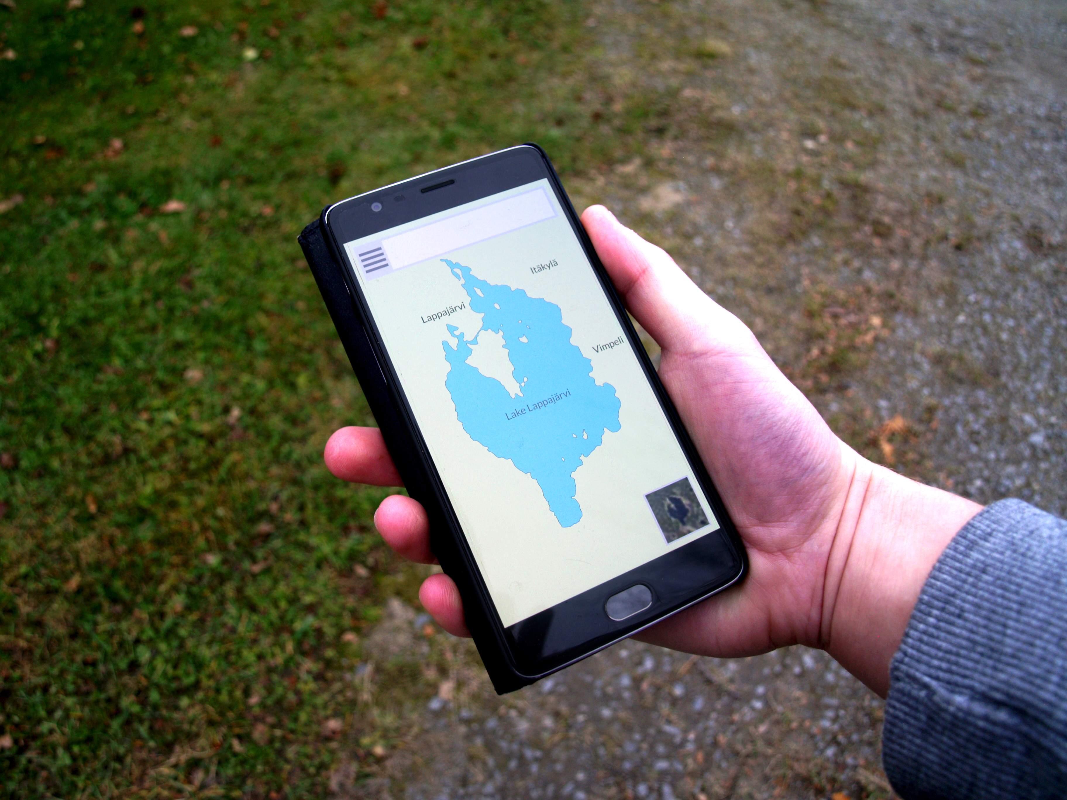
A mobile application or app is a computer program or software application designed to run on a mobile device such as a phone, tablet, or watch. Mobile applications often stand in contrast to desktop applications which are designed to run on desktop computers, and web applications which run in mobile web browsers rather than directly on the mobile device. Apps were originally intended for productivity assistance such as email, calendar, and contact databases, but the public demand for apps caused rapid expansion into other areas such as mobile games, factory automation, GPS and location-based services, order-tracking, and ticket purchases, so that there are now millions of apps available. Many apps require Internet access. Apps are generally downloaded from app stores, which are a type of digital distribution platforms. The term "app", short for " application", has since become very popular; in 2010, it was listed as "Word of the Year" by the American Dialect Society. Apps a ... [...More Info...] [...Related Items...] OR: [Wikipedia] [Google] [Baidu] |
GPS Phone
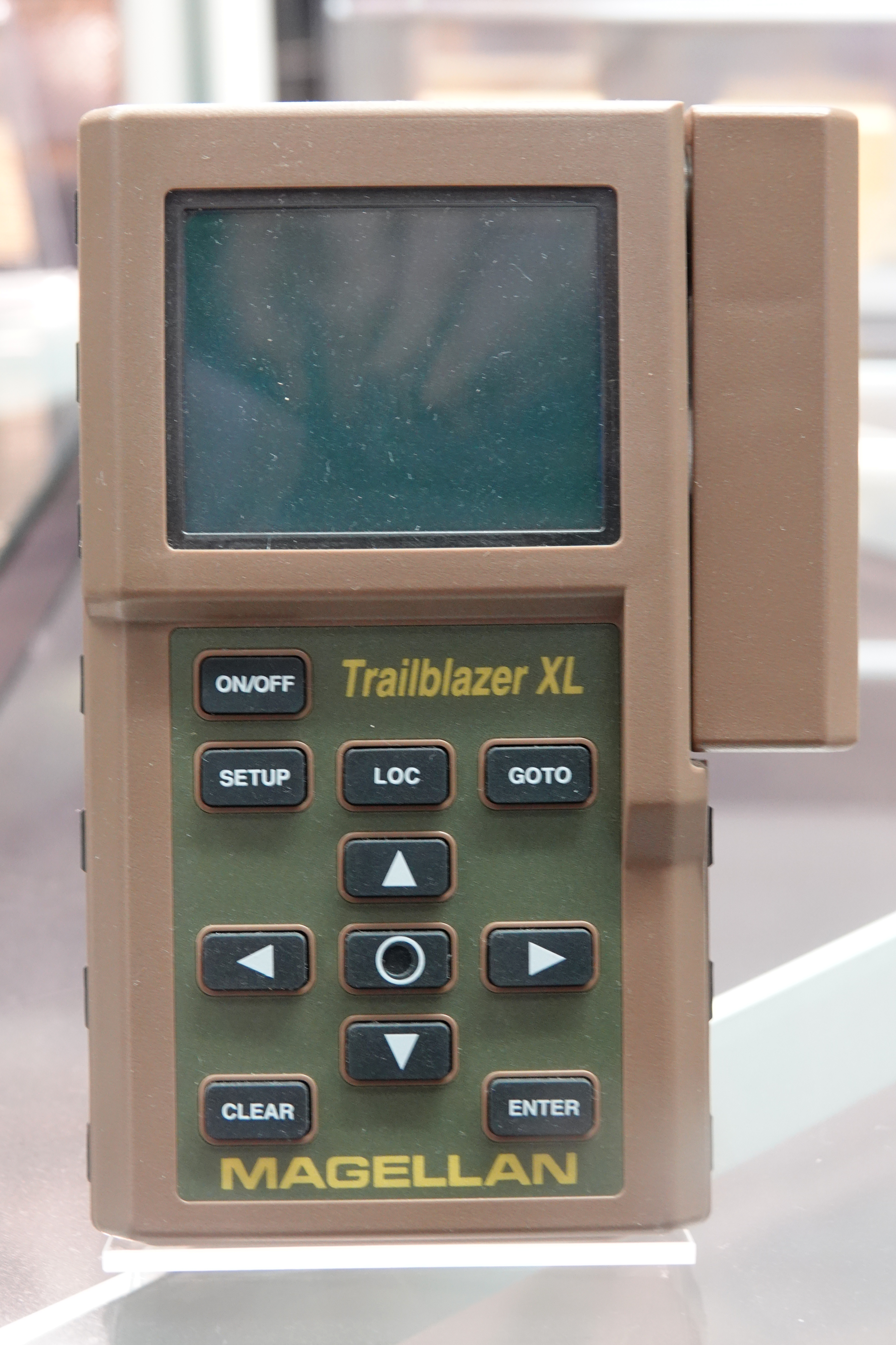
A satellite navigation device (satnav device) is a user equipment that uses one or more of several global navigation satellite systems (GNSS) to calculate the device's geographical position and provide navigational advice. Depending on the software used, the satnav device may display the position on a map, as geographic coordinates, or may offer routing directions. As of September 2020, there were four operational GNSS systems, the original United States' Global Positioning System (GPS), the European Union's Galileo, Russia's GLONASS, and China's BeiDou Navigation Satellite System. The Indian Regional Navigation Satellite System (IRNSS) will follow and Japan's Quasi-Zenith Satellite System (QZSS) scheduled for 2023 will augment the accuracy of a number of GNSS. A satellite navigation device can retrieve location and time information from one or more GNSS systems in all weather conditions, anywhere on or near the Earth's surface. Satnav reception requires an unobstructed l ... [...More Info...] [...Related Items...] OR: [Wikipedia] [Google] [Baidu] |
Smartphones
A smartphone is a portable computer device that combines mobile telephone and computing functions into one unit. They are distinguished from feature phones by their stronger hardware capabilities and extensive mobile operating systems, which facilitate wider software, internet (including web browsing over mobile broadband), and multimedia functionality (including music, video, cameras, and gaming), alongside core phone functions such as voice calls and text messaging. Smartphones typically contain a number of metal–oxide–semiconductor (MOS) integrated circuit (IC) chips, include various sensors that can be leveraged by pre-included and third-party software (such as a magnetometer, proximity sensors, barometer, gyroscope, accelerometer and more), and support wireless communications protocols (such as Bluetooth, Wi-Fi, or satellite navigation). Early smartphones were marketed primarily towards the enterprise market, attempting to bridge the functionality of standalone perso ... [...More Info...] [...Related Items...] OR: [Wikipedia] [Google] [Baidu] |
Wikimedia Commons
Wikimedia Commons (or simply Commons) is a media repository of free-to-use images, sounds, videos and other media. It is a project of the Wikimedia Foundation. Files from Wikimedia Commons can be used across all of the Wikimedia projects in all languages, including Wikipedia, Wikivoyage, Wikisource, Wikiquote, Wiktionary, Wikinews, Wikibooks, and Wikispecies, or downloaded for offsite use. As of July 2022, the repository contains over 87 million free-to-use media files, managed and editable by registered volunteers. Statistics page on Wikimedia Commons History The idea for the project came from Erik Möller in March 2004 and Wikimedia Commons were launched in September 7, 2004. In July 2013, the number of edits on Commons reached 100,000,000. Since 2018 it became possible to upload 3D models to the site. One of the first models uploaded to Commons was a reconstruction of the Asad Al-Lat statue which was destroyed in Palmyra by the ISIL in 2015. Various notable organizati ... [...More Info...] [...Related Items...] OR: [Wikipedia] [Google] [Baidu] |


