|
Razlog Valley
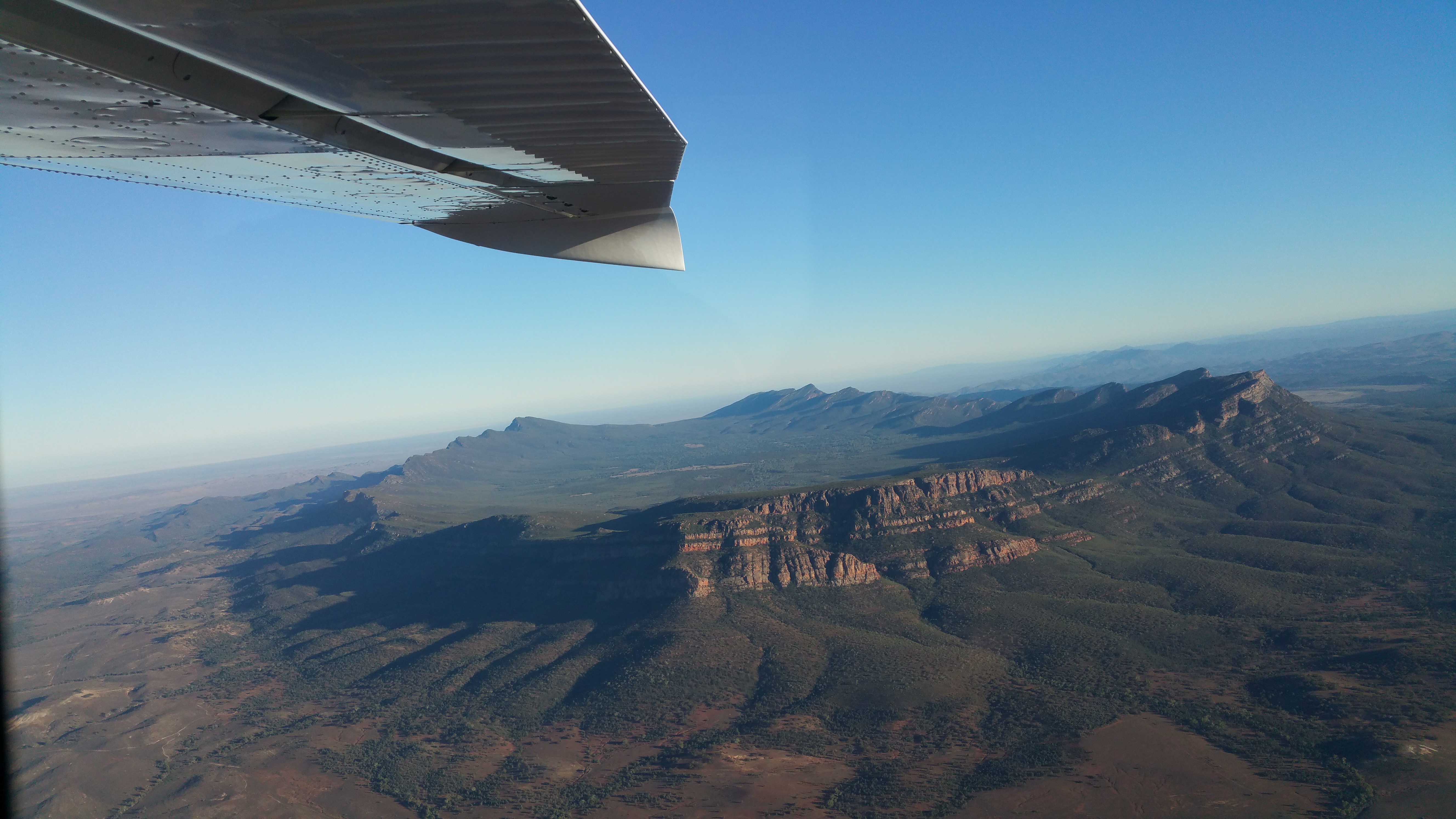
The Razlog Valley () is a valley in southwestern Bulgaria, Blagoevgrad Province, containing the Razlog, Bansko, and Belitsa municipalities. It is bounded by the Rila Mountains to the north and northwest, the Pirin Mountains to the south and southwest, and the Rhodope Mountains to the east. The transitional continental Mediterranean climate and nature of the valley are influenced by both the high alpine mountain “walls” of Rila and Pirin and the vast and wild Rhodopes, and the warm Mediterranean climate of the Aegean Sea entering from the south via the Mesta river course. It is home to Bansko, a renowned winter resort center and one of the top tourist destinations in Bulgaria. Another popular ski center is Semkovo. The valley is a syncline representing a structural sedimentary basin with an average altitude of the valley bottom of more than 800 m. The highest mountain ridges surrounding the valley reach almost 3000 m, and are rich in glacial landforms. In its northeastern ... [...More Info...] [...Related Items...] OR: [Wikipedia] [Google] [Baidu] |
Razlog Kapustin Ifb
Razlog ( ) is a town and ski resort in Razlog Municipality, Blagoevgrad Province in southwestern Bulgaria. It is situated in the Razlog Valley and was first mentioned during the reign of Byzantine emperor Basil II. The municipality The municipality of Razlog comprises the villages of Banya, Gorno Draglishte, Dobarsko, Bachevo, Godlevo, and Eleshnitsa with a total population of 20,410. Dobarsko, located on the southern slopes of Rila, is home to several historical landmarks. The Church of Theodore Tyro and Theodore Stratelates is a national monument of culture. The church has an abundance of original murals and frescoes, including ones depicting Jesus Christ in what some observers claim to be a rocket. The icons in the tzar (king) row of the church "Sretenie Gospodne" (1860) were painted by Simeon D. Molerov, a representative of the Bansko Painting School. History During his 1894–1896 trip in the region of Macedonia, Bulgarian geographer Vasil Kanchov visited Razlog (then ... [...More Info...] [...Related Items...] OR: [Wikipedia] [Google] [Baidu] |
Structural Basin
A structural basin is a large-scale structural geology, structural formation of rock stratum, strata formed by tectonics, tectonic warping (Fold (geology), folding) of previously flat-lying strata into a syncline fold. They are geological depression (geology), depressions, the inverse of dome (geology), domes. Elongated structural basins are a type of geological Trough (geology), trough. Some structural basins are sedimentary basins, aggregations of sediment that filled up a depression or accumulated in an area; others were formed by tectonic events long after the sedimentary layers were deposited. Basins may appear on a geologic map as roughly circular or elliptical, with concentric layers. Because the strata dip toward the center, the exposed strata in a basin are progressively younger from the outside in, with the youngest rocks in the center. Basins are often large in areal extent, often hundreds of kilometers across. Structural basins are often important sources of coal, ... [...More Info...] [...Related Items...] OR: [Wikipedia] [Google] [Baidu] |
Gorno Kraishte
Gorno Kraishte () is a village in the municipality of Belitsa, in Blagoevgrad Province, Bulgaria. It is located approximately 6 kilometers south of Belitsa and 90 kilometers southeast from Sofia. As of 2010 it had a population of 1176 people. The population is Muslim of pomak origin. Geography and climate The terrain is mountainous and hilly, covering parts of Western Rila and Rhodope Mountains and the valley in the upper reaches of the Mesta River. The average altitude is 850 meters. The climate is transitional continental with an average annual temperature is 8 °C. Winters are cold, with an average January temperature of just -2 °C. The snow cover lasts about 150 days a year, with increasing altitude and increasing the number of days with snow cover. Summer is short and cool with average temperatures in July around 18 °C. The three majestic mountains, among which it is located - Rila, Pirin and the Rhodope have a unique history and folklore. Gorno Kraishte has t ... [...More Info...] [...Related Items...] OR: [Wikipedia] [Google] [Baidu] |
Kraishte, Blagoevgrad Province
Kraishte () is a village in the municipality of Belitsa, in Blagoevgrad Province, Bulgaria. It is located approximately 4 kilometers south from Belitsa and 88 kilometers southeast from Sofia. As of 2010 it had a population of 2375 people. The population is Muslim of pomak origin. The village is situated on the eastern bank of Mesta river on the secondary road from Razlog to Velingrad Velingrad ( ) is a town in Pazardzhik Province, Southern Bulgaria, located at the western end of Chepino Valley, part of the Rhodope Mountains. It is the administrative center of the homonymous Velingrad Municipality and one of the most po ... and on the Septemvri-Dobrinishte narrow gauge line. The station of Belitsa is actually in the village of Kraishte. The village has central water supply and sewerage. The electricity is provided by aerial wires. There is a primary school "Peyo Yavorov" and a public library and a post office. References Villages in Blagoevgrad Province {{Bla ... [...More Info...] [...Related Items...] OR: [Wikipedia] [Google] [Baidu] |
Eleshnitsa, Blagoevgrad Province
Eleshnitsa is a village in Razlog Municipality, in Blagoevgrad Province, Bulgaria Bulgaria, officially the Republic of Bulgaria, is a country in Southeast Europe. It is situated on the eastern portion of the Balkans directly south of the Danube river and west of the Black Sea. Bulgaria is bordered by Greece and Turkey t .... Accessed May 5, 2010 References Villages in Blagoevgrad Province {{Blagoevgrad-geo-stub ...[...More Info...] [...Related Items...] OR: [Wikipedia] [Google] [Baidu] |
Gorno Draglishte
Gorno Draglishte is a village in Razlog Municipality, in Blagoevgrad Province, Bulgaria Bulgaria, officially the Republic of Bulgaria, is a country in Southeast Europe. It is situated on the eastern portion of the Balkans directly south of the Danube river and west of the Black Sea. Bulgaria is bordered by Greece and Turkey t .... This small mountain village at the foot of the Rila Mountain is surrounded by the Pirin and the Rhodopes. Gorno Draglishte is becoming a tourist attraction for both Bulgarians and foreigners. Nowadays it has a population of approximately 1,000 people. According to the earliest written evidence, the village exists at least since 1576 CE. References Villages in Blagoevgrad Province {{Blagoevgrad-geo-stub ... [...More Info...] [...Related Items...] OR: [Wikipedia] [Google] [Baidu] |
Dobarsko
Dobarsko ( ) is a village in southwestern Bulgaria, part of Razlog Municipality, Blagoevgrad Province. It is set at 1,070 m above sea level on the southern slopes of Rila with the westernmost Rhodope Mountains to the east and Pirin to the south near the valley of the Mesta River. Dobarsko is 80 km from Blagoevgrad and 17 km from the winter resort Bansko. the village has a population of 672 and about 200 houses, the mayor being Nikola Naydenov. History According to the legend, Dobarsko was founded by soldiers from List of Bulgarian monarchs, Bulgarian tsar Samuil of Bulgaria, Samuil's blinded army after the Battle of Belasitsa in 1014, who arrived in the area en route to the Rila Monastery and discovered a holy spring that allegedly cured them. Dobarsko is first mentioned in Tsar Ivan Shishman of Bulgaria, Ivan Shishman's donor's charter from the Rila Monastery in 1378. During the Ottoman rule of Bulgaria Dobarsko established itself as the most important and richest vill ... [...More Info...] [...Related Items...] OR: [Wikipedia] [Google] [Baidu] |
Bachevo
Village of Bachevo is located in South-Western planning region of Bulgaria. It is part of Razlog Municipality, Blagoevgrad Province. Accessed December 25, 2015 Situated at South-western Bulgaria in the (6 km. north-western from town, 52 km. south-eastern from city, and 156 km. south from |
Banya, Blagoevgrad Province
Banya is a village in Razlog Municipality, in Blagoevgrad Province, Bulgaria, in Guide Bulgaria, Accessed February 23, 2015 laying 4 km to the east of the town of and at about the same distance to the north of the ski resort of .Banya in Guide Bulgaria, Accessed February 23, 2015 Banya was first settled by the |
Razlog
Razlog ( ) is a town and ski resort in Razlog Municipality, Blagoevgrad Province in southwestern Bulgaria. It is situated in the Razlog Valley and was first mentioned during the reign of Byzantine emperor Basil II. The municipality The municipality of Razlog comprises the villages of Banya, Gorno Draglishte, Dobarsko, Bachevo, Godlevo, and Eleshnitsa with a total population of 20,410. Dobarsko, located on the southern slopes of Rila, is home to several historical landmarks. The Church of Theodore Tyro and Theodore Stratelates is a national monument of culture. The church has an abundance of original murals and frescoes, including ones depicting Jesus Christ in what some observers claim to be a rocket. The icons in the tzar (king) row of the church "Sretenie Gospodne" (1860) were painted by Simeon D. Molerov, a representative of the Bansko Painting School. History During his 1894–1896 trip in the region of Macedonia, Bulgarian geographer Vasil Kanchov visited Razlog ... [...More Info...] [...Related Items...] OR: [Wikipedia] [Google] [Baidu] |
Dobrinishte
Dobrinishte ( ) is a small town and ski resort in the Blagoevgrad Province, Bansko Municipality, southwestern Bulgaria. it had 2973 inhabitants. It is located 6 km east of Bansko, a famous winter resort. It has an altitude of 850 m and is surrounded by the Rila, Pirin, and Rhodope mountains. Dobrinishte offers good conditions for both winter and summer tourism: beautiful nature, hospitable population, ski runs, mineral waters and opportunities for rural and ecotourism. According to legends and song, between 6th and 15th century Dobrinishte was a Bulgarian stronghold which halted the Byzantines from invading the country from the valley of the Mesta River. Dobrinishte is also a terminal station of the scenic Septemvri-Dobrinishte narrow gauge line from Septemvri Septemvri (, , ) is a town in Pazardzhik Province, southern Bulgaria. It is the administrative center of homonymous Septemvri Municipality. As of 2024 the town had a population of 8,071. Geography The town ... [...More Info...] [...Related Items...] OR: [Wikipedia] [Google] [Baidu] |
Belitsa
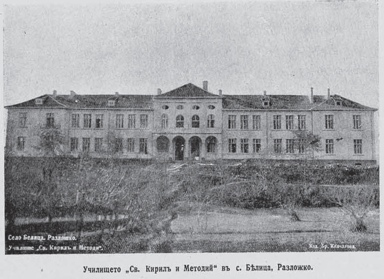
BelitsaTown of Belitsa, Municipality Belitsa, District Blagoevgrad at Guide-Bulgaria.com ( ) is a town in southwestern Bulgaria, located in the Belitsa Municipality of the province of Blagoevgrad. Geography Belitsa is close to the municipalities of Razlog, Yakoruda, and[...More Info...] [...Related Items...] OR: [Wikipedia] [Google] [Baidu] |


