|
Rapanui Rock
Shag Rock, also known as Rapanui, is a notable sea stack that marks the entrance of the Avon Heathcote Estuary near Christchurch, New Zealand. It is a prominent landmark for navigators at sea as well as travelers on the road to Sumner. The rock stands close to the southern shore just above the low tide level. In the February 2011 Christchurch earthquake it shattered and the remains, which are still easily seen from the road, have, with dark humour by some locals, been called "''Shag Pile''" (a pun referencing the style of carpet). Although no longer used by shipping, the estuary is accessible as far as Ferrymead using shallow draught vessels up to about 30 tons if the bar is crossed in favourable wind, sea and tidal conditions. The shipping channel into the estuary lies to the northern side of the rock. Toponymy Rapanui is the Māori name for the "''black, tooth-like rock''" on the beach at the mouth of the Avon-Heathcote Estuary, according to James Cowan when he retold a 200 ... [...More Info...] [...Related Items...] OR: [Wikipedia] [Google] [Baidu] |
Shag Rock
Shag Rock may refer to the following places: * Shag Rock (Antarctica) * Shag Rock (California), United States * Rapanui Rock, also called "Shag Rock", located in New Zealand * Shag Rock (Houtman Abrolhos), Australia See also * Shag Rock (band), Australian band formed in 2011 * Shag Rocks (other) Shag Rocks may refer to: * Shag Rocks (Massachusetts) * Shag Rocks, South Georgia The Shag Rocks ( es, Islas Aurora) are six small islets, as opposed to islands, in the westernmost extreme of South Georgia, west of the main island of South ... * Shag Reef, Tasmania, Australia {{geodis ... [...More Info...] [...Related Items...] OR: [Wikipedia] [Google] [Baidu] |
Tide
Tides are the rise and fall of sea levels caused by the combined effects of the gravity, gravitational forces exerted by the Moon (and to a much lesser extent, the Sun) and are also caused by the Earth and Moon orbiting one another. Tide tables can be used for any given locale to find the predicted times and amplitude (or "tidal range"). The predictions are influenced by many factors including the alignment of the Sun and Moon, the #Phase and amplitude, phase and amplitude of the tide (pattern of tides in the deep ocean), the amphidromic systems of the oceans, and the shape of the coastline and near-shore bathymetry (see ''#Timing, Timing''). They are however only predictions, the actual time and height of the tide is affected by wind and atmospheric pressure. Many shorelines experience semi-diurnal tides—two nearly equal high and low tides each day. Other locations have a diurnal cycle, diurnal tide—one high and low tide each day. A "mixed tide"—two uneven magnitude ... [...More Info...] [...Related Items...] OR: [Wikipedia] [Google] [Baidu] |
Rock Formations Of Canterbury, New Zealand
Rock most often refers to: * Rock (geology), a naturally occurring solid aggregate of minerals or mineraloids * Rock music, a genre of popular music Rock or Rocks may also refer to: Places United Kingdom * Rock, Caerphilly, a location in Wales * Rock, Cornwall, a village in England * Rock, County Tyrone, a village in Northern Ireland * Rock, Devon, a location in England * Rock, Neath Port Talbot, a location in Wales * Rock, Northumberland, a village in England * Rock, Somerset, a location in Wales * Rock, West Sussex, a hamlet in Washington, England * Rock, Worcestershire, a village and civil parish in England United States * Rock, Kansas, an unincorporated community * Rock, Michigan, an unincorporated community * Rock, West Virginia, an unincorporated community * Rock, Rock County, Wisconsin, a town in southern Wisconsin * Rock, Wood County, Wisconsin, a town in central Wisconsin Elsewhere * Corregidor, an island in the Philippines also known as "The Rock" * Jamaica, an isl ... [...More Info...] [...Related Items...] OR: [Wikipedia] [Google] [Baidu] |
Uninhabited Islands Of New Zealand
The list of uninhabited regions includes a number of places around the globe. The list changes year over year as human beings migrate into formerly uninhabited regions, or migrate out of formerly inhabited regions. List As a group, the list of uninhabited places are called the "nonecumene". This is a special geography term which means the uninhabited area of the world. * Virtually all of the Ocean *Virtually all of Antarctica *Most of The Arctic *Most of Greenland *Most of The Sahara * Antipodes Islands * Ashmore and Cartier Islands * Bajo Nuevo Bank * Baker Island * Ball's Pyramid * Balleny Islands * Big Major Cay * Bouvet Island * Much of the interior of Brazil * Caroline Island * Clipperton Island * The semi-arid regions and deserts of Australia * Devon Island * Much of Eastern Oregon * Elephant Island * Elobey Chico * Ernst Thälmann Island * Much of Fiordland, New Zealand * Goa Island * Gough Island * Hans Island * Harmil * Hashima Island * Hatutu * Heard Island a ... [...More Info...] [...Related Items...] OR: [Wikipedia] [Google] [Baidu] |
Geography Of Christchurch
Christchurch ( ; mi, Ōtautahi) is the largest city in the South Island of New Zealand and the seat of the Canterbury Region. Christchurch lies on the South Island's east coast, just north of Banks Peninsula on Pegasus Bay. The Avon River / Ōtākaro flows through the centre of the city, with an urban park along its banks. The city's territorial authority population is people, and includes a number of smaller urban areas as well as rural areas. The population of the urban area is people. Christchurch is the second-largest city by urban area population in New Zealand, after Auckland. It is the major urban area of an emerging sub-region known informally as Greater Christchurch. Notable smaller urban areas within this sub-region include Rangiora and Kaiapoi in Waimakariri District, north of the Waimakariri River, and Rolleston and Lincoln in Selwyn District to the south. The first inhabitants migrated to the area sometime between 1000 and 1250 AD. They hunted moa, which led ... [...More Info...] [...Related Items...] OR: [Wikipedia] [Google] [Baidu] |
List Of Islands
This is a list of the lists of islands in the world grouped by country, by continent, by body of water A body of water or waterbody (often spelled water body) is any significant accumulation of water on the surface of Earth or another planet. The term most often refers to oceans, seas, and lakes, but it includes smaller pools of water such a ..., and by other classifications. For rank-order lists, see the other lists of islands below. Lists of islands by country Africa Antarctica Asia Europe North America Oceania South America Lists of islands by continent Lists of islands by body of water By ocean: By other bodies of water: List of ancient islands Other lists of islands External links Island Superlatives {{DEFAULTSORT:List Of Islands * ... [...More Info...] [...Related Items...] OR: [Wikipedia] [Google] [Baidu] |
Desert Island
A desert island, deserted island, or uninhabited island, is an island, islet or atoll that is not permanently populated by humans. Uninhabited islands are often depicted in films or stories about shipwrecked people, and are also used as stereotypes for the idea of "paradise". Some uninhabited islands are protected as nature reserves, and some are privately owned. Devon Island in Canada's far north is the largest uninhabited island in the world. Small coral atolls or islands usually have no source of fresh water, but occasionally a freshwater lens can be reached with a well. Terminology Uninhabited islands are sometimes also called "deserted islands" or "desert islands". In the latter, the adjective '' desert'' connotes not desert climate conditions, but rather "desolate and sparsely occupied or unoccupied". The word ''desert'' has been "formerly applied more widely to any wild, uninhabited region, including forest-land", and it is this archaic meaning that appears in the p ... [...More Info...] [...Related Items...] OR: [Wikipedia] [Google] [Baidu] |
Auckland Art Gallery
Auckland Art Gallery Toi o Tāmaki is the principal public gallery in Auckland, New Zealand. It has the most extensive collection of national and international art in New Zealand and frequently hosts travelling international exhibitions. Set below the hilltop Albert Park in the central-city area of Auckland, the gallery was established in 1888 as the first permanent art gallery in New Zealand. The building originally housed both the Auckland Art Gallery and the Auckland public library, and opened with collections donated by benefactors Governor Sir George Grey and James Tannock Mackelvie. This was the second public art gallery in New Zealand, after the Dunedin Public Art Gallery, which opened three years earlier in 1884. Wellington's New Zealand Academy of Fine Arts opened in 1892 and a Wellington Public Library in 1893. In 2009, it was announced that the museum received a donation from American businessman Julian Robertson, valued at over $100 million, the largest ever o ... [...More Info...] [...Related Items...] OR: [Wikipedia] [Google] [Baidu] |
William Travers (New Zealand Politician)
William Thomas Locke Travers (January 1819 – 23 April 1903) was a New Zealand lawyer, politician, explorer, and naturalist. Early life Travers was born near Newcastle West, County Limerick, Ireland, either on 9 or 19 January 1819. His father chose to retire to France, and Travers was consequently brought up there. He was educated in Saint-Malo, a town in Brittany. In 1835, he joined the British military, and was part of the British Auxiliary Legion that fought in Spain's First Carlist War. After his military service ended, Travers became a lawyer. In 1849, he and his family moved to Nelson, New Zealand, where he continued to practice law. Later, he also lived in Christchurch and Wellington. He purchased Englefield Lodge in Christchurch in 1866 and sold the property in 1872 to Edward Stevens. Political career Travers' political career covered both national and provincial politics. He was a member of the 1st New Zealand Parliament, representing first the Town of Ne ... [...More Info...] [...Related Items...] OR: [Wikipedia] [Google] [Baidu] |
February 2011 Christchurch Earthquake
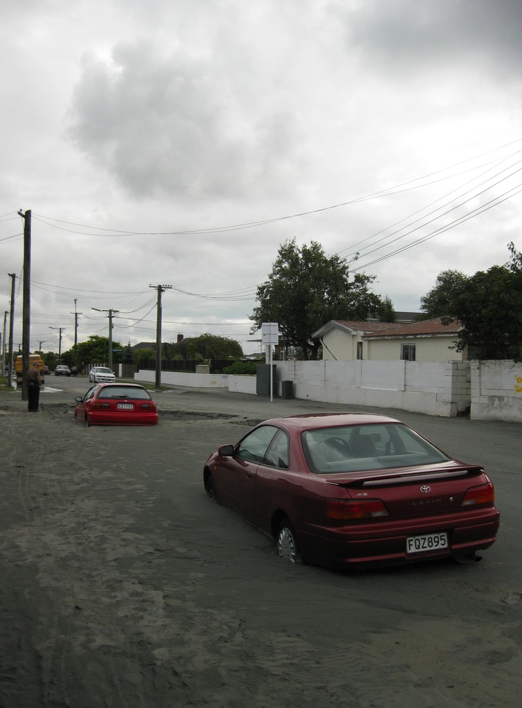
A major earthquake occurred in Christchurch on Tuesday 22 February 2011 at 12:51 p.m. local time (23:51 UTC, 21 February). The () earthquake struck the entire of the Canterbury region in the South Island, centred south-east of the central business district. It caused widespread damage across Christchurch, killing 185 people, in New Zealand's fifth-deadliest disaster. Christchurch's central city and eastern suburbs were badly affected, with damage to buildings and infrastructure already weakened by the magnitude 7.1 Canterbury earthquake of 4 September 2010 and its aftershocks. Significant liquefaction affected the eastern suburbs, producing around 400,000 tonnes of silt. The earthquake was felt across the South Island and parts of the lower and central North Island. While the initial quake only lasted for approximately 10 seconds, the damage was severe because of the location and shallowness of the earthquake's focus in relation to Christchurch as well as ... [...More Info...] [...Related Items...] OR: [Wikipedia] [Google] [Baidu] |
Christchurch City Council
The Christchurch City Council is the local government authority for Christchurch in New Zealand. It is a territorial authority elected to represent the people of Christchurch. Since October 2022, the Mayor of Christchurch is Phil Mauger, who succeeded after the retirement of Lianne Dalziel. The council currently consists of 16 councillors elected from sixteen wards, and is presided over by the mayor, who is elected at large. The number of elected members and ward boundaries changed prior during the 2016 election. History As a result of the 1989 local government reforms, on 1 November 1989 Christchurch City Council took over the functions of the former Christchurch City Council, Heathcote County Council, Riccarton Borough Council, Waimairi District Council, part of Paparua County Council, and the Christchurch Drainage Board. On 6 March 2006, Banks Peninsula District Council merged with Christchurch City Council. Councillor Yani Johanson campaigned since 2010 to live-strea ... [...More Info...] [...Related Items...] OR: [Wikipedia] [Google] [Baidu] |
Christchurch Art Gallery
The Christchurch Art Gallery Te Puna o Waiwhetū, commonly known as the Christchurch Art Gallery, is the public art gallery of the city of Christchurch, New Zealand. It has its own substantial art collection and also presents a programme of New Zealand and international exhibitions. It is funded by Christchurch City Council. The gallery opened on 10 May 2003, replacing the city's previous public art gallery, the Robert McDougall Art Gallery, which had opened in 1932. The Māori elements of the name are explained as follows: honours waipuna, the artesian spring beneath the gallery and refers to one of the tributaries in the immediate vicinity, which flows into the River Avon. may also be translated as ‘water in which stars are reflected’. History The previous public art gallery, the Robert McDougall Art Gallery, opened on 16 June 1932 and closed on 16 June 2002. It was located in the Christchurch Botanic Gardens, adjacent to Canterbury Museum, where the building still sta ... [...More Info...] [...Related Items...] OR: [Wikipedia] [Google] [Baidu] |


.jpg)


