|
Rancho Valle De San Felipe
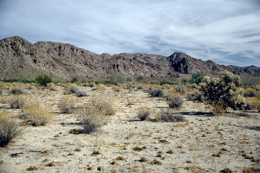
Rancho Valle de San Felipe was a Mexican land grant in present-day San Diego County, California given in 1846 by Governor Pío Pico to Felipe Castillo. The grant was located in the San Felipe Valley in the Laguna Mountains east of present-day Julian. History The three square league Rancho Valle de San Felipe was granted to Felipe Castillo in 1846. On his death in 1848, Castillo left the land to his four children (brothers, Loreto, Manuel, and Refugio, and sister Elena). The heirs sold the rancho to John Forster in 1850. John Forster (1815–1882), born in England, came to California in 1833. In 1837, he married Ysidora Pico, sister of Pío and Andrés Pico. John Forster was the grantee of Rancho de la Nación and later owner of the Rancho Santa Margarita y Las Flores. With the cession of California to the United States following the Mexican-American War, the 1848 Treaty of Guadalupe Hidalgo provided that the land grants would be honored. As required by the Land Act ... [...More Info...] [...Related Items...] OR: [Wikipedia] [Google] [Baidu] |
Ranchos Of California
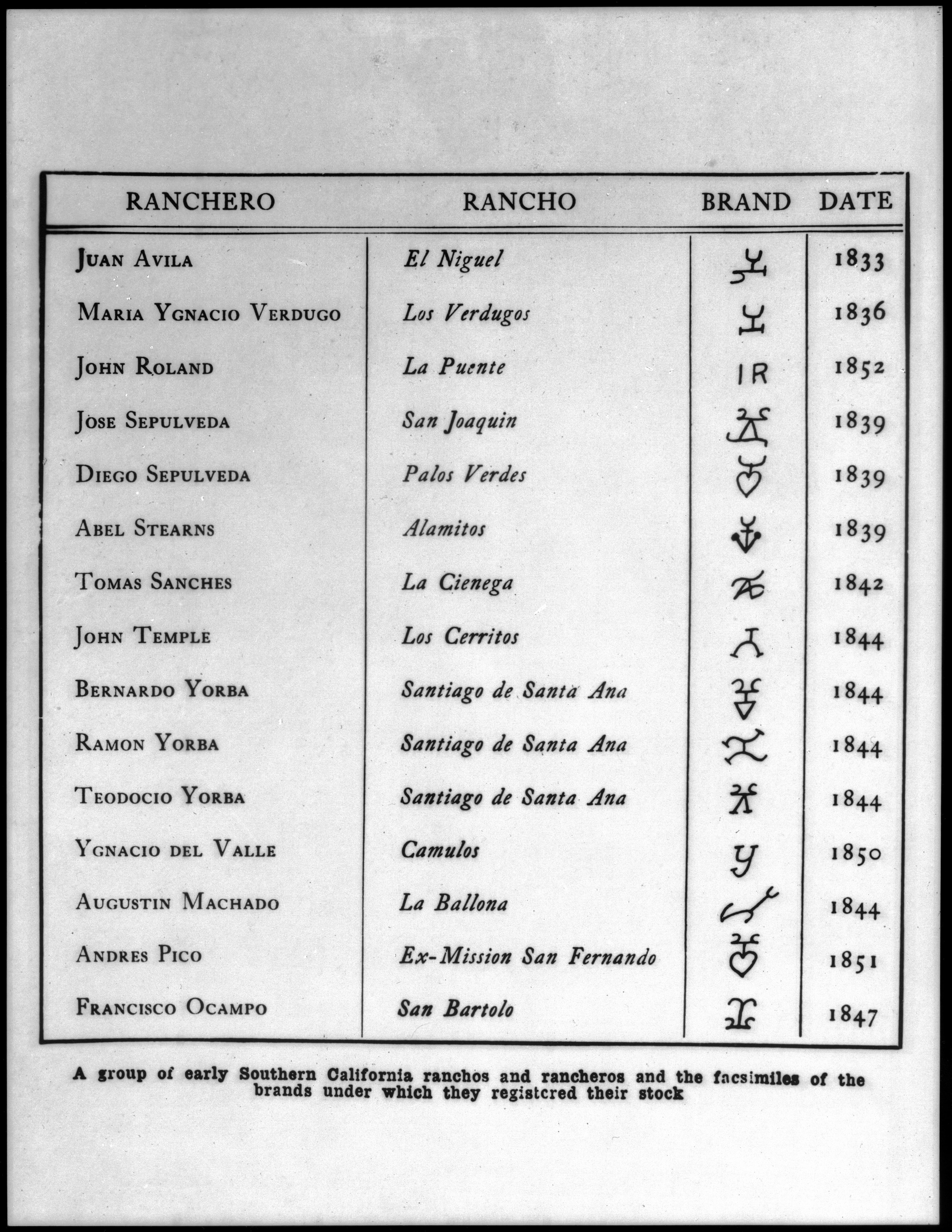
The Spanish and Mexican governments made many concessions and land grants in Alta California (now known as California) and Baja California from 1775 to 1846. The Spanish Concessions of land were made to retired soldiers as an inducement for them to remain in the frontier. These Concessions reverted to the Spanish crown upon the death of the recipient. The Mexican government later encouraged settlement by issuing much larger land grants to both native-born and naturalized Mexican citizens. The grants were usually two or more square leagues, or in size. Unlike Spanish Concessions, Mexican land grants provided permanent, unencumbered ownership rights. Most ranchos granted by Mexico were located along the California coast around San Francisco Bay, inland along the Sacramento River, and within the San Joaquin Valley. When the government secularized the Mission churches in 1833, they required that land be set aside for each Neophyte family. But the Native Americans were quickly ... [...More Info...] [...Related Items...] OR: [Wikipedia] [Google] [Baidu] |
Colorado Desert
California's Colorado Desert is a part of the larger Sonoran Desert. It encompasses approximately , including the heavily irrigated Coachella and Imperial valleys. It is home to many unique flora and fauna. Geography and geology The Colorado Desert is a subdivision of the larger Sonoran Desert encompassing approximately . The desert encompasses Imperial County and includes parts of San Diego County, Riverside County, and a small part of San Bernardino County, California, United States. Most of the Colorado Desert lies at a relatively low elevation, below , with the lowest point of the desert floor at below sea level, at the Salton Sea. Although the highest peaks of the Peninsular Ranges reach elevations of nearly , most of the region's mountains do not exceed . In this region, the geology is dominated by the transition of the tectonic plate boundary from rift to fault. The southernmost strands of the San Andreas Fault connect to the northernmost extensions of the East Pacif ... [...More Info...] [...Related Items...] OR: [Wikipedia] [Google] [Baidu] |
Former Settlements In San Diego County, California
A former is an object, such as a template, gauge or cutting die, which is used to form something such as a boat's hull. Typically, a former gives shape to a structure that may have complex curvature. A former may become an integral part of the finished structure, as in an aircraft fuselage, or it may be removable, being using in the construction process and then discarded or re-used. Aircraft formers Formers are used in the construction of aircraft fuselage, of which a typical fuselage has a series from the nose to the empennage, typically perpendicular to the longitudinal axis of the aircraft. The primary purpose of formers is to establish the shape of the fuselage and reduce the column length of stringers to prevent instability. Formers are typically attached to longerons, which support the skin of the aircraft. The "former-and-longeron" technique (also called stations and stringers) was adopted from boat construction, and was typical of light aircraft built until the ad ... [...More Info...] [...Related Items...] OR: [Wikipedia] [Google] [Baidu] |
Ranchos Of San Diego County, California
Rancho or Ranchos may refer to: Settlements and communities *Rancho, Aruba, former fishing village and neighbourhood of Oranjestad *Ranchos of California, 19th century land grants in Alta California **List of California Ranchos *Ranchos, Buenos Aires in Argentina Schools *Rancho Christian School in Temecula, California *Rancho High School in North Las Vegas, Nevada *Rancho San Joaquin Middle School in Irvine, California *Rancho Solano Preparatory School in Scottsdale, Arizona *Rancho Verde High School in Moreno Valley, California Film *Rancho, a character in the Bollywood film ''3 Idiots'' *Rancho (monkey), an Indian monkey animal actor Other *Rancho, a shock absorber brand by Tenneco Automotive * Rancho carnavalesto or Rancho, a type of dance club from Rio de Janeiro, Brazil *Rancho Los Amigos National Rehabilitation Center or Rancho *Rancho Point, a rock headland in the South Shetland Islands *Matra Rancho or Rancho, an early French leisure activity vehicle See also * * *El ... [...More Info...] [...Related Items...] OR: [Wikipedia] [Google] [Baidu] |
California Ranchos
The Spanish and Mexican governments made many concessions and land grants in Alta California (now known as California) and Baja California from 1775 to 1846. The Spanish Concessions of land were made to retired soldiers as an inducement for them to remain in the frontier. These Concessions reverted to the Spanish crown upon the death of the recipient. The Mexican government later encouraged settlement by issuing much larger land grants to both native-born and naturalized Mexican citizens. The grants were usually two or more square leagues, or in size. Unlike Spanish Concessions, Mexican land grants provided permanent, unencumbered ownership rights. Most ranchos granted by Mexico were located along the California coast around San Francisco Bay, inland along the Sacramento River, and within the San Joaquin Valley. When the government secularized the Mission churches in 1833, they required that land be set aside for each Neophyte family. But the Native Americans were quickly ... [...More Info...] [...Related Items...] OR: [Wikipedia] [Google] [Baidu] |
List Of Ranchos Of California
These California land grants were made by Spanish (1784–1821) and Mexican (1822–1846) authorities of Las Californias and Alta California to private individuals before California became part of the United States of America.Shumway, Burgess M.,1988, ''California Ranchos: Patented Private Land Grants Listed by County'', The Borgo Press, San Bernardino, CA, Under Spain, no private land ownership was allowed, so the grants were more akin to free leases. After Mexico achieved independence, the Spanish grants became actual land ownership grants. Following the Mexican–American War, the 1848 Treaty of Guadalupe Hidalgo provided that the land grants would be honored. Alta California ranchos in Mexico From 1773 to 1836, the border between Alta California and Baja California was about 30 miles south of the Mexico–United States border drawn by the Treaty of Guadalupe Hidalgo that ended the Mexican–American War in 1848. Under the Siete Leyes constitutional reforms of 1836, the Alt ... [...More Info...] [...Related Items...] OR: [Wikipedia] [Google] [Baidu] |
New Mexico Territory
The Territory of New Mexico was an organized incorporated territory of the United States from September 9, 1850, until January 6, 1912. It was created from the U.S. provisional government of New Mexico, as a result of ''Santa Fe de Nuevo México, Nuevo México'' becoming part of the American frontier after the Treaty of Guadalupe Hidalgo. It existed with varying boundaries until the territory was admitted to the Union as the U.S. state of New Mexico. This jurisdiction was an organized, incorporated territory of the US for nearly 62 years, the longest period of any territory in the contiguous United States. Before the territory was organized In 1846, during the Mexican–American War, the United States established U.S. provisional government of New Mexico, a provisional government of New Mexico. Territorial boundaries were somewhat ambiguous. After the Mexican Republic formally ceded the region to the United States in 1848, this temporary wartime/military government operated u ... [...More Info...] [...Related Items...] OR: [Wikipedia] [Google] [Baidu] |
Arizona Territory
The Territory of Arizona (also known as Arizona Territory) was a territory of the United States that existed from February 24, 1863, until February 14, 1912, when the remaining extent of the territory was admitted to the Union as the state of Arizona. It was created from the western half of the New Mexico Territory during the American Civil War. History Following the expansion of the New Mexico Territory in 1853, as a result of the Gadsden Purchase, several proposals for a division of the territory and the organization of a separate Territory of Arizona in the southern half of the territory were advanced as early as 1856. These proposals arose from concerns about the ability of the territorial government in Santa Fe to effectively administer the newly acquired southern portions of the territory. The first proposal dates from a conference held in Tucson that convened on August 29, 1856. The conference issued a petition to the U.S. Congress, signed by 256 people, requesting ... [...More Info...] [...Related Items...] OR: [Wikipedia] [Google] [Baidu] |
Union Army
During the American Civil War, the Union Army, also known as the Federal Army and the Northern Army, referring to the United States Army, was the land force that fought to preserve the Union (American Civil War), Union of the collective U.S. state, states. It proved essential to the preservation of the United States as a working, viable republic. The Union Army was made up of the permanent Regular Army (United States), regular army of the United States, but further fortified, augmented, and strengthened by the many temporary units of dedicated United States Volunteers, volunteers, as well as including those who were drafted in to service as Conscription in the United States, conscripts. To this end, the Union Army fought and ultimately triumphed over the efforts of the Confederate States Army in the American Civil War. Over the course of the war, 2,128,948 men enlisted in the Union Army, including 178,895 United States Colored Troops, colored troops; 25% of the white men who s ... [...More Info...] [...Related Items...] OR: [Wikipedia] [Google] [Baidu] |
American Civil War
The American Civil War (April 12, 1861 – May 26, 1865; also known by other names) was a civil war in the United States. It was fought between the Union ("the North") and the Confederacy ("the South"), the latter formed by states that had seceded. The central cause of the war was the dispute over whether slavery would be permitted to expand into the western territories, leading to more slave states, or be prevented from doing so, which was widely believed would place slavery on a course of ultimate extinction. Decades of political controversy over slavery were brought to a head by the victory in the 1860 U.S. presidential election of Abraham Lincoln, who opposed slavery's expansion into the west. An initial seven southern slave states responded to Lincoln's victory by seceding from the United States and, in 1861, forming the Confederacy. The Confederacy seized U.S. forts and other federal assets within their borders. Led by Confederate President Jefferson Davis, ... [...More Info...] [...Related Items...] OR: [Wikipedia] [Google] [Baidu] |
Vallecito, San Diego County, California
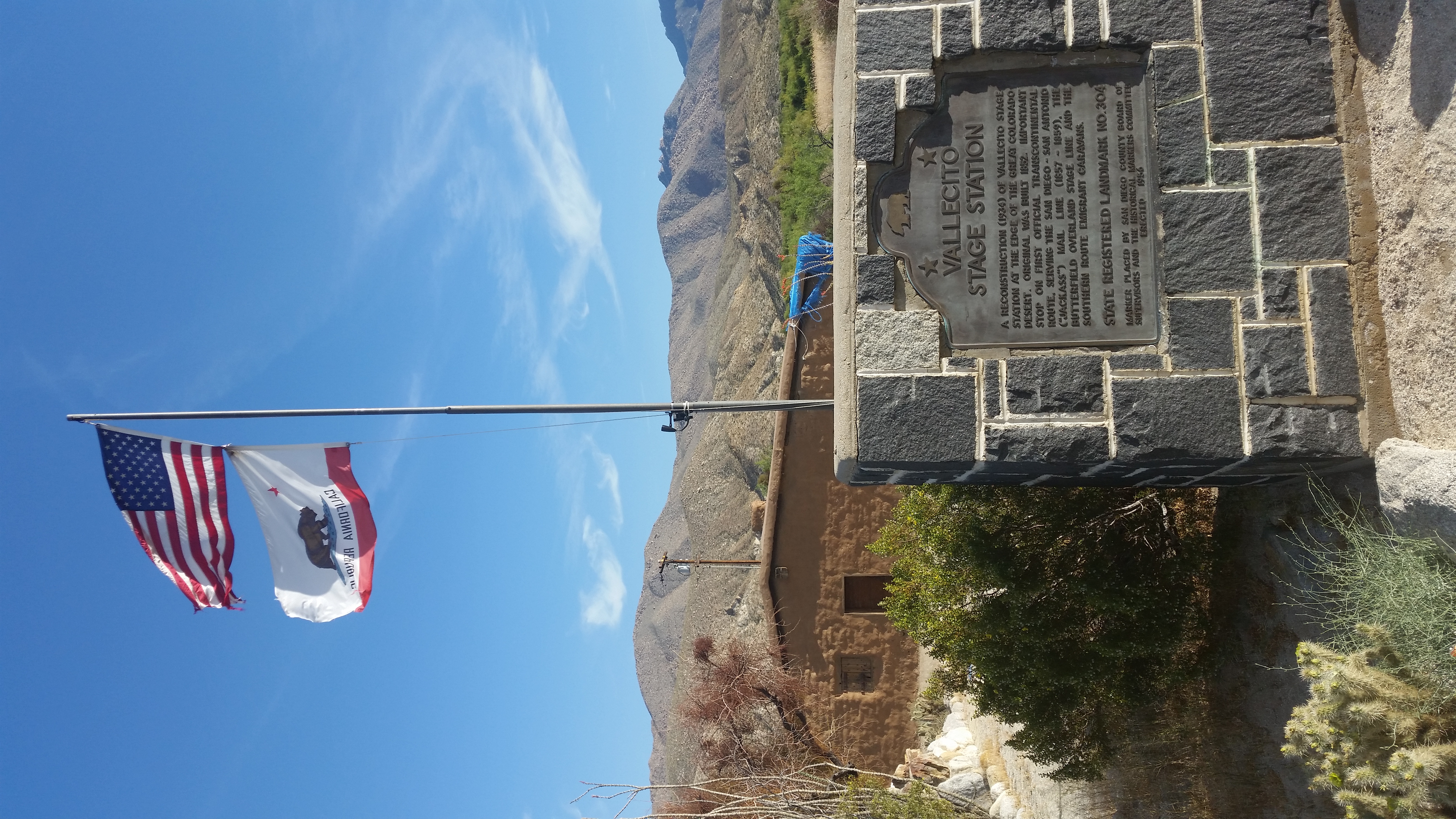
Vallecito, in San Diego County, California is an oasis of cienegas and salt grass along Vallecito Creek and a former settlement on the edge of the Colorado Desert in the Vallecito Valley. Its Spanish name is translated as "little valley". Vallecito was located at the apex of the gap in the Carrizo Badlands created by Carrizo Creek and its wash in its lower reach, to which Vallecito Creek is a tributary. The springs of Vallecito, like many in the vicinity, are a product of the faults that run along the base of the Peninsular Ranges to the west. Once a seasonal village of the native Kumeyaay people, on a trail across the desert from the Colorado River, this oasis became a crucial stopping place for Spanish and then Mexican travelers to recover from the desert crossing between Sonora and New Mexico to California. Later it also served the same function for American soldiers, 49ers and their herds of animals being driven to the goldfields on the Southern Emigrant Trail. The non ... [...More Info...] [...Related Items...] OR: [Wikipedia] [Google] [Baidu] |
Fort Yuma
Fort Yuma was a fort in California located in Imperial County, across the Colorado River from Yuma, Arizona. It was on the Butterfield Overland Mail route from 1858 until 1861 and was abandoned May 16, 1883, and transferred to the Department of the Interior. The Fort Yuma Indian School and the Saint Thomas Yuma Indian Mission now occupy the site. It is one of the "associated sites" listed as Yuma Crossing and Associated Sites on the National Register of Historic Places in the Yuma Crossing National Heritage Area. In addition, it is registered as California Historical Landmark #806. History Pre-Civil War First established after the end of the Mexican–American War (1848), the fort was originally located in the bottoms near the Colorado River, less than a mile below the mouth of the Gila River. It was constructed to defend the newly settled community of Yuma, New Mexico Territory, located on the other side of the Colorado River, and the nearby Mexican border. In March 1851 the p ... [...More Info...] [...Related Items...] OR: [Wikipedia] [Google] [Baidu] |


