|
Rancho Cañada De La Segunda
Rancho Cañada de la Segunda was a Mexican land grant in present-day Monterey County, California given in 1839 by Governor José Castro to Lazaro Soto. The grant extended along the north bank of the Carmel River, from the Pacific coast and present day Carmel-by-the-Sea up into the Carmel Valley. History Lazaro Soto's grandfather, Ygnacio Soto, came to California with the De Anza Expedition. His father, Ysidoro Soto, was an officer in the Mexican army at Monterey. Lazaro Soto was also a soldier in the Mexican army of California. Lazaro Soto received the one square league grant in Carmel Valley in 1839. Lazaro Soto married Felicita Cantua and he and his family resided in Monterey. Lazaro Soto was the officer in charge of horses and munitions at the Battle of Natividad. Lazaro Soto sold Rancho Cañada de la Segunda to Andrew Randall. Andrew Randall (1819–1856), a native of Rhode Island, came to California in 1849 as the newly appointed customs inspector for Monterey ... [...More Info...] [...Related Items...] OR: [Wikipedia] [Google] [Baidu] |
Ranchos Of California
The Spanish and Mexican governments made many concessions and land grants in Alta California (now known as California) and Baja California from 1775 to 1846. The Spanish Concessions of land were made to retired soldiers as an inducement for them to remain in the frontier. These Concessions reverted to the Spanish crown upon the death of the recipient. The Mexican government later encouraged settlement by issuing much larger land grants to both native-born and naturalized Mexican citizens. The grants were usually two or more square leagues, or in size. Unlike Spanish Concessions, Mexican land grants provided permanent, unencumbered ownership rights. Most ranchos granted by Mexico were located along the California coast around San Francisco Bay, inland along the Sacramento River, and within the San Joaquin Valley. When the government secularized the Mission churches in 1833, they required that land be set aside for each Neophyte family. But the Native Americans were quickly ... [...More Info...] [...Related Items...] OR: [Wikipedia] [Google] [Baidu] |
Butte County, California
Butte County () is a county located in the northern part of the U.S. state of California. In the 2020 census, its population was 211,632. The county seat is Oroville. Butte County comprises the Chico, CA metropolitan statistical area. It is in the California Central Valley, north of the state capital of Sacramento. Butte County is drained by the Feather River and the Sacramento River. Butte Creek and Big Chico Creek are additional perennial streams, both tributary to the Sacramento. The county is home to California State University, Chico and Butte College. History Butte County is named for the Sutter Buttes in neighboring Sutter County; ''butte'' means "small knoll" or "small hill" in French. Butte County was incorporated as one of California's 19 original counties on February 18, 1850. The county went across the present limits of the Tehama, Plumas, Colusa, and Sutter Counties. Between November 8 and 25, 2018, a major wildfire, the Camp Fire, destroyed most of th ... [...More Info...] [...Related Items...] OR: [Wikipedia] [Google] [Baidu] |
Mission Ranch
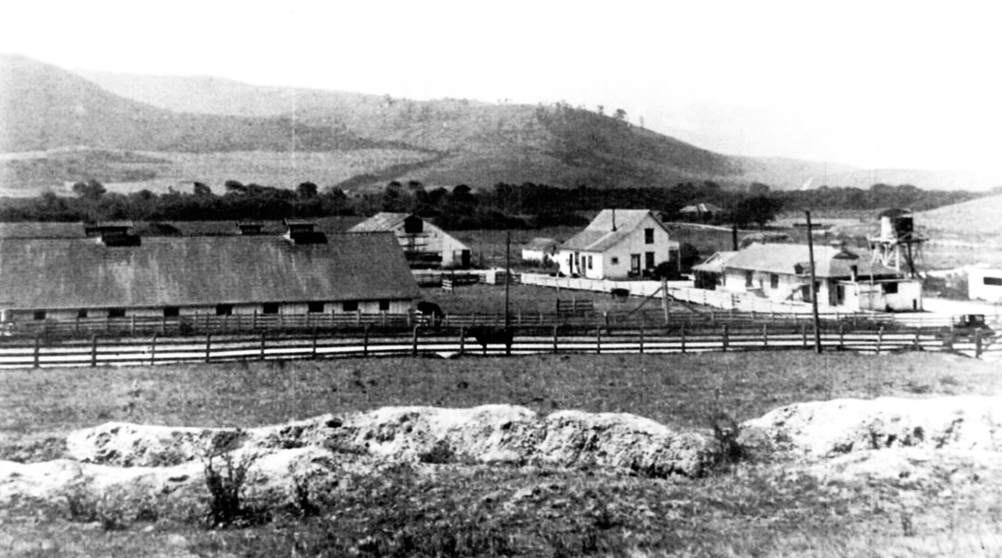
Mission Ranch is a historic hotel and restaurant in Carmel-by-the-Sea, Monterey County, California, United States. It is located south of downtown Carmel, near the Carmel Mission, at 26270 Dolores Street. The property was bought in 1986 by Clint Eastwood, who restored the premises in the style of the original buildings. The Mission Ranch includes with views of Point Lobos, Carmel River Beach and the Pacific Ocean. The Hotel has 31 rooms located within ten buildings on the property. History The Mission Ranch once included and was owned by Juan Romero, a native American. In 1852, Romero deeded the property to William J. Curtis, a Monterey storekeeper, for $300 (). Curtis sold the property to Lafayette F., and Annie Loveland in 1856. William Martin of Scotland arrived in Monterey in 1856 by ship with his family. His son, John Martin, bought land around the Carmel River from Loveland in 1859. He built the Martin Ranch on that went as far as the Carmel River to the homes along ... [...More Info...] [...Related Items...] OR: [Wikipedia] [Google] [Baidu] |
Pacific Improvement Company
The Pacific Improvement Company (PIC) was a large holding company in California and an affiliate of the Southern Pacific Railroad. It was formed in 1878, by the Big Four, who were influential businessmen, philanthropists and railroad tycoons who funded the Central Pacific Railroad, (C.P.R.R.). These men were: Leland Stanford (1824–1893), Collis Potter Huntington (1821–1900), Mark Hopkins (1813–1878), and Charles Crocker (1822–1888). They were controlling stockholders and directors of the company. Archived records date from 1869 to 1931. The company has been identified with many endeavors, including building the Hotel Del Monte in 1880, a large resort hotel in Monterey, California. By the 1880s, the Pacific Improvement Company was one of the largest corporations in the Western United States. The company controlled dozens of subsidiary companies, which conducted shipping, mining, publishing, land development, resort hotels, electric streetcars, and water system. Although i ... [...More Info...] [...Related Items...] OR: [Wikipedia] [Google] [Baidu] |
Rancho Los Laureles
Rancho Los Laureles was a Mexican land grant in present-day Monterey County, California given in 1839 by Governor Juan Alvarado to José M. Boronda and Vicente Blas Martínez. Los Laureles refers to the California Bay Laurel tree. The grant extended along the Carmel River and the Carmel Valley, was bounded to the east by the Rancho Tularcitos and Rancho Los Laureles (Ransom) on the west, and encompasses present day Carmel Valley Village. History The one and a half square league grant was made to Vicente Blas Martinez and José Manuel Boronda, along with Boronda's son, Juan de Mata Boronda. Vicente Blas Martinez married Maria Josefa Teodosia Amezquita (1801-) in 1817. In 1851, Vicente Blas Martinez and his wife, sold their half-interest in Rancho Los Laureles to the Borondas. The Boronda family patriarch, Manuel Boronda (1750-1826) accompanied Junípero Serra's second expedition to Alta California. By 1790, Boronda was stationed at the Presidio of San Francisco and m ... [...More Info...] [...Related Items...] OR: [Wikipedia] [Google] [Baidu] |
Ireland
Ireland ( ; ga, Éire ; Ulster Scots dialect, Ulster-Scots: ) is an island in the Atlantic Ocean, North Atlantic Ocean, in Northwestern Europe, north-western Europe. It is separated from Great Britain to its east by the North Channel (Great Britain and Ireland), North Channel, the Irish Sea, and St George's Channel. Ireland is the List of islands of the British Isles, second-largest island of the British Isles, the List of European islands by area, third-largest in Europe, and the List of islands by area, twentieth-largest on Earth. Geopolitically, Ireland is divided between the Republic of Ireland (officially Names of the Irish state, named Ireland), which covers five-sixths of the island, and Northern Ireland, which is part of the United Kingdom. As of 2022, the Irish population analysis, population of the entire island is just over 7 million, with 5.1 million living in the Republic of Ireland and 1.9 million in Northern Ireland, ranking it the List of European islan ... [...More Info...] [...Related Items...] OR: [Wikipedia] [Google] [Baidu] |
William Hatton (pioneer)
William Hatton (June 9, 1849 – October 22, 1894) was an American businessman who was one of Carmel Valley, California's pioneers. He was manager of the dairy and cattle interests of the Pacific Improvement Company, acquired land of his own, and became one of the wealthiest dairymen in Monterey County, California, Monterey County. Early life William Hatton was born on June 9, 1849, in Aghowle, County Wicklow, Ireland, fourth in a family of eight children. His father was Edward Hatton and mother Ann Kelly. He left Ireland at age thirteen and went to sea as an apprentice sailor. He lived a seafaring life for seven years, achieve the title of Chief mate, first mate. At age 20, he settled in Charleston, South Carolina where he worked as an agent for the United States Revenue Cutter Service, where he met Katherine Harney (1851-1922) a native of James Island, South Carolina. Hatton and Kate moved to Monterey County in 1870 and married in 1875. They had nine children in 18 years. ... [...More Info...] [...Related Items...] OR: [Wikipedia] [Google] [Baidu] |
Faxon Atherton
Faxon Dean Atherton (1815–1877) was an American businessman, trader and landowner; initially successful in Valparaíso, Chile, he became a prominent citizen of San Mateo County, California. He is the namesake of Atherton, California. Early life Faxon Dean Atherton was born on January 29, 1815, in Dedham, Massachusetts into an established New England family, with roots back to the colonial period of the United States. He was the son of Abner Atherton and Betsey Dean of Dedham, Massachusetts. His father was a sea captain, first married to Catherine Dean, who when she died married her sister Betsy, who became Atherton’s mother. Boston merchant In 1830, Atherton entered the shipping and merchant business at the age of 15 as an apprentice to his brother-in-law, merchant Charles T. Ward. It was a time of growth in trade between the Massachusetts shoe and leather goods mills which needed raw hides from California and Chile. William Sturgis was among the most prominent at this ... [...More Info...] [...Related Items...] OR: [Wikipedia] [Google] [Baidu] |
Land Patent
A land patent is a form of letters patent assigning official ownership of a particular tract of land that has gone through various legally-prescribed processes like surveying and documentation, followed by the letter's signing, sealing, and publishing in public records, made by a sovereign entity. It is the highest evidence of right, title, and interest to a defined area. It is usually granted by a central, federal, or state government to an individual, partnership, trust, or private company. The land patent is not to be confused with a land grant. Patented lands may be lands that had been granted by a sovereign authority in return for services rendered or accompanying a title or otherwise bestowed ''gratis'', or they may be lands privately purchased by a government, individual, or legal entity from their prior owners. "Patent" is both a process and a term. As a process, it is somewhat parallel to gaining a patent for intellectual property, including the steps of uniquely def ... [...More Info...] [...Related Items...] OR: [Wikipedia] [Google] [Baidu] |
Public Land Commission
The California Land Act of 1851 (), enacted following the Treaty of Guadalupe Hidalgo and the admission of California as a state in 1850, established a three-member Public Land Commission to determine the validity of prior Spanish and Mexican land grants. It required landowners who claimed title under the Mexican government to file their claim with a commission within two years. Contrary to the Treaty of Guadalupe Hidalgo, which guaranteed full protection of all property rights for Mexican citizens, it placed the burden on landholders to prove their title. While the commission eventually confirmed 604 of the 813 claims, almost all of the claims went to court and resulted in protracted litigation. The expense of the long court battles required many land holders to sell portions of the property or even trade it in payment for legal services. A few cases were litigated into the 1940s. Legislation California Senator William M. Gwin presented a bill that was approved by the Senate ... [...More Info...] [...Related Items...] OR: [Wikipedia] [Google] [Baidu] |
Treaty Of Guadalupe Hidalgo
The Treaty of Guadalupe Hidalgo ( es, Tratado de Guadalupe Hidalgo), officially the Treaty of Peace, Friendship, Limits, and Settlement between the United States of America and the United Mexican States, is the peace treaty that was signed on 2 February 1848, in the Villa de Guadalupe Hidalgo (now a neighborhood of Mexico City) between the United States and Mexico that ended the Mexican–American War (1846–1848). The treaty was ratified by the United States on 10 March and by Mexico on 19 May. The ratifications were exchanged on 30 May, and the treaty was proclaimed on 4 July 1848. With the defeat of its army and the fall of its capital in September 1847, Mexico entered into negotiations with the U.S. peace envoy, Nicholas Trist, to end the war. On the Mexican side, there were factions that did not concede defeat or seek to engage in negotiations. The treaty called for the United States to pay US$15 million to Mexico and to pay off the claims of American citizens against Mex ... [...More Info...] [...Related Items...] OR: [Wikipedia] [Google] [Baidu] |
Mexican-American War
Mexican Americans ( es, mexicano-estadounidenses, , or ) are Americans of full or partial Mexicans, Mexican heritage. In 2019, Mexican Americans comprised 11.3% of the US population and 61.5% of all Hispanic and Latino Americans. In 2019, 71% of Mexican Americans were born in the United States, though they make up 53% of the total population of foreign-born Latino Americans and 25% of the total foreign-born population. The United States is home to the second-largest Mexicans, Mexican community in the world (24% of the entire emigration from Mexico, Mexican-origin population of the world), behind only Mexico. Most Mexican Americans reside in Southwestern United States, the Southwest (over 60% in the states of California and Texas). Many Mexican Americans living in the United States have assimilated into Culture of the United States, American culture which has made some become less connected with their culture of birth (or of their parents/ grandparents) and sometimes creates an i ... [...More Info...] [...Related Items...] OR: [Wikipedia] [Google] [Baidu] |


