|
Ramat Hasharon
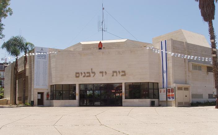
Ramat HaSharon ( he, רָמַת הַשָּׁרוֹן, ''lit.'' '' Sharon Heights'', ar, رمات هشارون) is a city located on Israel's central coastal strip in the south of the Sharon region, bordering Tel Aviv to the south, Hod HaSharon to the east, and Herzliya and Kibbutz Glil Yam to the north. It is part of the Tel Aviv District, within the Gush Dan metropolitan area. In it had a population of . History Ramat HaSharon, originally Ir Shalom ( he, עִיר שָׁלוֹם, ''lit.'' City of Peace), was a moshava established in 1923 by olim from Poland. It was built on 2,000 dunams () of land purchased for 5 Egyptian pounds per dunam. In the 1931 census, the village had a population of 312. In 1932, the community was renamed Kfar Ramat HaSharon (Heights of Sharon Village). By 1950, the population was up to 900. Rapid population growth in the 1960s and 70s led to construction of many new roadways, schools and parks. Several distinct neighborhood evolved in the 1970s, i ... [...More Info...] [...Related Items...] OR: [Wikipedia] [Google] [Baidu] |
List Of Cities In Israel
This list includes localities that are in Israel that the Israeli Ministry of Interior has designated as a city council. Jerusalem includes occupied East Jerusalem. The list is based on the current index of the Israel Central Bureau of Statistics (CBS). Within Israel's system of local government, an urban municipality can be granted a city council by the Interior Ministry when its population exceeds 20,000. The term "city" does not generally refer to local councils or urban agglomerations, even though a defined city often contains only a small portion of an urban area or metropolitan area's population. List Israel has 16 cities with populations over 100,000, including Jerusalem and Tel Aviv-Yafo. In all, there are 77 Israeli localities granted "municipalities" (or "city") status by the Ministry of the Interior, including four Israeli settlements in the West Bank. Two more cities are planned: Kasif, a planned city to be built in the Negev, and Harish, originally a small to ... [...More Info...] [...Related Items...] OR: [Wikipedia] [Google] [Baidu] |
City Council (Israel)
A city council ( he, עִירִיָּה, ''Iriya'') is the official designation of a city within Israel's system of local government. City status may be granted by the Interior Minister to a municipality, usually a local council and whose character is urban, defined as having areas zoned for distinct land use like residential, commercial, and industrial areas. City mayors and members of the city councils are elected every five years. See also *List of cities in Israel *Local council (Israel) *Regional council (Israel) References External linksLocal Government in Israel The Knesset Lexicon of Terms. 2009Local Authorities (רשויות מקומיות)on Israel Government portal * City Council Ordinance City councils Subdivisions of Israel City Councils A municipal council is the legislative body of a municipality or local government area. Depending on the location and classification of the municipality it may be known as a city council, town council, town board, ... [...More Info...] [...Related Items...] OR: [Wikipedia] [Google] [Baidu] |
Kiryat Shaul Cemetery
Kiryat Shaul Cemetery ( he, בית העלמין קריית שאול) is a 320-dunam (32 hectares) Jewish burial ground in Northern Tel Aviv near the neighborhood of Kiryat Shaul. On the east side of the cemetery is a large military cemetery. Founded in 1943, it includes more than 80,000 graves, including those of Israeli political and cultural figures. Due to lack of space, since 1991, the Yarkon Cemetery has been serving as the main cemetery for the Tel Aviv Metropolitan Area. History The Cemetery was established in 1943 when the Chair of the Religious Council of Tel Aviv, David-Zvi Pinkas, feared that they will run out of burial space in the Nahalat Yitzhak Cemetery. Chairman of the Chevra kadisha, Zalman Meisel, opened in negotiations to purchase the land. The purchase was completed in 1949. During its early years, the cemetery faced strong opposition, particularly from Planning Division at the Ministry of Interior. The opposition slowly subsided the following year. While ... [...More Info...] [...Related Items...] OR: [Wikipedia] [Google] [Baidu] |
Highway 2 (Israel)
Highway 2 (, ''Kvish 2'') is an Israeli highway located on the coastal plain of the Mediterranean Sea. It begins as a major arterial road within Tel Aviv, becoming a freeway as it exits the city northward continuing to Haifa. North of Tel Aviv, the highway is also called The Coastal Highway (, ''Kvish HaHof''). Highway 2 is one of the busiest highways in the country, and drivers experience frequent traffic congestion between Hadera and Tel Aviv during rush hours. The northern sections are also congested at times, especially during weekends and holidays, when many Israelis travel north for vacation. History The first section of the highway between Tel Aviv and Netanya was built in the early 1950s as a two lane road with at-grade intersections. The next section was built later that decade, extending the highway north to Olga Junction in Hadera. This section was also built as a two lane road. In 1965 the highway was widened to four lanes between Tel Aviv and Hadera, however gra ... [...More Info...] [...Related Items...] OR: [Wikipedia] [Google] [Baidu] |
Highway 4 (Israel)
Highway 4 ( he, כּֽבִישׁ אַרְבַּע, ''Kvish Arba' '') is an Israeli highway that runs along Israel's entire Israeli Coastal Plain, coastal plain of the Mediterranean Sea, from the Rosh HaNikra Crossing, Rosh HaNikra border crossing with Lebanon in the Northern District (Israel), North to the Israeli Gaza Strip barrier#Erez Crossing, Erez Border Crossing with the Gaza Strip in the South. The highway follows in part the route of the ancient Via Maris. Until the 1990s and the withdrawal of Israel Defense Forces from most of the Gaza Strip due to the Oslo Accords, Highway 4 continued all the way until Rafah and the Egypt, Egyptian border. The part of the remaining highway in the Gaza Strip is called the Salah al-Din Road. Although the highway is continuous, it is generally considered to be divided into five sections, each with its own nickname and characteristics such as a differing number of lanes and speed limits: *Northern Coastal Highway (Rosh Hanikra–Haifa). This ... [...More Info...] [...Related Items...] OR: [Wikipedia] [Google] [Baidu] |
Israel Military Industries
, former_name = Israel Military Industries , type = State-owned enterprise , industry = Arms industry , fate = Acquired by Elbit Systems , successor = Elbit Systems Land , founded = , founder = , defunct = , hq_location_city = Ramat HaSharon, Tel Aviv , hq_location_country = Israel , area_served = Worldwide , key_people = Yitzhak Aharonovich (Chairman) Avi Felder (President and CEO) , products = Weapons, combat vehicles, munitions , services = , revenue = , revenue_year = , operating_income = , income_year = , net_income = , net_income_year = , aum = , assets = , equity = , owner = Government of Israel , num_employees = , num_employees_year = , divisions = Fire Power DivisionManeuverability DivisionSmall Caliber Ammunition Division , subsid = Ashot Ashkelon IndustriesIMI TradingIMI ServicesIMI Academy , homepage www.imisystems.com, footnotes = , intl = IMI Systems, previous Israel Military Industries, also referred to as Ta'as ( h ... [...More Info...] [...Related Items...] OR: [Wikipedia] [Google] [Baidu] |
Highway 20 (Israel)
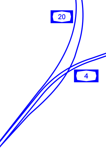
, length_km = 29 , direction_a = South , terminus_a = Rishon LeZion (Holot Interchange) , cities = Holon, Herzliya, Bat Yam, Tel Aviv, Givatayim, Ramat Gan , direction_b = North , terminus_b = Rishpon , junction = *Holon Interchange *Kibbutz Galuyot Interchange * La Guardia Interchange *Glilot Interchange , previous_route = 13 , previous_type = Hwy , next_route = 22 , next_type = Fwy , photo = , photo_notes = Aerial View of Highway 20 at Night Highway 20, more commonly known as the Ayalon Highway, or simply Ayalon ( he, נתיבי איילון, pronounced: ''"Netivei Ayalon"'', lit. "Ayalon lanes"), is a major intracity freeway in Gush Dan, Israel. The road runs along the eastern border of central Tel Aviv from north to south (with a planned east-west branch as well) and connects all of the major highways leading to the city—such as Highway 4 from Ashdod and the Southern regions, Highway 2 from Haifa and the Northern regions, Highway 5 from the East, and ... [...More Info...] [...Related Items...] OR: [Wikipedia] [Google] [Baidu] |
Highway 5 (Israel–Palestine)
Highway 5 or the Trans-Samaria Highway ( he, כביש חוצה שומרון, ''Kvish Hotze Shomron''), is one of Israel's main highways, connecting the Mediterranean coast immediately north of Tel Aviv with the central Sharon plain and eastwards to Ariel and other Israeli settlements in the northern West Bank. The name ''Highway 5'' is commonly used to describe the section of the highway running from the road's western end at the Glilot Interchange until where it until it reaches the main entrance of Ariel. In this capacity it intersects and creates a connection between four important arterial freeways in the northern Tel Aviv area: The Coastal Highway (Highway 2), the Ayalon Highway (Highway 20), Geha Highway (Highway 4) and the Cross-Israel Highway (Highway 6). An alternate name for the entire highway is ''Kvish Hotze Shomron'' meaning the ''Cross-Samaria highway'' though often this name is used when referring specifically to the section of the road in the West Bank, i.e., ... [...More Info...] [...Related Items...] OR: [Wikipedia] [Google] [Baidu] |
Millstone
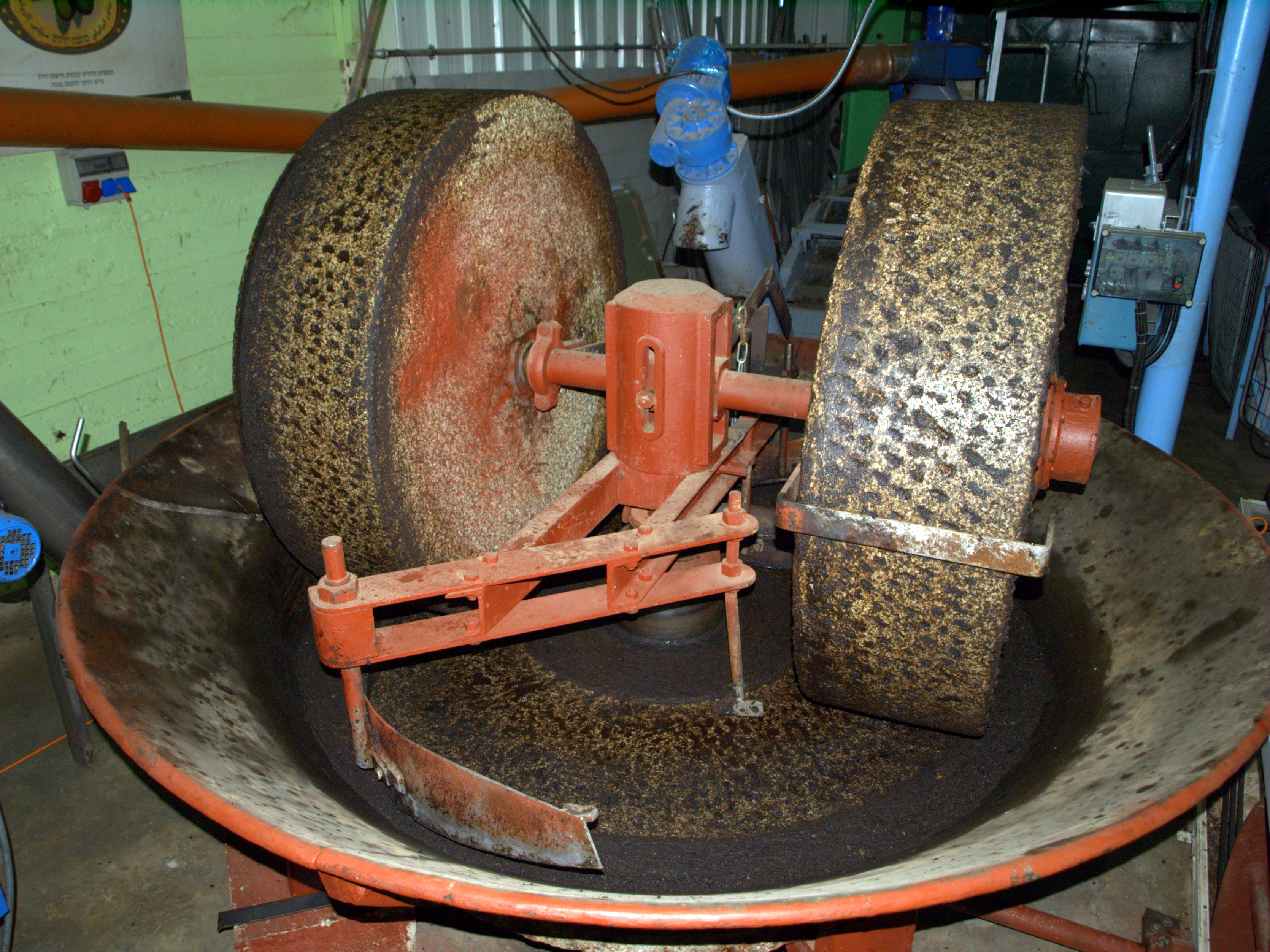
Millstones or mill stones are stones used in gristmills, for grinding wheat or other grains. They are sometimes referred to as grindstones or grinding stones. Millstones come in pairs: a convex stationary base known as the ''bedstone'' and a concave ''runner stone'' that rotates. The movement of the runner on top of the bedstone creates a "scissoring" action that grinds grain trapped between the stones. Millstones are constructed so that their shape and configuration help to channel ground flour to the outer edges of the mechanism for collection. The runner stone is supported by a cross-shaped metal piece (millrind or rynd) fixed to a "mace head" topping the main shaft or spindle leading to the driving mechanism of the mill (wind, water (including tide) or other means). History The earliest evidence for stones used to grind food is found in northern Australia, at the Madjedbebe rock shelter in Arnhem Land, dating back around 60,000 years. Grinding stones or grindston ... [...More Info...] [...Related Items...] OR: [Wikipedia] [Google] [Baidu] |
Mortar And Pestle
Mortar and pestle is a set of two simple tools used from the Stone Age to the present day to prepare ingredients or substances by crushing and grinding them into a fine paste or powder in the kitchen, laboratory, and pharmacy. The ''mortar'' () is characteristically a bowl, typically made of hard wood, metal, ceramic, or hard stone such as granite. The ''pestle'' (, also ) is a blunt, club-shaped object. The substance to be ground, which may be wet or dry, is placed in the mortar where the pestle is pounded, pressed, and rotated into the substance until the desired texture is achieved. Mortars and pestles have been used in cooking since prehistory; today they are typically associated with the profession of pharmacy due to their historical use in preparing medicines. They are used in chemistry settings for pulverizing small amounts of chemicals; in arts and cosmetics for pulverizing pigments, binders, and other substances; in ceramics for making grog; in masonry and in other typ ... [...More Info...] [...Related Items...] OR: [Wikipedia] [Google] [Baidu] |
Epigraphy
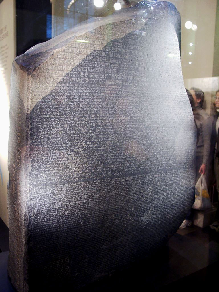
Epigraphy () is the study of inscriptions, or epigraphs, as writing; it is the science of identifying graphemes, clarifying their meanings, classifying their uses according to dates and cultural contexts, and drawing conclusions about the writing and the writers. Specifically excluded from epigraphy are the historical significance of an epigraph as a document and the artistic value of a literature, literary composition. A person using the methods of epigraphy is called an ''epigrapher'' or ''epigraphist''. For example, the Behistun inscription is an official document of the Achaemenid Empire engraved on native rock at a location in Iran. Epigraphists are responsible for reconstructing, translating, and dating the trilingual inscription and finding any relevant circumstances. It is the work of historians, however, to determine and interpret the events recorded by the inscription as document. Often, epigraphy and history are competences practised by the same person. Epigraphy ... [...More Info...] [...Related Items...] OR: [Wikipedia] [Google] [Baidu] |
Jerusalem
Jerusalem (; he, יְרוּשָׁלַיִם ; ar, القُدس ) (combining the Biblical and common usage Arabic names); grc, Ἱερουσαλήμ/Ἰεροσόλυμα, Hierousalḗm/Hierosóluma; hy, Երուսաղեմ, Erusałēm. is a city in Western Asia. Situated on a plateau in the Judaean Mountains between the Mediterranean Sea, Mediterranean and the Dead Sea, it is one of the List of oldest continuously inhabited cities, oldest cities in the world and is considered to be a holy city for the three major Abrahamic religions: Judaism, Christianity, and Islam. Both Israelis and Palestinians claim Jerusalem as their Capital city, capital, as Israel maintains its primary governmental institutions there and the State of Palestine ultimately foresees it as its seat of power. Because of this dispute, Status of Jerusalem, neither claim is widely recognized internationally. Throughout History of Jerusalem, its long history, Jerusalem has been destroyed at least twice, Sie ... [...More Info...] [...Related Items...] OR: [Wikipedia] [Google] [Baidu] |


