|
Rainish Eilean Mòr
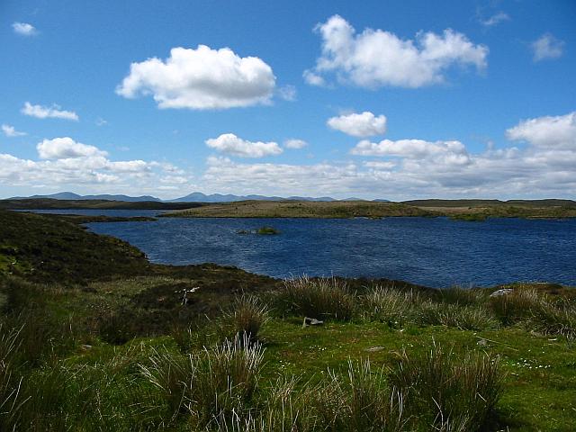
Rainish Eilean Mòr is an uninhabited island in Loch Orasaigh, north of the village of Leurbost in the area of South Lochs on the Isle of Lewis, Lewis and Harris. At in extent, it is one of Scotland's larger freshwater islands, but it is probably the largest relative to the size of the body of water in which it sits, Loch Orasaigh being only about in area. The entirety of the loch has been an SSSI since 1983 and the island's perimeter and the neighbouring islet to the south west have woodland cover including the species of Rowan, Aspen, Downy Birch, Grey Willow and Sallow Willow. The underlying geology is Lewisian Gneiss overlain by peaty podzols and gleys. The Gaelic name of the island means "large island of Rainish" and is taken from the surrounding area, which itself means "Roe deer headland", from Old Norse Old Norse, Old Nordic, or Old Scandinavian, is a stage of development of North Germanic languages, North Germanic dialects before their final divergence i ... [...More Info...] [...Related Items...] OR: [Wikipedia] [Google] [Baidu] |
List Of Freshwater Islands In Scotland
The freshwater islands in Scotland include those within freshwater lochs and rivers – including tidal areas, so the islands may not always be surrounded by freshwater. It has been estimated that there are at least 31,460 freshwater lochs in Scotland and that 1.9 per cent of the land surface is covered by freshwater. The distribution has a north-west to south-east gradient, with the highest concentrations occurring on the islands of the Outer Hebrides."Botanical survey of Scottish freshwater lochs" SNH Information and Advisory Note Number 4. Retrieved 1 January 2010. The more notable freshwater islands include Lochindorb Castle Island, [...More Info...] [...Related Items...] OR: [Wikipedia] [Google] [Baidu] |
Outer Hebrides
The Outer Hebrides () or Western Isles ( gd, Na h-Eileanan Siar or or ("islands of the strangers"); sco, Waster Isles), sometimes known as the Long Isle/Long Island ( gd, An t-Eilean Fada, links=no), is an island chain off the west coast of mainland Scotland. The islands are geographically coextensive with , one of the 32 unitary council areas of Scotland. They form part of the archipelago of the Hebrides, separated from the Scottish mainland and from the Inner Hebrides by the waters of the Minch, the Little Minch, and the Sea of the Hebrides. Scottish Gaelic is the predominant spoken language, although in a few areas English speakers form a majority. Most of the islands have a bedrock formed from ancient metamorphic rocks, and the climate is mild and oceanic. The 15 inhabited islands have a total population of and there are more than 50 substantial uninhabited islands. The distance from Barra Head to the Butt of Lewis is roughly . There are various important prehisto ... [...More Info...] [...Related Items...] OR: [Wikipedia] [Google] [Baidu] |
Orasaigh
This is a list of islands called Oronsay (Scottish Gaelic: '), which provides an index for islands in Scotland with this and similar names. It is one of the more common names for Scottish islands. The names come from ''Örfirisey'' which translates from Old Norse as "tidal" or "ebb island".Watson (2004) p. 505. The many islands include: Inner Hebrides * Eilean Ornsay, off Coll * Oronsay, Colonsay *Ornsay Ornsay is a small tidal island to the east of the Sleat peninsula on the Isle of Skye in the Inner Hebrides of Scotland. Description The island provides good shelter to a natural harbour which is overlooked by the village of Isleornsay. The ..., by Isleornsay (Eilean Iarmain), Sound of Sleat * Oronsay, Loch Bracadale, Skye * Oronsay, Loch Sunart (enclosing Loch Drumbuie), Morvern Outer Hebrides Lewis * Orasaigh off Leurbost () * Eilean Orasaigh near Cromor () North Uist * Orasaigh () N of Vallay * Oronsay, Outer Hebrides () by the hamlet of Greinetobht (approx 85 ... [...More Info...] [...Related Items...] OR: [Wikipedia] [Google] [Baidu] |
Leurbost
Leurbost () is a village on the east coast of the Isle of Lewis in the Outer Hebrides of Scotland. It is approximately south of Stornoway on the road to Harris. It is the main settlement in the area of the island known as North Lochs. Leurbost is within the parish of Lochs. Population: Over 500 Languages : English (UK) Gàidhlig (Gaelic) Football Team: Lochs FC Football Pitch/Best pies served at: Creagan Dubh Pies served by: Pie Ladies History In 1856 reports circulated of a 'sea-serpent' in a fresh water loch near the town. The creature, referred to as ''Searrach Uisge'', was said to be eel-like, long and raised comparisons to the mythical Kelpie. Economy Amenities in the village include a community centre; a school, Sgoil nan Loch, (which replaced the old Leurbost as well as Fidigarry ( Ranish), Knockiandue ( Keose) and Balallan Balallan ( gd, Baile Ailein, Bail' Ailein), meaning "Allan's Town", is a crofting township on the Isle of Lewis, in the Outer Hebrides, S ... [...More Info...] [...Related Items...] OR: [Wikipedia] [Google] [Baidu] |
Park, Outer Hebrides
Park ( gd, A' Phàirc), also known as South Lochs, is a huge area of land connected to the rest of Lewis only by a narrow neck between Loch Seaforth and Loch Erisort. This had a wall called ''Gàrradh an Tighearna'' (''"The Laird's Dyke"'') built across it by the Earl of Seaforth in the early 17th century, the outline of which can still be seen. Only the north of Park is now inhabited: settlements in the south were cleared by Sir James Matheson in the nineteenth century. A famous deer raid took place here in 1887 as a demonstration by starving people, commemorated by a broch resembling a cairn at the Eishken junction. Much of this area is still used for deer stalking. Community buyout The Pairc Estate extends to and includes 11 crofting townships with a combined population of nearly 400. In 2011 the Pairc Community Trust received approval from Roseanna Cunningham, the Environment Minister, for a bid to buy the estate under the crofting "Right to Buy" provisions of the Land Ref ... [...More Info...] [...Related Items...] OR: [Wikipedia] [Google] [Baidu] |
Isle Of Lewis
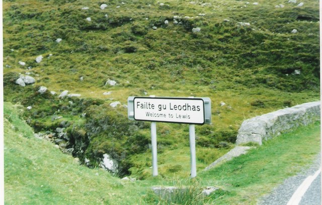
The Isle of Lewis ( gd, Eilean Leòdhais) or simply Lewis ( gd, Leòdhas, ) is the northern part of Lewis and Harris, the largest island of the Western Isles or Outer Hebrides archipelago in Scotland. The two parts are frequently referred to as if they were separate islands. The total area of Lewis is . Lewis is, in general, the lower-lying part of the island: the other part, Harris, is more mountainous. Due to its larger area and flatter, more fertile land, Lewis contains three-quarters of the population of the Western Isles, and the largest settlement, Stornoway. The island's diverse habitats are home to an assortment of flora and fauna, such as the golden eagle, red deer and seal, and are recognised in a number of conservation areas. Lewis has a Presbyterian tradition and a rich history. It was once part of the Norse Kingdom of the Isles. Today, life is very different from elsewhere in Scotland, with Sabbath observance, the Scottish Gaelic language and peat cutting retainin ... [...More Info...] [...Related Items...] OR: [Wikipedia] [Google] [Baidu] |
Lewis And Harris
Lewis and Harris ( gd, Leòdhas agus na Hearadh, sco, Lewis an Harris), or Lewis with Harris, is a single Scottish island in the Outer Hebrides, divided by mountains. It is the largest island in Scotland and the third largest in the British Isles, after Great Britain and the island of Ireland, with an area of , which is approximately 1% of the area of Great Britain. The northern two-thirds is called Lewis and the southern third Harris; each is frequently referred to as if it were a separate island. Etymology The island does not have a one-word name in either English or Scottish Gaelic, and is referred to as "Lewis and Harris", "Lewis with Harris", "Harris with Lewis" etc. Rarely used is the collective name of "the Long Island" ( gd, an t-Eilean Fada), although that epithet is sometimes applied to the entire archipelago of the Outer Hebrides, including the Uist group of islands and Barra. Geography Lewis–Harris boundary The boundary between Lewis and Harris runs fo ... [...More Info...] [...Related Items...] OR: [Wikipedia] [Google] [Baidu] |
SSSI
A Site of Special Scientific Interest (SSSI) in Great Britain or an Area of Special Scientific Interest (ASSI) in the Isle of Man and Northern Ireland is a conservation designation denoting a protected area in the United Kingdom and Isle of Man. SSSI/ASSIs are the basic building block of site-based nature conservation legislation and most other legal nature/geological conservation designations in the United Kingdom are based upon them, including national nature reserves, Ramsar sites, Special Protection Areas, and Special Areas of Conservation. The acronym "SSSI" is often pronounced "triple-S I". Selection and conservation Sites notified for their biological interest are known as Biological SSSIs (or ASSIs), and those notified for geological or physiographic interest are Geological SSSIs (or ASSIs). Sites may be divided into management units, with some areas including units that are noted for both biological and geological interest. Biological Biological SSSI/ASSIs may b ... [...More Info...] [...Related Items...] OR: [Wikipedia] [Google] [Baidu] |
Sorbus Aucuparia
''Sorbus aucuparia'', commonly called rowan (UK: /ˈrəʊən/, US: /ˈroʊən/) and mountain-ash, is a species of deciduous tree or shrub in the rose family. It is a highly variable species, and botanists have used different Circumscription (taxonomy), definitions of the species to include or exclude trees native to certain areas; a recent definition includes trees native to most of Europe and parts of Asia, as well as northern Africa. The range extends from Madeira, the British Isles and Iceland to Russia and northern China. Unlike many plants with similar distributions, it is not native to Japan. The tree has a slender trunk with smooth bark, a loose and roundish crown, and its leaves are pinnate in pairs of leaflets on a central vein with a terminal leaflet. It blossoms from May to June in dense corymbs of small yellowish white flowers and develops small red pomes as fruit that ripen from August to October and are eaten by many bird species. The plant is undemanding and frost h ... [...More Info...] [...Related Items...] OR: [Wikipedia] [Google] [Baidu] |
Populus Tremula
''Populus tremula'' (commonly called aspen, common aspen, Eurasian aspen, European aspen, or quaking aspen) is a species of poplar native to cool temperate regions of Europe and Asia, from Iceland and the British IslesJames KilkellIrish native Aspen tree/ref> east to Kamchatka, north to inside the Arctic Circle in Scandinavia and northern Russia, and south to central Spain, Turkey, the Tian Shan, North Korea, and northern Japan. It also occurs at one site in northwest Africa in Algeria. In the south of its range, it occurs at high altitudes in mountains.Rushforth, K. (1999). ''Trees of Britain and Europe''. Collins .Den Virtuella Floran''Populus tremula'' (in Swedish; with maps)/ref> Description It is a substantial deciduous tree growing to tall by broad, with a trunk attaining over in diameter. The bark is pale greenish-grey and smooth on young trees with dark grey diamond-shaped lenticels, becoming dark grey and fissured on older trees. The adult leaves, produced on br ... [...More Info...] [...Related Items...] OR: [Wikipedia] [Google] [Baidu] |
Betula Pubescens
''Betula pubescens'' (syn. ''Betula alba''), commonly known as downy birch and also as moor birch, white birch, European white birch or hairy birch, is a species of deciduous tree, native and abundant throughout northern Europe and northern Asia, growing farther north than any other broadleaf tree. It is closely related to, and often confused with, the silver birch (''B. pendula''), but grows in wetter places with heavier soils and poorer drainage; smaller trees can also be confused with the dwarf birch (''B. nana''). Six varieties are recognised and it hybridises with the silver and dwarf birches. A number of cultivars have been developed but many are no longer in cultivation. The larva of the autumnal moth (''Epirrita autumnata'') feeds on the foliage and in some years, large areas of birch forest can be defoliated by this insect. Many fungi are associated with the tree and certain pathogenic fungi are the causal agents of birch dieback disease. The tree is a pioneer species ... [...More Info...] [...Related Items...] OR: [Wikipedia] [Google] [Baidu] |
Lewisian Complex
The Lewisian complex or Lewisian gneiss is a suite of Precambrian metamorphic rocks that outcrop in the northwestern part of Scotland, forming part of the Hebridean Terrane and the North Atlantic Craton. These rocks are of Archaean and Paleoproterozoic age, ranging from 3.0–1.7 billion years ( Ga). They form the basement on which the Torridonian and Moine Supergroup sediments were deposited. The Lewisian consists mainly of granitic gneisses with a minor amount of supracrustal rocks. Rocks of the Lewisian complex were caught up in the Caledonian orogeny, appearing in the hanging walls of many of the thrust faults formed during the late stages of this tectonic event. Distribution The main outcrops of the Lewisian complex are on the islands of the Outer Hebrides, including Lewis, from which the complex takes its name. It is also exposed on several islands of the Inner Hebrides, small islands north of the Scottish mainland and forms a coastal strip on the mainland from near L ... [...More Info...] [...Related Items...] OR: [Wikipedia] [Google] [Baidu] |


