|
Rainbow Springs, Florida
Rainbow Springs is an unincorporated community and census-designated place (CDP) in southwestern Marion County, Florida, United States. It is named for the first-magnitude artesian spring found in the community. U.S. Route 41 passes through the CDP, leading south to Dunnellon and north to Williston. Ocala, the Marion county seat A county seat is an administrative center, seat of government, or capital city of a county or civil parish. The term is in use in Canada, China, Hungary, Romania, Taiwan, and the United States. The equivalent term shire town is used in the US st ..., is to the northeast. The community was first listed as a CDP for the 2020 census, at which time it had a population of 5,091. Demographics References Census-designated places in Marion County, Florida Census-designated places in Florida {{MarionCountyFL-geo-stub ... [...More Info...] [...Related Items...] OR: [Wikipedia] [Google] [Baidu] |
Census-designated Place
A census-designated place (CDP) is a concentration of population defined by the United States Census Bureau for statistical purposes only. CDPs have been used in each decennial census since 1980 as the counterparts of incorporated places, such as self-governing cities, towns, and villages, for the purposes of gathering and correlating statistical data. CDPs are populated areas that generally include one officially designated but currently unincorporated community, for which the CDP is named, plus surrounding inhabited countryside of varying dimensions and, occasionally, other, smaller unincorporated communities as well. CDPs include small rural communities, edge cities, colonias located along the Mexico–United States border, and unincorporated resort and retirement communities and their environs. The boundaries of any CDP may change from decade to decade, and the Census Bureau may de-establish a CDP after a period of study, then re-establish it some decades later. Most unin ... [...More Info...] [...Related Items...] OR: [Wikipedia] [Google] [Baidu] |
Federal Information Processing Standards
The Federal Information Processing Standards (FIPS) of the United States are a set of publicly announced standards that the National Institute of Standards and Technology (NIST) has developed for use in computer systems of non-military, American government agencies and contractors. FIPS standards establish requirements for ensuring computer security and interoperability, and are intended for cases in which suitable industry standards do not already exist. Many FIPS specifications are modified versions of standards the technical communities use, such as the American National Standards Institute (ANSI), the Institute of Electrical and Electronics Engineers (IEEE), and the International Organization for Standardization (ISO). Specific areas of FIPS standardization The U.S. government has developed various FIPS specifications to standardize a number of topics including: * Codes, e.g., FIPS county codes or codes to indicate weather conditions or emergency indications. In 1994, Nat ... [...More Info...] [...Related Items...] OR: [Wikipedia] [Google] [Baidu] |
County Seat
A county seat is an administrative center, seat of government, or capital city of a county or civil parish. The term is in use in Canada, China, Hungary, Romania, Taiwan, and the United States. The equivalent term shire town is used in the US state of Vermont and in some other English-speaking jurisdictions. County towns have a similar function in the Republic of Ireland and the United Kingdom, as well as historically in Jamaica. Function In most of the United States, counties are the political subdivisions of a state. The city, town, or populated place that houses county government is known as the seat of its respective county. Generally, the county legislature, county courthouse, sheriff's department headquarters, hall of records, jail and correctional facility are located in the county seat, though some functions (such as highway maintenance, which usually requires a large garage for vehicles, along with asphalt and salt storage facilities) may also be located or conducted ... [...More Info...] [...Related Items...] OR: [Wikipedia] [Google] [Baidu] |
Ocala, Florida
Ocala ( ) is a city in and the county seat of Marion County within the northern region of Florida, United States. As of the 2020 United States Census, the city's population was 63,591, making it the 54th most populated city in Florida. Home to over 400 thoroughbred farms and training centers, Ocala was officially named the Horse Capital of the World in 2007. Notable attractions include the Ocala National Forest, Silver Springs State Park, Rainbow Springs State Park, and the College of Central Florida. Ocala is the principal city of the Ocala, Florida Metropolitan Statistical Area, which had an estimated 2017 population of 354,353. History Ocala is located near what is thought to have been the site of ''Ocale'' or Ocali, a major Timucua village and chiefdom recorded in the 16th century. The modern city takes its name from the historical village, the name of which is believed to mean "Big Hammock" in the Timucua language. The Spaniard Hernando de Soto's expedition recorded Ocal ... [...More Info...] [...Related Items...] OR: [Wikipedia] [Google] [Baidu] |
Williston, Florida
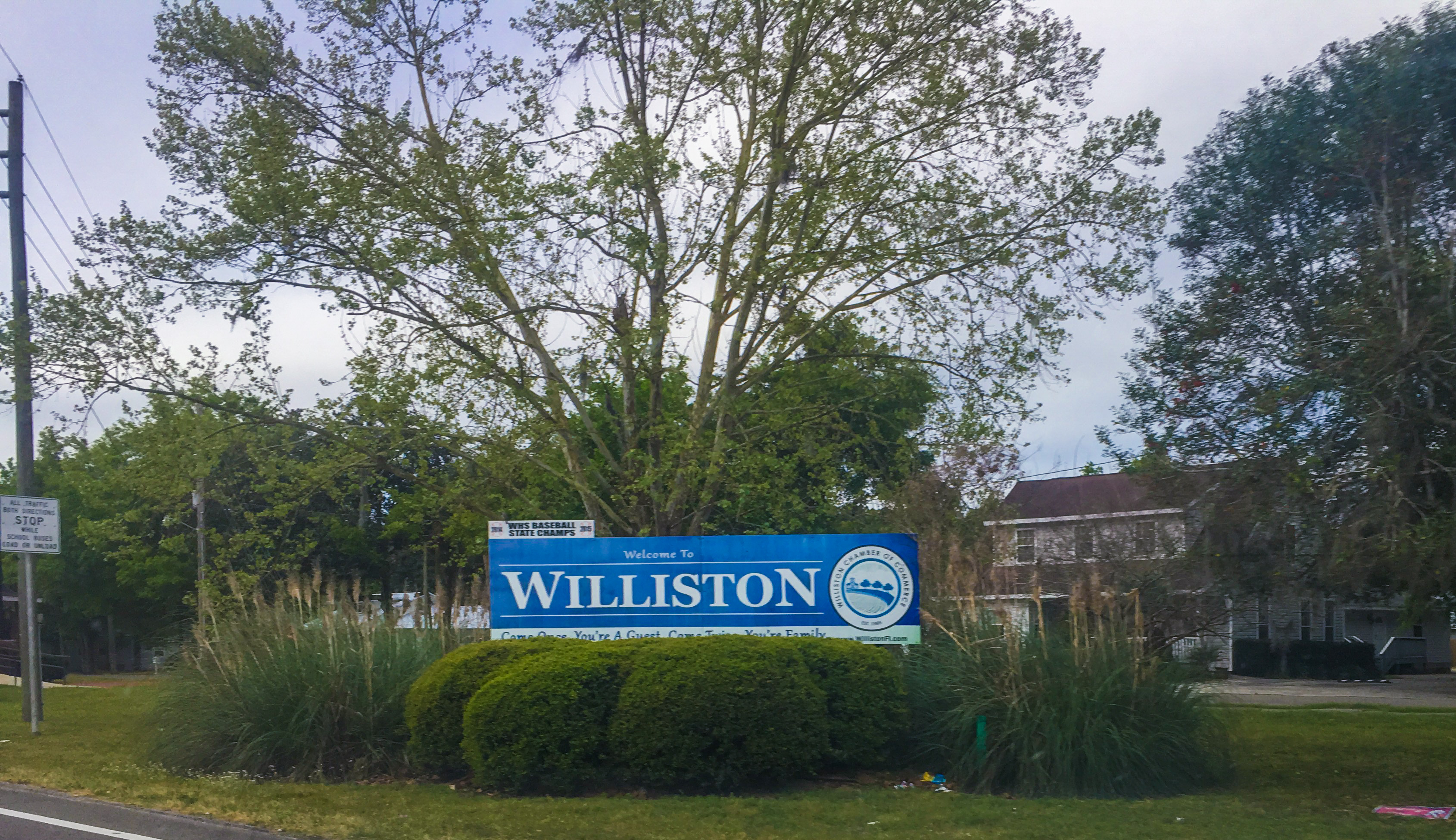
Williston is a city in Levy County, Florida, United States. As of the 2010 census it had a population of 2,768. Histoy The city was established before 1885 by J.M. Willis, who named it after himself. Geography Williston is located at (29.386811, –82.446706). According to the United States Census Bureau, the city has a total area of , of which , or 0.27%, is water. Demographics As of the census of 2000, there were 2,297 people, 836 households, and 580 families residing in the city. The population density was 379.0 inhabitants per square mile (146.3/km). There were 915 housing units at an average density of 151.0 per square mile (58.3/km). The racial makeup of the city was 73.44% White, 22.81% African American, 0.78% Native American, 0.74% Asian, 0.44% Pacific Islander, 1.09% from other races, and 1.09% from two or more races. Hispanic or Latino of any race were 3.57% of the population. There were 836 households, out of which 31.8% had children under the age of 18 livin ... [...More Info...] [...Related Items...] OR: [Wikipedia] [Google] [Baidu] |
Rainbow Springs
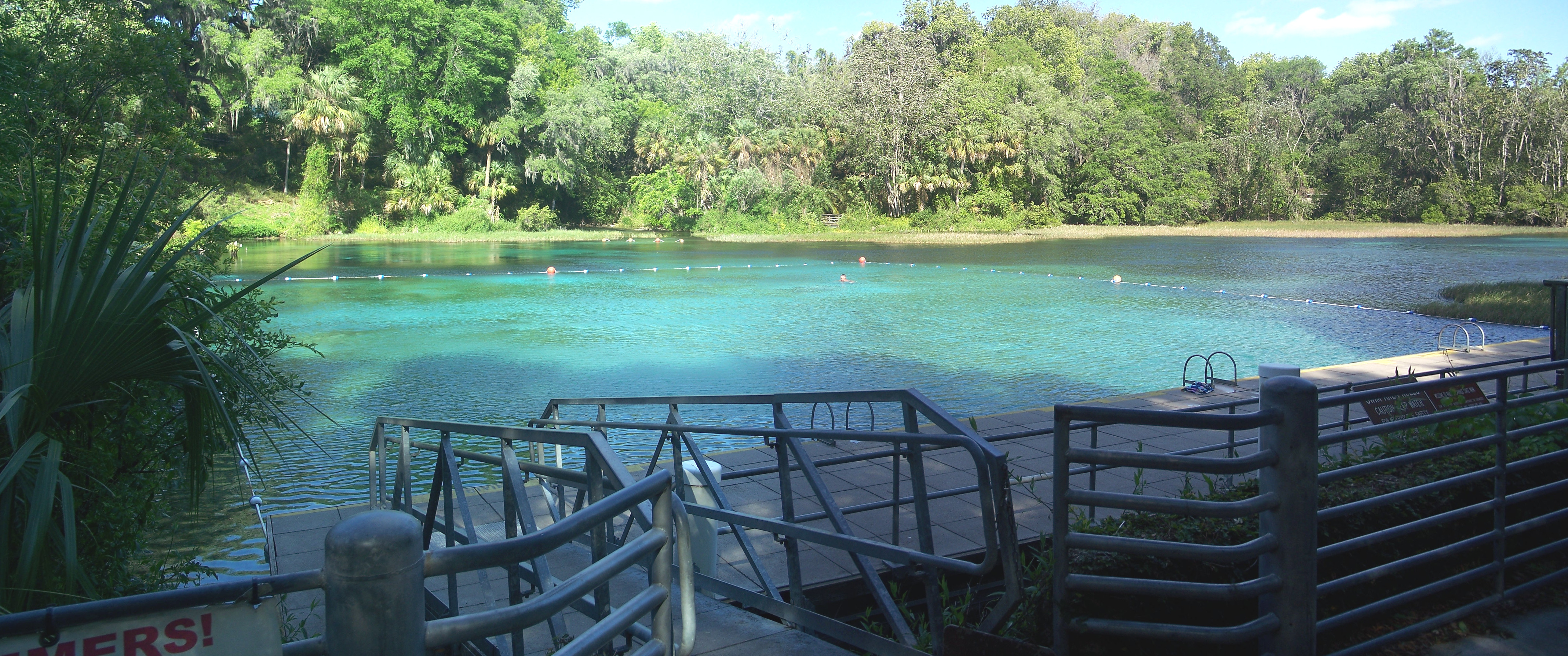
Rainbow Springs, formerly known as Blue Spring, is a first-magnitude artesian spring formation in Marion County, Florida, United States, several miles north of the city of Dunnellon. Rainbow Springs is the focal point of Rainbow Springs State Park. The spring formation is the fourth-largest in Florida, and produces over 490 million gallons of water daily. Rainbow Springs forms the headwaters of the Rainbow River, which empties into the Withlacoochee River. History Rainbow Springs was known as Wekiwa Creek by the Seminole Indians. It was known as Blue Spring until the 1930s, when the site was developed as a tourist attraction and the promoter sought a more distinctive name (there are several other springs in Florida named "Wekiwa" and "Blue"). To compete with the "glass bottom boats" of nearby Silver Springs, Florida, submarine tours were given of the springs. As for some other Florida springs, such as Weeki Wachee Springs, "mermaid shows" were an attraction in the 1950 ... [...More Info...] [...Related Items...] OR: [Wikipedia] [Google] [Baidu] |
Census-designated Place
A census-designated place (CDP) is a concentration of population defined by the United States Census Bureau for statistical purposes only. CDPs have been used in each decennial census since 1980 as the counterparts of incorporated places, such as self-governing cities, towns, and villages, for the purposes of gathering and correlating statistical data. CDPs are populated areas that generally include one officially designated but currently unincorporated community, for which the CDP is named, plus surrounding inhabited countryside of varying dimensions and, occasionally, other, smaller unincorporated communities as well. CDPs include small rural communities, edge cities, colonias located along the Mexico–United States border, and unincorporated resort and retirement communities and their environs. The boundaries of any CDP may change from decade to decade, and the Census Bureau may de-establish a CDP after a period of study, then re-establish it some decades later. Most unin ... [...More Info...] [...Related Items...] OR: [Wikipedia] [Google] [Baidu] |
Unincorporated Community
An unincorporated area is a region that is not governed by a local municipal corporation. Widespread unincorporated communities and areas are a distinguishing feature of the United States and Canada. Most other countries of the world either have no unincorporated areas at all or these are very rare: typically remote, outlying, sparsely populated or uninhabited areas. By country Argentina In Argentina, the provinces of Chubut, Córdoba, Entre Ríos, Formosa, Neuquén, Río Negro, San Luis, Santa Cruz, Santiago del Estero, Tierra del Fuego, and Tucumán have areas that are outside any municipality or commune. Australia Unlike many other countries, Australia has only one level of local government immediately beneath state and territorial governments. A local government area (LGA) often contains several towns and even entire metropolitan areas. Thus, aside from very sparsely populated areas and a few other special cases, almost all of Australia is part of an LGA. Uninc ... [...More Info...] [...Related Items...] OR: [Wikipedia] [Google] [Baidu] |
Geographic Names Information System
The Geographic Names Information System (GNIS) is a database of name and locative information about more than two million physical and cultural features throughout the United States and its territories, Antarctica, and the associated states of the Marshall Islands, Federated States of Micronesia, and Palau. It is a type of gazetteer. It was developed by the United States Geological Survey (USGS) in cooperation with the United States Board on Geographic Names (BGN) to promote the standardization of feature names. Data were collected in two phases. Although a third phase was considered, which would have handled name changes where local usages differed from maps, it was never begun. The database is part of a system that includes topographic map names and bibliographic references. The names of books and historic maps that confirm the feature or place name are cited. Variant names, alternatives to official federal names for a feature, are also recorded. Each feature receives a per ... [...More Info...] [...Related Items...] OR: [Wikipedia] [Google] [Baidu] |
Area Code 352
Area code 352 is a NANPA telephone dialing area around Ocala, Florida. It was split from area code 904 in 1995. It includes all of Dixie, Gilchrist, Levy, Marion, Citrus, Sumter, Lake (with the exception of Montverde, Florida), and Hernando counties, and all but the extreme north of Alachua County. It also includes the southern and eastern tips of Bradford County, the west edge of northern Putnam County, the southwestern part of Clay County, the northeast and north central parts of Pasco county, and the Steinhatchee and Tennile communities in southern Taylor County. Prior to October 2021, area code 352 had telephone numbers assigned for the central office code 988. In 2020, ''988'' was designated nationwide as a dialing code for the National Suicide Prevention Lifeline, which created a conflict for exchanges that permit seven-digit dialing. This area code was therefore scheduled to transition to ten-digit dialing by October 24, 2021. See also *List of Florida area code ... [...More Info...] [...Related Items...] OR: [Wikipedia] [Google] [Baidu] |
List Of Sovereign States
The following is a list providing an overview of sovereign states around the world with information on their status and recognition of their sovereignty. The 206 listed states can be divided into three categories based on membership within the United Nations System: 193 UN member states, 2 UN General Assembly non-member observer states, and 11 other states. The ''sovereignty dispute'' column indicates states having undisputed sovereignty (188 states, of which there are 187 UN member states and 1 UN General Assembly non-member observer state), states having disputed sovereignty (16 states, of which there are 6 UN member states, 1 UN General Assembly non-member observer state, and 9 de facto states), and states having a special political status (2 states, both in free association with New Zealand). Compiling a list such as this can be a complicated and controversial process, as there is no definition that is binding on all the members of the community of nations concerni ... [...More Info...] [...Related Items...] OR: [Wikipedia] [Google] [Baidu] |
Dunnellon, Florida
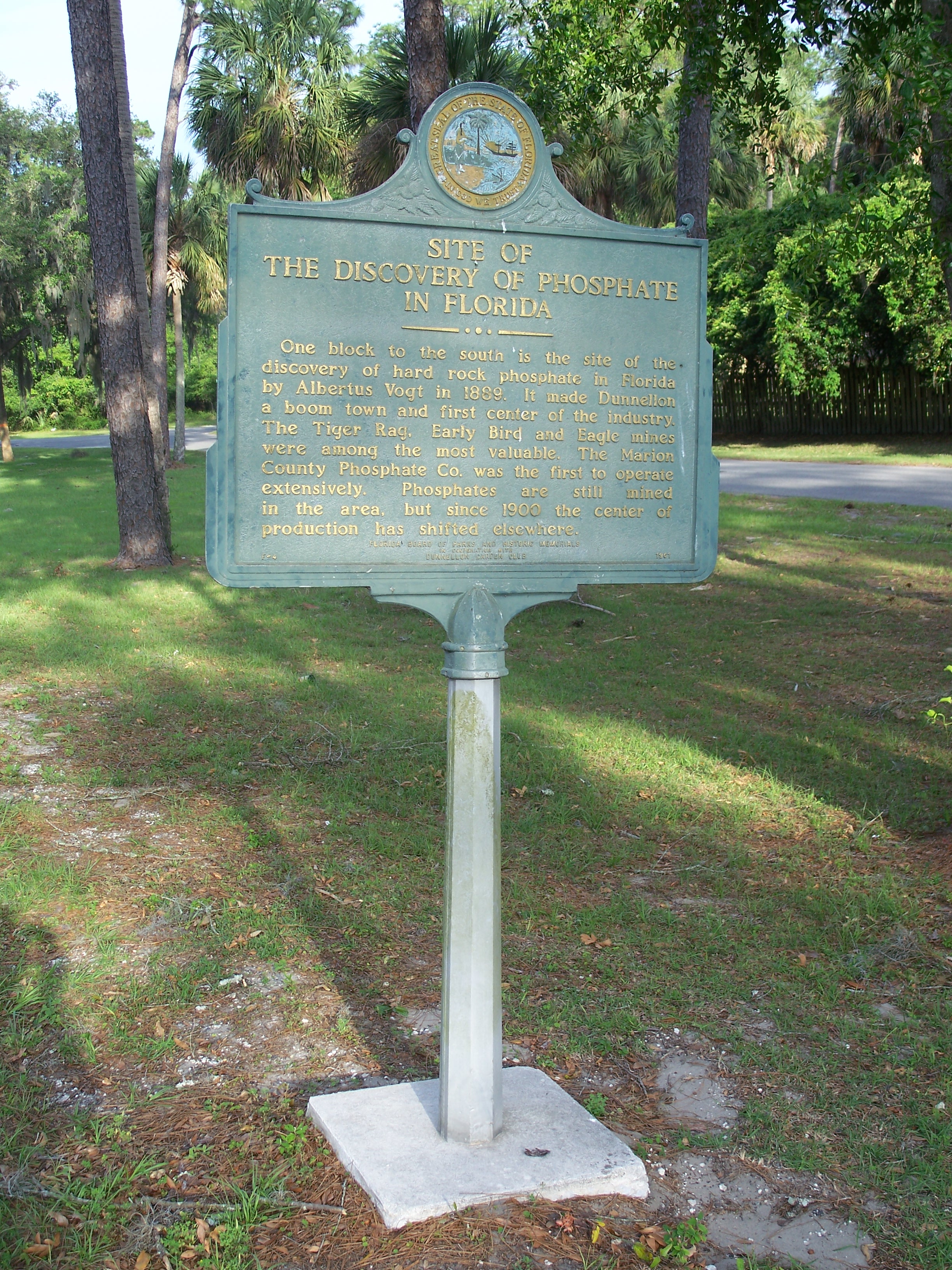
Dunnellon is a city with the unique feature of sitting in 3 counties in Marion, Levy & Citrus counties in Florida, United States. The predominant part falls in the Marion county. The population was 1,928 at the 2020 census, up from 1,733 in 2010. It is part of the Ocala Metropolitan Statistical Area. Geography Dunnellon is located in southwestern Marion County at 29°3'N 82°27'W (29.0500, –82.4555), due north of Tampa. It is bordered to the southwest by the Withlacoochee River, which forms the border with Citrus County. Dunnellon is bordered to the north by unincorporated Rainbow Springs. U.S. Route 41 passes through the city, leading north to Williston and south to Inverness. Ocala, the Marion county seat, is to the northeast. According to the United States Census Bureau, Dunnellon has a total area of , of which are land and , or 3.27%, are water. The Rainbow River joins the Withlacoochee River in Dunnellon, with the combined flow leading west toward the Gulf of Me ... [...More Info...] [...Related Items...] OR: [Wikipedia] [Google] [Baidu] |


