|
Railway Construction Act
The was promulgated by the Diet of Japan on June 21, 1892, and designated government support for a network of thirty-three railway lines covering most of Japan, with the exception of Hokkaidō. On April 11, 1922, the Diet amended the law to add an additional network of regional and local routes. Today, these lines form the backbone of the national railway network, JR (although JR has relinquished control of some of the more minor ones). Lines designated by the Act of 1892 {, class=wikitable !Route !Year Completed !Line name at present , - , colspan=3, Lines of the central region , - , Hachiōji or Gotenba — Kōfu — Suwa — Ina District or NishiChikuma District — Nagoya , 1911 Hachiōji — Nagoya via NishiChikuma District by national railway , Chūō Main Line , - , Nagano or Shinonoi (present day in Nagano) — Matsumoto — connect to the previous clause route , 1902 Shinonoi — Shiojiri by national railway , Shinonoi Line , - , Kōfu — Fujikawa , 1928 Kō ... [...More Info...] [...Related Items...] OR: [Wikipedia] [Google] [Baidu] |
Diet Of Japan
The is the national legislature of Japan. It is composed of a lower house, called the House of Representatives (, ''Shūgiin''), and an upper house, the House of Councillors (, '' Sangiin''). Both houses are directly elected under a parallel voting system. In addition to passing laws, the Diet is formally responsible for nominating the Prime Minister. The Diet was first established as the Imperial Diet in 1890 under the Meiji Constitution, and took its current form in 1947 upon the adoption of the post-war constitution. Both houses meet in the in Nagatachō, Chiyoda, Tokyo. Composition The houses of the National Diet are both elected under parallel voting systems. This means that the seats to be filled in any given election are divided into two groups, each elected by a different method; the main difference between the houses is in the sizes of the two groups and how they are elected. Voters are also asked to cast two votes: one for an individual candidate in a const ... [...More Info...] [...Related Items...] OR: [Wikipedia] [Google] [Baidu] |
Fuji, Shizuoka
is a city in eastern Shizuoka Prefecture, Japan. , the city had an estimated population of 245,015 in 106,087 households, and a population density of 1,000 persons per km2. The total area of the city is . Fuji is the third largest city in terms of population in Shizuoka Prefecture, trailing Hamamatsu and Shizuoka. Geography Located on the banks of the Fuji River, most of the city of Fuji enjoys good views of Mount Fuji, part of whose summit is within the city borders. The city is bordered to the south by Suruga Bay on the Pacific Ocean. File:Fuji city from Ashitaka Mountains.jpg, Fuji city and Suruga Bay from Ashitaka Mountains File:Fuji_City_Panorama.jpg, Fuji City and Mount Fuji seen from city hall Surrounding municipalities *Shizuoka Prefecture **Shimizu-ku, Shizuoka **Fujinomiya **Numazu ** Susono **Gotemba **Nagaizumi Demographics Per Japanese census data, the population of Fuji has grown rapidly over the past 50 years. Climate The city has a climate characterized ... [...More Info...] [...Related Items...] OR: [Wikipedia] [Google] [Baidu] |
Nanao Line
The is a railway line in Ishikawa Prefecture, Japan, operated by West Japan Railway Company (JR West) and the Noto Railway. It runs between Tsubata Station in Tsubata and Anamizu Station in Anamizu. JR West operates the section between Tsubata and , while the Noto Railway (the second company with this name, see Former connecting lines section below) operates the section between and Anamizu. The section between Wakuraonsen and Nanao is served by both companies. A further section of the line between Anamizu and closed in 2001. Prior to the transfer of the Wakuraonsen — Wajima section from JR West to Noto Railway in 1991, Noto Railway took control of another former Japanese National Railways (JNR) line in 1988, the Noto Line. It closed in 2005. In 2015, the IR Ishikawa Railway took over the Hokuriku Main Line at Tsubata, effectively isolating the Nanao Line from the rest of the JR network; however, all JR West Nanao Line services continue to run through into the IR Is ... [...More Info...] [...Related Items...] OR: [Wikipedia] [Google] [Baidu] |
Hokuriku Main Line
The Hokuriku Main Line ( ja, 北陸本線, ) is a 176.6 kilometer railway line owned by the West Japan Railway Company (JR West) connecting the Maibara Station in Maibara, Shiga, with the Naoetsu Station in Joetsu, Niigata. The section between Kanazawa Station and Naoetsu Station is now operated by third-sector railways. It serves the Hokuriku region on the northern central coast of Honshu, the largest island of Japan, as well as offering connections to the regions of Kansai, Tōkai, Kantō, and Tōhoku. The section of the line between Maibara and Kanazawa is an important transportation artery along the Sea of Japan coast, because the Shinkansen high-speed network has not yet been extended through the Hokuriku region. The Hokuriku Shinkansen was opened on March 14, 2015 between and , therefore the section between the Kanazawa Station and the Naoetsu Station was transformed from a JR line to a third-sector railway; the remaining Shinkansen segment onward to Kansai region is ... [...More Info...] [...Related Items...] OR: [Wikipedia] [Google] [Baidu] |
Tsubata, Ishikawa
is a town located in Kahoku District, Ishikawa Prefecture, Japan. , the town had an estimated population of 37,694 in 13873 households, and a population density of 430 persons per km2. The total area of the town was . Geography Tsubata is located near the middle of Ishikawa Prefecture. It plays an important role as a crossroads between the Kaga region, the Noto region, and Toyama Prefecture. To the east, valleys and dales branch out through the low hills, while a flat plain 2-3 kilometers in width spreads out to the west. Natural features of Tsubata are Mount Sangoku, Kohokugata Lake and the Tsubata and Omi rivers. The town has a humid continental climate (Köppen ''Cfa'') characterized by mild summers and cold winters with heavy snowfall. The average annual temperature in Tsubata is 14.2 °C. The average annual rainfall is 2512 mm with September as the wettest month. The temperatures are highest on average in August, at around 26.9 °C, and lowest in January, at a ... [...More Info...] [...Related Items...] OR: [Wikipedia] [Google] [Baidu] |
Nanao, Ishikawa
is a city located in Ishikawa Prefecture, Japan. , the city had an estimated population of 49,660 people in 21,809 households. The total area of the city was . Nanao is the fifth largest city by population in Ishikawa, behind Kanazawa, Hakusan, Komatsu, and Kaga. Geography Nanao occupies the southeastern coast of Noto Peninsula and is bordered by the Sea of Japan on the east and north, and Toyama Prefecture to the south. Parts of the city are within the borders of the Noto Hantō Quasi-National Park. The name "Nanao" (七尾) literally means "Seven Tails" and is said to be named for the seven mountain ridges (or "tails") surrounding Nanao that are visible when viewed from Joyama (七尾城山), site of the city's historical castle ruins. These ridges are called ''Kikuo'' (菊尾, ''"Chrysanthemum Tail"''), ''Kameo'' (亀尾, ''"Turtle Tail"''), ''Matsuo'' (松尾, ''"Pine Tail"''), ''Torano'o'' (虎尾, ''"Tiger Tail"''), ''Takeo'' (竹尾, ''"Bamboo Tail"''), ''Umeo'' (梅尾 ... [...More Info...] [...Related Items...] OR: [Wikipedia] [Google] [Baidu] |
Kanazawa, Ishikawa
is the capital Cities of Japan, city of Ishikawa Prefecture, Japan. , the city had an estimated population of 466,029 in 203,271 households, and a population density of 990 persons per km2. The total area of the city was . Overview Cityscape File:もてなしドーム3.jpg, Kanazawa Station(2013) File:Omichoichibakan004.jpg, Ōmichō-Market(Ōmichō-Ichiba)(2013) File:Kanazawa view from Utatsuyama Park.jpg, Skyline of Kanazawa City(2017) File:Cityscape at downtown Kanazawa.jpg, Central Business District, CBD of Kanazawa File:Katamachi Crossing.jpg, Downtown of Katamachi Area (2022) Geography Kanazawa is located in north-western Ishikawa Prefecture in the Hokuriku region of Japan and is bordered by the Sea of Japan to the west and Toyama Prefecture to the east. The city sits between the Sai River (Ishikawa), Sai and Asano river, Asano rivers. The eastern portion of the city is dominated by the Japanese Alps. Parts of the city are within the borders of the H ... [...More Info...] [...Related Items...] OR: [Wikipedia] [Google] [Baidu] |
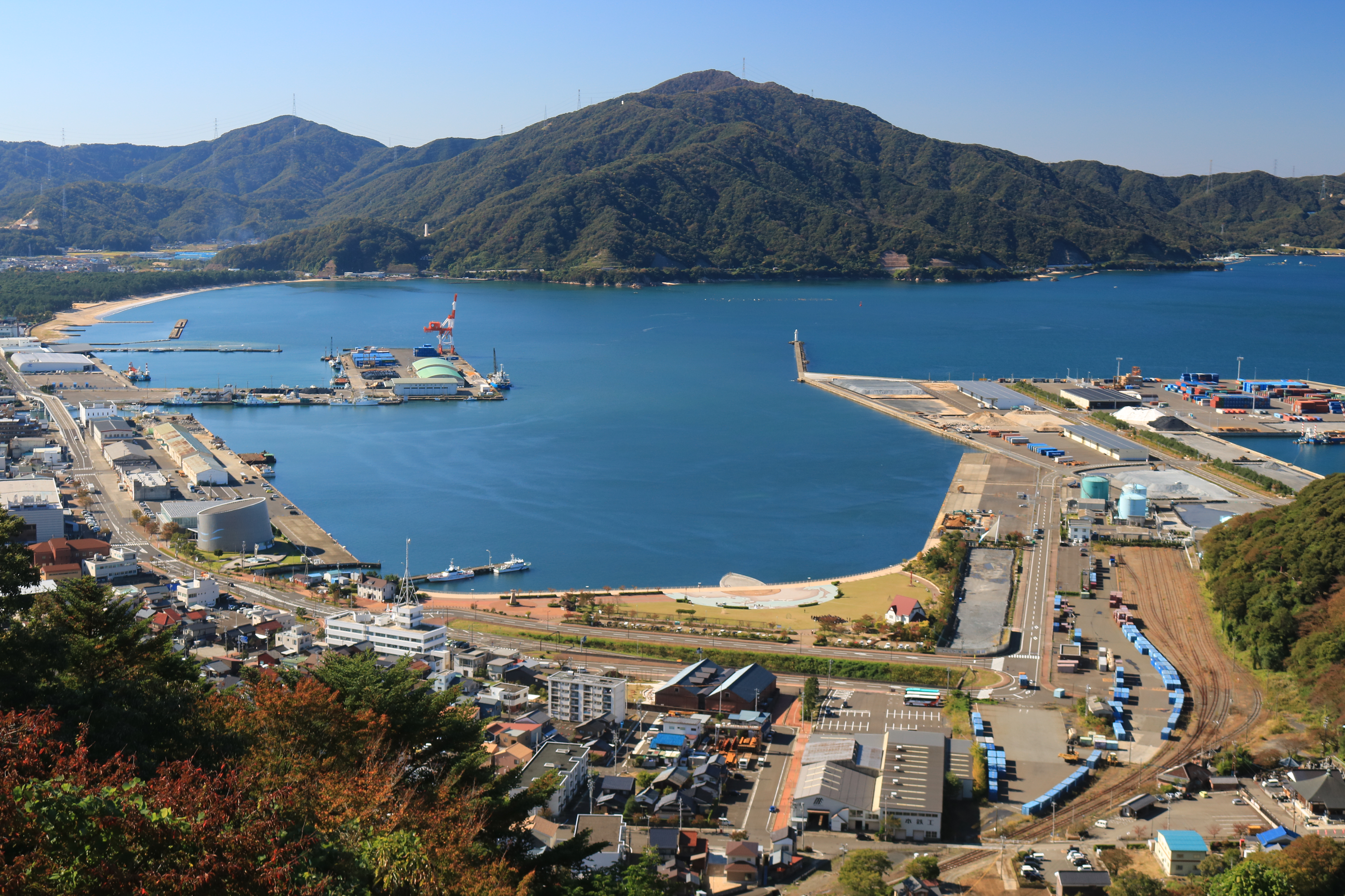
Tsuruga, Fukui
is a city located in Fukui Prefecture, Japan. , the city had an estimated population of 66,123 in 28,604 households and the population density of 260 persons per km2. The total area of the city was . Geography Tsuruga is located in central Fukui Prefecture, bordered by Shiga Prefecture to the south and Wakasa Bay of the Sea of Japan to the north. Tsuruga lies some 50 km south of Fukui, 90 km northwest of Nagoya, 40 km northwest of Maibara, 115 km northeast of Osaka, 75 km northeast of Kyoto, and 65 km east of Maizuru. Among cities on the Sea of Japan coast, Tsuruga is the nearest city to the Pacific Ocean. The distance between Tsuruga and Nagoya is only 115 km. Tsuruga and Nagoya are historically close to Shiga Prefecture and Kyoto. Neighbouring municipalities *Fukui Prefecture ** Echizen ** Mihama *Shiga Prefecture ** Takashima ** Nagahama Climate Tsuruga has a humid subtropical climate (Köppen climate classification ''Cfa'') with hot ... [...More Info...] [...Related Items...] OR: [Wikipedia] [Google] [Baidu] |
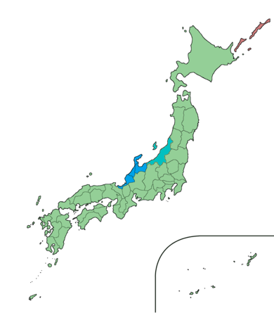
Hokuriku Region
The was located in the northwestern part of Honshu, the main island of Japan. It lay along the Sea of Japan within the Chūbu region, which it is currently a part of. It is almost equivalent to Koshi Province and Hokurikudō area in pre-modern Japan. Since the Heian period until the Edo period the region was a core recipient of population, the population grew to be much larger proportionately than it is today, despite the rural character. With the growth of urban centers in the 20th century, particularly Tokyo and Nagoya, Chūkyō, the Hokuriku has steadily declined in importance to become relative backwaters. The region is also known for traditional culture that originated from elsewhere that has been long lost along the Taiheiyō Belt. The Hokuriku region includes the four prefectures of Ishikawa Prefecture, Ishikawa, Fukui Prefecture, Fukui, Niigata Prefecture, Niigata and Toyama Prefecture, Toyama, although Niigata is sometimes included in one of the following regions: * ... [...More Info...] [...Related Items...] OR: [Wikipedia] [Google] [Baidu] |
Takayama Main Line
The is a Japanese railway line between Gifu Station in Gifu and Toyama Station in Toyama, operated by Central Japan Railway Company (JR Central) and West Japan Railway Company (JR West). The line directly links the Chūkyō Metropolitan Area (metropolitan Nagoya) and Hokuriku region in a shorter distance, but with a longer travel time, than by using the combination of the Tōkaidō Shinkansen and Hokuriku Main Line. Now the line primarily functions as a way to access the scenic areas of Hida (ancient Hida Province), in the rugged mountains of northern Gifu Prefecture, such as Gero ''onsen'' (hot spring), Takayama, Shirakawa-gō, and the Kiso River. The first section of the line, between Gifu and Kagamigahara, opened in . The whole line was completed in 1934. Basic data *Operators, distances: **Total distance: **Central Japan Railway Company ( Category 1) ***Gifu - Inotani: **West Japan Railway Company (Category 1) ***Inotani - Toyama: **Japan Freight Railway Company ( Categ ... [...More Info...] [...Related Items...] OR: [Wikipedia] [Google] [Baidu] |
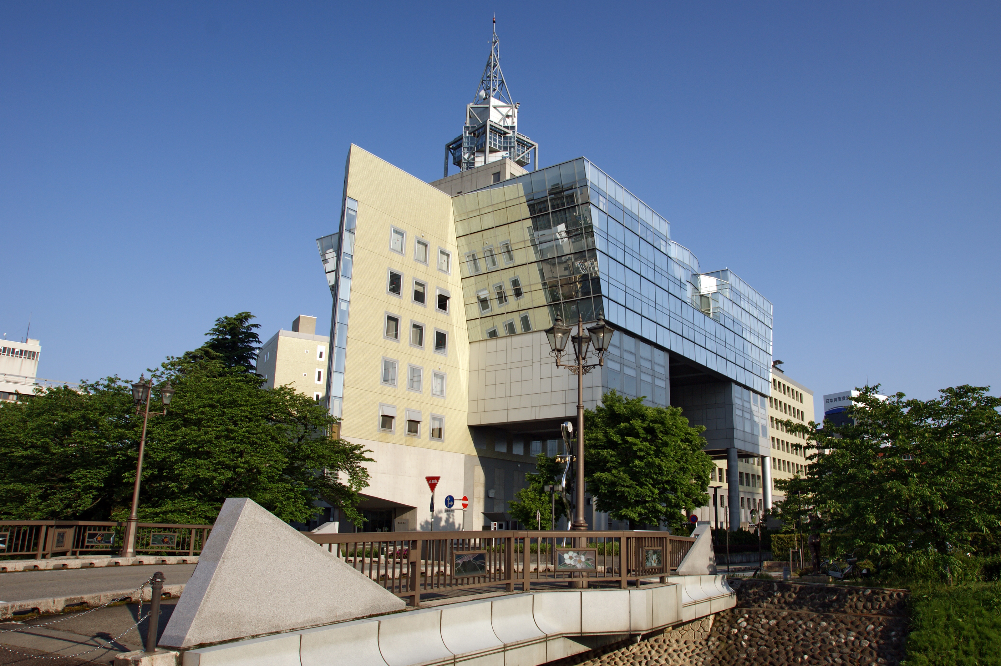
Toyama, Toyama
is the capital city of Toyama Prefecture, Japan, located on the coast of the Sea of Japan in the Chūbu region on central Honshū, about north of the city of Nagoya and northwest of Tokyo. , the city had an estimated population of 415,844 in 176,643 households, and a population density of 335 persons per km2. Its total area was . Overview The city has been designated an environmental model city by the national government for its efforts to reduce the emission of greenhouse gases. Cityscapes File:Toyama Castle (4207284334).jpg, Toyama Castle(2009) File:Anyobo, Toyama, Toyama Prefecture 930-0881, Japan - panoramio (35).jpg, Skyline of Toyama City(2015) File:View from Toyama City Hall, north side.jpg, CBD of Toyama(2018) File:Sogawa st.jpeg, Downtown Sōgawa(2016) File:Fugan unga.JPG, Toyama Kansui park(2016) Geography Located in the middle of its prefecture, Toyama is a seaside city by the coast of the Sea of Japan. Its municipal territory borders with ... [...More Info...] [...Related Items...] OR: [Wikipedia] [Google] [Baidu] |


