|
Ragged Island (Maryland)
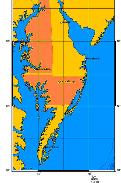
Ragged Island is an island in Dorchester County, Maryland, United States. It is located in Chesapeake Bay, on the western coast of Delmarva Peninsula, and covers an area of . It has a maximum elevation of above the sea level. An airport is located on the northern part of the island. In 1995, the island was purchased by a Maryland couple Richard and Ellen Bernstein. References {{coord, 38, 32, 12, N, 76, 16, 36, W, display=title Dorchester County, Maryland Coastal islands of Maryland ... [...More Info...] [...Related Items...] OR: [Wikipedia] [Google] [Baidu] |
Dorchester County, Maryland
Dorchester County is a county located in the U.S. state of Maryland. At the 2020 census, the population was 32,531. Its county seat is Cambridge. The county was formed in 1669 and named for the Earl of Dorset, a family friend of the Calverts (the founding family of the Maryland colony). Dorchester County comprises the Cambridge, MD Micropolitan Statistical Area, which is also included in the Salisbury-Cambridge, MD-DE Combined Statistical Area. It is located on the Eastern Shore of Maryland. Dorchester County is the largest county by total area on the Eastern Shore. It is bordered by the Choptank River to the north, Talbot County to the northwest, Caroline County to the northeast, Wicomico County to the southeast, Sussex County, Delaware, to the east, and the Chesapeake Bay to the west. Dorchester County uses the slogan, "The Heart of Chesapeake Country", due to its geographical location and the heart-like shape of the county on a map. History Many residents of Dorchester ... [...More Info...] [...Related Items...] OR: [Wikipedia] [Google] [Baidu] |
Chesapeake Bay
The Chesapeake Bay ( ) is the largest estuary in the United States. The Bay is located in the Mid-Atlantic (United States), Mid-Atlantic region and is primarily separated from the Atlantic Ocean by the Delmarva Peninsula (including the parts: the Eastern Shore of Maryland / Eastern Shore of Virginia and the state of Delaware) with its mouth of the Bay at the south end located between Cape Henry and Cape Charles (headland), Cape Charles. With its northern portion in Maryland and the southern part in Virginia, the Chesapeake Bay is a very important feature for the ecology and economy of those two states, as well as others surrounding within its watershed. More than 150 major rivers and streams flow into the Bay's drainage basin, which covers parts of six states (New York, Pennsylvania, Delaware, Maryland, Virginia and West Virginia) and all of District of Columbia. The Bay is approximately long from its northern headwaters in the Susquehanna River to its outlet in the Atlantic Ocea ... [...More Info...] [...Related Items...] OR: [Wikipedia] [Google] [Baidu] |
Delmarva Peninsula
The Delmarva Peninsula, or simply Delmarva, is a large peninsula and proposed state on the East Coast of the United States, occupied by the vast majority of the state of Delaware and parts of the Eastern Shore regions of Maryland and Virginia. The peninsula is long. In width, it ranges from near its center, to at the isthmus on its northern edge, to less near its southern tip of Cape Charles. It is bordered by the Chesapeake Bay on the west, Pocomoke Sound on the southwest, and the Delaware River, Delaware Bay, and the Atlantic Ocean on the east. Etymology In older sources, the peninsula between Delaware Bay and Chesapeake Bay was referred to variously as the Delaware and Chesapeake Peninsula or simply the Chesapeake Peninsula. The toponym ''Delmarva'' is a clipped compound of Delaware, Maryland, and Virginia ( official abbreviation ''VA''), which in turn was modeled after Delmar, a border town named after two of those states. While Delmar was founded and named in 1859, ... [...More Info...] [...Related Items...] OR: [Wikipedia] [Google] [Baidu] |

