|
Radisson, Quebec
Radisson is a small unconstituted locality situated near the Robert-Bourassa hydroelectric power station on the La Grande River in the James Bay region of Quebec, Canada. Geographically, Radisson is located halfway between the southern and northernmost points in Quebec and is, besides Schefferville, the only non-native town north of the 53rd parallel in this province. Despite its remoteness, Radisson has plenty of services for its residents and travellers: two fuel stations, hotel, motel, campground (summer only), a general store, restaurants, gift shops, a school and a hospital. It is also home to a huge Hydro-Québec employee facility, from where guided tours to the Robert-Bourassa power station start. It also houses employees of Air Inuit who are stationed at La Grande Rivière Airport. The Cree village of Chisasibi is about to the west, near the mouth of the La Grande River. To the East is the Trans-Taiga Road (French: ''Route Transtaïga'') that leads to the Caniapisca ... [...More Info...] [...Related Items...] OR: [Wikipedia] [Google] [Baidu] |
Robert-Bourassa Generating Station
The Robert-Bourassa generating station, formerly known as La Grande-2 (LG-2), is a hydroelectric power station on the La Grande River that is part of Hydro-Québec's James Bay Project in Canada. The station can generate 5,616 MW and its 16 units were gradually commissioned between 1979 and 1981. Annual generation is in the vicinity of 26500 GWh. Together with the adjacent 2,106 MW La Grande-2-A generating station (LG-2-A), commissioned in 1991–1992, it uses the reservoir and dam system of the Robert-Bourassa Reservoir to generate electricity. The two plants taken together account for more than 20% of Hydro-Québec's total installed capacity of 36,810 MW in 2009. It is Canada's largest hydroelectric power station, ranks in 12th place on the list of largest hydroelectric power stations and is the world's largest underground power station. Initially known as La Grande-2, it was renamed after Robert Bourassa who, as Premier of Quebec (1970–1976 and 1985–1994) gave the Ja ... [...More Info...] [...Related Items...] OR: [Wikipedia] [Google] [Baidu] |
James Bay Project
The James Bay Project (french: projet de la Baie-James) refers to the construction of a series of hydroelectric power stations on the La Grande River in northwestern Quebec, Canada by state-owned utility Hydro-Québec, and the diversion of neighbouring rivers into the La Grande watershed. It is located between James Bay to the west and Labrador to the east, and its waters flow from the Laurentian Plateau of the Canadian Shield. The project covers an area the size of New York State and is one of the largest hydroelectric systems in the world. It has cost upwards of US$20 billion to build and has an installed generating capacity of 16,527 megawatts. If fully expanded to include all of the original planned dams, as well as the additional James Bay II projects, the system would generate a total of 27,000 MW, making it the largest hydroelectric system in the world. It has been built since 1974 by James Bay Energy () for Hydro-Québec. Located in a region inhabited by Cree and Inuit ... [...More Info...] [...Related Items...] OR: [Wikipedia] [Google] [Baidu] |
Caniapiscau
Caniapiscau () is a vast unorganized territory in the Côte-Nord region of Quebec, Canada, part of Caniapiscau Regional County Municipality. The territory is home to the huge Caniapiscau Reservoir, the largest body of water in Quebec. The reservoir was named after Lake Caniapiscau that was flooded in 1981 during the formation of the reservoir. The name comes from the Cree or Innu term ''kaniapiskau'' or ''kaneapiskak'' which means "rocky point" or "place where there is a rocky point". Albert Peter Low had noted in 1895 that "a high rocky headland jutts into the lake." He probably referred to the northwest facing peninsula that gives the reservoir the shape of an arc as we know it now. In the 19th century, Lake Caniapiscau was frequented by hunters and fur traders. In 1834, the Hudson's Bay Company opened there an outpost to link its facilities in the James Bay region with those of Ungava Bay. The Kaniapiskau Post closed in 1870. Community Caniapiscau () is a small community w ... [...More Info...] [...Related Items...] OR: [Wikipedia] [Google] [Baidu] |
Caniapiscau Reservoir
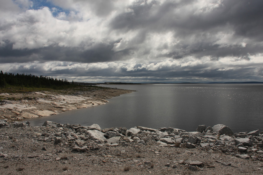
The Caniapiscau Reservoir () is a reservoir on the upper Caniapiscau River in the Côte-Nord administrative region of the Canadian province of Quebec. It is the largest body of water in Quebec and the second largest reservoir in Canada. The Caniapiscau Reservoir, formed by two dams and forty-three dikes, is the largest reservoir in surface area of the James Bay Project. As headpond, it feeds the power plants of the La Grande complex in the winter and provides up to 35% of their production. Its total catchment area is about . The reservoir was named after Lake Caniapiscau that was flooded during the formation of the reservoir. The name is an adaptation of the Cree or Innu toponym ''kâ-neyâpiskâw'', which means "rocky point". Albert Peter Low had noted in 1895 that "a high rocky headland jutts into the lake." He probably referred to the northwest facing peninsula that gives the reservoir the shape of an arc as we current know it. The Caniapiscau Reservoir is accessible by b ... [...More Info...] [...Related Items...] OR: [Wikipedia] [Google] [Baidu] |
Trans-Taiga Road
The Trans-Taiga Road (french: Route Transtaïga) is an extremely remote wilderness road in northern Quebec, Canada. It is long to Centrale Brisay and another along the Caniapiscau Reservoir, all of it unpaved. Description The road's northeastern terminus is almost at the 55th parallel north, making it the northernmost continuous road in Eastern North America. Though the terminus is also the farthest point from any town via road in North America ( from Radisson), is nonetheless relatively close – – to Schefferville geographically. It does not, however, provide access to it, as the intervening terrain is impassable even in an all-terrain vehicle. The road's end is also close to the southern limit of Nunavik, Quebec's Inuit region which is negotiating for autonomous status within Quebec. The Trans-Taiga Road branches off from the James Bay Road (french: Route de la Baie James, links=no) at kilometre 544. It was built as an access road to the hydro-electric generating stat ... [...More Info...] [...Related Items...] OR: [Wikipedia] [Google] [Baidu] |
Chisasibi, Quebec
Chisasibi ( cr, ᒋᓵᓰᐲ, translit=Cisâsîpî; meaning Great River) is a village on the eastern shore of James Bay, in the Eeyou Istchee equivalent territory (ET) in northern Quebec, Canada. It is situated on the south shore of La Grande River (the Grand River), less than from the river's mouth. Chisasibi is one of nine Cree villages in the region, and is a member of the Grand Council of the Crees of Quebec.Cree Culture , Chisasibi The territory surrounding Chisasibi is part of the , of which parts are jointly managed by the municipalities of the [...More Info...] [...Related Items...] OR: [Wikipedia] [Google] [Baidu] |
La Grande Rivière Airport
La Grande Rivière Airport is an airfield location about south southwest of Radisson, Quebec, Canada. It is used mostly to shuttle Hydro-Québec personnel between Radisson and the larger cities in Quebec, but it is also served by regular scheduled flights of Air Inuit. Air Creebec also served the airport until March 2012. During the mid- and late 1970s, Nordair operated scheduled passenger flights nonstop to Montreal Dorval Airport (now Trudeau International Airport) with Boeing 737-200 jetliners on a weekly basis.http://www.departedflights.com, April 15, 1975 & Nov. 15, 1979 Official Airline Guide (OAG) editions, Montreal Dorval Airport flight schedules for Nordair Airlines and destinations Accidents and incidents *On 15 November 1975, Douglas C-47 C-FCSC of Nordair was damaged beyond economic repair by fire at La Grande Rivière Airport. *On 1 August 1994, RAF Tornado GR1 ZD844 made an emergency landing at La Grande Rivière Airport. The aircraft had just had a m ... [...More Info...] [...Related Items...] OR: [Wikipedia] [Google] [Baidu] |
Air Inuit
Air Inuit ( Inuktitut syllabics: ᐃᓄᐃᑦ ᖃᖓᑦᑕᔪᖏᑦ) is an airline based in the Montreal borough of Saint-Laurent, Quebec, Canada. It operates domestic passenger services and charter and cargo services in Nunavik, Labrador and Nunavut. Its main base is Kuujjuaq Airport. History The airline was established and started operations in 1978 using a de Havilland Canada DHC-2 Beaver aircraft. The airline is collectively owned by the Inuit of Nunavik through the Makivik Corporation. In 1984 acquired Chaparal Charters and its fleet of two Twin Otters and one Douglas DC-3. In 2012, Air Inuit relocated their headquarters to a new multi-purpose facility on Côte-Vertu Boulevard near the Montréal–Trudeau International Airport. In 2016, Air Inuit pilot Melissa Haney became the first female Inuk pilot to reach the rank of captain. She was featured on a commemorative postage stamp released by the Canadian Ninety-Nines. Destinations Air Inuit operates scheduled s ... [...More Info...] [...Related Items...] OR: [Wikipedia] [Google] [Baidu] |
53rd Parallel North
The 53rd parallel north is a circle of latitude that is 53 degrees north of the Earth's equatorial plane. It crosses Europe, Asia, the Pacific Ocean, North America, and the Atlantic Ocean. At this latitude the sun is visible for 16 hours, 56 minutes during the summer solstice and 7 hours, 34 minutes during the winter solstice. Approximately 53º20' North, north of this parallel, during the June summer solstice, the sun is visible for 17 hours exactly. One minute of longitude along the 53rd parallel is approximately . Around the world Starting at the Prime Meridian (northeast of Boston, Lincolnshire, England) and heading eastwards, the parallel 53° north passes through: See also *52nd parallel north *54th parallel north The 54th parallel north is a circle of latitude that is 54 degrees north of the Earth's equatorial plane. It crosses Europe, Asia, the Pacific Ocean, North America, and the Atlantic Ocean. At this latitude, the sun is visible for 17 hours, 9 ... ... [...More Info...] [...Related Items...] OR: [Wikipedia] [Google] [Baidu] |
Schefferville, Quebec
Schefferville is a town in the Provinces and territories of Canada, Canadian province of Quebec. Schefferville is in the heart of the Naskapi and Innu territory in northern Quebec, less than 2 km (1¼ miles) from the border with Labrador on the north shore of Knob Lake. It is located within the Caniapiscau Regional County Municipality and has an area of . Schefferville completely surrounds the autonomous Innu community of Matimekosh, Quebec, Matimekosh, and it abuts the small community of Lac-John Reserve. Both of the latter communities are First Nations Innu reserves. Schefferville is also close to the Naskapi reserved land of Kawawachikamach (Naskapi reserved land), Kawawachikamach. The isolated town is not connected to the provincial road network but is accessible by airplane via the Schefferville Airport or by train. Schefferville is the northern terminus of Tshiuetin Rail Transportation (formerly operated by the Quebec North Shore and Labrador Railway) with service to ... [...More Info...] [...Related Items...] OR: [Wikipedia] [Google] [Baidu] |


