|
R600 Road (Ireland)
The R600 road is a regional road in County Cork in Ireland. From west to east, it starts in the north of Clonakilty, going through Timoleague, Ballinspittle, Kinsale, Belgooly, and ending at Cork Airport, where the road continues as the N27 to Cork city centre and the N40 South Ring Road. Sections of the R600 are way-marked as part the Wild Atlantic Way tourist route. See also *Roads in Ireland References External linksRoads Act 1993 (Classification of Regional Roads) Order 2006– Department of Transport The Department for Transport (DfT) is a department of His Majesty's Government responsible for the English transport network and a limited number of transport matters in Scotland, Wales and Northern Ireland that have not been devolved. The d ... Regional roads in the Republic of Ireland Roads in County Cork {{Ireland-road-stub ... [...More Info...] [...Related Items...] OR: [Wikipedia] [Google] [Baidu] |
Cork (city)
Cork ( , from , meaning 'marsh') is the second largest city in Ireland and third largest city by population on the island of Ireland. It is located in the south-west of Ireland, in the province of Munster. Following an extension to the city's boundary in 2019, its population is over 222,000. The city centre is an island positioned between two channels of the River Lee which meet downstream at the eastern end of the city centre, where the quays and docks along the river lead outwards towards Lough Mahon and Cork Harbour, one of the largest natural harbours in the world. Originally a monastic settlement, Cork was expanded by Viking invaders around 915. Its charter was granted by Prince John in 1185. Cork city was once fully walled, and the remnants of the old medieval town centre can be found around South and North Main streets. The city's cognomen of "the rebel city" originates in its support for the Yorkist cause in the Wars of the Roses. Corkonians sometimes refer to ... [...More Info...] [...Related Items...] OR: [Wikipedia] [Google] [Baidu] |
Kinsale
Kinsale ( ; ) is a historic port and fishing town in County Cork, Ireland. Located approximately south of Cork City on the southeast coast near the Old Head of Kinsale, it sits at the mouth of the River Bandon, and has a population of 5,281 (as of the 2016 census) which increases in the summer when tourism peaks. Kinsale is a holiday destination for both Irish and overseas tourists. The town is known for its restaurants, including the Michelin-starred Bastion restaurant, and holds a number of annual gourmet food festivals. As a historically strategic port town, Kinsale's notable buildings include Desmond Castle (associated with the Earls of Desmond and also known as the French Prison) of , the 17th-century pentagonal bastion fort of James Fort on Castlepark peninsula, and Charles Fort, a partly restored star fort of 1677 in nearby Summercove. Other historic buildings include the Church of St Multose (Church of Ireland) of 1190, St John the Baptist (Catholic) of 1839, and t ... [...More Info...] [...Related Items...] OR: [Wikipedia] [Google] [Baidu] |
Clonakilty
Clonakilty (; ), sometimes shortened to Clon, is a town in County Cork, Ireland. The town is located at the head of the tidal Clonakilty Bay. The rural hinterland is used mainly for dairy farming. The town's population as of 2016 was 4,592. The town is a tourism hub in West Cork, and was recognised as the "Best Town in Europe" in 2017, and "Best Place of the Year" in 2017 by the Royal Institute of the Architects of Ireland. Clonakilty is in the Cork South-West (Dáil Éireann) constituency, which has three seats. History The Clonakilty area has a number of ancient and pre-Celtic sites, including Lios na gCon ringfort. Norman settlers built castles around Clonakilty, and a number of Norman surnames survive in the West Cork area to the present day. In 1292, Thomas De Roach received a charter to hold a market every Monday at Kilgarriffe (then called Kyle Cofthy or Cowhig's Wood), close to where the present town now stands. In the 14th century, a ten-mile strip of fallow woodl ... [...More Info...] [...Related Items...] OR: [Wikipedia] [Google] [Baidu] |
Regional Road (Ireland)
A regional road ( ga, bóthar réigiúnach) in the Republic of Ireland is a class of road not forming a major route (such as a national primary road or national secondary road), but nevertheless forming a link in the Roads in Ireland, national route network. There are over 11,600 kilometres (7,200 miles) of regional roads. Regional roads are numbered with three-digit route numbers, prefixed by "R" (e.g. R105). The equivalent road category in Northern Ireland are Roads in Northern Ireland#"B" roads, B roads. History Until 1977, classified roads in the Republic of Ireland were designated with one of two prefixes: Trunk Roads in Ireland, "T" for Trunk Roads and "L" for Link Roads. ThLocal Government (Roads and Motorways) Act authorised the designation of roads as National roads: in 1977, twenty-five National Primary roads (N1-N25) and thirty-three National Secondary roads (N51-N83) were initially designated unde Many of the remaining classified roads became Regional roads (formally ... [...More Info...] [...Related Items...] OR: [Wikipedia] [Google] [Baidu] |
County Cork
County Cork ( ga, Contae Chorcaí) is the largest and the southernmost county of Ireland, named after the city of Cork, the state's second-largest city. It is in the province of Munster and the Southern Region. Its largest market towns are Mallow, Macroom, Midleton, and Skibbereen. the county had a population of 581,231, making it the third- most populous county in Ireland. Cork County Council is the local authority for the county, while Cork City Council governs the city of Cork and its environs. Notable Corkonians include Michael Collins, Jack Lynch, Roy Keane, Sonia O'Sullivan and Cillian Murphy. Cork borders four other counties: Kerry to the west, Limerick to the north, Tipperary to the north-east and Waterford to the east. The county contains a section of the Golden Vale pastureland that stretches from Kanturk in the north to Allihies in the south. The south-west region, including West Cork, is one of Ireland's main tourist destinations, known for its rugged coast ... [...More Info...] [...Related Items...] OR: [Wikipedia] [Google] [Baidu] |
Timoleague
Timoleague () is a village in the eastern division of Carbery East in County Cork, Ireland. It is located along Ireland's southern coast between Kinsale and Clonakilty, on the estuary of the Argideen River. Nearby is the village of Courtmacsherry. It is about south of Bandon and from Cork on the R600 coastal road. History Timoleague gets its name from its original Irish name ''Tigh Molaga'', meaning the Home/House of Molaga.Timoleague Friary ". corkandross.org, 1 November 2009. Retrieved on 19 April 2009. St. Molaga was reputed to have brought beekeeping/honey to Ireland. Honey production is still evident in the area. The village was formerly spelt Tagumlag, Tymulagy, Tymoleague. The town of Timoleague and much of the adjacent country belonged to the Hodnetts, an English family who settled in the area from [...More Info...] [...Related Items...] OR: [Wikipedia] [Google] [Baidu] |
Ballinspittle
Ballinspittle () is a village in County Cork, Ireland. It is in the barony of Courceys and lies about southwest of Kinsale, on the R600 road. It is near Garrylucas and Garrettstown Blue Flag beaches. The village is a community with new housing estates, businesses, a post office, a national school and a Gaelic Athletic Association facility known as the Jim O' Regan Memorial Park. History Built heritage Ancient historical sites in the area include Ballycatten Fort, which dates from the sixth century, and Curtapurteen, which, according to legend, Saint Patrick once visited. The most southerly tip the Old Head of Kinsale is a site of ancient and present-day lighthouses, as well as a golf links. Templetrine Church, built in the 1820s, is located nearby. Moving statue In the summer of 1985, Ballinspittle received national and international attention when inhabitants claimed to have witnessed a statue of the Blessed Virgin Mary moving spontaneously. As news of the phenomenon spre ... [...More Info...] [...Related Items...] OR: [Wikipedia] [Google] [Baidu] |
Belgooly
Belgooly ( is a village in County Cork, Ireland, located 4.6 kilometres to the north-east of Kinsale. In 2016 it had a population of 826. History The Belgooly Flour Mill, a ruinous building within the village, is entered in the initial Record of Protected Structures. Other, more ancient monuments, included on the Record of Monuments and Places for County Cork, include a reputed holy well site immediately west of the village, and a standing stone to the south in Mitchelstown East townland. On 26 August 1941 a Luftwaffe Junkers Ju 88 crashed close to Belgooly, after being shot down by 615 Squadron of the RAF. Amenities and development The village has a small shop with post-office, Belgooly GAA club facilities, Church of the Sacred Heart Roman Catholic church, and is home to the 'Huntsman' and 'Coleman's' public houses (the latter in business since at least 1914). The village is located within the study area of the Cork Area Strategic Plan and the lands that surround the village ... [...More Info...] [...Related Items...] OR: [Wikipedia] [Google] [Baidu] |
Cork Airport
Cork Airport ( ga, Aerfort Chorcaí, ) is the second-largest of the three principal international airports in Ireland, after Dublin and ahead of Shannon. It is located in Cork City, south of the city centre in an area known as Farmers Cross. In 2018, Cork Airport handled 2,392,821, growing by 8.3% to 2,585,466 passengers as of 2019 and representing a fourth consecutive year of growth. Aviation was severely impacted by the COVID-19 global pandemic in 2020 and passenger numbers at Cork Airport fell to 530,000, a decline of 80%. Cork is the state's second-busiest airport in terms of passenger numbers, after Dublin, and third busiest on the island of Ireland, after Dublin and Belfast International. History 1957 to 1980 In 1957 the Government of Ireland agreed in principle to the building of an airport for Cork. After considering many sites in the area, it was agreed that the airport should be built at Ballygarvan. Tenders were invited for the construction of the airport in 1 ... [...More Info...] [...Related Items...] OR: [Wikipedia] [Google] [Baidu] |
N27 Road (Ireland)
The N27 road is a national primary road in Cork city, Ireland. The road forms a route from the city centre to Cork Airport, and onto the R600 connecting to the port town of Kinsale. The route runs out of the city centre along the following route: ''Michael Collins Bridge'', ''Custom House Street'', ''Éamon De Valera Bridge'', ''Albert Street'' and ''Old Market Road''. The bridges are across the two diverged parts of the River Lee which flow around the city centre. The ''South Link Road'' was opened to traffic in May 1985. By the mid 1990s, the road surface of the ''South Link Road'' had fallen into a state of disrepair. Between 1998 and 1999, a new road surface was laid down along the entire distance of this route. The ''South Link Road'' brings the N27 from the city centre area out to the N40 Cork South Ring Road at the ''Kinsale Road Roundabout'', a three lane signal-controlled non-symmetrical roundabout (with 5 exits) that has been upgraded to a grade-separated interchange ... [...More Info...] [...Related Items...] OR: [Wikipedia] [Google] [Baidu] |
N40 Road (Ireland)
The N40 road (commonly known as the Cork South Ring Road, or locally 'The South Link') is a national primary road in Cork City, Ireland. The road runs through Cork City forming an orbital and distributor route through the south side of the city, linking the N22 at Ballincollig to the N25 at the Dunkettle Interchange. The present N40 was created on 23 February 2012 via statutory instrument. The newly designated N40 was formed from parts of both the N22 and N25. It is intended that once the Cork North Ring Road is completed, that the N40 will comprise a complete orbital route through the inner city. Route The Cork South Ring Road commences at the junction with the N22 at the end of the Ballincollig bypass. The N40 next passes the Curraheen Interchange before meeting the Bandon Road Roundabout, which forms a junction with the N71. This junction also gives access to west Bishopstown. The next exit leads from the Sarsfield Roundabout up to the Wilton Roundabout after pass ... [...More Info...] [...Related Items...] OR: [Wikipedia] [Google] [Baidu] |
Wild Atlantic Way
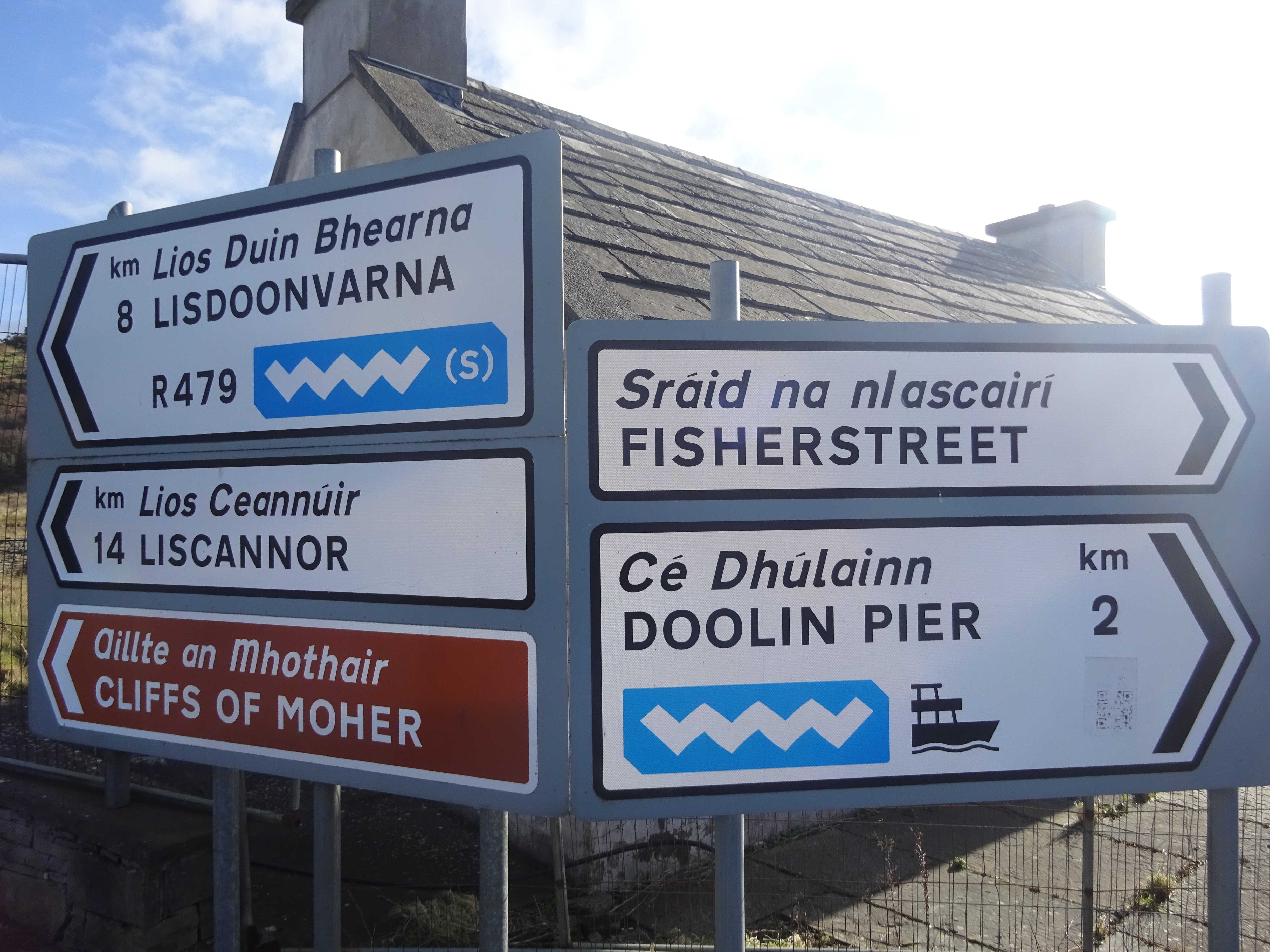
The Wild Atlantic Way ( ga, Slí an Atlantaigh Fhiáin) is a tourism trail on the west coast, and on parts of the north and south coasts, of Ireland. The 2,500 km (1,553 mile) driving route passes through nine counties and three provinces, stretching from County Donegal's Inishowen Peninsula in Ulster to Kinsale, County Cork, in Munster, on the Celtic Sea coast. Description The route is broken down into five sections: * County Donegal * County Donegal to County Mayo * County Mayo to County Clare * County Clare to County Kerry * County Kerry to County Cork Along the route, there are 157 discovery points, 1,000 attractions and more than 2,500 activities. The route was officially launched in 2014 by the Minister of State for Tourism and Sport, Michael Ring, T.D. Key points of interest North West - Donegal, Leitrim and Sligo * Malin Head, Ireland’s most northerly point * Lough Foyle * Lough Swilly * Isle of Doagh * Carrickabraghy Castle * Shrove * Fort Dunre ... [...More Info...] [...Related Items...] OR: [Wikipedia] [Google] [Baidu] |


