|
R238 Road (Ireland)
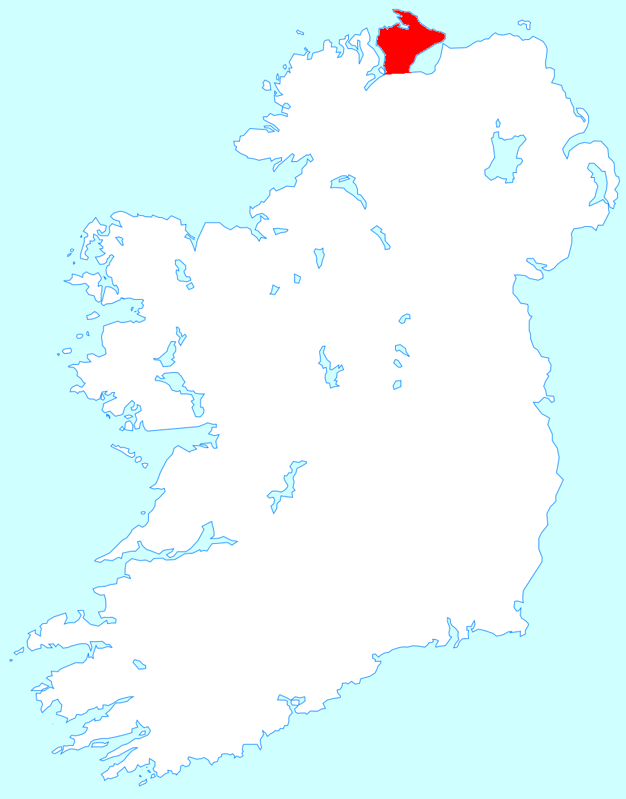
The R238 road is a regional road in Ireland. It is a ring road around the Inishowen Peninsula in County Donegal. The R238 is also part of the main road from Derry to Buncrana. Sections of the road form part of the Wild Atlantic Way. In July 2010, the road was the site of Ireland's worst road crash resulting in eight deaths. The R238 travels north from the N13 at Bridge End. The road travels along Lough Swilly to reach Buncrana. From there the road proceeds inland to Carndonagh. After Carndonagh, the road goes to meet the Lough Foyle coast at Moville. From Moville the road proceeds southwest to end at the County Londonderry border just past Muff. The R238 is long. See also *Roads in Ireland *July 2010 R238 traffic collision On 11 July 2010, eight people were killed when a black Volkswagen Passat collided with a red Toyota Corolla on the Buncrana to Clonmany section of the R238 road in County Donegal, Ireland. It was the deadliest road accident in the country since ... ... [...More Info...] [...Related Items...] OR: [Wikipedia] [Google] [Baidu] |
IRL N13
IRL may refer to: Places * Republic of Ireland (ISO 3166-1 alpha-3 country code) * Irlam railway station (National Rail station code IRL), England Organizations * International Rugby League, the governing body for the sport of rugby league * Industrial Research Limited, New Zealand * Isamaa ja Res Publica Liit (Pro Patria and Res Publica Union), an Estonian political party * Institute for Research on Learning, Palo Alto, California, US, 1986–2000 * Institut Ramon Llull, promoting Catalan language and culture * Ipswich Rugby League, Australian rugby league football competition Other uses * ''IRL'' (film), a 2013 film * Indy Racing League 1995–2013, later INDYCAR * Internet resource locator * "In real life", internet term * In Real Life (band), boy band * Inverse reinforcement learning Reinforcement learning (RL) is an area of machine learning concerned with how intelligent agents ought to take actions in an environment in order to maximize the notion of cumulative re ... [...More Info...] [...Related Items...] OR: [Wikipedia] [Google] [Baidu] |
Moville
Moville (; ) is a coastal town located on the Inishowen Peninsula of County Donegal, Ireland, close to the northern tip of the island of Ireland. It is the first coastal town of the Wild Atlantic Way when starting on the northern end. Location The town is located on the western shore of Lough Foyle, approximately from Derry, which lies across the border in Northern Ireland. Features include Moville Green, a pier, a large seaside park in the Victorian style which features bandstands, walking trails, playgrounds, a coastal footpath and views east across the waters of the lough to Northern Ireland. Moville is close to several beaches, and receives visitors and daytrippers in the summer months. Moville Community College is located to the south of the town centre, in the townland of Carrownaff. History In the second half of the 19th century, Moville was a point of embarkation for travellers, especially emigrants, to Canada and the United States of America. In the late 19th century, ... [...More Info...] [...Related Items...] OR: [Wikipedia] [Google] [Baidu] |
Lough Swilly
Lough Swilly () in Ireland is a glacial fjord or sea inlet lying between the western side of the Inishowen, Inishowen Peninsula and the Fanad Peninsula, in County Donegal. Along with Carlingford Lough and Killary Harbour it is one of three glacial fjords in Ireland. Geography and ecology Located on the Fanad Peninsula, in County Donegal, the northern extremities of the lough are marked by Fanad, Fanad Head with its lighthouse and Dunaff Head. Towns situated on the lough include Buncrana on Inishowen and Rathmullan on the western side. At the southern end of the lough lies Letterkenny. In the south of the lough a number of islands (Burt, Inch Island, Inch, Coney, Big Isle) were poldered and the land reclaimed during the 19th century for agriculture and the Londonderry and Lough Swilly Railway constructed embankments on the line from Derry to Letterkenny. These reclaimed lands are now wetlands associated with wildlife conservation and birdwatching, and support over 4,000 whooper s ... [...More Info...] [...Related Items...] OR: [Wikipedia] [Google] [Baidu] |
Wild Atlantic Way
The Wild Atlantic Way ( ga, Slí an Atlantaigh Fhiáin) is a tourism trail on the west coast, and on parts of the north and south coasts, of Ireland. The 2,500 km (1,553 mile) driving route passes through nine counties and three provinces, stretching from County Donegal's Inishowen Peninsula in Ulster to Kinsale, County Cork, in Munster, on the Celtic Sea coast. Description The route is broken down into five sections: * County Donegal * County Donegal to County Mayo * County Mayo to County Clare * County Clare to County Kerry * County Kerry to County Cork Along the route, there are 157 discovery points, 1,000 attractions and more than 2,500 activities. The route was officially launched in 2014 by the Minister of State for Tourism and Sport, Michael Ring, T.D. Key points of interest North West - Donegal, Leitrim and Sligo * Malin Head, Ireland’s most northerly point * Lough Foyle * Lough Swilly * Isle of Doagh * Carrickabraghy Castle * Shrove * Fort Dunre ... [...More Info...] [...Related Items...] OR: [Wikipedia] [Google] [Baidu] |
Derry
Derry, officially Londonderry (), is the second-largest city in Northern Ireland and the fifth-largest city on the island of Ireland. The name ''Derry'' is an anglicisation of the Old Irish name (modern Irish: ) meaning 'oak grove'. The old walled city lies on the west bank of the River Foyle, which is spanned by two road bridges and one footbridge. The city now covers both banks (Cityside on the west and Waterside on the east). The population of the city was 83,652 at the 2001 Census, while the Derry Urban Area had a population of 90,736. The district administered by Derry City and Strabane District Council contains both Londonderry Port and City of Derry Airport. Derry is close to the border with County Donegal, with which it has had a close link for many centuries. The person traditionally seen as the founder of the original Derry is Saint , a holy man from , the old name for almost all of modern County Donegal, of which the west bank of the Foyle was a part before 1 ... [...More Info...] [...Related Items...] OR: [Wikipedia] [Google] [Baidu] |
County Donegal
County Donegal ( ; ga, Contae Dhún na nGall) is a county of Ireland in the province of Ulster and in the Northern and Western Region. It is named after the town of Donegal in the south of the county. It has also been known as County Tyrconnell (), after the historic territory of the same name, on which it was based. Donegal County Council is the local council and Lifford the county town. The population was 166,321 at the 2022 census. Name County Donegal is named after the town of Donegal () in the south of the county. It has also been known by the alternative name County Tyrconnell, Tirconnell or Tirconaill (, meaning 'Land of Conall'). The latter was its official name between 1922 and 1927. This is in reference to the kingdom of Tír Chonaill and the earldom that succeeded it, which the county was based on. History County Donegal was the home of the once-mighty Clann Dálaigh, whose best-known branch was the Clann Ó Domhnaill, better known in English as the O'Don ... [...More Info...] [...Related Items...] OR: [Wikipedia] [Google] [Baidu] |
Inishowen
Inishowen () is a peninsula in the north of County Donegal in Ireland. Inishowen is the largest peninsula on the island of Ireland. The Inishowen peninsula includes Ireland's most northerly point, Malin Head. The Grianan of Aileach, a ringfort that served as the royal seat of the over-kingdom of Ailech, stands at the entrance to the peninsula. Towns and villages The main towns and villages of Inishowen are: * Ballyliffin, Buncrana, Bridgend, Burnfoot, Burt * Carndonagh, Carrowmenagh, Clonmany, Culdaff * Dunaff * Fahan * Glengad, Gleneely, Greencastle * Malin, Malin Head, Moville, Muff * Redcastle * Shrove * Quigley's Point * Urris Geography Inishowen is a peninsula of 884.33 square kilometres (218,523 acres), situated in the northernmost part of the island of Ireland. It is bordered to the north by the Atlantic Ocean, to the east by Lough Foyle, and to the west by Lough Swilly. It is joined at the south to the rest of the island and is mostly in County Donegal in ... [...More Info...] [...Related Items...] OR: [Wikipedia] [Google] [Baidu] |
Republic Of Ireland
Ireland ( ga, Éire ), also known as the Republic of Ireland (), is a country in north-western Europe consisting of 26 of the 32 counties of the island of Ireland. The capital and largest city is Dublin, on the eastern side of the island. Around 2.1 million of the country's population of 5.13 million people resides in the Greater Dublin Area. The sovereign state shares its only land border with Northern Ireland, which is part of the United Kingdom. It is otherwise surrounded by the Atlantic Ocean, with the Celtic Sea to the south, St George's Channel to the south-east, and the Irish Sea to the east. It is a unitary, parliamentary republic. The legislature, the , consists of a lower house, ; an upper house, ; and an elected President () who serves as the largely ceremonial head of state, but with some important powers and duties. The head of government is the (Prime Minister, literally 'Chief', a title not used in English), who is elected by the Dáil and appointed by ... [...More Info...] [...Related Items...] OR: [Wikipedia] [Google] [Baidu] |
Regional Road (Ireland)
A regional road ( ga, bóthar réigiúnach) in the Republic of Ireland is a class of road not forming a major route (such as a national primary road or national secondary road), but nevertheless forming a link in the Roads in Ireland, national route network. There are over 11,600 kilometres (7,200 miles) of regional roads. Regional roads are numbered with three-digit route numbers, prefixed by "R" (e.g. R105). The equivalent road category in Northern Ireland are Roads in Northern Ireland#"B" roads, B roads. History Until 1977, classified roads in the Republic of Ireland were designated with one of two prefixes: Trunk Roads in Ireland, "T" for Trunk Roads and "L" for Link Roads. ThLocal Government (Roads and Motorways) Act authorised the designation of roads as National roads: in 1977, twenty-five National Primary roads (N1-N25) and thirty-three National Secondary roads (N51-N83) were initially designated unde Many of the remaining classified roads became Regional roads (formally ... [...More Info...] [...Related Items...] OR: [Wikipedia] [Google] [Baidu] |
County Londonderry
County Londonderry ( Ulster-Scots: ''Coontie Lunnonderrie''), also known as County Derry ( ga, Contae Dhoire), is one of the six counties of Northern Ireland, one of the thirty two counties of Ireland and one of the nine counties of Ulster. Before the partition of Ireland, it was one of the counties of the Kingdom of Ireland from 1613 onward and then of the United Kingdom after the Acts of Union 1800. Adjoining the north-west shore of Lough Neagh, the county covers an area of and today has a population of about 247,132. Since 1972, the counties in Northern Ireland, including Londonderry, have no longer been used by the state as part of the local administration. Following further reforms in 2015, the area is now governed under three different districts; Derry and Strabane, Causeway Coast and Glens and Mid-Ulster. Despite no longer being used for local government and administrative purposes, it is sometimes used in a cultural context in All-Ireland sporting and cultural even ... [...More Info...] [...Related Items...] OR: [Wikipedia] [Google] [Baidu] |
Redcastle, County Donegal
Redcastle () is a village in County Donegal, Ireland, located on the eastern shores of Inishowen Inishowen () is a peninsula in the north of County Donegal in Ireland. Inishowen is the largest peninsula on the island of Ireland. The Inishowen peninsula includes Ireland's most northerly point, Malin Head. The Grianan of Aileach, a ringfort ... and overlooking the wide expanse of Lough Foyle. To the south is the city of Derry and to the north lie the villages of Moville and Greencastle. See also * List of towns and villages in Ireland References Towns and villages in County Donegal {{Donegal-geo-stub ... [...More Info...] [...Related Items...] OR: [Wikipedia] [Google] [Baidu] |
Culdaff
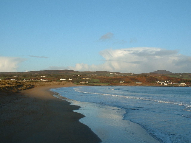
Culdaff () is a village on the Inishowen peninsula of County Donegal, Ireland. Known for its beach, it attracts tourists from all over Ireland. , the population was 237. The present village dates back to the 8th century and was originally the site of the monastery of St Buadán ( Baithéne mac Brénaind), after which the Church of Ireland is named. William Lawson Micks and Samuel Arnold Lawson, acted as Trustees for one hundred acres of bogland at Meenawarra near Culdaff on behalf of the purchaser, Jane Leferre.Bonner, Brian (1982) ''Redford Glebe: the story of an Ulster townland'', Donegal; p. 24 Culdaff Beach Culdaff beach is only about 50 yards away from the village. It includes two beaches, 'the small beach' and 'the big beach'. The beach can be very busy during the summer, and is known for the expansive sand on the main beach, and a large area of rocks around the second and further along the coastline. Fishing The Bunagee Pier is the mooring for two boats that take anglers ... [...More Info...] [...Related Items...] OR: [Wikipedia] [Google] [Baidu] |


