|
Qurghonteppa Oblast
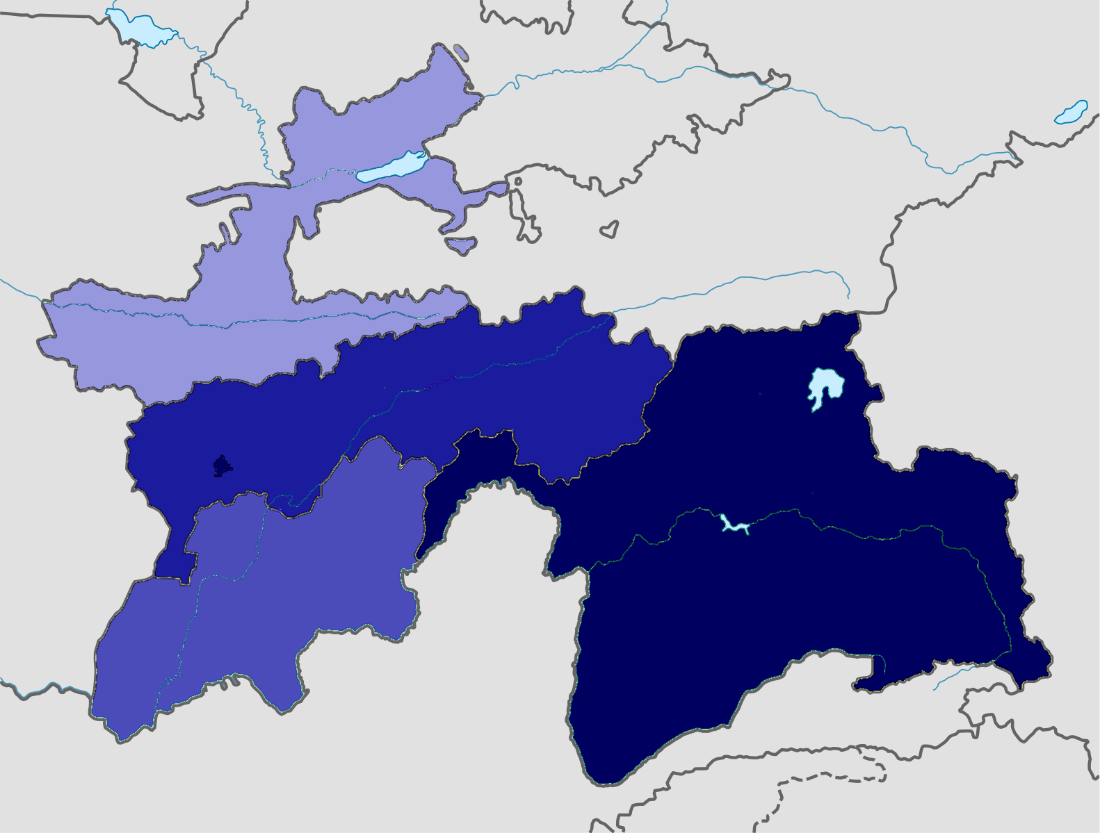
Qurghonteppa Oblast (also known as Kurgan-Tyube Oblast (russian: ąÜčāčĆą│ą░╠üąĮ-ąóčÄą▒ąĖ╠üąĮčüą║ą░čÅ ąŠą▒ą╗ą░čüčéčī; tg, ąÆąĖą╗ąŠčÅčéąĖ ąÜė»čĆęōąŠąĮč鹥ą┐ą┐ą░)) was an administrative subdivision in Tajikistan until 1992, when it was merged with Kulob Oblast to create Khatlon Province. History Qurghonteppa district was first created in 1924 when Tajikistan was part of the Soviet Union. In 1929 the district was dissolved. In 1938 the district of Stalinobad was created and on 7 January 1944 Qurghonteppa Oblast was created. The districts included in Qurghonteppa Oblast were Voroshilovobod District, Dangara District, Dahanakiik District, Kaghanovichobod District, Kirovobod District, Kuibeshev District, Qurghonteppa District, Mikoyanobod District, Molotovobod District, Oktyabr District, Jilikul District and Shahritus District. On the 24 August 1947 the oblast was abolished. In April 1977 Qurghonteppa Oblast was reconstituted, only to be abolished and merged with Kulob Obla ... [...More Info...] [...Related Items...] OR: [Wikipedia] [Google] [Baidu] |
Tajikistan
Tajikistan (, ; tg, ąóąŠęĘąĖą║ąĖčüč鹊ąĮ, Tojikiston; russian: ąóą░ą┤ąČąĖą║ąĖčüčéą░ąĮ, Tadzhikistan), officially the Republic of Tajikistan ( tg, ęČčāą╝ę│čāčĆąĖąĖ ąóąŠęĘąĖą║ąĖčüč鹊ąĮ, Jumhurii Tojikiston), is a landlocked country in Central Asia. It has an area of and an estimated population of 9,749,625 people. Its capital and largest city is Dushanbe. It is bordered by Afghanistan to the south, Uzbekistan to the west, Kyrgyzstan to the north, and China to the east. It is separated narrowly from Pakistan by Afghanistan's Wakhan Corridor. The traditional homelands of the Tajiks include present-day Tajikistan as well as parts of Afghanistan and Uzbekistan. The territory that now constitutes Tajikistan was previously home to several ancient cultures, including the city of Sarazm of the Neolithic and the Bronze Age and was later home to kingdoms ruled by people of different faiths and cultures, including the Oxus civilization, Andronovo culture, Buddhism, Nestorian Ch ... [...More Info...] [...Related Items...] OR: [Wikipedia] [Google] [Baidu] |
Jilikul District
Dusti District (russian: ąĀą░ą╣ąŠąĮ ąöčāčüčéąĖ; tg, ąØąŠę│ąĖčÅąĖ ąöė»čüčéėŻ, before 2016: ''Jilikul District'') is a district in Khatlon Region, Tajikistan Tajikistan (, ; tg, ąóąŠęĘąĖą║ąĖčüč鹊ąĮ, Tojikiston; russian: ąóą░ą┤ąČąĖą║ąĖčüčéą░ąĮ, Tadzhikistan), officially the Republic of Tajikistan ( tg, ęČčāą╝ę│čāčĆąĖąĖ ąóąŠęĘąĖą║ąĖčüč鹊ąĮ, Jumhurii Tojikiston), is a landlocked country in Centr .... Its capital is the village Jilikul. The population of the district is 117,100 (January 2020 estimate). Administrative divisions The district has an area of about and is divided administratively into one town and five jamoats. They are as follows:Jamoat-level basic indicators United Nations Development Programme in Tajikistan, accessed 8 October 2020 References [...More Info...] [...Related Items...] OR: [Wikipedia] [Google] [Baidu] |
Central Asia
Central Asia, also known as Middle Asia, is a subregion, region of Asia that stretches from the Caspian Sea in the west to western China and Mongolia in the east, and from Afghanistan and Iran in the south to Russia in the north. It includes the former Soviet Union, Soviet republics of the Soviet Union, republics of Kazakhstan, Kyrgyzstan, Tajikistan, Turkmenistan, and Uzbekistan, which are colloquially referred to as the "-stans" as the countries all have names ending with the Persian language, Persian suffix "-stan", meaning "land of". The current geographical location of Central Asia was formerly part of the historic region of Turkestan, Turkistan, also known as Turan. In the pre-Islamic and early Islamic eras ( and earlier) Central Asia was inhabited predominantly by Iranian peoples, populated by Eastern Iranian languages, Eastern Iranian-speaking Bactrians, Sogdians, Khwarezmian language, Chorasmians and the semi-nomadic Scythians and Dahae. After expansion by Turkic peop ... [...More Info...] [...Related Items...] OR: [Wikipedia] [Google] [Baidu] |
Sayid Abdulloh Nuri
Sayid Abdulloh Nuri ( Tajik: ąĪą░ą╣ąĖą┤ ąÉą▒ą┤čāą╗ą╗ąŠę│ąĖ ąØčāčĆėŻ, Perso-Arabic script: ž│█īž» ž╣ž©ž»ž¦┘ä┘ä┘ć ┘å┘łž▒█ī) (March 15, 1947 – August 9, 2006), also transliterated as ''Abdullah Nuri'', led the Islamic Renaissance Party of Tajikistan from 1993 until he died of cancer in late 2006. During the Tajik Civil War of 1992 to 1997 he led the United Tajik Opposition. Nuri and President of Tajikistan Emomali Rakhmonov ended the civil war by signing the Tajik National Peace Accord in 1997.Tajikistan: Influential Islamic politician remembered RadioFreeEurope/RadioLiberty Nuri was born in , [...More Info...] [...Related Items...] OR: [Wikipedia] [Google] [Baidu] |
Islamic Renaissance Party Of Tajikistan
The Islamic Renaissance Party of Tajikistan, also known as the Islamic Revival Party of Tajikistan, is a banned Islamist political party in Tajikistan. Until 2015, when it was designated a terrorist organisation, it was the only legal Islamist party in Central Asia. History The party was organised in 1990, and had its founding congress the following year. In 1992, it hosted a conference in Saratov, Russia, attended by Islamists from ex-Soviet central Asia, Tatarstan and Bashkortostan. When Tajikistan became independent, the party was banned in 1993. After the ban of the party, majority of opposition forces fled to neighboring Afghanistan where they established the Movement for Islamic Revival in Tajikistan (MIRT), headed by Said Abdullo Nuri. It fought with the United Tajik Opposition and the Garmi people against the government during the Tajik Civil War but was legalised following peace accords in 1998. In 1999 it was the second largest party in Tajikistan. The party's l ... [...More Info...] [...Related Items...] OR: [Wikipedia] [Google] [Baidu] |
Civil War In Tajikistan
The Tajikistani Civil War ( tg, ęČą░ąĮą│ąĖ čłą░ę│čĆą▓ą░ąĮą┤ąĖąĖ ąóąŠęĘąĖą║ąĖčüč鹊ąĮ, translit=Jangi shahrvandiyi Tojikiston / ├ćangi shahrvandiji To├¦ikiston; russian: ąōčĆą░ąČą┤ą░ąĮčüą║ą░čÅ ą▓ąŠą╣ąĮą░ ą▓ ąóą░ą┤ąČąĖą║ąĖčüčéą░ąĮąĄ), also known as the Tajik Civil War, began in May 1992 when regional groups from the Garm and Gorno-Badakhshan regions of Tajikistan rose up against the newly formed government of President Rahmon Nabiyev, which was dominated by people from the Khujand and Kulob regions. The rebel groups were led by a combination of liberal democratic reformers and Islamists, who would later organize under the banner of the United Tajik Opposition. The government was supported by Russian military and border guards. The main zone of conflict was in the country's south, although disturbances occurred nationwide. The civil war was at its peak during its first year and continued for five years, devastating the country. An estimated 20,000 to 150,000 people were killed i ... [...More Info...] [...Related Items...] OR: [Wikipedia] [Google] [Baidu] |
Vakhsh River
The Vakhsh (Russian and Tajik: ąÆą░čģčł - ''Vaxsh'', fa, ┘łž«ž┤), also known as the Surkhob (ąĪčāčĆčģąŠą▒, ž│ž▒ž«ž¦ž©), in north-central Tajikistan, and the Kyzyl-Suu ( ky, ąÜčŗąĘčŗą╗-ąĪčāčā), in Kyrgyzstan, is a Central Asian river, and one of the main rivers of Tajikistan. It is a tributary of the Amu Darya river."Tajikistan - Topography and Drainage" in Tajikistan: a Country Study (Washington: Library of Congress, 1996) Geography The river flows through the , passing through very mountainous territory that frequently restricts its flow to narrow channels within deep gorges. Some of the largest glaciers in Tajikistan, including the[...More Info...] [...Related Items...] OR: [Wikipedia] [Google] [Baidu] |
Pamiris
The Pamiris, russian: ą¤ą░ą╝ąĖ╠üčĆčåčŗ, Pam├Łrtsy, zh, s=ÕĖĢń▒│Õ░öõ║║, p=P├ĀmŪÉ'─ørr├®n, ur, are an Eastern Iranian ethnic group, native to the Badakhshan region of Central Asia, which includes the Gorno-Badakhshan Autonomous Region of Tajikistan; the Badakhshan Province of Afghanistan; Taxkorgan Tajik Autonomous County in Xinjiang, China; and the Upper Hunza Valley in Pakistan. Ethnic identity The Pamiris are composed of people who speak the Pamiri languages, the indigenous language in the Gorno-Badakhshan autonomous province. The Pamiris share close linguistic, cultural and religious ties with the people in Badakhshan Province in Afghanistan, the Sarikoli speakers in the Pamir region of Taxkorgan Tajik Autonomous County in Xinjiang Province in China and the Wakhi speakers in Afghanistan and Pakistan. In the Pamiri languages, the Pamiris refer to themselves as Pamiri, a reference to the historic Badakhshan region where they live. In China, Pamiris are referred to as e ... [...More Info...] [...Related Items...] OR: [Wikipedia] [Google] [Baidu] |
Gharmis
The Gharmi, or Garmi people (russian: ąōą░čĆą╝ąĖ tg, ęÆą░čĆą╝ėŻ, tg, ─×arm├«/Ųóarm─½/ž║ž▒┘ģ┘ē), are one of the original groups of Tajiks, originate from the Rasht Valley in central Tajikistan. From the 1920s to 1955 there was a Gharm oblast in Tajikistan, and henceforth people from central Tajikistan were known as Gharmis. During the 1950s many Gharmis were forced to migrate from central Tajikistan to the Vakhsh River Valley in western Tajikistan. Gharmis were largely excluded from government positions, which were dominated by individuals from Khujand and Kulob. Gharmis who settled in Qurghonteppa Oblast are frequently described as a clan group that found social niches in education and the marketplace. After Tajikistan became independent in 1991, many Gharmis participated in protests against the government. When the Civil War of Tajikistan broke out in 1992 a large number of Gharmis joined the DPT- IRP opposition. The organization Human Rights Watch among others, reported that ... [...More Info...] [...Related Items...] OR: [Wikipedia] [Google] [Baidu] |
Kurgan-Tyube
, native_name_lang=tg , image_skyline = ąæąŠčģčéą░čĆ 2018.jpg , imagesize = 300px , image_caption = Bokhtar in 2018 , image_flag = , image_seal = , image_map = , map_caption = , pushpin_map = Tajikistan , pushpin_label_position =bottom , pushpin_mapsize = 300 , pushpin_map_caption = Location in Tajikistan , subdivision_type = Country , subdivision_type1 = Province , subdivision_name = , subdivision_name1 = Khatlon , subdivision_type2 = , subdivision_name2 = , established_title = , established_date = , government_type = , leader_title = , leader_name = , area_magnitude = , area_total_sq_mi = , area_total_km2 = 26 , area_land_sq_mi = , area_land_km2 = , area_urban_sq_mi = , area_urban_km2 = , area_metro_km2 = , area_metro_sq_mi = , population_as_of= 2019 , population_footnotes = , population_total = 110 800 , population_urban = , population_metro = 190 000 , population_density_sq_mi = , population_density_km2 = 4261 , timezone = , utc_offset = ... [...More Info...] [...Related Items...] OR: [Wikipedia] [Google] [Baidu] |
Qurghonteppa
, native_name_lang=tg , image_skyline = ąæąŠčģčéą░čĆ 2018.jpg , imagesize = 300px , image_caption = Bokhtar in 2018 , image_flag = , image_seal = , image_map = , map_caption = , pushpin_map = Tajikistan , pushpin_label_position =bottom , pushpin_mapsize = 300 , pushpin_map_caption = Location in Tajikistan , subdivision_type = Country , subdivision_type1 = Province , subdivision_name = , subdivision_name1 = Khatlon , subdivision_type2 = , subdivision_name2 = , established_title = , established_date = , government_type = , leader_title = , leader_name = , area_magnitude = , area_total_sq_mi = , area_total_km2 = 26 , area_land_sq_mi = , area_land_km2 = , area_urban_sq_mi = , area_urban_km2 = , area_metro_km2 = , area_metro_sq_mi = , population_as_of= 2019 , population_footnotes = , population_total = 110 800 , population_urban = , population_metro = 190 000 , population_density_sq_mi = , population_density_km2 = 4261 , timezone = , utc_offset = ... [...More Info...] [...Related Items...] OR: [Wikipedia] [Google] [Baidu] |
Khatlon
Khatlon Region ( tg, ąÆąĖą╗ąŠčÅčéąĖ ąźą░čéą╗ąŠąĮ, ''Viloyati Xatlon''), one of the four provinces of Tajikistan ( tg, ą▓ąĖą╗ąŠčÅčé, ''Viloyat''), is the most populous of the four first level administrative regions. It is situated in the southwest of the country, between the Hisor (Gissar) Range in the north and the river Panj in the south and borders on Afghanistan in the southeast and on Uzbekistan in the west. During Soviet times, Khatlon was divided into Kurgan-Tyube (Qurghonteppa) Oblast (Western Khatlon) ŌĆō with the Kofarnihon and Vakhsh river valleys ŌĆō and Kulob Oblast (Eastern Khatlon) ŌĆō with the Kyzylsu and Yakhsu river valleys. Both regions were merged in November 1992 into today's Khatlon Region (or ''viloyat''/''oblast''). The capital city is Bokhtar, formerly known as ''Qurghonteppa'' and ''Kurgan-Tyube''. Khatlon has an area of 24,700 square kilometres and consists of 21 districts and 4 district-level cities. The total population of Khatlon in ... [...More Info...] [...Related Items...] OR: [Wikipedia] [Google] [Baidu] |
.png)

