|
Quincy Center Station
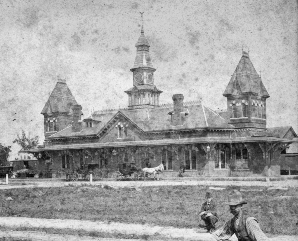
Quincy Center station is an intermodal transit station in Quincy, Massachusetts. It is a transfer station between the MBTA Red Line subway, MBTA Commuter Rail's Old Colony Lines and Greenbush Line, and a number of MBTA bus routes. It is located between Hancock Street and Burgin Parkway in the Quincy Center district. Opened in 1971, the station was covered by a large parking garage which was closed in 2012 due to structural problems. A project to remove and replace the garage is under way. All buses and trains are accessible from the Hancock Street entrance. Access from Burgin Parkway was formerly through the garage; a new accessible entrance will be added as part of the current project. History Old Colony Railroad The Old Colony Railroad opened its main line from South Boston to Plymouth on November 10, 1845. Quincy station was located at Quincy Square behind the town hall. New station buildings – low brick structures very similar to the extant building at – were ... [...More Info...] [...Related Items...] OR: [Wikipedia] [Google] [Baidu] |
Quincy, Massachusetts
Quincy ( ) is a coastal U.S. city in Norfolk County, Massachusetts, United States. It is the largest city in the county and a part of Greater Boston, Metropolitan Boston as one of Boston's immediate southern suburbs. Its population in 2020 was 101,636, making it the seventh-largest city in the U.S. state, state. Known as the "City of Presidents", Quincy is the birthplace of two President of the United States, U.S. presidents—John Adams and his son John Quincy Adams—as well as John Hancock (a President of the Continental Congress and the first signer of the United States Declaration of Independence, Declaration of Independence) and the first and third Governor of Massachusetts. First settled in 1625, Quincy was briefly part of Dorchester, Boston, Dorchester before becoming the north precinct of Braintree, Massachusetts, Braintree in 1640. In 1792, Quincy was split off from Braintree; the new town was named after Colonel John Quincy, maternal grandfather of Abigail Adams and af ... [...More Info...] [...Related Items...] OR: [Wikipedia] [Google] [Baidu] |
North Quincy Station
North Quincy station is an MBTA subway Red Line station in Quincy, Massachusetts. It is located in North Quincy, off Hancock Street ( Route 3A). A major park-and-ride stop, it has over 1200 parking spaces for commuters. It also serves as a minor bus terminal, with five MBTA bus routes stopping at the south end of the station. The station is fully accessible. It opened in 1971 along with Wollaston and Quincy Center as the first section of the South Shore Line section of the Red Line. It is the only one of the four Red Line stations in Quincy not located at a former Old Colony Railroad station site; the Old Colony served Atlantic and Norfolk Downs stations short distances away. Station layout North Quincy station has a single island platform serving the two tracks of the Red Line. Two tracks carrying the Old Colony Lines and Greenbush Line are adjacent to the west. Parking lots are located on both sides of the tracks. At the south end of the platform, a footbridge connects to ... [...More Info...] [...Related Items...] OR: [Wikipedia] [Google] [Baidu] |
Old Colony Lines (MBTA)
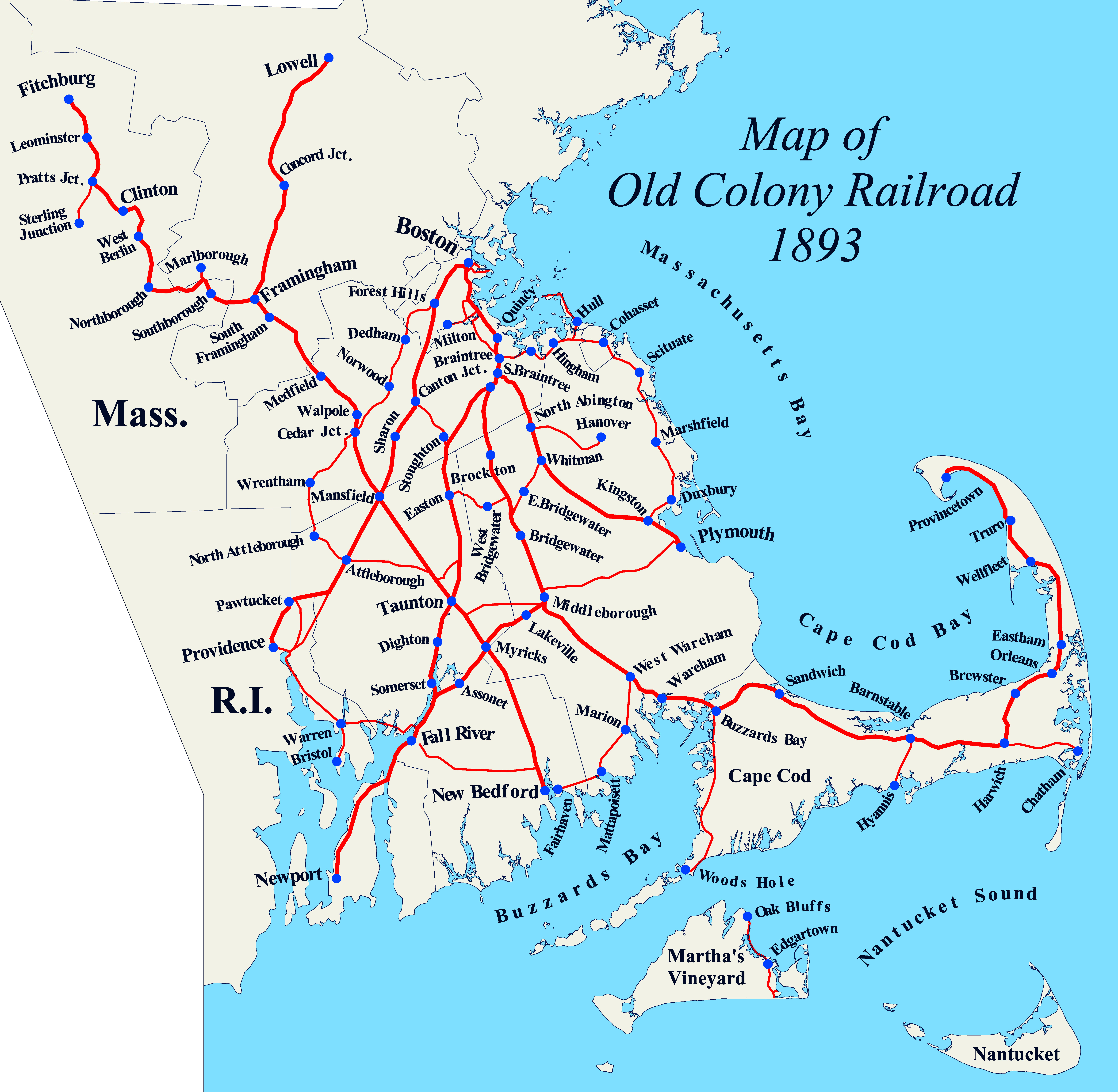
The Old Colony Lines are a pair of branches of the MBTA Commuter Rail system, connecting downtown Boston, Massachusetts with the South Shore and cranberry-farming country to the south and southeast. The two branches operate concurrently for via the Old Colony Mainline from South Station to Braintree station. The Middleborough/Lakeville Line then winds south through Holbrook, Brockton, Bridgewater, Middleborough, and Lakeville via the Middleborough Main Line and Cape Main Line. The Kingston/Plymouth Line heads southeast to serve Weymouth, Abington, Whitman, Hanson, Halifax, Kingston, and Plymouth by way of the Plymouth branch. History The Old Colony under the New Haven Historically, train service extended beyond the current terminus of the three branches. Greenbush service continued on a now-abandoned right-of-way to Kingston, where it joined the Plymouth line. The Plymouth line extended into downtown Plymouth, and a branch connected to Middleborough through Carver. ... [...More Info...] [...Related Items...] OR: [Wikipedia] [Google] [Baidu] |
Accessible
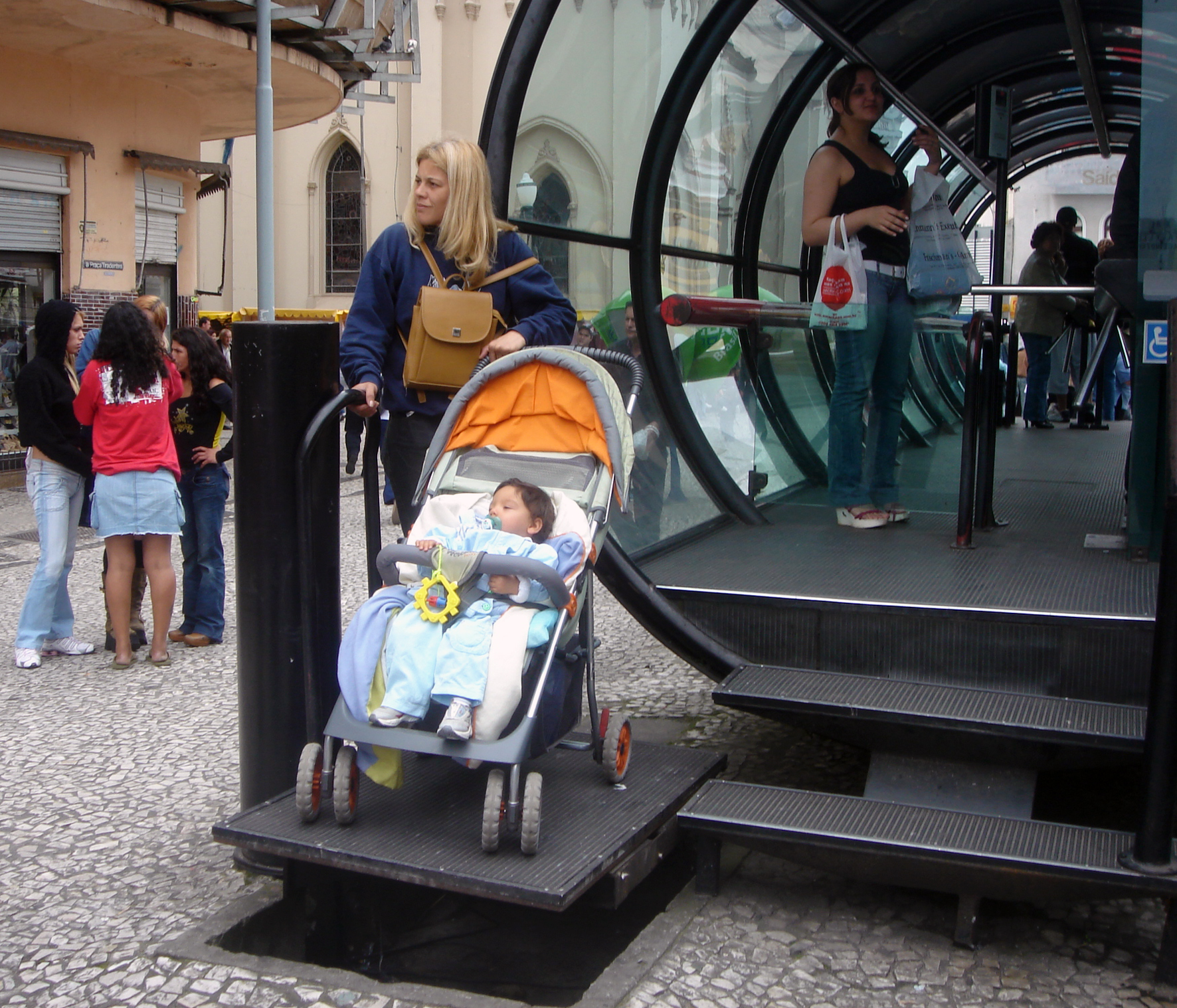
Accessibility is the design of products, devices, services, vehicles, or environments so as to be usable by people with disabilities. The concept of accessible design and practice of accessible development ensures both "direct access" (i.e. unassisted) and "indirect access" meaning compatibility with a person's assistive technology (for example, computer screen readers). Accessibility can be viewed as the "ability to access" and benefit from some system or entity. The concept focuses on enabling access for people with disabilities, or enabling access through the use of assistive technology; however, research and development in accessibility brings benefits to everyone. Accessibility is not to be confused with usability, which is the extent to which a product (such as a device, service, or environment) can be used by specified users to achieve specified goals with effectiveness, efficiency, convenience, or satisfaction in a specified context of use. Accessibility is also s ... [...More Info...] [...Related Items...] OR: [Wikipedia] [Google] [Baidu] |
MBTA 1806 And Quincy Center Garage Ramps, October 2015
The Massachusetts Bay Transportation Authority (abbreviated MBTA and known colloquially as "the T") is the public agency responsible for operating most public transportation services in Greater Boston, Massachusetts. The MBTA transit network includes the MBTA subway with three metro lines (the Blue, Orange, and Red lines), two light rail lines (the Green and Ashmont–Mattapan lines), and a five-line bus rapid transit system (the Silver Line); MBTA bus local and express service; the twelve-line MBTA Commuter Rail system, and several ferry routes. In , the system had a ridership of , or about per weekday as of , of which the rapid transit lines averaged and the light rail lines , making it the fourth-busiest rapid transit system and the third-busiest light rail system in the United States. As of , average weekday ridership of the commuter rail system was , making it the sixth-busiest commuter rail system in the U.S. The MBTA is the successor of several previous public an ... [...More Info...] [...Related Items...] OR: [Wikipedia] [Google] [Baidu] |
Braintree Station (MBTA)
Braintree station is an intermodal transit station in Braintree, Massachusetts. It serves the MBTA's Red Line (MBTA), Red Line and the MBTA Commuter Rail Old Colony Lines (MBTA), Old Colony Lines as well as MBTA buses. It is located at Ivory and Union Streets. The tracks of the Red Line and commuter rail lines are all parallel to one another, their Platform (rail), platforms are offset; the commuter rail platform is located north of Union Street, while the Red Line platform is south of the street. The station features a large park and ride garage, with space for 1,322 automobiles. Braintree is MBTA accessibility, fully accessible on all modes. Station layout The two Red Line tracks and two commuter rail tracks run parallel approximately north-south on an embankment through the station site, with the Red Line tracks on the west. The station has two island platforms. The Red Line platform is located south of Union Street, with the fare lobby under the platform. Tail tracks continu ... [...More Info...] [...Related Items...] OR: [Wikipedia] [Google] [Baidu] |
Haymarket North Extension
The Haymarket North Extension is a section of the Massachusetts Bay Transportation Authority's rapid transit Orange Line which currently constitutes the northern section of the line. It runs from North Station through an underground crossing of the Charles River (with the 2003-completed Leonard Zakim Bridge later built directly over it), then along the Haverhill Line right-of-way to Oak Grove station in Malden, Massachusetts. Built to replace the Charlestown Elevated and originally intended to be extended as far as Reading, it opened in stages between 1975 and 1977. Route The Haymarket North Extension begins just north of Haymarket station in Boston, with an underground station at . The tunnel runs under the Charles River, surfacing in Charlestown just south of Community College station. The extension runs on the surface under the elevated Interstate 93 highway and crosses the Haverhill Line and Newburyport/Rockport Line on a flyover, touching down at Sullivan Square stati ... [...More Info...] [...Related Items...] OR: [Wikipedia] [Google] [Baidu] |
Exit Fare
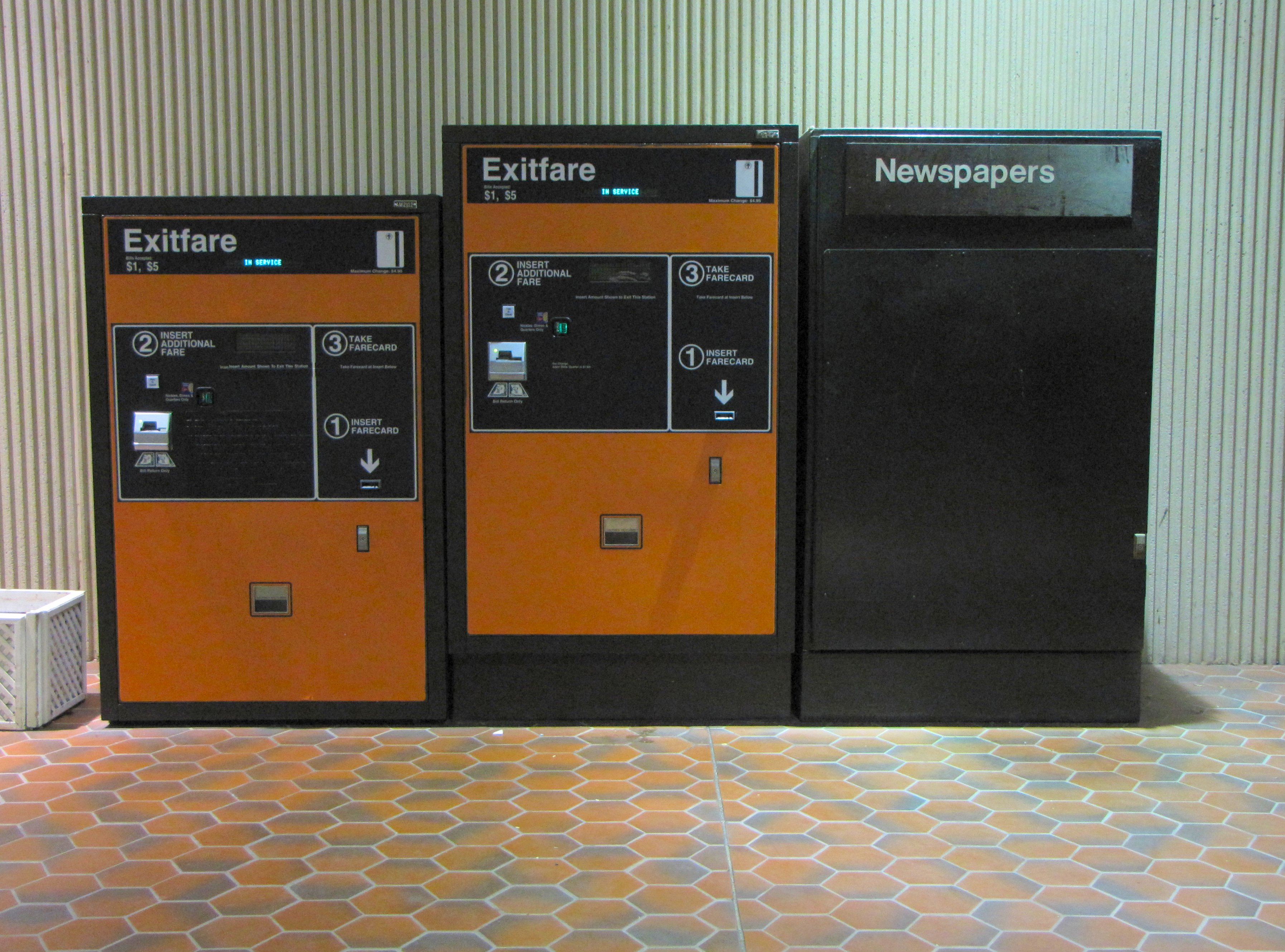
An exit fare is a method of collecting ridership fees, or fares, from a transportation system, where the fee (or part of the fee) is collected from passengers upon reaching their destination. Examples Exit fares were used on the subway lines of the early MBTA in Boston, Massachusetts, as a cost-cutting method to be able to collect increased fares without having to upgrade fare collection equipment at station entrances. The perceived unfairness of this system (what to do with a passenger who can't pay the exit fare?) prompted Boston politician Walter A. O'Brien to commission the protest song " M.T.A.", which later became a hit song by the Kingston Trio. The last of the subway exit fares were eliminated from the Boston rail transit lines on December 4, 2006, with the implementation of the CharlieCard (its name a reference to the main character in the protest song). However, the MBTA's trackless trolley routes that used left-side boarding in the lower bus tunnel at Harvard statio ... [...More Info...] [...Related Items...] OR: [Wikipedia] [Google] [Baidu] |
Brockton (MBTA Station)
Brockton station is an MBTA Commuter Rail station in Brockton, Massachusetts. It serves the MBTA Middleborough/Lakeville Line and is a stop on the CapeFLYER seasonal line. The station consists of a single full-length high-level platform which is fully handicapped accessible. It is located adjacent to the BAT Centre, the primary hub for Brockton Area Transit Authority local bus service. The first station in the town (then called North Bridgewater) opened in 1846 on the Fall River Railroad. The railroad helped Brockton grow into a major manufacturing center. In the 1890s, Brockton was the site of the state's first major grade crossing elimination program, which included the construction of a massive stone viaduct and a pair of station buildings designed by Bradford Gilbert. Passenger service ended in 1959, and the station was demolished during an urban renewal program in the 1960s. After two decades of planning, the modern station was opened for commuter rail service by the Mas ... [...More Info...] [...Related Items...] OR: [Wikipedia] [Google] [Baidu] |
Holbrook, Massachusetts
Holbrook is a town in Norfolk County, Massachusetts, Norfolk County, Massachusetts, United States. , the town's population was 11,405. History Holbrook was first settled by Europeans (mostly British colonists) in 1710 as the southern part of Old Braintree, and was officially incorporated on February 29, 1872, the last town created from the former lands of Braintree, Massachusetts, Braintree. It used to be known as East Randolph, being divided from Randolph, Massachusetts, Randolph by track from the Old Colony Railroad line. In the 18th and 19th centuries, farming and cottage trades, particularly shoe production, dominated the economy. Slowly, the town evolved into a primarily residential community with many residents commuting to work in Boston proper and the primary employment within the town being in service industries. Some residents served during the Civil War, and members of the famed 54th Massachusetts Volunteer Infantry are buried in Union Cemetery. The impact of t ... [...More Info...] [...Related Items...] OR: [Wikipedia] [Google] [Baidu] |
Braintree (MBTA Station)
Braintree station is an intermodal transit station in Braintree, Massachusetts. It serves the MBTA's Red Line and the MBTA Commuter Rail Old Colony Lines as well as MBTA buses. It is located at Ivory and Union Streets. The tracks of the Red Line and commuter rail lines are all parallel to one another, their platforms are offset; the commuter rail platform is located north of Union Street, while the Red Line platform is south of the street. The station features a large park and ride garage, with space for 1,322 automobiles. Braintree is fully accessible on all modes. Station layout The two Red Line tracks and two commuter rail tracks run parallel approximately north-south on an embankment through the station site, with the Red Line tracks on the west. The station has two island platforms. The Red Line platform is located south of Union Street, with the fare lobby under the platform. Tail tracks continue south to a four-track storage yard, Caddigan Yard. The three-level parking ... [...More Info...] [...Related Items...] OR: [Wikipedia] [Google] [Baidu] |


