|
Qazipora
Qazipora was initially an autonomous village in Bandipora district, Jammu and Kashmir, India. Later on it was merged with Patushay, and formed a new Village called Qazipora Patushi. It is just 4 km away from Bandipora town, and 59 km away from Srinagar. Transport Road Qazipora is connected by road with other places in Jammu and Kashmir and India by the Srinagar-Bandipora Road, Sopore-Bandipora Road, etc. Rail The nearest railway stations to Qazipora are Sopore Railway Station and Srinagar Railway Station, located at a distance of 27 and 71 kilometres from Qazipora respectively. Air The nearest airport is Srinagar International Airport located at a distance of 67 km from Qazipora. Culture See: Culture of Kashmir See also * Patushay * Bandipora * Gurez Valley * Wullar Lake * Qazipora Patushi * Harmukh * Kashmir Kashmir () is the northernmost geographical region of the Indian subcontinent. Until the mid-19th century, the term "Kashmir" ... [...More Info...] [...Related Items...] OR: [Wikipedia] [Google] [Baidu] |
Qazipora Patushi
''Qazipora Patushi'' is a village located in the Bandipore district of Jammu and Kashmir, India, formed by the merging of former two villages, Patushay and Qazipora. The total geographical area of the Locality is 558.1 hectares. Qazipora Patushi has a total population of 8,096 people. There are about 1,114 houses in Qazipora Patushi. Demographics According to the 2021 census of India The 2021 Census of India, also the 16th Indian Census, is intended to be carried out in 2023. In April 2019, a data user conference was held and it was announced that 330,000 enumerators would be enlisted and that they would be encouraged to us ..., Qazipora Patushi has 1114 households. The literacy rate of Qazipora Patushi was 62.40% compared to 67.16% of Jammu and Kashmir. In Qazipora Patushi, Male literacy stands at 71.00% while the female literacy rate was 53.09%. Caste factor Schedule Tribe (ST) constitutes 0.40% of total population in Qazipora Patushi. There is no population of Sch ... [...More Info...] [...Related Items...] OR: [Wikipedia] [Google] [Baidu] |
Patushay
''Patushay'' (also known as Potshai) was initially an autonomic village in the Bandipora district of Jammu and Kashmir, India. Later on it was merged with Qazipora, and formed a new Village called Qazipora Patushi. It is 4 km away from Bandipora town, and 59 km away from Srinagar. The name Patushay is derived from the word Put, meaning Old, and Shay, meaning Place of history. Notable Persons * Khazer Mohammad Parrey: KM Parrey was the famous and the only Contractor in the district in early 60's, he was commonly known as (Khazer Parrey / Lala). km Parrey constructed various projects in the district as well as in other district(s) like: Sopore-Bandipora Road, Kaloosa Bridge (old), Forest Training Institute Bandipora, Higher Secondary School Kaloosa and many other projects. * Dr. Altaf Gauhar Haji was the first Oncology Surgeon in the Valley. * Kousar Shafeeq: Vice-chairperson District Development Council Bandipora. Educational Institutions There are various sch ... [...More Info...] [...Related Items...] OR: [Wikipedia] [Google] [Baidu] |
Bandipore District
Bandipore district (also spelt as Bandipora or Bandipur) is one of the 20 districts in the Indian union territory of Jammu and Kashmir. Bandipore town is the administrative headquarters of the district. Bandipore, a township with peculiar scenic beauty is located in the foothills of the snow-clad peaks of Harmukh overlooking the shores of Wular Lake and has produced hundreds of scholars and intellectuals. The district is famous for its tourist places such as Wular Vintage Park, Athwatoo and Gurez valley. Before 1947, this town was a big trade and literary centre of Kashmir. This district was carved out from the erstwhile Baramulla district in 2007. The district is bounded by Kupwara district from the north, Baramulla district from west and Kargil district in Ladakh and Ganderbal district from the east. This district occupies an area of 398 km2. The district has a population of 392,232 as per 2011 census. Education Some of the institutions and colleges of Bandipur Which p ... [...More Info...] [...Related Items...] OR: [Wikipedia] [Google] [Baidu] |
Bandipora District
Bandipore district (also spelt as Bandipora or Bandipur) is one of the 20 districts in the Indian union territory of Jammu and Kashmir. Bandipore town is the administrative headquarters of the district. Bandipore, a township with peculiar scenic beauty is located in the foothills of the snow-clad peaks of Harmukh overlooking the shores of Wular Lake and has produced hundreds of scholars and intellectuals. The district is famous for its tourist places such as Wular Vintage Park, Athwatoo and Gurez valley. Before 1947, this town was a big trade and literary centre of Kashmir. This district was carved out from the erstwhile Baramulla district in 2007. The district is bounded by Kupwara district from the north, Baramulla district from west and Kargil district in Ladakh and Ganderbal district from the east. This district occupies an area of 398 km2. The district has a population of 392,232 as per 2011 census. Education Some of the institutions and colleges of Bandipur Which ... [...More Info...] [...Related Items...] OR: [Wikipedia] [Google] [Baidu] |
Kashmir
Kashmir () is the northernmost geographical region of the Indian subcontinent. Until the mid-19th century, the term "Kashmir" denoted only the Kashmir Valley between the Great Himalayas and the Pir Panjal Range. Today, the term encompasses a larger area that includes the Indian-administered territories of Jammu and Kashmir and Ladakh, the Pakistani-administered territories of Azad Kashmir and Gilgit-Baltistan, and the Chinese-administered territories of Aksai Chin and the Trans-Karakoram Tract. Quote: "Kashmir, region of the northwestern Indian subcontinent. It is bounded by the Uygur Autonomous Region of Xinjiang to the northeast and the Tibet Autonomous Region to the east (both parts of China), by the Indian states of Himachal Pradesh and Punjab to the south, by Pakistan to the west, and by Afghanistan to the northwest. The northern and western portions are administered by Pakistan and comprise three areas: Azad Kashmir, Gilgit, and Baltistan, ... The southern and so ... [...More Info...] [...Related Items...] OR: [Wikipedia] [Google] [Baidu] |
Harmukh
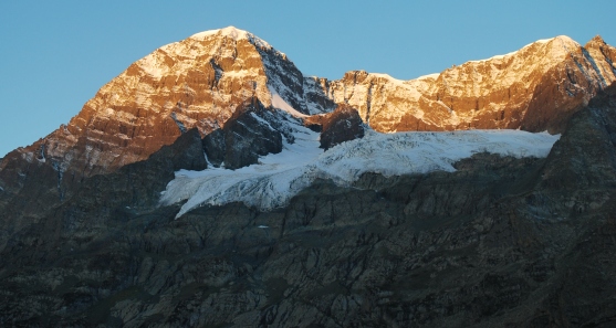
Mt Harmukh (originally "Haramukuta") is a mountain with a peak elevation of , in Ganderbal district of Jammu and Kashmir (union territory), Jammu and Kashmir in India. Harmukh is part of the Himalaya Mountain Range, Range and is located between Sind River in the south and Kishanganga River in the north, rising above Gangabal Lake in the vicinity of Kashmir valley. It is mostly climbed from the northwestern side of Arin, via Kudara, Bandipore. Harmukh is considered sacred in Hinduism. Etymology Harmukh derives from Haramukuta, meaning "the diadem of Hara (Shiva)". The entire region of Harmukh is also known as ''Ramaradhan'', as it is believed that Parashurama had meditated near lakes on this mountain range. Religious beliefs Harmukh, with Gangbal Lake at its foot, is considered a sacred mountain by Hindus. It is also known as 'Kailash of Kashmir' According to the legend of "Hurmukhuk Gosoni", once a hermit tried to reach the summit of Harmukh to see Shiva face to face. For tw ... [...More Info...] [...Related Items...] OR: [Wikipedia] [Google] [Baidu] |
Wular Lake
Wular Lake (), also known as Wolar () in Kashmiri, is one of the largest fresh water lakes in South Asia. It is located near Bandipora town in Bandipora district of Jammu and Kashmir, India. The lake basin was formed as a result of tectonic activity and is fed by the Jhelum River and stream madhumati. The lake's size varies seasonally from 30 to 189 square kilometres. In addition, much of the lake has been drained as a result of willow plantations being built on the shore in the 1950s. Etymology In ancient times, Wular Lake was also called Mahapadmasar (Sanskrit: महापद्मसरः). Nilamata Purana also mentions it as ''Mahapadmasaras''. The lake, with its big dimensions and the extent of water, gives rise to high leaping waves in the afternoons, called Ullola in Sanskrit, meaning "stormy leaping, high rising waves". Therefore, it was also being called ''Ullola''. It is believed to have gotten corrupted over the centuries to ''Wulor'' or ''Wular''. [...More Info...] [...Related Items...] OR: [Wikipedia] [Google] [Baidu] |
Gurez
Gurez, or Gurais (''Guráai'' in the local Shina language), is a valley located in the high Himalayas, about from Bandipore and from Srinagar, to the north of the Kashmir valley. At about above sea level, the valley is surrounded by snow-capped mountains. It has diverse fauna and wildlife including the Himalayan brown bear and the snow leopard. The Kishanganga River flows through the valley. The valley lies near the Line of Control, which separates it from the Astore and Neelum districts of Pakistan-administered Kashmir. Being situated very close to the Burzil Pass, which leads into Astore, the inhabitants are ethnic Dards/ Shins. They speak the Shina language and have the same styles of dress and culture as their kinsmen in Pakistani-administered Gilgit-Baltistan. Dawar is the central township in the area. The population of the area is estimated to be about 30,000, and is scattered among fifteen villages. Tourism industry is emerging , hotels like Gurez knights, kaka P ... [...More Info...] [...Related Items...] OR: [Wikipedia] [Google] [Baidu] |
Culture Of Kashmir
The culture of Kashmir encompasses the spoken language, written literature, cuisine, architecture, traditions, and history of the Kashmiri people native to the northern part of the Indian subcontinent. The culture of Kashmir was influenced by the Persian as well as Central Asian cultures after the Islamic invasion of Kashmir. Kashmiri culture is heavily influenced by Hinduism, Buddhism and later by Islam. Early History ''Vedic'' art and culture grew in Kashmir, and some early Vedic hymns were composed there. The '' Bharata Natya Shastra'', which is notable as an ancient encyclopedic treatise on the arts which has influenced dance, music and literary traditions in Indian culture, originated in Kashmir. 2nd century BC writer ''Patanjali'' compiled his compendium on Yoga in Kashmir. The ''Panchatantra'' is also said to have originated in this region. At the time when ''Pali'' was the primary language for Buddhist literature in the rest of India, all the Buddhist literatur ... [...More Info...] [...Related Items...] OR: [Wikipedia] [Google] [Baidu] |
Sheikh Ul-Alam International Airport
Sheikh ul-Alam International Airport also known as Srinagar Airport and Budgam Airbase, is an international airport serving Srinagar, the summer capital of Jammu and Kashmir, India. It is owned by the Indian Air Force, and the Airports Authority of India operates a civil enclave at the airport. It was designated as an international airport in 2005. It has an integrated terminal and one asphalt runway. The airport is actually located in Budgam, which is from Srinagar. History Originally, the Srinagar Airport was used only by the Indian Air Force. During the Indo-Pakistani War of 1947, the airport received an airlift of Indian troops who prevented Pakistan from capturing the city of Srinagar. Although the airport was small and lacked landing aids, the airlift was still carried out successfully on 27 October. In September 1965, the Srinagar Airport was subjected to an air raid amid the Indo-Pakistani War of 1965, which left some aircraft damaged. In 1979, the Airports Authori ... [...More Info...] [...Related Items...] OR: [Wikipedia] [Google] [Baidu] |
Srinagar Railway Station
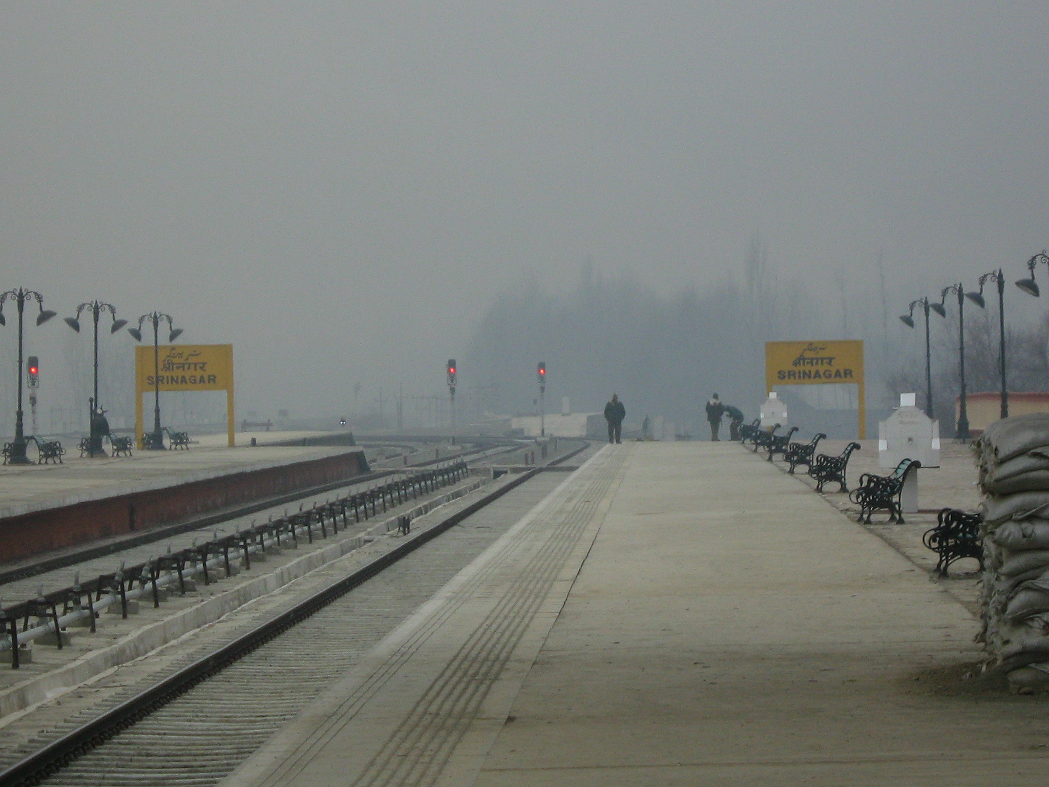
Srinagar railway station is a railway station of the city of Srinagar in the Indian union territory of Jammu and Kashmir. The station is part of the Jammu–Baramulla line and lies in Firozpur division, which once completed, will connect the city to the rail network of India. Currently, services are to Baramulla and Banihal. The railway line once fully completed is expected to increase tourism and travel to the Kashmir Valley. The work of last leg Chenab Bridge is in final stages and is expected to be completed by 2021. The station is also planned to be part of a second railway line, the Srinagar–Kargil–Leh line. History The station has been built as part of the Jammu–Baramulla line megaproject, intending to link the Kashmir Valley with Jammu Tawi and the rest of the Indian railway network. Location The station, in Nowgam, is 8 km from the city centre. The main hub of stations in Kashmir Is Budgam stations and where all trains are being repaired or any other ... [...More Info...] [...Related Items...] OR: [Wikipedia] [Google] [Baidu] |
Google Maps
Google Maps is a web mapping platform and consumer application offered by Google. It offers satellite imagery, aerial photography, street maps, 360° interactive panoramic views of streets ( Street View), real-time traffic conditions, and route planning for traveling by foot, car, bike, air (in beta) and public transportation. , Google Maps was being used by over 1 billion people every month around the world. Google Maps began as a C++ desktop program developed by brothers Lars and Jens Rasmussen at Where 2 Technologies. In October 2004, the company was acquired by Google, which converted it into a web application. After additional acquisitions of a geospatial data visualization company and a real-time traffic analyzer, Google Maps was launched in February 2005. The service's front end utilizes JavaScript, XML, and Ajax. Google Maps offers an API that allows maps to be embedded on third-party websites, and offers a locator for businesses and other organizations in numero ... [...More Info...] [...Related Items...] OR: [Wikipedia] [Google] [Baidu] |


