|
Project Puffin
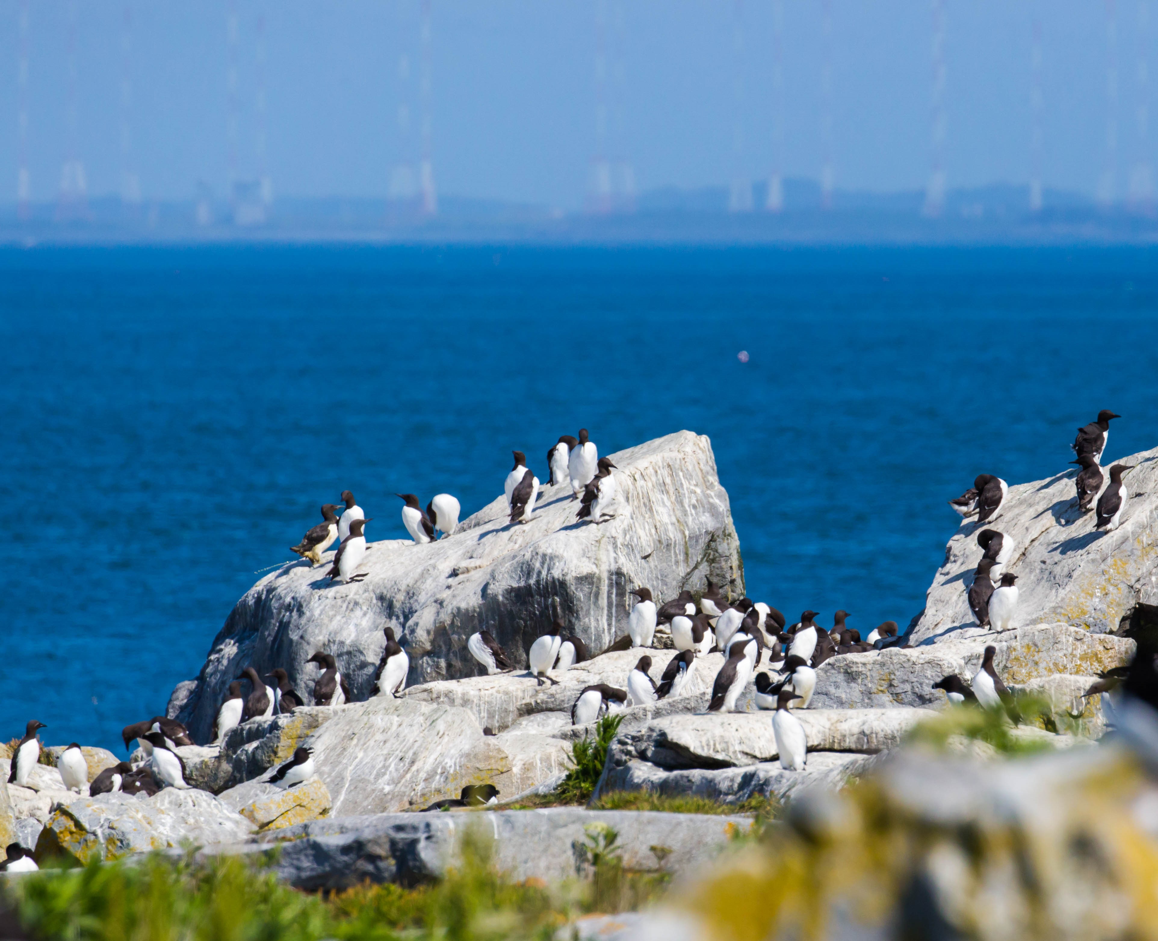
Project Puffin is an effort initiated by Dr. Stephen W. Kress of the National Audubon Society to learn how to restore puffins to historic nesting islands in the Gulf of Maine. It was started in 1973 when puffins were nesting in only two locations in Maine — Matinicus Rock and Machias Seal Island. The project began with an attempt to restore puffins to Eastern Egg Rock Island in Muscongus Bay, about away from Pemaquid Point. The restoration efforts are based on the fact that young puffins usually return to breed on the same island where they hatched. Young puffins from Great Island were transplanted to Eastern Egg Rock when they were about 10–14 days old. The young puffins were then nested in artificial sod burrows for about one month. Audubon biologists placed handfuls of vitamin-fortified fish in their burrows each day. As the young puffins reached fledging age, they received identification tags so they could be recognized in the future. After spending their first 2&nd ... [...More Info...] [...Related Items...] OR: [Wikipedia] [Google] [Baidu] |
National Audubon Society
The National Audubon Society (Audubon; ) is an American non-profit environmental organization dedicated to conservation of birds and their habitats. Located in the United States and incorporated in 1905, Audubon is one of the oldest of such organizations in the world. There are completely independent Audubon Societies in the United States, which were founded several years earlier such as the Massachusetts Audubon Society and Connecticut Audubon Society. The society has nearly 500 local chapters, each of which is an independent 501(c)(3) non-profit organization voluntarily affiliated with the National Audubon Society. They often organize birdwatching field trips and conservation-related activities. It also coordinates the Christmas Bird Count held each December in the U.S., a model of citizen science, in partnership with Cornell Lab of Ornithology, and the Great Backyard Bird Count each February. Together with Cornell, Audubon created eBird, an online database for bird observat ... [...More Info...] [...Related Items...] OR: [Wikipedia] [Google] [Baidu] |
Puffins
Puffins are any of three species of small alcids (auks) in the bird genus ''Fratercula''. These are pelagic seabirds that feed primarily by diving in the water. They breed in large colonies on coastal cliffs or offshore islands, nesting in crevices among rocks or in burrows in the soil. Two species, the tufted puffin and horned puffin, are found in the North Pacific Ocean, while the Atlantic puffin is found in the North Atlantic Ocean. All puffin species have predominantly black or black and white plumage, a stocky build, and large beaks that get brightly colored during the breeding season. They shed the colorful outer parts of their bills after the breeding season, leaving a smaller and duller beak. Their short wings are adapted for swimming with a flying technique underwater. In the air, they beat their wings rapidly (up to 400 times per minute) in swift flight, often flying low over the ocean's surface. Etymology The English name "puffin" – puffed in the sense of swollen ... [...More Info...] [...Related Items...] OR: [Wikipedia] [Google] [Baidu] |
Gulf Of Maine
The Gulf of Maine is a large gulf of the Atlantic Ocean on the east coast of North America. It is bounded by Cape Cod at the eastern tip of Massachusetts in the southwest and by Cape Sable Island at the southern tip of Nova Scotia in the northeast. The gulf includes the entire coastlines of the U.S. states of New Hampshire and Maine, as well as Massachusetts north of Cape Cod, and the southern and western coastlines of the provinces and territories of Canada, Canadian provinces of New Brunswick and Nova Scotia, respectively. The gulf was named for the adjoining English colonial Province of Maine, which was in turn likely named by early explorers after the Maine (province), province of Maine in France. Massachusetts Bay, Penobscot Bay, Passamaquoddy Bay, and the Bay of Fundy are all arms of the Gulf of Maine. Geography and hydrography The Gulf of Maine is a roughly rectangular depression with a surface area of around , enclosed to the west and north by the North American mainland ... [...More Info...] [...Related Items...] OR: [Wikipedia] [Google] [Baidu] |
Machias Seal Island
Machias Seal Island is an island in disputed water between the Gulf of Maine and the Bay of Fundy, about southeast from Cutler, Maine, and southwest of Grand Manan Island, New Brunswick. Sovereignty of the island is disputed by the United States and Canada. The Canadian Coast Guard continues to staff a lighthouse on the island; the first lighthouse was constructed there in 1832. Geography The relationship of Machias Seal Island to the Grand Manan archipelago is a source of some dispute among geologists. The island is considered to be a possible continuation of the series of exposed shoals, rocks, and islets strewn south and west of Grand Manan Island. The deeper Grand Manan Channel lies to the north and west of the island, separating it from the coast of Washington County, Maine. Machias Seal Island is a barren island and devoid of trees. Because of its location at the boundary between the Gulf of Maine and the Bay of Fundy, Machias Seal Island is fog-bound for many days of t ... [...More Info...] [...Related Items...] OR: [Wikipedia] [Google] [Baidu] |
Eastern Egg Rock Island
Eastern Egg Rock Island is an island in the Town of St. George in Knox County in the U.S. state of Maine. It is owned by the Maine Department of Inland Fisheries and Wildlife (MDIFW), and it is located off the southern Atlantic Coast of the state. Project Puffin, a restoration effort by the Audubon Society, is implemented on Eastern Egg Rock through a contract with the MDIFW."Project Puffin: Eastern Egg Rock." Audubon Society. Retrieved September 6, 2010. Geography The island is by the mouth of Maine's , about off |
Muscongus Bay
Muscongus Bay is a bay on the coast of Maine, United States, between Penobscot Bay and John's Bay. Muscongus was the name of an Abenaki village meaning "fishing place" or "many r largerock ledges." John Smith recorded the river in 1616 as Nusconcus and was also spelled Nuscongus. The two main tributaries are the Saint George River at its eastern end and the Medomak River, which flows into the bay at Waldoboro. Historically, the Medomak River and Muscongus Bay were the dividing line between the Waldo Patent and Pemaquid Patent and Waldoboro was a customs point of entry.Stahl, Jasper Jacob. ''History of old Broad Bay and Waldoboro''. Portland, Me.: Bond Wheelwright Co., 1956. Print. Muscongus Bay has many islands including Hog which is home to a National Audubon Society camp, Allen, Eastern Egg Rock, Franklin (home of Franklin Island National Wildlife Refuge), and Louds Island historically referred to as Muscongus Island prior purchase from Thomas Drowne by William Loud. Mon ... [...More Info...] [...Related Items...] OR: [Wikipedia] [Google] [Baidu] |
Pemaquid Point
The Pemaquid Point Light is a historic U.S. lighthouse located in Bristol, Lincoln County, Maine, at the tip of the Pemaquid Neck. History The lighthouse was commissioned in 1827 by President John Quincy Adams and built that year. Because of poor workmanship (salt water was used in the mortar mix), the lighthouse began to crumble and was replaced in 1835. The second contract for the construction stipulated that only fresh water be used. Keeper Isaac Dunham oversaw the construction and wrote in a letter to the US Lighthouse Establishment that the agreement was upheld and the work went well. The original light was an Argand-Lewis parabolic reflector, lit with candles and with a visibility of . Augustin Fresnel invented a superior way of focusing light in the early 1850s and most lighthouses in the US were converted to the Fresnel Lens, with Pemaquid Point receiving a fourth order Fresnel in 1856. The lens is one of only six Fresnel lenses still in service in Maine. The keeper's ho ... [...More Info...] [...Related Items...] OR: [Wikipedia] [Google] [Baidu] |
Great Island (Newfoundland And Labrador)
The Ramea Islands, Newfoundland and Labrador, are an archipel of the south coast of Newfoundland. In 1864 there was a small community of 30 families. The Ramea Islands are a group that contains five large islands, namely Northwest Island, Great Island (or Big Island), Middle Island, Harbour Island and Southwest Island. In the early 1940s, all inhabitants moved to Northwest Island and formed the present town of Ramea.Explore Newfoundland and Labrador'Ramea' 2010. Access date: July 16, 2021. See also *List of communities in Newfoundland and Labrador This article lists unincorporated communities of the province of Newfoundland and Labrador, Canada. Incorporated towns and cities are incorporated municipalities and can be found on List of municipalities in Newfoundland and Labrador. Newfoundla ... References Populated coastal places in Canada Populated places in Newfoundland and Labrador {{Newfoundland-geo-stub ... [...More Info...] [...Related Items...] OR: [Wikipedia] [Google] [Baidu] |
Burrow
An Eastern chipmunk at the entrance of its burrow A burrow is a hole or tunnel excavated into the ground by an animal to construct a space suitable for habitation or temporary refuge, or as a byproduct of locomotion. Burrows provide a form of shelter against predation and exposure to the elements, and can be found in nearly every biome and among various biological interactions. Many animal species are known to form burrows. These species range from small invertebrates, such as the ''Corophium arenarium'', to very large vertebrate species such as the polar bear. Burrows can be constructed into a wide variety of substrates and can range in complexity from a simple tube a few centimeters long to a complex network of interconnecting tunnels and chambers hundreds or thousands of meters in total length; an example of the latter level of complexity, a well-developed burrow, would be a rabbit warren. Vertebrate burrows A large variety of vertebrates construct or use burrows in many t ... [...More Info...] [...Related Items...] OR: [Wikipedia] [Google] [Baidu] |
Bird Ringing
Birds are a group of warm-blooded vertebrates constituting the class Aves (), characterised by feathers, toothless beaked jaws, the laying of hard-shelled eggs, a high metabolic rate, a four-chambered heart, and a strong yet lightweight skeleton. Birds live worldwide and range in size from the bee hummingbird to the ostrich. There are about ten thousand living species, more than half of which are passerine, or "perching" birds. Birds have whose development varies according to species; the only known groups without wings are the extinct moa and elephant birds. Wings, which are modified forelimbs, gave birds the ability to fly, although further evolution has led to the loss of flight in some birds, including ratites, penguins, and diverse endemic island species. The digestive and respiratory systems of birds are also uniquely adapted for flight. Some bird species of aquatic environments, particularly seabirds and some waterbirds, have further evolved for swimming. Birds ... [...More Info...] [...Related Items...] OR: [Wikipedia] [Google] [Baidu] |
Rockland, Maine
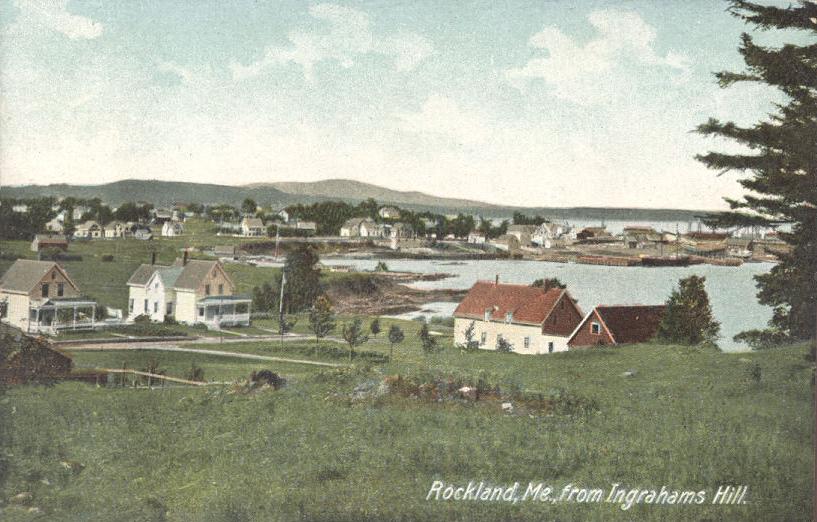
Rockland is a city in Knox County, Maine, in the United States. As of the 2020 census, the town population was 6,936. It is the county seat of Knox County. The city is a popular tourist destination. It is a departure point for the Maine State Ferry Service to the islands of Penobscot Bay: Vinalhaven, North Haven and Matinicus. History Abenaki Indigenous People called it Catawamteak, meaning "great landing place." In 1767, John Lermond and his two brothers from Warren built a camp to produce oak staves and pine lumber. Thereafter known as Lermond's Cove, it was first settled about 1769. When in 1777 Thomaston was incorporated, Lermond's Cove became a district called Shore village. On July 28, 1848, it was set off as the town of East Thomaston. Renamed Rockland in 1850, it was chartered as a city in 1854. Rockland developed rapidly because of shipbuilding and lime production. In 1854 alone, the city built eleven ships, three barks, six brigs and four schooners. The city ... [...More Info...] [...Related Items...] OR: [Wikipedia] [Google] [Baidu] |


.jpg)
