|
Priors Norton
Norton is a settlement and civil parish in the English county of Gloucestershire. Overview The main settlements in the parish are the three hamlets of Norton (sometimes called Cold Elm Norton), Bishop's Norton and Prior's Norton. The parish is bisected by the main A38 road that connects Gloucester and Tewkesbury, Bishop's Norton lying to its west and Prior's Norton to its east. Norton formerly lay on the road but is now bypassed. For the purposes of local government the parish forms part of the Tewkesbury borough The village has a small school (Norton Church of England Primary School), a village hall, a sports pitch, two pubs (The Red Lion at Wainlode Hill and the New Dawn Inn) and a church. The parish of Norton had a population of 439 according to the 2011 census. On the Bishop's Norton side, just down from the trigpoint at the top of Sandhurst Hill, is a commemoration stone in the middle of a small group of trees with the following inscription: "This stone marks the site ... [...More Info...] [...Related Items...] OR: [Wikipedia] [Google] [Baidu] |
Tewkesbury Borough
Tewkesbury is a local government district and borough in Gloucestershire, England. Named after its main town, Tewkesbury, the borough had a population of 85,800 in 2015. Other places in the borough include Ashchurch, Bishop's Cleeve, Churchdown and Winchcombe. It is administratively distinct from the parish of Tewkesbury, which is served by Tewkesbury Town Council. It was formed on 1 April 1974, under the Local Government Act 1972, from the municipal borough of Tewkesbury, along with Cheltenham Rural District and part of Gloucester Rural District. Prior to assuming its borough charter the district was intended to be referred to as North Gloucestershire, and consultations have taken place in an attempt to change the name to avoid confusion with Tewkesbury proper. Gloucestershire Airport is in the borough, near to Gloucester and Cheltenham. The borough is also served by Ashchurch for Tewkesbury Ashchurch for Tewkesbury is a railway station serving the North Gloucester ... [...More Info...] [...Related Items...] OR: [Wikipedia] [Google] [Baidu] |
Gloucestershire
Gloucestershire ( abbreviated Glos) is a county in South West England. The county comprises part of the Cotswold Hills, part of the flat fertile valley of the River Severn and the entire Forest of Dean. The county town is the city of Gloucester and other principal towns and villages include Cheltenham, Cirencester, Kingswood, Bradley Stoke, Stroud, Thornbury, Yate, Tewkesbury, Bishop's Cleeve, Churchdown, Brockworth, Winchcombe, Dursley, Cam, Berkeley, Wotton-under-Edge, Tetbury, Moreton-in-Marsh, Fairford, Lechlade, Northleach, Stow-on-the-Wold, Chipping Campden, Bourton-on-the-Water, Stonehouse, Nailsworth, Minchinhampton, Painswick, Winterbourne, Frampton Cotterell, Coleford, Cinderford, Lydney and Rodborough and Cainscross that are within Stroud's urban area. Gloucestershire borders Herefordshire to the north-west, Worcestershire to the north, Warwickshire to the north-east, Oxfordshire to the east, Wiltshire to the south, Bristol and Somerset ... [...More Info...] [...Related Items...] OR: [Wikipedia] [Google] [Baidu] |
Tewkesbury (UK Parliament Constituency)
Tewkesbury is a constituency represented in the House of Commons of the UK Parliament since its 1997 recreation by Laurence Robertson, a Conservative. History 1610 to 1918 Tewkesbury existed in this period, first in the parliamentary borough form. It returned two MPs until this was reduced to one in 1868, then saw itself become instead a larger county division under the Redistribution of Seats Act 1885, and it was abolished in 1918. ;Prominent politicians * William Dowdeswell was Chancellor of the Exchequer for two years under Rockingham, and his short tenure of this position appears to have been a successful one, he being in Lecky's words a good financier, but nothing more. To general astonishment, he refused to abandon his friends and to take an office under The 1st Earl of Chatham ("Pitt the Elder"), who succeeded Rockingham in August 1766. Dowdeswell then led the Rockingham party in the House of Commons, taking an active part in debate until his death. In 1774 he warne ... [...More Info...] [...Related Items...] OR: [Wikipedia] [Google] [Baidu] |
Gloucester
Gloucester ( ) is a cathedral city and the county town of Gloucestershire in the South West of England. Gloucester lies on the River Severn, between the Cotswolds to the east and the Forest of Dean to the west, east of Monmouth and east of the border with Wales. Including suburban areas, Gloucester has a population of around 132,000. It is a port, linked via the Gloucester and Sharpness Canal to the Severn Estuary. Gloucester was founded by the Romans and became an important city and '' colony'' in AD 97 under Emperor Nerva as '' Colonia Glevum Nervensis''. It was granted its first charter in 1155 by Henry II. In 1216, Henry III, aged only nine years, was crowned with a gilded iron ring in the Chapter House of Gloucester Cathedral. Gloucester's significance in the Middle Ages is underlined by the fact that it had a number of monastic establishments, including: St Peter's Abbey founded in 679 (later Gloucester Cathedral), the nearby St Oswald's Priory, Glo ... [...More Info...] [...Related Items...] OR: [Wikipedia] [Google] [Baidu] |
Civil Parish
In England, a civil parish is a type of administrative parish used for local government. It is a territorial designation which is the lowest tier of local government below districts and counties, or their combined form, the unitary authority. Civil parishes can trace their origin to the ancient system of ecclesiastical parishes, which historically played a role in both secular and religious administration. Civil and religious parishes were formally differentiated in the 19th century and are now entirely separate. Civil parishes in their modern form came into being through the Local Government Act 1894, which established elected parish councils to take on the secular functions of the parish vestry. A civil parish can range in size from a sparsely populated rural area with fewer than a hundred inhabitants, to a large town with a population in the tens of thousands. This scope is similar to that of municipalities in Continental Europe, such as the communes of France. Howev ... [...More Info...] [...Related Items...] OR: [Wikipedia] [Google] [Baidu] |
English County
The counties of England are areas used for different purposes, which include administrative, geographical, cultural and political demarcation. The term "county" is defined in several ways and can apply to similar or the same areas used by each of these demarcation structures. These different types of county each have a more formal name but are commonly referred to just as "counties". The current arrangement is the result of incremental reform. The original county structure has its origins in the Middle Ages. These counties are often referred to as the historic, traditional or former counties. The Local Government Act 1888 created new areas for organising local government that it called administrative counties and county boroughs. These administrative areas adopted the names of, and closely resembled the areas of, the traditional counties. Later legislative changes to the new local government structure led to greater distinction between the traditional and the administrative ... [...More Info...] [...Related Items...] OR: [Wikipedia] [Google] [Baidu] |
Hamlet (place)
A hamlet is a human settlement that is smaller than a town or village. Its size relative to a parish can depend on the administration and region. A hamlet may be considered to be a smaller settlement or subdivision or satellite entity to a larger settlement. The word and concept of a hamlet has roots in the Anglo-Norman settlement of England, where the old French ' came to apply to small human settlements. Etymology The word comes from Anglo-Norman ', corresponding to Old French ', the diminutive of Old French ' meaning a little village. This, in turn, is a diminutive of Old French ', possibly borrowed from (West Germanic) Franconian languages. Compare with modern French ', Dutch ', Frisian ', German ', Old English ' and Modern English ''home''. By country Afghanistan In Afghanistan, the counterpart of the hamlet is the qala ( Dari: قلعه, Pashto: کلي) meaning "fort" or "hamlet". The Afghan ''qala'' is a fortified group of houses, generally with its own co ... [...More Info...] [...Related Items...] OR: [Wikipedia] [Google] [Baidu] |
A38 Road
The A38, parts of which are known as Devon Expressway, Bristol Road and Gloucester Road, is a major A-class trunk road in England. The road runs from Bodmin in Cornwall to Mansfield in Nottinghamshire. It is long, making it the longest two-digit A road in England. It was formerly known as the ''Leeds–Exeter Trunk Road'', when this description also included the A61. Before the opening of the M5 motorway in the 1960s and 1970s, the A38 formed the main "holiday route" from the Midlands to Somerset, Devon and Cornwall. Considerable lengths of the road in the West Midlands closely follow Roman roads, including part of Icknield Street. Between Worcester and Birmingham the current A38 follows the line of a Saxon salt road; For most of the length of the M5 motorway, the A38 road runs alongside it as a single carriageway road. Route description Bodmin to Birmingham The road starts on the eastern side of Bodmin at a junction with the A30 before traversing the edge of the ... [...More Info...] [...Related Items...] OR: [Wikipedia] [Google] [Baidu] |
Tewkesbury
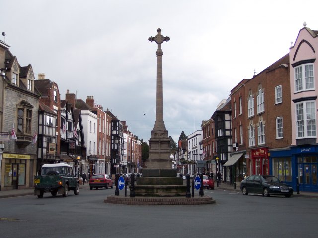
Tewkesbury ( ) is a medieval market town and civil parish in the north of Gloucestershire, England. The town has significant history in the Wars of the Roses and grew since the building of Tewkesbury Abbey. It stands at the confluence of the River Severn and the River Avon, and thus became an important trading point, which continued as railways and later M5 and M50 motorway connections were established. The town gives its name to the Borough of Tewkesbury, due to the earlier governance by the Abbey, yet the town is the second largest settlement in the Borough. The town lies on border with Worcestershire, identified largely by the Carrant Brook (a tributary of the River Avon). The name Tewkesbury is thought to come from Theoc, the name of a Saxon who founded a hermitage there in the 7th century, and in the Old English language was called '. Toulmin Smith L., ed. 1909, ''The Itinerary of John Leland'', London, IV, 150 An erroneous derivation from Theotokos (the Greek title of ... [...More Info...] [...Related Items...] OR: [Wikipedia] [Google] [Baidu] |
Tewkesbury (borough)
Tewkesbury is a local government district and borough in Gloucestershire, England. Named after its main town, Tewkesbury, the borough had a population of 85,800 in 2015. Other places in the borough include Ashchurch, Bishop's Cleeve, Churchdown and Winchcombe. It is administratively distinct from the parish of Tewkesbury, which is served by Tewkesbury Town Council. It was formed on 1 April 1974, under the Local Government Act 1972, from the municipal borough of Tewkesbury, along with Cheltenham Rural District and part of Gloucester Rural District. Prior to assuming its borough charter the district was intended to be referred to as North Gloucestershire, and consultations have taken place in an attempt to change the name to avoid confusion with Tewkesbury proper. Gloucestershire Airport is in the borough, near to Gloucester and Cheltenham. The borough is also served by Ashchurch for Tewkesbury on the mainline as well as a number of Gloucestershire Warwickshire Railway stati ... [...More Info...] [...Related Items...] OR: [Wikipedia] [Google] [Baidu] |
Wards And Electoral Divisions Of The United Kingdom
The wards and electoral divisions in the United Kingdom are electoral districts at sub-national level, represented by one or more councillors. The ward is the primary unit of English electoral geography for civil parishes and borough and district councils, the electoral ward is the unit used by Welsh principal councils, while the electoral division is the unit used by English county councils and some unitary authorities. Each ward/division has an average electorate of about 5,500 people, but ward population counts can vary substantially. As of 2021 there are 8,694 electoral wards/divisions in the UK. England The London boroughs, metropolitan boroughs and non-metropolitan districts (including most unitary authorities) are divided into wards for local elections. However, county council elections (as well as those for several unitary councils which were formerly county councils, such as the Isle of Wight and Shropshire Councils) instead use the term ''electoral division''. In ... [...More Info...] [...Related Items...] OR: [Wikipedia] [Google] [Baidu] |
Deerhurst
Deerhurst is a village and civil parish in Gloucestershire, England, about southwest of Tewkesbury. The village is on the east bank of the River Severn. The parish includes the village of Apperley and the hamlet of Deerhurst Walton. The 2011 Census recorded the parish's population as 906, the majority of whom live in Apperley. The place-name is derived from Old English and means "deer-wood". It was spelt ''Deorhyrst'' in AD 804, ''Dorhirst'' in about 1050 and ''Derherste'' in the Domesday Book in 1086. Geography The parish has an area of about , bounded by the Severn to the west, the A38 road to the east and Coombe Hill Canal to the south. The parish is low-lying and much of it is repeatedly flooded. After serious flooding in 1947 several cottages were abandoned and demolished. Deerhurst was inundated again by the floods of 2007. Priory and parish church By AD 804 there was a Benedictine monastery at Deerhurst, which also held the manor. In about 1060 King Edward the ... [...More Info...] [...Related Items...] OR: [Wikipedia] [Google] [Baidu] |

_drawn_and_engraved_under_the_direction_of_Edward_Wedlake_Brayley.jpg)


