|
Port Albert, Victoria
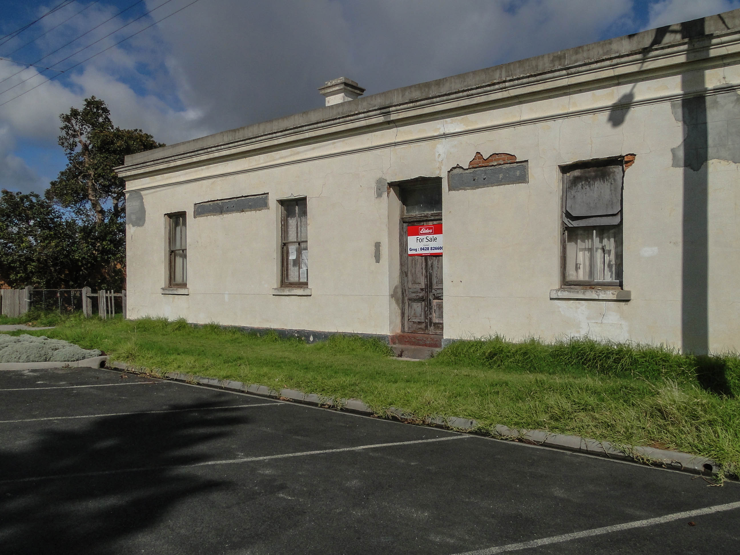
Port Albert is a coastal town in Victoria, Australia, on the coast of Corner Inlet on the Yarram - Port Albert Road, south-east of Morwell, south-east of Melbourne, in the Shire of Wellington. At the , Port Albert had a population of 293. Location and features Port Albert was one of the earliest ports established in Victoria. In 1841 the Gippsland Company investigated the area following favourable reports from explorer Angus McMillan. In May of that year the first settlers arrived. Initially the area was known as Seabank or Old Port, but was changed to New Leith when the town started developing, and later changed to Alberton and Port Albert in honour of Prince Albert of Saxe-Coburg and Gotha, the husband of Queen Victoria. The Post Office opened on 1 November 1842 as Alberton (it was renamed Port Albert in 1856) and was the fourth to open in the Port Phillip District. It became the administrative centre of Gippsland and a transport hub for cargo between Melbourne and V ... [...More Info...] [...Related Items...] OR: [Wikipedia] [Google] [Baidu] |
Electoral District Of Gippsland South
The electoral district of Gippsland South (initially known as South Gippsland) is a Lower House electoral district of the Victorian Parliament. It is located within the Eastern Victoria Region of the Legislative Council. Gippsland South extends along the state's coast from Venus Bay to Loch Sport and includes the country Victorian towns of Foster, Korumburra, Leongatha, Mirboo North, Port Albert, Port Welshpool, Rosedale, Sale and Yarram. The electorate includes all of South Gippsland Shire and the southern parts of Wellington Shire. Industries include agriculture, timber production and tourism. Dairying is the biggest agricultural contributor to the local economy. Natural features include Wilsons Promontory National Park, Corner Inlet, and a number of lakes and islands along the coast and border. Its area was initially defined by the 1858 Electoral Act as: "''Commencing at the mouth of Merryman's Creek on the Ninety Mile Beach; bounded on the north by Merryman's Creek t ... [...More Info...] [...Related Items...] OR: [Wikipedia] [Google] [Baidu] |
Van Diemen's Land
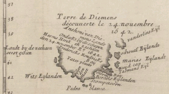
Van Diemen's Land was the colonial name of the island of Tasmania used by the British during the European exploration of Australia in the 19th century. A British settlement was established in Van Diemen's Land in 1803 before it became a separate colony in 1825. Its penal colonies became notorious destinations for the transportation of convicts due to the harsh environment, isolation and reputation for being inescapable. Macquarie Harbour and Port Arthur are among the most well-known penal settlements on the island. With the passing of the Australian Constitutions Act 1850, Van Diemen's Land (along with New South Wales, Queensland, South Australia, Victoria, and Western Australia) was granted responsible self-government with its own elected representative and parliament. On 1 January 1856, the colony of Van Diemen's Land was officially changed to Tasmania. The last penal settlement was closed in Tasmania in 1877. Toponym The island was named in honour of Anthony van Die ... [...More Info...] [...Related Items...] OR: [Wikipedia] [Google] [Baidu] |
Towns In Victoria (Australia)
This is a list of locality names and populated place names in the state of Victoria, Australia, outside the Melbourne metropolitan area. It is organised by region from the south-west of the state to the east and, for convenience, is sectioned by Local Government Area (LGA). Localities are bounded areas recorded on VICNAMES, although boundaries are the responsibility of each council. Many localities cross LGA boundaries, some being partly within three LGAs, but are listed here once under the LGA in which the major population centre or area occurs. The Office of Geographic Names (OGN), led by the Registrar of Geographic Names, administers the naming or renaming of localities (as well as roads, and other features) in Victoria, and maintains the Register of Geographic Names, referred as the VICNAMES register, pursuant to the ''Geographic Place Names Act 1998''. The OGN has issued the mandatory ''Naming rules for places in Victoria, Statutory requirements for naming roads, features ... [...More Info...] [...Related Items...] OR: [Wikipedia] [Google] [Baidu] |
Ports And Harbours Of Victoria (Australia)
A port is a maritime law, maritime facility comprising one or more Wharf, wharves or loading areas, where ships load and discharge Affreightment, cargo and passengers. Although usually situated on a sea coast or estuary, ports can also be found far inland, such as Port of Hamburg, Hamburg, Port of Manchester, Manchester and Duluth; these access the sea via rivers or canals. Because of their roles as port of entry, ports of entry for immigrants as well as soldiers in wartime, many port cities have experienced dramatic multi-ethnic and multicultural changes throughout their histories. Ports are extremely important to the global economy; 70% of global merchandise trade by value passes through a port. For this reason, ports are also often densely populated settlements that provide the labor for processing and handling goods and related services for the ports. Today by far the greatest growth in port development is in Asia, the continent with some of the World's busiest ... [...More Info...] [...Related Items...] OR: [Wikipedia] [Google] [Baidu] |
Coastal Towns In Victoria (Australia)
The coast, also known as the coastline or seashore, is defined as the area where land meets the ocean, or as a line that forms the boundary between the land and the coastline. The Earth has around of coastline. Coasts are important zones in natural ecosystems, often home to a wide range of biodiversity. On land, they harbor important ecosystems such as freshwater or estuarine wetlands, which are important for bird populations and other terrestrial animals. In wave-protected areas they harbor saltmarshes, mangroves or seagrasses, all of which can provide nursery habitat for finfish, shellfish, and other aquatic species. Rocky shores are usually found along exposed coasts and provide habitat for a wide range of sessile animals (e.g. mussels, starfish, barnacles) and various kinds of seaweeds. Along tropical coasts with clear, nutrient-poor water, coral reefs can often be found between depths of . According to a United Nations atlas, 44% of all people live within 5 km (3.3mi) of ... [...More Info...] [...Related Items...] OR: [Wikipedia] [Google] [Baidu] |
South Gippsland Railway Line
The South Gippsland railway line is a partially closed railway line in Victoria, Australia. It was first opened in 1892, branching from the Orbost line at Dandenong, and extending to Port Albert. Much of it (the section up to Leongatha) remained open until December 1994 (passenger services finished the previous July). Today, only the section between Dandenong and Cranbourne remains open for use. The section of the line from Nyora to Leongatha was used by the South Gippsland Tourist Railway until it ceased operations in 2016. The section from Nyora to Welshpool, with extension trail to Port Welshpool and a portion of the former line at Koo Wee Rup, have been converted into the Great Southern Rail Trail. History The Melbourne and Suburban Railway Company opened a line from Princes Bridge railway station to Punt Road (Richmond) and South Yarra in 1859 and extended to Dandenong in 1879. The South Gippsland railway line was opened from Dandenong to Cranbourne in 1888 and extended ... [...More Info...] [...Related Items...] OR: [Wikipedia] [Google] [Baidu] |
Port Albert Railway Station
Port Albert was the original terminus station on the South Gippsland railway line, the railway opening to that station on 13 January 1892. Early survey documents regard the station site as "Palmerston" station ground.Victorian Railways - Original Plan & Section Book c. 1888 It closed during the 1940s. References Disused railway stations in Victoria (Australia) Transport in Gippsland (region) Shire of Wellington {{VictoriaAU-railstation-stub ... [...More Info...] [...Related Items...] OR: [Wikipedia] [Google] [Baidu] |
Port Albert Hotel
A port is a maritime facility comprising one or more wharves or loading areas, where ships load and discharge cargo and passengers. Although usually situated on a sea coast or estuary, ports can also be found far inland, such as Hamburg, Manchester and Duluth; these access the sea via rivers or canals. Because of their roles as ports of entry for immigrants as well as soldiers in wartime, many port cities have experienced dramatic multi-ethnic and multicultural changes throughout their histories. Ports are extremely important to the global economy; 70% of global merchandise trade by value passes through a port. For this reason, ports are also often densely populated settlements that provide the labor for processing and handling goods and related services for the ports. Today by far the greatest growth in port development is in Asia, the continent with some of the world's largest and busiest ports, such as Singapore and the Chinese ports of Shanghai and Ningbo-Zhou ... [...More Info...] [...Related Items...] OR: [Wikipedia] [Google] [Baidu] |
Fishing
Fishing is the activity of trying to catch fish. Fish are often caught as wildlife from the natural environment, but may also be caught from stocked bodies of water such as ponds, canals, park wetlands and reservoirs. Fishing techniques include hand-gathering, spearing, netting, angling, shooting and trapping, as well as more destructive and often illegal techniques such as electrocution, blasting and poisoning. The term fishing broadly includes catching aquatic animals other than fish, such as crustaceans ( shrimp/ lobsters/crabs), shellfish, cephalopods (octopus/squid) and echinoderms ( starfish/ sea urchins). The term is not normally applied to harvesting fish raised in controlled cultivations ( fish farming). Nor is it normally applied to hunting aquatic mammals, where terms like whaling and sealing are used instead. Fishing has been an important part of human culture since hunter-gatherer times, and is one of the few food production activities that have persisted ... [...More Info...] [...Related Items...] OR: [Wikipedia] [Google] [Baidu] |
Dargo, Victoria
Dargo is a town in Victoria, Australia, located east of Melbourne, in the Shire of Wellington. At the 2016 census, Dargo and the surrounding area had a population of 99. The median age of residents was 63. The town provided a stopover for Victorian Gold Rush miners on their way to the goldfields of Grant, Talbotville, and Crooked River. The Post Office opened on 18 March 1868. Today the town is a producer of timber and beef cattle, and outside these industries tourism has become a major source of revenue. The town is a popular destination for four-wheel drive enthusiasts, bushwalkers, sambar deer hunters, and trout Trout are species of freshwater fish belonging to the genera '' Oncorhynchus'', '' Salmo'' and '' Salvelinus'', all of the subfamily Salmoninae of the family Salmonidae. The word ''trout'' is also used as part of the name of some non-salm ... fishermen. An annual Walnut Festival formerly ran through the Australian Easter holiday period and was usually w ... [...More Info...] [...Related Items...] OR: [Wikipedia] [Google] [Baidu] |
China
China, officially the People's Republic of China (PRC), is a country in East Asia. It is the world's most populous country, with a population exceeding 1.4 billion, slightly ahead of India. China spans the equivalent of five time zones and borders fourteen countries by land, the most of any country in the world, tied with Russia. Covering an area of approximately , it is the world's third largest country by total land area. The country consists of 22 provinces, five autonomous regions, four municipalities, and two Special Administrative Regions (Hong Kong and Macau). The national capital is Beijing, and the most populous city and financial center is Shanghai. Modern Chinese trace their origins to a cradle of civilization in the fertile basin of the Yellow River in the North China Plain. The semi-legendary Xia dynasty in the 21st century BCE and the well-attested Shang and Zhou dynasties developed a bureaucratic political system to serve hereditary monarchies, or dyna ... [...More Info...] [...Related Items...] OR: [Wikipedia] [Google] [Baidu] |


