|
Polessky District
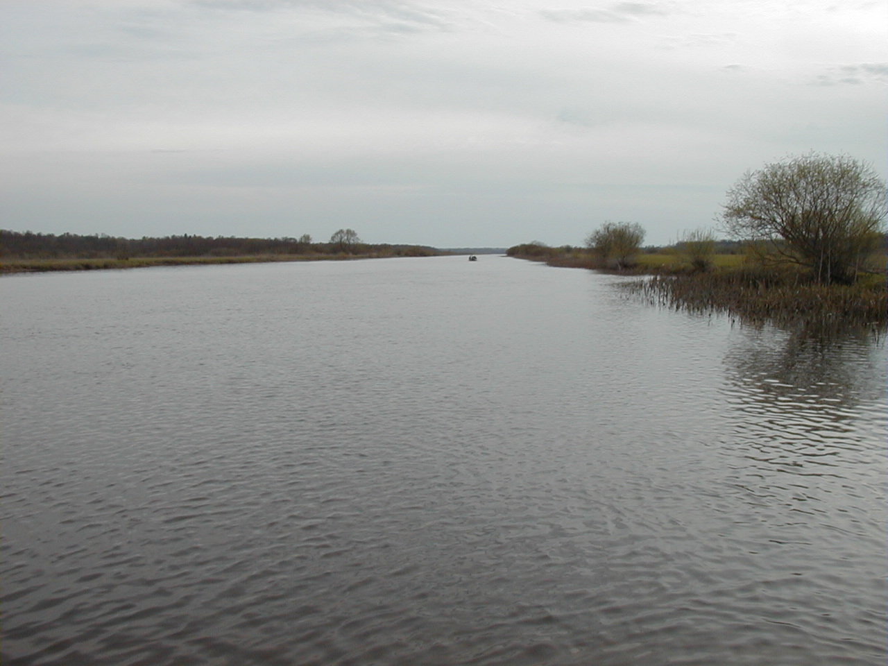
Polessky District (russian: Поле́сский райо́н) is an administrative district (raion), one of the fifteen in Kaliningrad Oblast, Russia.Law #463 As a municipal division, it is incorporated as Polessky Municipal District.Law #260 It is located in the center of the oblast. The area of the district is . Its administrative center is the town of Polessk.Resolution #639 As of the 2010 Census, the total population of the district was 19,205, with the population of Polessk accounting for 39.5% of that number. Geography The district is situated in the center of the oblast, with the Curonian Lagoon to the north. The Deyma River, a branch of the Pregolya, flows through the district. Near Polessk, the Polessk Canal connects the Pregolya and the Neman Rivers, crossing a bog. History The district was established on April 7, 1946 as Labiausky District (). It was given its present name on September 7, 1946. Economy Economy is focused on fishery and agriculture. ... [...More Info...] [...Related Items...] OR: [Wikipedia] [Google] [Baidu] |
Kaliningrad Oblast
Kaliningrad Oblast (russian: Калинингра́дская о́бласть, translit=Kaliningradskaya oblast') is the westernmost federal subject of Russia. It is a semi-exclave situated on the Baltic Sea. The largest city and administrative centre of the province (oblast) is the city of Kaliningrad, formerly known as Königsberg. The port city of Baltiysk is Russia's only port on the Baltic Sea that remains ice-free in winter. Kaliningrad Oblast had a population of roughly 1 million in the Russian Census of 2010. The oblast is bordered by Poland to the south, Lithuania to the north and east and the Baltic Sea to the north-west. The territory was formerly the northern part of the Prussian province of East Prussia; the remaining southern part of the province is today part of the Warmian-Masurian Voivodeship in Poland. With the defeat of Nazi Germany in World War II, the territory was annexed to the Russian SFSR by the Soviet Union. Following the post-war migrat ... [...More Info...] [...Related Items...] OR: [Wikipedia] [Google] [Baidu] |
Administrative Center
An administrative center is a seat of regional administration or local government, or a county town, or the place where the central administration of a commune A commune is an alternative term for an intentional community. Commune or comună or comune or other derivations may also refer to: Administrative-territorial entities * Commune (administrative division), a municipality or township ** Communes of ... is located. In countries with French as administrative language (such as Belgium, Luxembourg, Switzerland and many African countries), a (, plural form , literally 'chief place' or 'main place'), is a town or city that is important from an administrative perspective. Algeria The capital of an Algerian province is called a chef-lieu. The capital of a Districts of Algeria, district, the next largest division, is also called a chef-lieu, whilst the capital of the lowest division, the Municipalities of Algeria, municipalities, is called agglomération de chef-lieu (chef-lieu ... [...More Info...] [...Related Items...] OR: [Wikipedia] [Google] [Baidu] |
Districts Of Kaliningrad Oblast
A district is a type of administrative division that, in some countries, is managed by the local government. Across the world, areas known as "districts" vary greatly in size, spanning regions or counties, several municipalities, subdivisions of municipalities, school district, or political district. By country/region Afghanistan In Afghanistan, a district (Persian ps, ولسوالۍ ) is a subdivision of a province. There are almost 400 districts in the country. Australia Electoral districts are used in state elections. Districts were also used in several states as cadastral units for land titles. Some were used as squatting districts. New South Wales had several different types of districts used in the 21st century. Austria In Austria, the word is used with different meanings in three different contexts: * Some of the tasks of the administrative branch of the national and regional governments are fulfilled by the 95 district administrative offices (). The area a dist ... [...More Info...] [...Related Items...] OR: [Wikipedia] [Google] [Baidu] |
Bolshakovo
Bolshakovo (russian: Большако́во, pl, Skajzgiry, lt, Didieji Skaisgiriai, german: Groß Skaisgirren or ' (1938-1946)), also referred to as Bolshakovo-Novoye (russian: Большако́во-Новое), is a settlement located in the southern part of Slavsky District of Kaliningrad Oblast, Russia, 90 km from Kaliningrad. The adjective "Novoye" (new) is sometimes used to distinguish it from an eponymous village in Ivanovo Oblast of Russia. It is situated on the road from Talpaki to Sovetsk. There are also roads from Bolshakovo to Polessk and to Chernyakhovsk. Bolshakovo is a railway station on the Kaliningrad–Sovetsk line. Bolshakovo lies on the border of Polessk Lowland in a marsh landscape and has approximately 2,000 inhabitants. Bolshakovo is a transmission site of the ''Voice of Russia'' broadcasting station, the Bolshakovo transmitter. History In 1454, the region was incorporated by King Casimir IV Jagiellon to the Kingdom of Poland upon the requ ... [...More Info...] [...Related Items...] OR: [Wikipedia] [Google] [Baidu] |
Guryevsk, Kaliningrad Oblast
Guryevsk (russian: Гу́рьевск, german: Neuhausen, pl, Romnowo) is a town and the administrative center of Guryevsky District of Kaliningrad Oblast, Russia, located northeast of Kaliningrad. Population: History In 1255 the Sambians tribe's stronghold of Vurgvala was taken by Teutonic Knights and renamed as ''Neuhausen'' in 1262. Around 1292, the Castle of the Sambian Chapter was built. In 1454, King Casimir IV Jagiellon incorporated the region to the Kingdom of Poland upon the request of the anti-Teutonic Prussian Confederation. After the subsequent Thirteen Years' War (1454–1466), it became a part of Poland as a fief held by the Teutonic Knights until 1525,Górski, pp. 96–97, 214–215 and by secular Ducal Prussia afterwards. From 1701, the settlement was part of the Kingdom of Prussia, and in 1871 it became part of the German Empire upon the unification of Germany, within which it was administered as part of the Province of East Prussia. In 1877, the village ha ... [...More Info...] [...Related Items...] OR: [Wikipedia] [Google] [Baidu] |
Sovetsk, Kaliningrad Oblast
Sovetsk (russian: Сове́тск; german: Tilsit; Old Prussian: ''Tilzi''; lt, Tilžė; pl, Tylża) is a town in Kaliningrad Oblast, Russia, located on the south bank of the Neman River which forms the border with Lithuania. Geography Sovetsk lies in the historic region of Lithuania Minor at the confluence of the Tilse and Neman rivers. Panemunė in Lithuania was formerly a suburb of the town; after Germany's defeat in World War I, the trans-Neman suburb was detached from Tilsit (with the rest of the Klaipėda Region) in 1920. Climate Sovetsk has a borderline oceanic climate (''Cfb'' in the Köppen climate classification) using the boundary, or a humid continental climate (''Dfb'') using the boundary. History Tilsit, which received civic rights from Albert, Duke of Prussia in 1552,''Słownik geograficzny Królestwa Polskiego i innych krajów słowiańskich, Tom XII'', p. 703 developed around a castle of the Teutonic Knights, known as the Schalauer Haus, founded in 1 ... [...More Info...] [...Related Items...] OR: [Wikipedia] [Google] [Baidu] |
Kaliningrad
Kaliningrad ( ; rus, Калининград, p=kəlʲɪnʲɪnˈɡrat, links=y), until 1946 known as Königsberg (; rus, Кёнигсберг, Kyonigsberg, ˈkʲɵnʲɪɡzbɛrk; rus, Короле́вец, Korolevets), is the largest city and administrative centre of Kaliningrad Oblast, a Russian semi-exclave between Lithuania and Poland. The city sits about west from mainland Russia. The city is situated on the Pregolya River, at the head of the Vistula Lagoon on the Baltic Sea, and is the only ice-free port of Russia and the Baltic states on the Baltic Sea. Its population in 2020 was 489,359, with up to 800,000 residents in the urban agglomeration. Kaliningrad is the second-largest city in the Northwestern Federal District, after Saint Petersburg, the third-largest city in the Baltic region, and the seventh-largest city on the Baltic Sea. The settlement of modern-day Kaliningrad was founded in 1255 on the site of the ancient Old Prussian settlement ''Twangste'' by th ... [...More Info...] [...Related Items...] OR: [Wikipedia] [Google] [Baidu] |
Neman River
The Neman, Nioman, Nemunas or MemelTo bankside nations of the present: Lithuanian: be, Нёман, , ; russian: Неман, ''Neman''; past: ger, Memel (where touching Prussia only, otherwise Nieman); lv, Nemuna; et, Neemen; pl, Niemen; ; uk, Німан, ''Niman'' is a river in Europe that rises in central Belarus and flows through Lithuania then forms the northern border of Kaliningrad Oblast, Russia's western exclave, which specifically follows its southern channel. It drains into the Curonian Lagoon, narrowly connected to the Baltic Sea. It flows about , so is considered a major Eastern European river. It flows generally west to Grodno within of the Polish border, north to Kaunas, then westward again to the sea. The largest river in Lithuania, and the third-largest in Belarus, it is navigable for most of its length. It starts from two small headwaters merging about southwest of the town of Uzda – about southwest of capital city Minsk. Only , an eastward mea ... [...More Info...] [...Related Items...] OR: [Wikipedia] [Google] [Baidu] |
Polessk Canal
Polessk (russian: Поле́сск; german: Labiau; lt, Labguva; pl, Labiawa) is a town and the administrative center of Polessky District in Kaliningrad Oblast, Russia, located northeast of Kaliningrad, the administrative center of the oblast, at the junction of a main road and a railroad at the Deyma River, shortly before it enters the Curonian Lagoon. Population figures: 4,744 (1885). Geography The Polessk Canal begins in the town. History It was founded in the 13th century, by the Teutonic Order who erected a castle there and named it Labiau. Initially it was part of the State of the Teutonic Order. In 1454, King Casimir IV Jagiellon incorporated the region to the Kingdom of Poland upon the request of the anti-Teutonic Prussian Confederation. After the subsequent Thirteen Years' War (1454–1466) the settlement became a part of Poland as a fief held by the Teutonic Knights until 1525 and by Ducal Prussia afterwards. In this town, on November 20, 1656, was signed ... [...More Info...] [...Related Items...] OR: [Wikipedia] [Google] [Baidu] |
Pregolya River
The Pregolya or Pregola (russian: Прего́ля; german: Pregel; lt, Prieglius; pl, Pregoła) is a river in the Russian Kaliningrad Oblast exclave. Name A possible ancient name by Ptolemy of the Pregolya River is Chronos (from Germanic *''hrauna'', "stony"), although other theories identify Chronos as a much larger river, the Nemunas. The oldest recorded names of the river are ''Prigora'' (1302), ''Pregor'' (1359), ''Pregoll, Pregel'' (1331), ''Pregill'' (1460). Georg Gerullis connected the name with Lithuanian ''prãgaras'', ''pragorė̃'' ("abyss") and the Lithuanian verb ''gérti'' ("drink"). Vytautas Mažiulis instead derived it from ''spragė́ti'' or ''sprógti'' ("burst") and the suffix -''ara'' ("river").http://journals.lki.lt/actalinguisticalithuanica/article/download/856/947/ Overview It starts as a confluence of the Instruch and the Angrapa and drains into the Baltic Sea through the Vistula Lagoon. Its length under the name of Pregolya is 123 km, 292 k ... [...More Info...] [...Related Items...] OR: [Wikipedia] [Google] [Baidu] |
Deyma River
The Deyma (russian: link=no, Дейма; german: link=no, Deime; lt, link=no, Deimena) is a river in Russia's Kaliningrad Oblast. It separates from the Pregolya at Gvardeysk, flows through Polessk, and ends at the Curonian Lagoon. The Polessk Canal connects the Deima with the Nemunas The Neman, Nioman, Nemunas or MemelTo bankside nations of the present: Lithuanian: be, Нёман, , ; russian: Неман, ''Neman''; past: ger, Memel (where touching Prussia only, otherwise Nieman); lv, Nemuna; et, Neemen; pl, Niemen; .... Rivers of Kaliningrad Oblast 0Deyma {{Russia-river-stub ... [...More Info...] [...Related Items...] OR: [Wikipedia] [Google] [Baidu] |
Curonian Lagoon
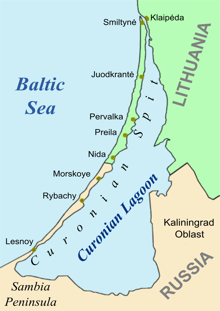
The Curonian Lagoon (or Bay, Gulf; russian: Куршский залив, lt, Kuršių marios, pl, Zalew Kuroński, german: Kurisches Haff, lv, Kuršu joma) is a freshwater lagoon separated from the Baltic Sea by the Curonian Spit. Its surface area is . The Neman River ( lt, Nemunas) supplies about 90% of its inflows; its watershed consists of about 100,450 square kilometres in Lithuania and Russia's Kaliningrad Oblast. Human history In the 13th century, the area around the lagoon was part of the ancestral lands of the Curonians and Old Prussians. Later it bordered the historical region of Lithuania Minor. At the northern end of the Spit, the Klaipėda Strait connects the lagoon to the Baltic Sea, and the place was chosen by the Teutonic Knights in 1252 to found ''Memelburg'' castle and the city of Memel — officially called Klaipėda in 1923–39, when the Memel Territory was separated from Germany, and again after 1945, when it became part of the Lithuanian SSR. As the ... [...More Info...] [...Related Items...] OR: [Wikipedia] [Google] [Baidu] |
_(10004827914).jpg)


