|
Pohutukawa Bay
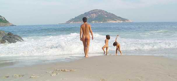
Pohutukawa Bay is a beach north of Long Bay, located on the North Shore of Auckland. It is situated northeast of Okura, close to Piripiri Point. Directly south of Pohutukawa Bay Beach is Granny's Bay Beach, and a little further south is Long Bay Regional Park. The beach is accessible only at low tide, and it is among one of Auckland's most popular naturist beaches. Public nudity is technically legal on any New Zealand beach where it is "known to occur". Getting to the beach requires going through the coastal track, a walk that starts from the beach carparks, and ends at the Okura River The Okura River, also known as the Okura Estuary, is a river in the north of the Auckland Region in the North Island of New Zealand. The river rises in the low hills to the south of Silverdale and flows into Karepiro Bay on the Hauraki Gulf. The .... References Naturism in New Zealand Nude beaches Beaches of the Auckland Region {{Auckland-geo-stub ... [...More Info...] [...Related Items...] OR: [Wikipedia] [Google] [Baidu] |
Pacific Ocean
The Pacific Ocean is the largest and deepest of Earth's five oceanic divisions. It extends from the Arctic Ocean in the north to the Southern Ocean (or, depending on definition, to Antarctica) in the south, and is bounded by the continents of Asia and Oceania in the west and the Americas in the east. At in area (as defined with a southern Antarctic border), this largest division of the World Ocean—and, in turn, the hydrosphere—covers about 46% of Earth's water surface and about 32% of its total surface area, larger than Earth's entire land area combined .Pacific Ocean . '' Britannica Concise.'' 2008: Encyclopædia Britannica, Inc. The centers of both the |
Long Bay Regional Park
Long Bay Regional Park is a regional park in Long Bay located in Auckland, New Zealand. It is located in the Hibiscus and Bays in the northern part of the city and is operated by Auckland Council. Geography The cliffs of the park are formed by Waitemata Group sandstone. The northern section of the park features large pōhutukawa and regenerating native bush. The regional park is adjacent to the Long Bay-Okura Marine Reserve, a 980-hectare reserve extending from Karepiro Bay to Torbay Torbay is a borough and unitary authority in Devon, south west England. It is governed by Torbay Council and consists of of land, including the resort towns of Torquay, Paignton and Brixham, located on east-facing Tor Bay, part of Lyme .... History Areas of farmland above Long Bay Regional Park were protected from development by a court ruling in July 2008. References {{Protected areas of New Zealand Hibiscus and Bays Local Board Area Parks in the Auckland Region Regi ... [...More Info...] [...Related Items...] OR: [Wikipedia] [Google] [Baidu] |
Long Bay, New Zealand
Long Bay is one of the northernmost suburbs of the North Shore, part of the contiguous Auckland metropolitan area located in New Zealand. The coastline is occupied by the Long Bay Regional Park, and the shoreline is in Long Bay-Okura Marine Reserve, which opened in 1995. The beach is sandy and swimming is safe. It offers forest walks and scenic cliffs. This beach has low tide water. Smaller beaches to the north, such as Pohutukawa Bay, accessible except at high tide, are among Auckland's most popular naturist spots; Public nudity is technically legal on any New Zealand beach where it is "known to occur". The Vaughan Homestead is an historic house at the north end of the beach. It is open fortnightly to the public. History Long Bay was traditionally known by the name Whakarewatoto by the Ngāti Manuhiri iwi of the North Shore. A small Māori community of Ngāti Kahu lived at Long Bay, which they called Te Oneroa, until the 1850s. The Vaughan family bought 600 hectares and far ... [...More Info...] [...Related Items...] OR: [Wikipedia] [Google] [Baidu] |
North Shore, New Zealand
The North Shore is part of the large urban area of Auckland, New Zealand, located to the north of the Waitematā Harbour. To the east, has the Hauraki Gulf, to the west, is West Auckland, New Zealand, West Auckland, to the south, has the Waitematā Harbour and Central Auckland, to the north has the Hibiscus Coast. From 1989 until 2010, North Shore City was an independent city within the Auckland Region, until it was incorporated into the Auckland Council. North Shore City The North Shore was formerly North Shore City, a distinct territorial authority district, which was governed by the North Shore City Council from 1989 until 2010, when it was incorporated into Auckland Council. The city had an estimated population of 229,000 at 30 June 2010, making it the fourth most populous city in New Zealand prior to the November 2010 reorganisation. The former city was also the country's fourth largest city in land, with an area of 129.81 square kilometres and a coastline of 141 kilomet ... [...More Info...] [...Related Items...] OR: [Wikipedia] [Google] [Baidu] |
Auckland
Auckland (pronounced ) ( mi, Tāmaki Makaurau) is a large metropolitan city in the North Island of New Zealand. The List of New Zealand urban areas by population, most populous urban area in the country and the List of cities in Oceania by population, fifth largest city in Oceania, Auckland has an urban population of about It is located in the greater Auckland Region—the area governed by Auckland Council—which includes outlying rural areas and the islands of the Hauraki Gulf, and which has a total population of . While European New Zealanders, Europeans continue to make up the plurality of Auckland's population, the city became multicultural and Cosmopolitanism, cosmopolitan in the late-20th century, with Asian New Zealanders, Asians accounting for 31% of the city's population in 2018. Auckland has the fourth largest Foreign born, foreign-born population in the world, with 39% of its residents born overseas. With its large population of Pasifika New Zealanders, the city is ... [...More Info...] [...Related Items...] OR: [Wikipedia] [Google] [Baidu] |
Piripiri Point , a figure in Māori mythology
{{disambiguation, geo, plant ...
Piripiri may refer to: Places * Piripiri, Piauí, Brazil * Piripiri, Manawatū-Whanganui, New Zealand * Piripiri Caves and Piri Piri School, in Waitomo District, New Zealand Plants * ''Acaena'' (Māori: ''piripiri''), a plant genus of the Southern Hemisphere * ''Cyperus giganteus'', a plant of Latin America * Piripiri pepper, or ''peri-peri'', a Capiscum cultivar See also * Hinepiripiri In Māori mythology Hinepiripiri occurs in some versions of the legend of Tāwhaki as Tāwhaki's wife and the mother of Wahieroa In Māori mythology, Wahieroa is a son of Tāwhaki, and father of Rātā. Tāwhaki was attacked and left for dead by ... [...More Info...] [...Related Items...] OR: [Wikipedia] [Google] [Baidu] |
High Court Of New Zealand
The High Court of New Zealand ( mi, Te Kōti Matua o Aotearoa) is the superior court of New Zealand. It has general jurisdiction and responsibility, under the Senior Courts Act 2016, as well as the High Court Rules 2016, for the administration of justice throughout New Zealand. There are 18 High Court locations throughout New Zealand, plus one stand-alone registry. The High Court was established in 1841. It was originally called the "Supreme Court of New Zealand", but the name was changed in 1980 to make way for the naming of an eventual new Supreme Court of New Zealand. The High Court is a court of first instance for serious criminal cases such as homicide, civil claims exceeding $350,000 and certain other civil cases. In its appellate function, the High Court hears appeals from the District Court, other lower courts and various tribunals. Composition and locations The High Court comprises the Chief Justice (who is head of the judiciary) and up to 55 other Judges (whic ... [...More Info...] [...Related Items...] OR: [Wikipedia] [Google] [Baidu] |
Okura River
The Okura River, also known as the Okura Estuary, is a river in the north of the Auckland Region in the North Island of New Zealand. The river rises in the low hills to the south of Silverdale and flows into Karepiro Bay on the Hauraki Gulf. The river is extremely tide, tidal with only a narrow channel being navigable by small craft at low tide. The area is popular for horse riding, riders wait till low tide and then ford the boating channel to ride the estuary and beaches on the northern side. Geography The village of Ōkura is situated on the southern bank. The Long Bay-Okura Marine Reserve extends from the Okura River to the Weiti River. The sand banks (above high tide mark) in Karepiro Bay are Dotterel breeding areas, protected by DOC (Department of Conservation). History The northern shore of the Okura River was traditionally known as Otaimaro, and was an extensive Māori settlement. In 1848, Henry Dacre and his father Captain Ranulph Dacre purchased the lands surroundi ... [...More Info...] [...Related Items...] OR: [Wikipedia] [Google] [Baidu] |
Naturism In New Zealand
Naturism refers to a lifestyle of practising non-sexual social nudity in private and in public, and to the cultural movement which advocates and defends that lifestyle. Both are also known as "nudism". Naturist organisations have existed in New Zealand since the 1930s. Although not a daily feature of public life, social nudity is practised in a variety of other contexts in New Zealand culture. New Zealand Naturist Federation An attempt to set up a nudist club in Dunedin in 1933 was unsuccessful, attracting hostility from clergy, women's groups, and the police. Nudist clubs (known as "sun clubs") were successfully established in Dunedin and Auckland in early 1938; the Auckland Sun Group went into recess shortly afterwards due to the outbreak of World War II. In 1953 the allied nudist clubs of New Zealand gathered at Whanganui to hold a festival, called a "rally", which became an annual event. At the 1957 rally, held at the Canterbury Sun and Health Club's grounds in Rolleston ... [...More Info...] [...Related Items...] OR: [Wikipedia] [Google] [Baidu] |
Nude Beaches
A nude beach, sometimes called a clothing-optional or free beach, is a beach where users are at liberty to be nude. Nude beaches usually have mixed bathing. Such beaches are usually on public lands, and any member of the public is allowed to use the facilities without membership in any movement or subscription to any personal belief. The use of the beach facilities is normally anonymous. Unlike a naturist resort or facility, there is normally no membership or vetting requirement for the use of a nude beach. The use of nude beach facilities is usually casual, not requiring pre-booking. Nude beaches may be official (legally sanctioned), unofficial (tolerated by residents and law enforcement), or illegal. In some countries, nude beaches are relatively few and are usually at some distance from cities, and access is at times more difficult than at a regular beach and the facilities at these beaches tend to be very basic with a few notable exceptions. In other countries, like Denmar ... [...More Info...] [...Related Items...] OR: [Wikipedia] [Google] [Baidu] |
.jpg)


_p225_AUCKLAND%2C_NEW_ZEALAND.jpg)

