|
Poelkapelle
Langemark-Poelkapelle () is a municipality located in the Belgian province of West Flanders. Geography Other places in the municipality include Bikschote, Langemark and Poelkapelle. On January 1, 2006, Langemark-Poelkapelle had a total population of 7,780. The total area is which gives a population density of 148 inhabitants per km2. Gallery File:Area at Langemark-Poelkapelle German War Cemetery1.jpg, Farm at Langemark File:Flanders fields at Langemark-Poelkapelle 2.JPG, Fields at Langemark File:Langemark_German_War_Cemetery_BCE1-0000.JPG See also * Langemark German war cemetery The German war cemetery of Langemark (formerly spelt 'Langemarck') is near the village of Langemark, part of the municipality of Langemark-Poelkapelle, in the Belgian province of West Flanders. More than 44,000 soldiers are buried here. The villag ... References External links * Official Website Municipalities of West Flanders {{WestFlanders-geo-stub ... [...More Info...] [...Related Items...] OR: [Wikipedia] [Google] [Baidu] |
Langemark
Langemark is a village in the Belgian province of West Flanders, and a subdivision of the municipality of Langemark-Poelkapelle. The village has about 5,000 inhabitants. Besides the village center, there are also three smaller hamlets on the territory, , Bikschote and Saint-Julien/Sint-Juliaan. Written as Langemarck on French, British and German maps, the village is known in military history as the scenesee trench map of the first gas attacks by the German army in the western front, which marked the beginning of the Second Battle of Ypres in April 1915. Before and during the First Battle of Ypres, the German reserve corps suffered enormous losses: over 10,000 young soldiers (some only 15 years old), led by young officers without practical experience, died without achieving any objective. On 10 November 1914, about 2,000 soldiers died during an attempted breakthrough. One day later, the German Command (Oberste Heeresleitung) published the following communiqué: :''Westlich ... [...More Info...] [...Related Items...] OR: [Wikipedia] [Google] [Baidu] |
Staden
Staden (; vls, Stoan) is a village and rural Municipalities of Belgium, municipality in the Belgium, Belgian province of West Flanders. The municipality has around 11 000 inhabitants. In the local West-Flemish dialect, the ''d'' is not pronounced, which results in ''Stoan'' as pronunciation. Geography In 1976, Staden fused with the smaller villages of Oostnieuwkerke and Westrozebeke into a single municipality. As Staden was the bigger village, its name was used for the resulting municipality. Next to those three village centres, there are also a number of smaller hamlets. At the boundary between Staden, Westrozebeke and Poelkapelle, you can find the hamlet Vijfwegen. And on the boundary between Oostnieuwkerke and Hooglede, you can find the hamlet Sleihage. Both these hamlets had their own church and parish. The remaining population is spread over even smaller hamlets. :Source: Website gemeente Staden The municipality of Staden borders the following villages and municipalit ... [...More Info...] [...Related Items...] OR: [Wikipedia] [Google] [Baidu] |
Zonnebeke
Zonnebeke (; vls, Zunnebeke) is a municipality located in the Belgian province of West Flanders. The municipality comprises the villages of , , Passendale, Zandvoorde and Zonnebeke proper. On January 1, 2006, Zonnebeke had a total population of 11,758. The total area is 67.57 km2 which gives a population density of 174 inhabitants per km2. History The villages of Zonnebeke congregated around a large Augustinian abbey and its associated Benedictine convent in Nonnebosschen. Both were destroyed during the iconoclastic outbreak in 1580. Only the abbey was rebuilt, but was looted during the French occupation the abbey was confiscated. Passendale played a role in the Battle of Westrozebeke in 1382. Situated in the centre of the Ypres Salient, World War I destroyed the whole area. Left abandoned until the early 1920s, people slowly returned and rebuilt the villages. In 1932, the locals opened a cheese making facility, which to this day is the only source of Passendale cheese. ... [...More Info...] [...Related Items...] OR: [Wikipedia] [Google] [Baidu] |
Langemark German War Cemetery
The German war cemetery of Langemark (formerly spelt 'Langemarck') is near the village of Langemark, part of the municipality of Langemark-Poelkapelle, in the Belgian province of West Flanders. More than 44,000 soldiers are buried here. The village was the scene of the first gas attacks by the German army in the western frontsee trench map, marking the beginning of the Second Battle of Ypres in April 1915. During the First Battle of Ypres (1914) in World War I, inexperienced German infantry suffered severe casualties when they made a futile frontal attack on allied positions near Langemark and were checked by experienced French infantry and British riflemen. Contrary to popular myth, only fifteen percent of the German soldiers involved in the Battle of Langemark were schoolboys and students. Legend has it that the German infantry sang the first stanza of what later (1919) became their national anthem " Deutschland, Deutschland über alles", as they charged. The cemetery, which evo ... [...More Info...] [...Related Items...] OR: [Wikipedia] [Google] [Baidu] |
Arrondissement Of Ypres
{{WestFlanders-geo-stub ...
The Arrondissement of Ypres ( nl, Arrondissement Ieper; french: Arrondissement d'Ypres) is one of the eight administrative arrondissements in the Province of West Flanders, Belgium. It is both an administrative and a judicial arrondissement. However, the Judicial Arrondissement of Ypres also comprises the municipalities of Staden and Moorslede in the Arrondissement of Roeselare. Municipalities The Administrative Arrondissement of Ypres consists of the following municipalities: *Heuvelland *Langemark-Poelkapelle *Mesen *Poperinge *Vleteren *Wervik *Ypres *Zonnebeke Ypres Ypres ( , ; nl, Ieper ; vls, Yper; german: Ypern ) is a Belgian city and municipality in the province of West Flanders. Though the Dutch name is the official one, the city's French name is most commonly used in English. The municipality co ... [...More Info...] [...Related Items...] OR: [Wikipedia] [Google] [Baidu] |
West Flanders
) , settlement_type = Province of Belgium , image_flag = Flag of West Flanders.svg , flag_size = , image_shield = Wapen van West-Vlaanderen.svg , shield_size = , image_map = Provincie West-Vlaanderen in Belgium.svg , coordinates = , subdivision_type = Country , subdivision_name = , subdivision_type1 = Region , subdivision_name1 = , seat_type = Capital , seat = Bruges , leader_title = Governor , leader_name = Carl Decaluwé , area_total_km2 = 3197 , area_footnotes = , population_footnotes = , population_total = 1195796 , population_as_of = 1 January 2019 , population_density_km2 = auto , blank_name_sec2 = HDI (2019) , blank_info_sec2 = 0.935 · 5th of 11 , website = West Flanders ( nl, West-Vlaanderen ; vls, West Vlo ... [...More Info...] [...Related Items...] OR: [Wikipedia] [Google] [Baidu] |
Houthulst
Houthulst (; vls, Oetulst, ) is a municipality located in the Belgian province of West Flanders. The municipality consists of the sub-municipalities Houthulst, Jonkershove, Klerken and Merkem. On January 1, 2006, Houthulst had a total population of 9,051. The total area is 55.89 km² which gives a population density of 162 inhabitants per km². Landmarks * The ''Sint-Jan Baptistkerk'' (Church of Saint John the Baptist) is the church of Houthulst. It was rebuilt in 1924 after being completely destroyed during World War I. * The , containing the graves of almost 1800 Belgian soldiers killed during World War I. The cemetery also contains 81 Italian graves. Most of the soldiers who have been buried here were killed during the final assault on the Germans on September 28, 1918, to liberate the Vrijbos forest. References External links *Official website- Available only in Dutch Dutch commonly refers to: * Something of, from, or related to the Netherlands * Dutch people () ... [...More Info...] [...Related Items...] OR: [Wikipedia] [Google] [Baidu] |
Ypres
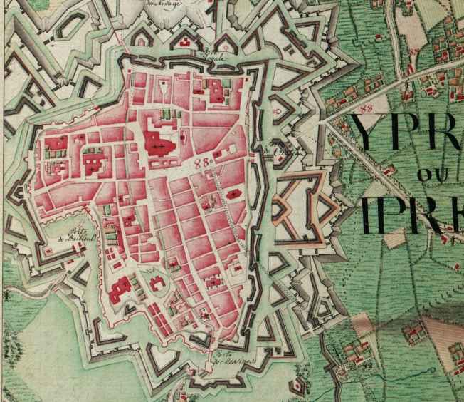
Ypres ( , ; nl, Ieper ; vls, Yper; german: Ypern ) is a Belgian city and municipality in the province of West Flanders. Though the Dutch name is the official one, the city's French name is most commonly used in English. The municipality comprises the city of Ypres/Ieper and the villages of Boezinge, Brielen, Dikkebus, Elverdinge, Hollebeke, Sint-Jan, Vlamertinge, Voormezele, Zillebeke, and Zuidschote. Together, they are home to about 34,900 inhabitants. During the First World War, Ypres (or "Wipers" as it was commonly known by the British troops) was the centre of the Battles of Ypres between German and Allied forces. History Origins before First World War Ypres is an ancient town, known to have been raided by the Romans in the first century BC. It is first mentioned by name in 1066 and is probably named after the river Ieperlee on the banks of which it was founded. During the Middle Ages, Ypres was a prosperous Flemish city with a population of 40,000 in 1200 AD, renow ... [...More Info...] [...Related Items...] OR: [Wikipedia] [Google] [Baidu] |
Lo-Reninge
Lo-Reninge (; vls, Lo-Rênienge) is a city and municipality located in the Belgian province of West Flanders. The municipality comprises the towns of Lo, Noordschote, Pollinkhove and Reninge. On January 1, 2006, Lo-Reninge had a total population of 3,306. The total area is 62.94 km² which gives a population density of 53 inhabitants per km². The Old Town Hall of Lo, built between 1565-1566, and its belfry were inscribed on the UNESCO World Heritage List in 1999 as part of the Belfries of Belgium and France site. It is the birthplace of Flemish painter Jacques-Albert Senave. Image-City wall - Lo.jpg, The 13th century city wall of Lo, with the Caesar's Tree behind it. Windmolen Margrietmolen, Lo-Reninge (DSCF9531).jpg, The Margriet windmill Sint-Pieterskerk, Lo (DSCF9550).jpg, Sint-Pieter's church in Lo References External links *Official website- Information available in Dutch and limited information available in French, English and German German(s) may refer to: ... [...More Info...] [...Related Items...] OR: [Wikipedia] [Google] [Baidu] |
New Flemish Alliance
The New Flemish Alliance ( nl, Nieuw-Vlaamse Alliantie, N-VA) is a Flemish nationalist and conservative political party in Belgium. The party was founded in 2001 by the right-leaning fraction of the centrist-nationalist People's Union (VU). The N-VA is a regionalist and separatist movement that self-identifies with the promotion of civic nationalism.Manifesto of the New Flemish Alliance point 13: "Inclusion for newcomers" (in Dutch). It is considered part of the ; the party strives for the peaceful [...More Info...] [...Related Items...] OR: [Wikipedia] [Google] [Baidu] |
Christian Democratic And Flemish
Christian Democratic and Flemish (, , CD&V) is a Flemish Christian-democratic political party in Belgium. The party has historical ties to both trade unionism ( ACV) and trade associations (UNIZO) and the Farmer's League. Until 2001, the party was named the Christian People's Party (''Christelijke Volkspartij'', CVP). It was traditionally the largest political party of Flanders, until it was overtaken by the New Flemish Alliance (N-VA) in the 2010s. CD&V participated in most governments and has generally the largest number of mayors. Most Prime Ministers of Belgium and Ministers-President of Flanders have been CD&V politicians. Herman Van Rompuy, the president of the European Council from 2009 to 2014, is one of the leading politicians of CD&V. CD&V is a member of the European People's Party (EPP) and Centrist Democrat International. History The history of the CD&V dates back to the 19th century. It originated in the 19th century Catholic Party. At the end of the century, the ... [...More Info...] [...Related Items...] OR: [Wikipedia] [Google] [Baidu] |
Municipalities Of Belgium
Belgium comprises 581 municipalities ( nl, gemeenten; french: communes; german: Gemeinden), 300 of them grouped into five provinces in Flanders and 262 others in five provinces in Wallonia, while the remaining 19 are in the Brussels Capital Region, which is not divided in provinces. In most cases, the municipalities are the smallest administrative subdivisions of Belgium, but in municipalities with more than 100,000 inhabitants, on the initiative of the local council, sub-municipal administrative entities with elected councils may be created. As such, only Antwerp, having over 500,000 inhabitants, became subdivided into nine districts ( nl, districten). The Belgian arrondissements ( nl, arrondissementen; french: arrondissements; german: Bezirke), an administrative level between province (or the capital region) and municipality, or the lowest judicial level, are in English sometimes called districts as well. Lists of municipalities Here are three lists of municipalities for e ... [...More Info...] [...Related Items...] OR: [Wikipedia] [Google] [Baidu] |


