|
Pictured Rocks
Pictured Rocks National Lakeshore is a U.S. National Lakeshore in the Upper Peninsula of Michigan, United States. It extends for 42 miles (67 km) along the shore of Lake Superior and covers . The park has extensive views of the hilly shoreline between Munising and Grand Marais in Alger County, with picturesque rock formations, waterfalls, and sand dunes. Pictured Rocks derives its name from the 15 miles (24 km) of colorful sandstone cliffs northeast of Munising. The cliffs reach up to 200 feet (60 m) above lake level. They have been naturally sculptured into a variety of shallow caves, arches, and formations resembling castle turrets and human profiles. Near Munising, visitors can also visit Grand Island, most of which are included in the separate Grand Island National Recreation Area. The U.S. Congress designated Pictured Rocks the first National Lakeshore in the United States in 1966. It is governed by the National Park Service (NPS), with 22 year-round NP ... [...More Info...] [...Related Items...] OR: [Wikipedia] [Google] [Baidu] |
Alger County, Michigan
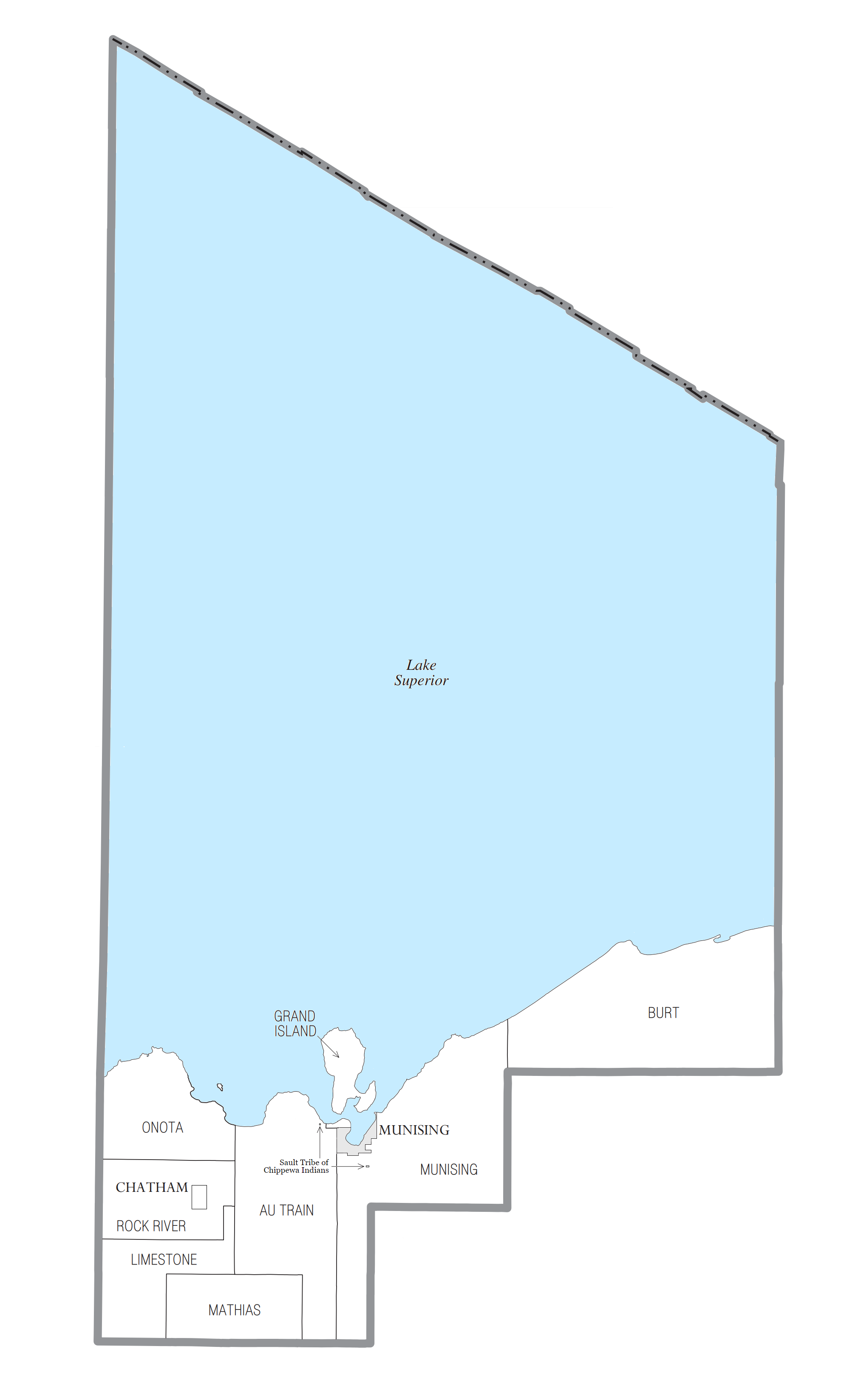
Alger County ( ) is a county in the Upper Peninsula of the U.S. state of Michigan. As of the 2020 Census, the population was 8,842. Its county seat is Munising. The Pictured Rocks National Lakeshore is located within the county. History Alger County was detached from Schoolcraft County, set off and organized in 1885. The county was named for lumber baron Russell Alexander Alger, who was elected as a Michigan Governor, and US Senator, and appointed as US Secretary of War during the William McKinley Presidential administration. ''See also'', List of Michigan county name etymologies, List of Michigan counties, and List of abolished U.S. counties. Geography According to the U.S. Census Bureau, the county has a total area of , of which is land and (82%) is water. It is the second-largest county in Michigan by total area, mainly because of Lake Superior on the north side of the county. Highways * * * * * * * * * * * * * * , passes through Pictured Rocks National ... [...More Info...] [...Related Items...] OR: [Wikipedia] [Google] [Baidu] |
Grand Island National Recreation Area
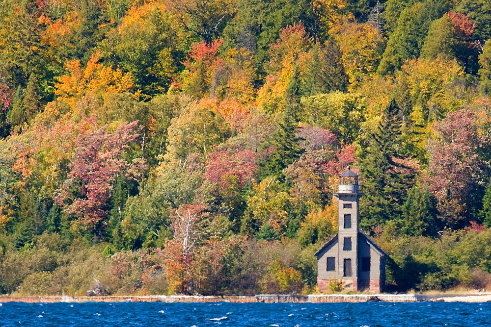
The Grand Island National Recreation Area is a national recreation area in Hiawatha National Forest under jurisdiction of the U.S. Forest Service. Located on Grand Island, Michigan offshore from Munising, Michigan, the Grand Island National Recreation Area covers approximately of Lake Superior woodland. Grand Island's glacier-cut lake shoreline measures approximately in length. The island's maximum dimension is from north to south. Grand Island was designated a national recreation area by the U.S. Congress in 1990 after the U.S. Forest Service purchased the island from its former owner, Cleveland Cliffs Iron Co. Lake Superior Lake Superior dominates the Grand Island biotic environment. Even in high summer, the lake's temperature rarely rises above . Geology Grand Island's geology is an extension of the sandstone strata of the adjacent Pictured Rocks National Lakeshore. Island sandstone cliffs as tall as in height plunge down into the lake. A perimeter trail skirts much of th ... [...More Info...] [...Related Items...] OR: [Wikipedia] [Google] [Baidu] |
Limonite
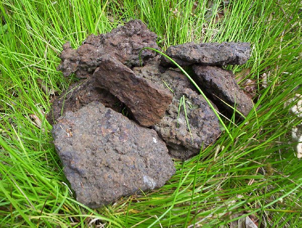
Limonite () is an iron ore consisting of a mixture of hydrated iron(III) oxide-hydroxides in varying composition. The generic formula is frequently written as FeO(OH)·H2O, although this is not entirely accurate as the ratio of oxide to hydroxide can vary quite widely. Limonite is one of the three principal iron ores, the others being hematite and magnetite, and has been mined for the production of iron since at least 2500 BP. Names Limonite is named for the Greek word λειμών (/leː.mɔ̌ːn/), meaning "wet meadow", or λίμνη (/lím.nɛː/), meaning “marshy lake” as an allusion to its occurrence as '' bog iron ore'' in meadows and marshes. In its brown form it is sometimes called brown hematite or brown iron ore. Characteristics Limonite is relatively dense with a specific gravity varying from 2.7 to 4.3.Northrop, Stuart A. (1959) "Limonite" ''Minerals of New Mexico'' (revised edition) University of New Mexico Press, Albuquerque, New Mexico, pp. 329–333, ... [...More Info...] [...Related Items...] OR: [Wikipedia] [Google] [Baidu] |
Manganese
Manganese is a chemical element with the symbol Mn and atomic number 25. It is a hard, brittle, silvery metal, often found in minerals in combination with iron. Manganese is a transition metal with a multifaceted array of industrial alloy uses, particularly in stainless steels. It improves strength, workability, and resistance to wear. Manganese oxide is used as an oxidising agent; as a rubber additive; and in glass making, fertilisers, and ceramics. Manganese sulfate can be used as a fungicide. Manganese is also an essential human dietary element, important in macronutrient metabolism, bone formation, and free radical defense systems. It is a critical component in dozens of proteins and enzymes. It is found mostly in the bones, but also the liver, kidneys, and brain. In the human brain, the manganese is bound to manganese metalloproteins, most notably glutamine synthetase in astrocytes. Manganese was first isolated in 1774. It is familiar in the laboratory in the form of the ... [...More Info...] [...Related Items...] OR: [Wikipedia] [Google] [Baidu] |
Iron
Iron () is a chemical element with symbol Fe (from la, ferrum) and atomic number 26. It is a metal that belongs to the first transition series and group 8 of the periodic table. It is, by mass, the most common element on Earth, right in front of oxygen (32.1% and 30.1%, respectively), forming much of Earth's outer and inner core. It is the fourth most common element in the Earth's crust. In its metallic state, iron is rare in the Earth's crust, limited mainly to deposition by meteorites. Iron ores, by contrast, are among the most abundant in the Earth's crust, although extracting usable metal from them requires kilns or furnaces capable of reaching or higher, about higher than that required to smelt copper. Humans started to master that process in Eurasia during the 2nd millennium BCE and the use of iron tools and weapons began to displace copper alloys, in some regions, only around 1200 BCE. That event is considered the transition from the Bronze Age to the Iron A ... [...More Info...] [...Related Items...] OR: [Wikipedia] [Google] [Baidu] |
Ordovician
The Ordovician ( ) is a geologic period and System (geology), system, the second of six periods of the Paleozoic Era (geology), Era. The Ordovician spans 41.6 million years from the end of the Cambrian Period million years ago (Mya) to the start of the Silurian Period Mya. The Ordovician, named after the Celtic Britons, Welsh tribe of the Ordovices, was defined by Charles Lapworth in 1879 to resolve a dispute between followers of Adam Sedgwick and Roderick Murchison, who were placing the same Rock (geology), rock beds in North Wales in the Cambrian and Silurian systems, respectively. Lapworth recognized that the fossil fauna in the disputed Stratum, strata were different from those of either the Cambrian or the Silurian systems, and placed them in a system of their own. The Ordovician received international approval in 1960 (forty years after Lapworth's death), when it was adopted as an official period of the Paleozoic Era by the International Union of Geological Sciences, Intern ... [...More Info...] [...Related Items...] OR: [Wikipedia] [Google] [Baidu] |
Au Train Formation
The Au Train Formation is a geologic formation in Michigan. It preserves fossils dating back to the Ordovician period Period may refer to: Common uses * Era, a length or span of time * Full stop (or period), a punctuation mark Arts, entertainment, and media * Period (music), a concept in musical composition * Periodic sentence (or rhetorical period), a concept .... See also References * * Pictured Rocks: Geologic Formations, url=http://www.nps.gov/piro/naturescience/geologicformations.htm, publisher=US National Park Service, accessdate=June 14, 2020 Ordovician System of North America Ordovician Michigan Lower Ordovician Series {{Michigan-geologic-formation-stub ... [...More Info...] [...Related Items...] OR: [Wikipedia] [Google] [Baidu] |
Jacobsville Formation
Jacobsville Sandstone is a red sandstone formation, marked with light-colored streaks and spots, primarily found in northern Upper Michigan, portions of Ontario, and under much of Lake Superior. Desired for its durability and aesthetics, the sandstone was used as an architectural building stone in both Canada and the United States. The stone was extracted by thirty-two quarries throughout the Upper Peninsula of Michigan approximately between 1870 and 1915. The sandstone has been variously called redstone, brownstone, Lake Superior Sandstone, and Eastern Sandstone. In 1907, the Jacobsville Formation was given its current classification and the name ''Jacobsville'', in honor of Jacobsville, Michigan, a town known for its production of the sandstone. The sandstone was deposited within terrestrial fluvial environments early in the Neoproterozoic Era. Geology Classification The earliest geologic studies of southern Lake Superior were made in the early 1800s. Many studies used the ... [...More Info...] [...Related Items...] OR: [Wikipedia] [Google] [Baidu] |
Precambrian
The Precambrian (or Pre-Cambrian, sometimes abbreviated pꞒ, or Cryptozoic) is the earliest part of Earth's history, set before the current Phanerozoic Eon. The Precambrian is so named because it preceded the Cambrian, the first period of the Phanerozoic Eon, which is named after Cambria, the Latinised name for Wales, where rocks from this age were first studied. The Precambrian accounts for 88% of the Earth's geologic time. The Precambrian is an informal unit of geologic time, subdivided into three eons ( Hadean, Archean, Proterozoic) of the geologic time scale. It spans from the formation of Earth about 4.6 billion years ago ( Ga) to the beginning of the Cambrian Period, about million years ago ( Ma), when hard-shelled creatures first appeared in abundance. Overview Relatively little is known about the Precambrian, despite it making up roughly seven-eighths of the Earth's history, and what is known has largely been discovered from the 1960s onwards. The Precambrian fossil ... [...More Info...] [...Related Items...] OR: [Wikipedia] [Google] [Baidu] |
Period (geology)
The geologic time scale, or geological time scale, (GTS) is a representation of time based on the rock record of Earth. It is a system of chronological dating that uses chronostratigraphy (the process of relating strata to time) and geochronology (scientific branch of geology that aims to determine the age of rocks). It is used primarily by Earth scientists (including geologists, paleontologists, geophysicists, geochemists, and paleoclimatologists) to describe the timing and relationships of events in geologic history. The time scale has been developed through the study of rock layers and the observation of their relationships and identifying features such as lithologies, paleomagnetic properties, and fossils. The definition of standardized international units of geologic time is the responsibility of the International Commission on Stratigraphy (ICS), a constituent body of the International Union of Geological Sciences (IUGS), whose primary objective is to precisely define ... [...More Info...] [...Related Items...] OR: [Wikipedia] [Google] [Baidu] |
Cambrian
The Cambrian Period ( ; sometimes symbolized C with bar, Ꞓ) was the first geological period of the Paleozoic Era, and of the Phanerozoic Eon. The Cambrian lasted 53.4 million years from the end of the preceding Ediacaran Period 538.8 million years ago (mya) to the beginning of the Ordovician Period mya. Its subdivisions, and its base, are somewhat in flux. The period was established as "Cambrian series" by Adam Sedgwick, who named it after Cambria, the Latin name for 'Cymru' (Wales), where Britain's Cambrian rocks are best exposed. Sedgwick identified the layer as part of his task, along with Roderick Murchison, to subdivide the large "Transition Series", although the two geologists disagreed for a while on the appropriate categorization. The Cambrian is unique in its unusually high proportion of sedimentary deposits, sites of exceptional preservation where "soft" parts of organisms are preserved as well as their more resistant shells. As a result, our understanding of the Ca ... [...More Info...] [...Related Items...] OR: [Wikipedia] [Google] [Baidu] |
Munising Formation
The Munising Group or Formation is a thick, white to light grey Cambrian sedimentary unit that crops out in Michigan and (to a lesser extent) Ontario. At one end of its extent, it comprises a basal conglomerate overlain by the Chapel Rock Member and the Miners Castle Member; elsewhere, it comprises the Eau Claire, Galesville (=Dresbach), and Franconia Members. Anhydritic evaporite deposits are present in places. The conglomerate was deposited by rivers in flood, with the Chapel Rock member, which contains deltaic deposits, representing transgression as the conglomerate cones became submerged; the Miners Castle member was deposited further from the shoreline, representing shelf deposits. Its uppermost strata may be Early Ordovician in age, and contain conodonts, trilobites and phosphatic moulds of brachiopods, ostrocoderm fish and gastropods. The Munising lies unconformably above the Jacobsville Formation Jacobsville Sandstone is a red sandstone formation, marked with light- ... [...More Info...] [...Related Items...] OR: [Wikipedia] [Google] [Baidu] |


