|
Piccadilly Gardens Tram Stop
Piccadilly Gardens is a tram stop in Zone 1 of Greater Manchester's Metrolink light rail system. It is located beside Piccadilly Gardens in Manchester city centre, and serves both as a transport hub (by integrating with the adjacent Manchester Piccadilly Gardens bus station), and interchange station (which can be used for changing between Metrolink lines). Piccadilly Gardens tram stop opened on 27 April 1992, as part of Metrolink's Phase 1. The station was rebuilt during 2009 with a wider platform and a new canopy, reopening on 2 November 2009. The stop is one of the most used on the Metrolink network. History In 1931, a new bus station was opened on Parker Street on the former site of the Manchester Royal Infirmary, providing a central transport interchange for bus passengers. In 1945, adjacent site was landscaped as an ornamental sunken garden and named Piccadilly Gardens. In 1991, construction work began on a new light rail transport network, Manchester Metrolink ... [...More Info...] [...Related Items...] OR: [Wikipedia] [Google] [Baidu] |
Manchester Metrolink
Manchester Metrolink (branded locally simply as Metrolink) is a tram/ light rail system in Greater Manchester, England. The network has 99 stops along of standard-gauge route, making it the most extensive light rail system in the United Kingdom. Metrolink is owned by the public body Transport for Greater Manchester (TfGM) and operated and maintained under contract by a Keolis/ Amey consortium. In 2021/22, 26 million passenger journeys were made on the system. The network consists of eight lines which radiate from Manchester city centre to termini at Altrincham, Ashton-under-Lyne, Bury, East Didsbury, Eccles, Manchester Airport, Rochdale and Trafford Centre. It runs on a mixture of on-street track shared with other traffic; reserved track sections segregated from other traffic, and converted former railway lines. Metrolink is operated by a fleet of 147 high-floor Bombardier M5000 light rail vehicles. Each service runs to a 12-minute headway; stops with more than one serv ... [...More Info...] [...Related Items...] OR: [Wikipedia] [Google] [Baidu] |
Transport Hub
A transport hub is a place where passengers and cargo are exchanged between vehicles and/or between transport modes. Public transport hubs include railway stations, rapid transit stations, bus stops, tram stops, airports and ferry slips. Freight hubs include classification yards, airports, seaports and truck terminals, or combinations of these. For private transport by car, the parking lot functions as a unimodal hub. History Historically, an interchange service in the scheduled passenger air transport industry involved a "through plane" flight operated by two or more airlines where a single aircraft was used with the individual airlines operating it with their own flight crews on their respective portions of a direct, no-change-of-plane multi-stop flight. In the U.S., a number of air carriers including Alaska Airlines, American Airlines, Braniff International Airways, Continental Airlines, Delta Air Lines, Eastern Airlines, Frontier Airlines (1950-1986), Hughes Airwest, ... [...More Info...] [...Related Items...] OR: [Wikipedia] [Google] [Baidu] |
Tram Stops In Manchester
A tram (called a streetcar or trolley in North America) is a rail vehicle that travels on tramway tracks on public urban streets; some include segments on segregated right-of-way. The tramlines or networks operated as public transport are called tramways or simply trams/streetcars. Many recently built tramways use the contemporary term light rail. The vehicles are called streetcars or trolleys (not to be confused with trolleybus) in North America and trams or tramcars elsewhere. The first two terms are often used interchangeably in the United States, with ''trolley'' being the preferred term in the eastern US and ''streetcar'' in the western US. ''Streetcar'' or ''tramway'' are preferred in Canada. In parts of the United States, internally powered buses made to resemble a streetcar are often referred to as "trolleys". To avoid further confusion with trolley buses, the American Public Transportation Association (APTA) refers to them as "trolley-replica buses". In the United ... [...More Info...] [...Related Items...] OR: [Wikipedia] [Google] [Baidu] |
Transport Hub
A transport hub is a place where passengers and cargo are exchanged between vehicles and/or between transport modes. Public transport hubs include railway stations, rapid transit stations, bus stops, tram stops, airports and ferry slips. Freight hubs include classification yards, airports, seaports and truck terminals, or combinations of these. For private transport by car, the parking lot functions as a unimodal hub. History Historically, an interchange service in the scheduled passenger air transport industry involved a "through plane" flight operated by two or more airlines where a single aircraft was used with the individual airlines operating it with their own flight crews on their respective portions of a direct, no-change-of-plane multi-stop flight. In the U.S., a number of air carriers including Alaska Airlines, American Airlines, Braniff International Airways, Continental Airlines, Delta Air Lines, Eastern Airlines, Frontier Airlines (1950-1986), Hughes Airwest, ... [...More Info...] [...Related Items...] OR: [Wikipedia] [Google] [Baidu] |
Manchester Royal Infirmary
Manchester Royal Infirmary (MRI) is a large NHS teaching hospital in Chorlton-on-Medlock, Manchester, England. Founded by Charles White in 1752 as part of the voluntary hospital movement of the 18th century, it is now a major regional and national medical centre. It is the largest Hospital within Manchester University NHS Foundation Trust, and based on its Oxford Road Campus in South Manchester where it shares a site with the Royal Manchester Children's Hospital, Manchester Royal Eye Hospital and Saint Mary's Hospital as well as several other educational and research facilities. The Hospital is also a key site for medical educational within Manchester, serving as a main teaching hospital for School of Medical Sciences, University of Manchester. History The first premises was a house in Garden Street, off Withy Grove, Manchester, which were opened on Monday 27 July 1752, financed by subscriptions. Government of the institution was in the hands of the trustees. Any subscriber ... [...More Info...] [...Related Items...] OR: [Wikipedia] [Google] [Baidu] |
Interchange Station
An interchange station or a transfer station is a train station for more than one railway route in a public transport system that allows passengers to change from one route to another, often without having to leave a station or pay an additional fare. Transfer may occur within the same mode, or between rail modes, or to buses (for stations with bus termini attached). Such stations usually have more platforms than single route stations. These stations can exist in either commercial centers or on the city outskirts in residential areas. Cities typically plan for land use around interchange stations for development. Passengers may be required to pay extra fare for the interchange if they leave a paid area. History With the opening of the Woodside and Birkenhead Dock Street Tramway in 1873, Birkenhead Dock railway station in Birkenhead, England probably became the world's first tram to train interchange station. Examples Verney Junction interchange station in Buckinghamshire, ... [...More Info...] [...Related Items...] OR: [Wikipedia] [Google] [Baidu] |
Manchester Piccadilly Gardens Bus Station
Manchester Piccadilly Gardens bus station, often abbreviated to Piccadilly Gardens, is one of two main bus stations in Manchester city centre. Adjacent is a Manchester Metrolink station named Piccadilly Gardens. The majority of the stands are located between Piccadilly Gardens and the Piccadilly Plaza, where buses for south or west Manchester usually begin or end their route. Other stands, also serving Piccadilly Gardens, are located on Oldham Street, Piccadilly or Lever Street for services heading towards north or east of Manchester. The bus station was first opened on the site of the demolished Manchester Infirmary in 1931 to serve as the new terminus of the various extensive regional express bus services run by Manchester and its partners that had to be curtailed under the Road Traffic Act of 1930 and subsequent regulation of bus services. The station was extended in 1932/33 and finally extended to form the full length of Parker Street in 1935. Services There are numerous buse ... [...More Info...] [...Related Items...] OR: [Wikipedia] [Google] [Baidu] |
Manchester City Centre
Manchester City Centre is the central business district of Manchester in Greater Manchester, England situated within the confines of Great Ancoats Street, A6042 Trinity Way, and A57(M) Mancunian Way which collectively form an inner ring road. The City Centre ward had a population of 17,861 at the 2011 census. Manchester city centre evolved from the civilian ''vicus'' of the Roman fort of Mamucium, on a sandstone bluff near the confluence of the rivers Medlock and Irwell. This became the township of Manchester during the Middle Ages, and was the site of the Peterloo Massacre of 1819. Manchester was granted city status in 1853, after the Industrial Revolution, from which the city centre emerged as the global centre of the cotton trade which encouraged its "splendidly imposing commercial architecture" during the Victorian era, such as the Royal Exchange, the Corn Exchange, the Free Trade Hall, and the Great Northern Warehouse. After the decline of the cotton trade and the Ma ... [...More Info...] [...Related Items...] OR: [Wikipedia] [Google] [Baidu] |
Piccadilly Gardens
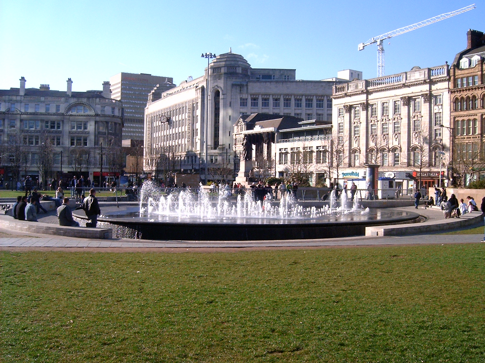
Piccadilly Gardens is a green space in Manchester city centre, England, on the edge of the Northern Quarter. It takes its name from the adjacent street, Piccadilly, which runs across the city centre from Market Street to London Road. The gardens also contain a bus station and a tram stop. Piccadilly Gardens were laid out after World War I on the former site of the Manchester Royal Infirmary. Originally landscaped as an ornamental sunken garden, the area was levelled out and reconfigured in 2002 with a water feature and concrete pavilion by Japanese architect Tadao Ando. Location Piccadilly Gardens are located in Manchester city centre, just to the south of the Northern Quarter. The green space is bounded on four sides by streets: Mosley Street to the west, Parker Street to the south and Portland Street to the east; along the northern side is Piccadilly, a street that runs eastwards from the junction of Market Street to the junction of London Road with Ducie Street. The ... [...More Info...] [...Related Items...] OR: [Wikipedia] [Google] [Baidu] |
Greater Manchester
Greater Manchester is a metropolitan county and combined authority, combined authority area in North West England, with a population of 2.8 million; comprising ten metropolitan boroughs: City of Manchester, Manchester, City of Salford, Salford, Metropolitan Borough of Bolton, Bolton, Metropolitan Borough of Bury, Bury, Metropolitan Borough of Oldham, Oldham, Metropolitan Borough of Rochdale, Rochdale, Metropolitan Borough of Stockport, Stockport, Tameside, Trafford and Metropolitan Borough of Wigan, Wigan. The county was created on 1 April 1974, as a result of the Local Government Act 1972, and designated a functional Manchester City Region, city region on 1 April 2011. Greater Manchester is formed of parts of the Historic counties of England, historic counties of Cheshire, Lancashire and the West Riding of Yorkshire. Greater Manchester spans , which roughly covers the territory of the Greater Manchester Built-up Area, the List of urban areas in the United Kingdom, second most ... [...More Info...] [...Related Items...] OR: [Wikipedia] [Google] [Baidu] |
Zone 1 (Manchester Metrolink)
Zone 1 of the Manchester Metrolink light rail network is the heart of the system where all of the other lines converge. Its boundaries are broadly equivalent to those of Manchester city centre, and approximately mirror the city's Inner Ring Road. Within Zone 1, first opened in 1992 as the City Zone, trams largely run along semi-pedestrianised streets rather than on their own separate alignment. The original route between the Altrincham and Bury lines ran to Victoria station via Market Street and High Street, and was soon joined by a branch to Piccadilly station by a three-way ''delta'' junction. A second route between the South-West and North-Eastern parts of the network was built to ease congestion on the original line. Opened in 2017, the Second City Crossing (2CC) added one additional stop to the network. City-centre stops Since 2019, there are ten Metrolink stops in Zone 1, these are: * Cornbrook – a major interchange on the Metrolink system and is also in Zone 2 * Deans ... [...More Info...] [...Related Items...] OR: [Wikipedia] [Google] [Baidu] |


